CanalPlanAC

Wrights Bridge

 
Also known as: Old Hill Colliery Bridge
Wright's Bridge, Sandwell B64 6PG, United Kingdom
 
Information about the place
Wrights Bridge is a minor waterways place on the Birmingham Canal Navigations (Dudley Canal No 2 - Coombeswood ) between Windmill End Junction (Junction with Netherton Tunnel Branch Canal) (1 mile and 4½ furlongs to the northwest) and Coombeswood (Limit of Navigation - The canal from here to Selly Oak is closed) (1 mile and 1½ furlongs to the southeast).
 
 
The nearest place in the direction of Windmill End Junction is Smiths Bridge (No access over footbridge); ½ furlongs away.
 
The nearest place in the direction of Coombeswood is Hayden Cross Railway Bridge; ¼ furlongs away.

There is access (suitable for wheels) to the towpath here.

Mooring here is unrated.

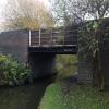
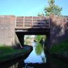
There is a bridge here which takes pedestrian traffic over the canal.


Amenities

Amenities nearby at Smiths Bridge

 Fish & Chips
 Old Hill Station
 
Maps
If you are a user and are logged on, or if you are actively planning a route, a map will be displayed here.
Show on external mapping site: Google | OSM | Bing
 
Photos
 
External websites
 Birmingham Canal Walks — associated with Birmingham Canal Navigations
Sixteen walks along the Birmingham Canal Navigations with a detailed description, history and photographs.
 
Nearest facilities

Mouseover for more information or show routes to facility

Nearest water point

In the direction of Coombeswood

Hawne Basin1 mile, ¾ furlongs away
On this waterway in the direction of Coombeswood
King's Norton Water Point6 miles, 6 furlongs away
Travel to Coombeswood, then on the Birmingham Canal Navigations (Dudley Canal No 2 - Lapal Canal - Original Line West End ) to Lapal Canal - New line Diverges From Original Route, then on the Birmingham Canal Navigations (Dudley Canal No 2 - Lapal Canal - Abandoned Line ) to Somery Road Bridge, then on the Birmingham Canal Navigations (Dudley Canal No 2 - Lapal Canal - Original Line East End ) to New Selly Oak Junction, then on the Worcester and Birmingham Canal (Birmingham to King's Norton) to King's Norton Junction, then on the Worcester and Birmingham Canal (Diglis Basin to King's Norton Junction) to King's Norton Water Point
Holliday Wharf7 miles, ½ furlongs away
Travel to Coombeswood, then on the Birmingham Canal Navigations (Dudley Canal No 2 - Lapal Canal - Original Line West End ) to Lapal Canal - New line Diverges From Original Route, then on the Birmingham Canal Navigations (Dudley Canal No 2 - Lapal Canal - Abandoned Line ) to Somery Road Bridge, then on the Birmingham Canal Navigations (Dudley Canal No 2 - Lapal Canal - Original Line East End ) to New Selly Oak Junction, then on the Worcester and Birmingham Canal (Birmingham to King's Norton) to Holliday Wharf
Worcester Bar7 miles, 2½ furlongs away
Travel to Coombeswood, then on the Birmingham Canal Navigations (Dudley Canal No 2 - Lapal Canal - Original Line West End ) to Lapal Canal - New line Diverges From Original Route, then on the Birmingham Canal Navigations (Dudley Canal No 2 - Lapal Canal - Abandoned Line ) to Somery Road Bridge, then on the Birmingham Canal Navigations (Dudley Canal No 2 - Lapal Canal - Original Line East End ) to New Selly Oak Junction, then on the Worcester and Birmingham Canal (Birmingham to King's Norton) to Worcester Bar
Cambrian Wharf Services7 miles, 6½ furlongs away
Travel to Coombeswood, then on the Birmingham Canal Navigations (Dudley Canal No 2 - Lapal Canal - Original Line West End ) to Lapal Canal - New line Diverges From Original Route, then on the Birmingham Canal Navigations (Dudley Canal No 2 - Lapal Canal - Abandoned Line ) to Somery Road Bridge, then on the Birmingham Canal Navigations (Dudley Canal No 2 - Lapal Canal - Original Line East End ) to New Selly Oak Junction, then on the Worcester and Birmingham Canal (Birmingham to King's Norton) to Worcester Bar, then on the Birmingham Canal Navigations (Main Line) to Deep Cuttings Junction, then on the Birmingham Canal Navigations (Newhall Branch) to Cambrian Wharf Services
Yardley Wood Water Point9 miles, 2 furlongs away
Travel to Coombeswood, then on the Birmingham Canal Navigations (Dudley Canal No 2 - Lapal Canal - Original Line West End ) to Lapal Canal - New line Diverges From Original Route, then on the Birmingham Canal Navigations (Dudley Canal No 2 - Lapal Canal - Abandoned Line ) to Somery Road Bridge, then on the Birmingham Canal Navigations (Dudley Canal No 2 - Lapal Canal - Original Line East End ) to New Selly Oak Junction, then on the Worcester and Birmingham Canal (Birmingham to King's Norton) to King's Norton Junction, then on the Stratford-on-Avon Canal (Northern Section) to Yardley Wood Water Point
Hopwood Visitor Moorings9 miles, 7½ furlongs away
Travel to Coombeswood, then on the Birmingham Canal Navigations (Dudley Canal No 2 - Lapal Canal - Original Line West End ) to Lapal Canal - New line Diverges From Original Route, then on the Birmingham Canal Navigations (Dudley Canal No 2 - Lapal Canal - Abandoned Line ) to Somery Road Bridge, then on the Birmingham Canal Navigations (Dudley Canal No 2 - Lapal Canal - Original Line East End ) to New Selly Oak Junction, then on the Worcester and Birmingham Canal (Birmingham to King's Norton) to King's Norton Junction, then on the Worcester and Birmingham Canal (Diglis Basin to King's Norton Junction) to Hopwood Visitor Moorings
Earlswood Reservoir Feeder13 miles, 3 furlongs away
Travel to Coombeswood, then on the Birmingham Canal Navigations (Dudley Canal No 2 - Lapal Canal - Original Line West End ) to Lapal Canal - New line Diverges From Original Route, then on the Birmingham Canal Navigations (Dudley Canal No 2 - Lapal Canal - Abandoned Line ) to Somery Road Bridge, then on the Birmingham Canal Navigations (Dudley Canal No 2 - Lapal Canal - Original Line East End ) to New Selly Oak Junction, then on the Worcester and Birmingham Canal (Birmingham to King's Norton) to King's Norton Junction, then on the Stratford-on-Avon Canal (Northern Section) to Earlswood Reservoir Feeder
Waring's Green Wharf14 miles, 3 furlongs away
Travel to Coombeswood, then on the Birmingham Canal Navigations (Dudley Canal No 2 - Lapal Canal - Original Line West End ) to Lapal Canal - New line Diverges From Original Route, then on the Birmingham Canal Navigations (Dudley Canal No 2 - Lapal Canal - Abandoned Line ) to Somery Road Bridge, then on the Birmingham Canal Navigations (Dudley Canal No 2 - Lapal Canal - Original Line East End ) to New Selly Oak Junction, then on the Worcester and Birmingham Canal (Birmingham to King's Norton) to King's Norton Junction, then on the Stratford-on-Avon Canal (Northern Section) to Waring's Green Wharf
Tardebigge Wharf15 miles, 3¼ furlongs away
Travel to Coombeswood, then on the Birmingham Canal Navigations (Dudley Canal No 2 - Lapal Canal - Original Line West End ) to Lapal Canal - New line Diverges From Original Route, then on the Birmingham Canal Navigations (Dudley Canal No 2 - Lapal Canal - Abandoned Line ) to Somery Road Bridge, then on the Birmingham Canal Navigations (Dudley Canal No 2 - Lapal Canal - Original Line East End ) to New Selly Oak Junction, then on the Worcester and Birmingham Canal (Birmingham to King's Norton) to King's Norton Junction, then on the Worcester and Birmingham Canal (Diglis Basin to King's Norton Junction) to Tardebigge Wharf

In the direction of Parkhead Junction

Bumble Hole Visitor Centre1 mile, 5 furlongs away
On this waterway in the direction of Parkhead Junction
Blowers Green Pumphouse4 miles, 1¼ furlongs away
On this waterway in the direction of Parkhead Junction
Dudley Tunnel (northern entrance)6 miles, 1½ furlongs and 3 locks away
Travel to Parkhead Junction, then on the Birmingham Canal Navigations (Dudley Canal No 1 - Through Route) to Pensnett Junction, then on the Birmingham Canal Navigations (Dudley Canal No 1 - Dudley Tunnel) to Dudley Tunnel (northern entrance)
Dudley Canal & Tunnel Trust Footbridge6 miles, 2¼ furlongs and 3 locks away
Travel to Parkhead Junction, then on the Birmingham Canal Navigations (Dudley Canal No 1 - Through Route) to Pensnett Junction, then on the Birmingham Canal Navigations (Dudley Canal No 1 - Dudley Tunnel) to Dudley Tunnel (northern entrance), then on the Birmingham Canal Navigations (Dudley Canal No 1 - Birmingham End) to Dudley Canal & Tunnel Trust Footbridge
Black Country Museum6 miles, 2½ furlongs and 3 locks away
Travel to Parkhead Junction, then on the Birmingham Canal Navigations (Dudley Canal No 1 - Through Route) to Pensnett Junction, then on the Birmingham Canal Navigations (Dudley Canal No 1 - Dudley Tunnel) to Dudley Tunnel (northern entrance), then on the Birmingham Canal Navigations (Dudley Canal No 1 - Birmingham End) to Black Country Museum
Todds End Customer Service Facility6 miles, 2¾ furlongs and 3 locks away
Travel to Parkhead Junction, then on the Birmingham Canal Navigations (Dudley Canal No 1 - Through Route) to Pensnett Junction, then on the Birmingham Canal Navigations (Dudley Canal No 1 - Dudley Tunnel) to Dudley Tunnel (northern entrance), then on the Birmingham Canal Navigations (Dudley Canal No 1 - Birmingham End) to Todds End Customer Service Facility
Handsworth Wharf Winding Hole9 miles and 3 locks away
Travel to Windmill End Junction, then on the Birmingham Canal Navigations (Netherton Tunnel Branch) to Dudley Port Junction, then on the Birmingham Canal Navigations (Main Line) to Bromford Junction, then on the Birmingham Canal Navigations (Spon Lane Locks Branch) to Spon Lane Junction, then on the Birmingham Canal Navigations (Old Main Line) to Engine Arm Junction, then on the Birmingham Canal Navigations (Engine Arm) to Handsworth Wharf Winding Hole
C&RT Bradley Workshops9 miles, 3¾ furlongs and 3 locks away
Travel to Windmill End Junction, then on the Birmingham Canal Navigations (Netherton Tunnel Branch) to Dudley Port Junction, then on the Birmingham Canal Navigations (Main Line) to Deepfields Junction, then on the Birmingham Canal Navigations (Wednesbury Oak Loop) to C&RT Bradley Workshops
Broad Street Basin11 miles, ¾ furlongs and 3 locks away
Travel to Windmill End Junction, then on the Birmingham Canal Navigations (Netherton Tunnel Branch) to Dudley Port Junction, then on the Birmingham Canal Navigations (Main Line) to Broad Street Basin
Lower Ocker Hill Branch Junction7 miles, 5 furlongs and 8 locks away
Travel to Windmill End Junction, then on the Birmingham Canal Navigations (Netherton Tunnel Branch) to Dudley Port Junction, then on the Birmingham Canal Navigations (Main Line) to Pudding Green Junction, then on the Birmingham Canal Navigations (Wednesbury Old Canal - Main Line) to Ryders Green Junction, then on the Birmingham Canal Navigations (Walsall Canal) to Lower Ocker Hill Branch Junction

Nearest rubbish disposal

In the direction of Coombeswood

Hawne Basin1 mile, ¾ furlongs away
On this waterway in the direction of Coombeswood
Worcester Bar7 miles, 2½ furlongs away
Travel to Coombeswood, then on the Birmingham Canal Navigations (Dudley Canal No 2 - Lapal Canal - Original Line West End ) to Lapal Canal - New line Diverges From Original Route, then on the Birmingham Canal Navigations (Dudley Canal No 2 - Lapal Canal - Abandoned Line ) to Somery Road Bridge, then on the Birmingham Canal Navigations (Dudley Canal No 2 - Lapal Canal - Original Line East End ) to New Selly Oak Junction, then on the Worcester and Birmingham Canal (Birmingham to King's Norton) to Worcester Bar
Cambrian Wharf Services7 miles, 6½ furlongs away
Travel to Coombeswood, then on the Birmingham Canal Navigations (Dudley Canal No 2 - Lapal Canal - Original Line West End ) to Lapal Canal - New line Diverges From Original Route, then on the Birmingham Canal Navigations (Dudley Canal No 2 - Lapal Canal - Abandoned Line ) to Somery Road Bridge, then on the Birmingham Canal Navigations (Dudley Canal No 2 - Lapal Canal - Original Line East End ) to New Selly Oak Junction, then on the Worcester and Birmingham Canal (Birmingham to King's Norton) to Worcester Bar, then on the Birmingham Canal Navigations (Main Line) to Deep Cuttings Junction, then on the Birmingham Canal Navigations (Newhall Branch) to Cambrian Wharf Services
Waring's Green Wharf14 miles, 3 furlongs away
Travel to Coombeswood, then on the Birmingham Canal Navigations (Dudley Canal No 2 - Lapal Canal - Original Line West End ) to Lapal Canal - New line Diverges From Original Route, then on the Birmingham Canal Navigations (Dudley Canal No 2 - Lapal Canal - Abandoned Line ) to Somery Road Bridge, then on the Birmingham Canal Navigations (Dudley Canal No 2 - Lapal Canal - Original Line East End ) to New Selly Oak Junction, then on the Worcester and Birmingham Canal (Birmingham to King's Norton) to King's Norton Junction, then on the Stratford-on-Avon Canal (Northern Section) to Waring's Green Wharf
Farmers Bridge Lock No 88 miles, 1¾ furlongs and 7 locks away
Travel to Coombeswood, then on the Birmingham Canal Navigations (Dudley Canal No 2 - Lapal Canal - Original Line West End ) to Lapal Canal - New line Diverges From Original Route, then on the Birmingham Canal Navigations (Dudley Canal No 2 - Lapal Canal - Abandoned Line ) to Somery Road Bridge, then on the Birmingham Canal Navigations (Dudley Canal No 2 - Lapal Canal - Original Line East End ) to New Selly Oak Junction, then on the Worcester and Birmingham Canal (Birmingham to King's Norton) to Worcester Bar, then on the Birmingham Canal Navigations (Main Line) to Deep Cuttings Junction, then on the Birmingham Canal Navigations (Newhall Branch) to Farmers Bridge Junction, then on the Birmingham Canal Navigations (Birmingham and Fazeley Canal - Main Line) to Farmers Bridge Lock No 8
Tardebigge Wharf15 miles, 3¼ furlongs away
Travel to Coombeswood, then on the Birmingham Canal Navigations (Dudley Canal No 2 - Lapal Canal - Original Line West End ) to Lapal Canal - New line Diverges From Original Route, then on the Birmingham Canal Navigations (Dudley Canal No 2 - Lapal Canal - Abandoned Line ) to Somery Road Bridge, then on the Birmingham Canal Navigations (Dudley Canal No 2 - Lapal Canal - Original Line East End ) to New Selly Oak Junction, then on the Worcester and Birmingham Canal (Birmingham to King's Norton) to King's Norton Junction, then on the Worcester and Birmingham Canal (Diglis Basin to King's Norton Junction) to Tardebigge Wharf

In the direction of Parkhead Junction

Blowers Green Bridge4 miles, 1 furlong away
On this waterway in the direction of Parkhead Junction
Waterfront Services (Dudley)5 miles, 2¼ furlongs and 1 lock away
Travel to Parkhead Junction, then on the Birmingham Canal Navigations (Dudley Canal No 1 - Through Route) to Waterfront Services (Dudley)
Black Country Museum6 miles, 2½ furlongs and 3 locks away
Travel to Parkhead Junction, then on the Birmingham Canal Navigations (Dudley Canal No 1 - Through Route) to Pensnett Junction, then on the Birmingham Canal Navigations (Dudley Canal No 1 - Dudley Tunnel) to Dudley Tunnel (northern entrance), then on the Birmingham Canal Navigations (Dudley Canal No 1 - Birmingham End) to Black Country Museum
Handsworth Wharf Winding Hole9 miles and 3 locks away
Travel to Windmill End Junction, then on the Birmingham Canal Navigations (Netherton Tunnel Branch) to Dudley Port Junction, then on the Birmingham Canal Navigations (Main Line) to Bromford Junction, then on the Birmingham Canal Navigations (Spon Lane Locks Branch) to Spon Lane Junction, then on the Birmingham Canal Navigations (Old Main Line) to Engine Arm Junction, then on the Birmingham Canal Navigations (Engine Arm) to Handsworth Wharf Winding Hole
C&RT Bradley Workshops9 miles, 3¾ furlongs and 3 locks away
Travel to Windmill End Junction, then on the Birmingham Canal Navigations (Netherton Tunnel Branch) to Dudley Port Junction, then on the Birmingham Canal Navigations (Main Line) to Deepfields Junction, then on the Birmingham Canal Navigations (Wednesbury Oak Loop) to C&RT Bradley Workshops
Broad Street Basin11 miles, ¾ furlongs and 3 locks away
Travel to Windmill End Junction, then on the Birmingham Canal Navigations (Netherton Tunnel Branch) to Dudley Port Junction, then on the Birmingham Canal Navigations (Main Line) to Broad Street Basin
Delph Bottom Lock No 86 miles, 2 furlongs and 8 locks away
Travel to Parkhead Junction, then on the Birmingham Canal Navigations (Dudley Canal No 1 - Through Route) to Delph Bottom Lock No 8
Lower Ocker Hill Branch Junction7 miles, 5 furlongs and 8 locks away
Travel to Windmill End Junction, then on the Birmingham Canal Navigations (Netherton Tunnel Branch) to Dudley Port Junction, then on the Birmingham Canal Navigations (Main Line) to Pudding Green Junction, then on the Birmingham Canal Navigations (Wednesbury Old Canal - Main Line) to Ryders Green Junction, then on the Birmingham Canal Navigations (Walsall Canal) to Lower Ocker Hill Branch Junction
Perry Barr Top Lock Services13 miles, 2¼ furlongs and 8 locks away
Travel to Windmill End Junction, then on the Birmingham Canal Navigations (Netherton Tunnel Branch) to Dudley Port Junction, then on the Birmingham Canal Navigations (Main Line) to Pudding Green Junction, then on the Birmingham Canal Navigations (Wednesbury Old Canal - Main Line) to Ryders Green Junction, then on the Birmingham Canal Navigations (Walsall Canal) to Tame Valley Junction, then on the Birmingham Canal Navigations (Tame Valley Canal) to Perry Barr Top Lock Services
Wolverhampton Lock No 911 miles, 6¼ furlongs and 11 locks away
Travel to Windmill End Junction, then on the Birmingham Canal Navigations (Netherton Tunnel Branch) to Dudley Port Junction, then on the Birmingham Canal Navigations (Main Line) to Wolverhampton Lock No 9
Longwood Junction13 miles, 7¾ furlongs and 17 locks away
Travel to Windmill End Junction, then on the Birmingham Canal Navigations (Netherton Tunnel Branch) to Dudley Port Junction, then on the Birmingham Canal Navigations (Main Line) to Pudding Green Junction, then on the Birmingham Canal Navigations (Wednesbury Old Canal - Main Line) to Ryders Green Junction, then on the Birmingham Canal Navigations (Walsall Canal) to Tame Valley Junction, then on the Birmingham Canal Navigations (Tame Valley Canal) to Tame Valley - Rushall Junction, then on the Birmingham Canal Navigations (Rushall Canal) to Longwood Junction
Aldridge Marina17 miles, 3¾ furlongs and 17 locks away
Travel to Windmill End Junction, then on the Birmingham Canal Navigations (Netherton Tunnel Branch) to Dudley Port Junction, then on the Birmingham Canal Navigations (Main Line) to Pudding Green Junction, then on the Birmingham Canal Navigations (Wednesbury Old Canal - Main Line) to Ryders Green Junction, then on the Birmingham Canal Navigations (Walsall Canal) to Tame Valley Junction, then on the Birmingham Canal Navigations (Tame Valley Canal) to Tame Valley - Rushall Junction, then on the Birmingham Canal Navigations (Rushall Canal) to Longwood Junction, then on the Birmingham Canal Navigations (Daw End Branch) to Aldridge Marina
Stourbridge Basin12 miles, 1 furlong and 25 locks away
Travel to Parkhead Junction, then on the Birmingham Canal Navigations (Dudley Canal No 1 - Through Route) to Black Delph, then on the Stourbridge Canals (Main Line) to Wordsley Junction, then on the Stourbridge Canals (Stourbridge Branch) to Stourbridge Basin
LMS Railway Interchange Basins19 miles, 6 furlongs and 17 locks away
Travel to Windmill End Junction, then on the Birmingham Canal Navigations (Netherton Tunnel Branch) to Dudley Port Junction, then on the Birmingham Canal Navigations (Main Line) to Pudding Green Junction, then on the Birmingham Canal Navigations (Wednesbury Old Canal - Main Line) to Ryders Green Junction, then on the Birmingham Canal Navigations (Walsall Canal) to Tame Valley Junction, then on the Birmingham Canal Navigations (Tame Valley Canal) to Tame Valley - Rushall Junction, then on the Birmingham Canal Navigations (Rushall Canal) to Longwood Junction, then on the Birmingham Canal Navigations (Daw End Branch) to Catshill Junction, then on the Birmingham Canal Navigations (Wyrley and Essington Canal) to LMS Railway Interchange Basins

Nearest chemical toilet disposal

In the direction of Coombeswood

Hawne Basin1 mile, ¾ furlongs away
On this waterway in the direction of Coombeswood
Holliday Wharf7 miles, ½ furlongs away
Travel to Coombeswood, then on the Birmingham Canal Navigations (Dudley Canal No 2 - Lapal Canal - Original Line West End ) to Lapal Canal - New line Diverges From Original Route, then on the Birmingham Canal Navigations (Dudley Canal No 2 - Lapal Canal - Abandoned Line ) to Somery Road Bridge, then on the Birmingham Canal Navigations (Dudley Canal No 2 - Lapal Canal - Original Line East End ) to New Selly Oak Junction, then on the Worcester and Birmingham Canal (Birmingham to King's Norton) to Holliday Wharf
Worcester Bar7 miles, 2½ furlongs away
Travel to Coombeswood, then on the Birmingham Canal Navigations (Dudley Canal No 2 - Lapal Canal - Original Line West End ) to Lapal Canal - New line Diverges From Original Route, then on the Birmingham Canal Navigations (Dudley Canal No 2 - Lapal Canal - Abandoned Line ) to Somery Road Bridge, then on the Birmingham Canal Navigations (Dudley Canal No 2 - Lapal Canal - Original Line East End ) to New Selly Oak Junction, then on the Worcester and Birmingham Canal (Birmingham to King's Norton) to Worcester Bar
Cambrian Wharf Services7 miles, 6½ furlongs away
Travel to Coombeswood, then on the Birmingham Canal Navigations (Dudley Canal No 2 - Lapal Canal - Original Line West End ) to Lapal Canal - New line Diverges From Original Route, then on the Birmingham Canal Navigations (Dudley Canal No 2 - Lapal Canal - Abandoned Line ) to Somery Road Bridge, then on the Birmingham Canal Navigations (Dudley Canal No 2 - Lapal Canal - Original Line East End ) to New Selly Oak Junction, then on the Worcester and Birmingham Canal (Birmingham to King's Norton) to Worcester Bar, then on the Birmingham Canal Navigations (Main Line) to Deep Cuttings Junction, then on the Birmingham Canal Navigations (Newhall Branch) to Cambrian Wharf Services
Earlswood Reservoir Feeder13 miles, 3 furlongs away
Travel to Coombeswood, then on the Birmingham Canal Navigations (Dudley Canal No 2 - Lapal Canal - Original Line West End ) to Lapal Canal - New line Diverges From Original Route, then on the Birmingham Canal Navigations (Dudley Canal No 2 - Lapal Canal - Abandoned Line ) to Somery Road Bridge, then on the Birmingham Canal Navigations (Dudley Canal No 2 - Lapal Canal - Original Line East End ) to New Selly Oak Junction, then on the Worcester and Birmingham Canal (Birmingham to King's Norton) to King's Norton Junction, then on the Stratford-on-Avon Canal (Northern Section) to Earlswood Reservoir Feeder
Waring's Green Wharf14 miles, 3 furlongs away
Travel to Coombeswood, then on the Birmingham Canal Navigations (Dudley Canal No 2 - Lapal Canal - Original Line West End ) to Lapal Canal - New line Diverges From Original Route, then on the Birmingham Canal Navigations (Dudley Canal No 2 - Lapal Canal - Abandoned Line ) to Somery Road Bridge, then on the Birmingham Canal Navigations (Dudley Canal No 2 - Lapal Canal - Original Line East End ) to New Selly Oak Junction, then on the Worcester and Birmingham Canal (Birmingham to King's Norton) to King's Norton Junction, then on the Stratford-on-Avon Canal (Northern Section) to Waring's Green Wharf
Tardebigge Wharf15 miles, 3¼ furlongs away
Travel to Coombeswood, then on the Birmingham Canal Navigations (Dudley Canal No 2 - Lapal Canal - Original Line West End ) to Lapal Canal - New line Diverges From Original Route, then on the Birmingham Canal Navigations (Dudley Canal No 2 - Lapal Canal - Abandoned Line ) to Somery Road Bridge, then on the Birmingham Canal Navigations (Dudley Canal No 2 - Lapal Canal - Original Line East End ) to New Selly Oak Junction, then on the Worcester and Birmingham Canal (Birmingham to King's Norton) to King's Norton Junction, then on the Worcester and Birmingham Canal (Diglis Basin to King's Norton Junction) to Tardebigge Wharf
Swallow Wharf17 miles, ½ furlongs away
Travel to Coombeswood, then on the Birmingham Canal Navigations (Dudley Canal No 2 - Lapal Canal - Original Line West End ) to Lapal Canal - New line Diverges From Original Route, then on the Birmingham Canal Navigations (Dudley Canal No 2 - Lapal Canal - Abandoned Line ) to Somery Road Bridge, then on the Birmingham Canal Navigations (Dudley Canal No 2 - Lapal Canal - Original Line East End ) to New Selly Oak Junction, then on the Worcester and Birmingham Canal (Birmingham to King's Norton) to King's Norton Junction, then on the Stratford-on-Avon Canal (Northern Section) to Swallow Wharf
Cuckoo Wharf10 miles, 6½ furlongs and 24 locks away
Travel to Coombeswood, then on the Birmingham Canal Navigations (Dudley Canal No 2 - Lapal Canal - Original Line West End ) to Lapal Canal - New line Diverges From Original Route, then on the Birmingham Canal Navigations (Dudley Canal No 2 - Lapal Canal - Abandoned Line ) to Somery Road Bridge, then on the Birmingham Canal Navigations (Dudley Canal No 2 - Lapal Canal - Original Line East End ) to New Selly Oak Junction, then on the Worcester and Birmingham Canal (Birmingham to King's Norton) to Worcester Bar, then on the Birmingham Canal Navigations (Main Line) to Deep Cuttings Junction, then on the Birmingham Canal Navigations (Newhall Branch) to Farmers Bridge Junction, then on the Birmingham Canal Navigations (Birmingham and Fazeley Canal - Main Line) to Cuckoo Wharf

In the direction of Parkhead Junction

Blowers Green Pumphouse4 miles, 1¼ furlongs away
On this waterway in the direction of Parkhead Junction
Waterfront Services (Dudley)5 miles, 2¼ furlongs and 1 lock away
Travel to Parkhead Junction, then on the Birmingham Canal Navigations (Dudley Canal No 1 - Through Route) to Waterfront Services (Dudley)
Dudley Tunnel (northern entrance)6 miles, 1½ furlongs and 3 locks away
Travel to Parkhead Junction, then on the Birmingham Canal Navigations (Dudley Canal No 1 - Through Route) to Pensnett Junction, then on the Birmingham Canal Navigations (Dudley Canal No 1 - Dudley Tunnel) to Dudley Tunnel (northern entrance)
Black Country Museum6 miles, 2½ furlongs and 3 locks away
Travel to Parkhead Junction, then on the Birmingham Canal Navigations (Dudley Canal No 1 - Through Route) to Pensnett Junction, then on the Birmingham Canal Navigations (Dudley Canal No 1 - Dudley Tunnel) to Dudley Tunnel (northern entrance), then on the Birmingham Canal Navigations (Dudley Canal No 1 - Birmingham End) to Black Country Museum
Todds End Customer Service Facility6 miles, 2¾ furlongs and 3 locks away
Travel to Parkhead Junction, then on the Birmingham Canal Navigations (Dudley Canal No 1 - Through Route) to Pensnett Junction, then on the Birmingham Canal Navigations (Dudley Canal No 1 - Dudley Tunnel) to Dudley Tunnel (northern entrance), then on the Birmingham Canal Navigations (Dudley Canal No 1 - Birmingham End) to Todds End Customer Service Facility
Handsworth Wharf Winding Hole9 miles and 3 locks away
Travel to Windmill End Junction, then on the Birmingham Canal Navigations (Netherton Tunnel Branch) to Dudley Port Junction, then on the Birmingham Canal Navigations (Main Line) to Bromford Junction, then on the Birmingham Canal Navigations (Spon Lane Locks Branch) to Spon Lane Junction, then on the Birmingham Canal Navigations (Old Main Line) to Engine Arm Junction, then on the Birmingham Canal Navigations (Engine Arm) to Handsworth Wharf Winding Hole
Broad Street Basin11 miles, ¾ furlongs and 3 locks away
Travel to Windmill End Junction, then on the Birmingham Canal Navigations (Netherton Tunnel Branch) to Dudley Port Junction, then on the Birmingham Canal Navigations (Main Line) to Broad Street Basin
Lower Ocker Hill Branch Junction7 miles, 5 furlongs and 8 locks away
Travel to Windmill End Junction, then on the Birmingham Canal Navigations (Netherton Tunnel Branch) to Dudley Port Junction, then on the Birmingham Canal Navigations (Main Line) to Pudding Green Junction, then on the Birmingham Canal Navigations (Wednesbury Old Canal - Main Line) to Ryders Green Junction, then on the Birmingham Canal Navigations (Walsall Canal) to Lower Ocker Hill Branch Junction
Sneyd Wharf16 miles, 7½ furlongs and 3 locks away
Travel to Windmill End Junction, then on the Birmingham Canal Navigations (Netherton Tunnel Branch) to Dudley Port Junction, then on the Birmingham Canal Navigations (Main Line) to Horseley Fields Junction, then on the Birmingham Canal Navigations (Wyrley and Essington Canal) to Sneyd Wharf
Perry Barr Top Lock Services13 miles, 2¼ furlongs and 8 locks away
Travel to Windmill End Junction, then on the Birmingham Canal Navigations (Netherton Tunnel Branch) to Dudley Port Junction, then on the Birmingham Canal Navigations (Main Line) to Pudding Green Junction, then on the Birmingham Canal Navigations (Wednesbury Old Canal - Main Line) to Ryders Green Junction, then on the Birmingham Canal Navigations (Walsall Canal) to Tame Valley Junction, then on the Birmingham Canal Navigations (Tame Valley Canal) to Perry Barr Top Lock Services
Longwood Junction13 miles, 7¾ furlongs and 17 locks away
Travel to Windmill End Junction, then on the Birmingham Canal Navigations (Netherton Tunnel Branch) to Dudley Port Junction, then on the Birmingham Canal Navigations (Main Line) to Pudding Green Junction, then on the Birmingham Canal Navigations (Wednesbury Old Canal - Main Line) to Ryders Green Junction, then on the Birmingham Canal Navigations (Walsall Canal) to Tame Valley Junction, then on the Birmingham Canal Navigations (Tame Valley Canal) to Tame Valley - Rushall Junction, then on the Birmingham Canal Navigations (Rushall Canal) to Longwood Junction

Nearest place to turn

In the direction of Coombeswood

Hawne Basin1 mile, ¾ furlongs away
On this waterway in the direction of Coombeswood
Selly Oak Winding Hole4 miles, 3¼ furlongs away
Travel to Coombeswood, then on the Birmingham Canal Navigations (Dudley Canal No 2 - Lapal Canal - Original Line West End ) to Lapal Canal - New line Diverges From Original Route, then on the Birmingham Canal Navigations (Dudley Canal No 2 - Lapal Canal - Abandoned Line ) to Somery Road Bridge, then on the Birmingham Canal Navigations (Dudley Canal No 2 - Lapal Canal - Original Line East End ) to New Selly Oak Junction, then on the Worcester and Birmingham Canal (Birmingham to King's Norton) to Selly Oak Winding Hole
The Vale Winding Hole5 miles, 7 furlongs away
Travel to Coombeswood, then on the Birmingham Canal Navigations (Dudley Canal No 2 - Lapal Canal - Original Line West End ) to Lapal Canal - New line Diverges From Original Route, then on the Birmingham Canal Navigations (Dudley Canal No 2 - Lapal Canal - Abandoned Line ) to Somery Road Bridge, then on the Birmingham Canal Navigations (Dudley Canal No 2 - Lapal Canal - Original Line East End ) to New Selly Oak Junction, then on the Worcester and Birmingham Canal (Birmingham to King's Norton) to The Vale Winding Hole

In the direction of Parkhead Junction

Neptune Winding Hole5¾ furlongs away
On this waterway in the direction of Parkhead Junction
Brickhouse Farm Winding Hole7¾ furlongs away
On this waterway in the direction of Parkhead Junction
Warrens Colliery Basin1 mile, 3¾ furlongs away
On this waterway in the direction of Parkhead Junction
Windmill End Junction1 mile, 4½ furlongs away
On this waterway in the direction of Parkhead Junction
Boshboil Arm Junction1 mile, 4¾ furlongs away
On this waterway in the direction of Parkhead Junction
Dudley - Bumble Hole Junction1 mile, 6¼ furlongs away
On this waterway in the direction of Parkhead Junction
The Boat Inn (Netherton)1 mile, 7¼ furlongs away
Travel to Dudley - Bumble Hole Junction, then on the Birmingham Canal Navigations (Bumblehole Branch) to The Boat Inn (Netherton) On this waterway in the direction of Parkhead Junction
Withymoor Goods Station2 miles, 1¼ furlongs away
On this waterway in the direction of Parkhead Junction
Primrose Hill Wharf2 miles, 2½ furlongs away
On this waterway in the direction of Parkhead Junction
Primrose Hill Winding Hole2 miles, 4½ furlongs away
On this waterway in the direction of Parkhead Junction
Parkhead Junction4 miles, 1¼ furlongs away
On this waterway in the direction of Parkhead Junction
Dudley Port Junction4 miles, 3¾ furlongs away
Travel to Windmill End Junction, then on the Birmingham Canal Navigations (Netherton Tunnel Branch) to Dudley Port Junction
Albion Junction5 miles, 1¼ furlongs away
Travel to Windmill End Junction, then on the Birmingham Canal Navigations (Netherton Tunnel Branch) to Dudley Port Junction, then on the Birmingham Canal Navigations (Main Line) to Albion Junction
Pudding Green Junction5 miles, 5¼ furlongs away
Travel to Windmill End Junction, then on the Birmingham Canal Navigations (Netherton Tunnel Branch) to Dudley Port Junction, then on the Birmingham Canal Navigations (Main Line) to Pudding Green Junction
Hart Hill Winding Hole4 miles, 7 furlongs and 1 lock away
Travel to Parkhead Junction, then on the Birmingham Canal Navigations (Dudley Canal No 1 - Through Route) to Hart Hill Winding Hole
Waterfront Moorings (Dudley)5 miles, 2½ furlongs and 1 lock away
Travel to Parkhead Junction, then on the Birmingham Canal Navigations (Dudley Canal No 1 - Through Route) to Waterfront Moorings (Dudley)

Nearest self-operated pump-out

In the direction of Coombeswood

Lapworth Services19 miles, 2½ furlongs and 19 locks away
Travel to Coombeswood, then on the Birmingham Canal Navigations (Dudley Canal No 2 - Lapal Canal - Original Line West End ) to Lapal Canal - New line Diverges From Original Route, then on the Birmingham Canal Navigations (Dudley Canal No 2 - Lapal Canal - Abandoned Line ) to Somery Road Bridge, then on the Birmingham Canal Navigations (Dudley Canal No 2 - Lapal Canal - Original Line East End ) to New Selly Oak Junction, then on the Worcester and Birmingham Canal (Birmingham to King's Norton) to King's Norton Junction, then on the Stratford-on-Avon Canal (Northern Section) to Kingswood Junction (south), then on the Stratford-on-Avon Canal (Southern Section) to Lapworth Services

In the direction of Parkhead Junction

Dudley Tunnel (northern entrance)6 miles, 1½ furlongs and 3 locks away
Travel to Parkhead Junction, then on the Birmingham Canal Navigations (Dudley Canal No 1 - Through Route) to Pensnett Junction, then on the Birmingham Canal Navigations (Dudley Canal No 1 - Dudley Tunnel) to Dudley Tunnel (northern entrance)
Black Country Museum6 miles, 2½ furlongs and 3 locks away
Travel to Parkhead Junction, then on the Birmingham Canal Navigations (Dudley Canal No 1 - Through Route) to Pensnett Junction, then on the Birmingham Canal Navigations (Dudley Canal No 1 - Dudley Tunnel) to Dudley Tunnel (northern entrance), then on the Birmingham Canal Navigations (Dudley Canal No 1 - Birmingham End) to Black Country Museum
Todds End Customer Service Facility6 miles, 2¾ furlongs and 3 locks away
Travel to Parkhead Junction, then on the Birmingham Canal Navigations (Dudley Canal No 1 - Through Route) to Pensnett Junction, then on the Birmingham Canal Navigations (Dudley Canal No 1 - Dudley Tunnel) to Dudley Tunnel (northern entrance), then on the Birmingham Canal Navigations (Dudley Canal No 1 - Birmingham End) to Todds End Customer Service Facility
Handsworth Wharf Winding Hole9 miles and 3 locks away
Travel to Windmill End Junction, then on the Birmingham Canal Navigations (Netherton Tunnel Branch) to Dudley Port Junction, then on the Birmingham Canal Navigations (Main Line) to Bromford Junction, then on the Birmingham Canal Navigations (Spon Lane Locks Branch) to Spon Lane Junction, then on the Birmingham Canal Navigations (Old Main Line) to Engine Arm Junction, then on the Birmingham Canal Navigations (Engine Arm) to Handsworth Wharf Winding Hole
Lower Ocker Hill Branch Junction7 miles, 5 furlongs and 8 locks away
Travel to Windmill End Junction, then on the Birmingham Canal Navigations (Netherton Tunnel Branch) to Dudley Port Junction, then on the Birmingham Canal Navigations (Main Line) to Pudding Green Junction, then on the Birmingham Canal Navigations (Wednesbury Old Canal - Main Line) to Ryders Green Junction, then on the Birmingham Canal Navigations (Walsall Canal) to Lower Ocker Hill Branch Junction
Aldridge Marina17 miles, 3¾ furlongs and 17 locks away
Travel to Windmill End Junction, then on the Birmingham Canal Navigations (Netherton Tunnel Branch) to Dudley Port Junction, then on the Birmingham Canal Navigations (Main Line) to Pudding Green Junction, then on the Birmingham Canal Navigations (Wednesbury Old Canal - Main Line) to Ryders Green Junction, then on the Birmingham Canal Navigations (Walsall Canal) to Tame Valley Junction, then on the Birmingham Canal Navigations (Tame Valley Canal) to Tame Valley - Rushall Junction, then on the Birmingham Canal Navigations (Rushall Canal) to Longwood Junction, then on the Birmingham Canal Navigations (Daw End Branch) to Aldridge Marina
Kinver Services14 miles, 3¾ furlongs and 31 locks away
Travel to Parkhead Junction, then on the Birmingham Canal Navigations (Dudley Canal No 1 - Through Route) to Black Delph, then on the Stourbridge Canals (Main Line) to Stourton Junction, then on the Staffordshire and Worcestershire Canal (Main Line: Stourport to Stourton) to Kinver Services

Nearest boatyard pump-out

In the direction of Coombeswood

Hawne Basin1 mile, ¾ furlongs away
On this waterway in the direction of Coombeswood
Sherborne Wharf Services7 miles, 6¾ furlongs away
Travel to Coombeswood, then on the Birmingham Canal Navigations (Dudley Canal No 2 - Lapal Canal - Original Line West End ) to Lapal Canal - New line Diverges From Original Route, then on the Birmingham Canal Navigations (Dudley Canal No 2 - Lapal Canal - Abandoned Line ) to Somery Road Bridge, then on the Birmingham Canal Navigations (Dudley Canal No 2 - Lapal Canal - Original Line East End ) to New Selly Oak Junction, then on the Worcester and Birmingham Canal (Birmingham to King's Norton) to Worcester Bar, then on the Birmingham Canal Navigations (Main Line) to Sherborne Wharf Services
Earlswood Reservoir Feeder13 miles, 3 furlongs away
Travel to Coombeswood, then on the Birmingham Canal Navigations (Dudley Canal No 2 - Lapal Canal - Original Line West End ) to Lapal Canal - New line Diverges From Original Route, then on the Birmingham Canal Navigations (Dudley Canal No 2 - Lapal Canal - Abandoned Line ) to Somery Road Bridge, then on the Birmingham Canal Navigations (Dudley Canal No 2 - Lapal Canal - Original Line East End ) to New Selly Oak Junction, then on the Worcester and Birmingham Canal (Birmingham to King's Norton) to King's Norton Junction, then on the Stratford-on-Avon Canal (Northern Section) to Earlswood Reservoir Feeder
Waring's Green Wharf14 miles, 3 furlongs away
Travel to Coombeswood, then on the Birmingham Canal Navigations (Dudley Canal No 2 - Lapal Canal - Original Line West End ) to Lapal Canal - New line Diverges From Original Route, then on the Birmingham Canal Navigations (Dudley Canal No 2 - Lapal Canal - Abandoned Line ) to Somery Road Bridge, then on the Birmingham Canal Navigations (Dudley Canal No 2 - Lapal Canal - Original Line East End ) to New Selly Oak Junction, then on the Worcester and Birmingham Canal (Birmingham to King's Norton) to King's Norton Junction, then on the Stratford-on-Avon Canal (Northern Section) to Waring's Green Wharf
Swallow Wharf17 miles, ½ furlongs away
Travel to Coombeswood, then on the Birmingham Canal Navigations (Dudley Canal No 2 - Lapal Canal - Original Line West End ) to Lapal Canal - New line Diverges From Original Route, then on the Birmingham Canal Navigations (Dudley Canal No 2 - Lapal Canal - Abandoned Line ) to Somery Road Bridge, then on the Birmingham Canal Navigations (Dudley Canal No 2 - Lapal Canal - Original Line East End ) to New Selly Oak Junction, then on the Worcester and Birmingham Canal (Birmingham to King's Norton) to King's Norton Junction, then on the Stratford-on-Avon Canal (Northern Section) to Swallow Wharf
Barston Lane Bridge No 7619 miles, 1¾ furlongs and 25 locks away
Travel to Coombeswood, then on the Birmingham Canal Navigations (Dudley Canal No 2 - Lapal Canal - Original Line West End ) to Lapal Canal - New line Diverges From Original Route, then on the Birmingham Canal Navigations (Dudley Canal No 2 - Lapal Canal - Abandoned Line ) to Somery Road Bridge, then on the Birmingham Canal Navigations (Dudley Canal No 2 - Lapal Canal - Original Line East End ) to New Selly Oak Junction, then on the Worcester and Birmingham Canal (Birmingham to King's Norton) to Worcester Bar, then on the Birmingham Canal Navigations (Main Line) to Deep Cuttings Junction, then on the Birmingham Canal Navigations (Newhall Branch) to Farmers Bridge Junction, then on the Birmingham Canal Navigations (Birmingham and Fazeley Canal - Main Line) to Aston Junction, then on the Birmingham Canal Navigations (Birmingham and Fazeley Canal - Digbeth Branch) to Proof House Junction, then on the Grand Union Canal (Warwick and Birmingham Canal) to Camp Hill Top Lock Winding Hole, then on the Grand Union Canal (Warwick and Birmingham Canal: widened section - Main Line) to Barston Lane Bridge No 76

In the direction of Parkhead Junction

Withymoor Island Service Wharf2 miles, ¼ furlongs away
On this waterway in the direction of Parkhead Junction
Oxley Marine13 miles, 2¾ furlongs and 24 locks away
Travel to Windmill End Junction, then on the Birmingham Canal Navigations (Netherton Tunnel Branch) to Dudley Port Junction, then on the Birmingham Canal Navigations (Main Line) to Aldersley Junction, then on the Staffordshire and Worcestershire Canal (Main Line: Aldersley to Autherley) to Oxley Marine
Autherley Wharf13 miles, 4¼ furlongs and 25 locks away
Travel to Windmill End Junction, then on the Birmingham Canal Navigations (Netherton Tunnel Branch) to Dudley Port Junction, then on the Birmingham Canal Navigations (Main Line) to Aldersley Junction, then on the Staffordshire and Worcestershire Canal (Main Line: Aldersley to Autherley) to Autherley Junction, then on the Shropshire Union Canal (Birmingham and Liverpool Junction Canal - Main Line) to Autherley Wharf
Brewood Wharf18 miles, 5¾ furlongs and 25 locks away
Travel to Windmill End Junction, then on the Birmingham Canal Navigations (Netherton Tunnel Branch) to Dudley Port Junction, then on the Birmingham Canal Navigations (Main Line) to Aldersley Junction, then on the Staffordshire and Worcestershire Canal (Main Line: Aldersley to Autherley) to Autherley Junction, then on the Shropshire Union Canal (Birmingham and Liverpool Junction Canal - Main Line) to Brewood Wharf
Direction of TV transmitter (From Wolfbane Cybernetic)
 
 
Geograph
 
Wikipedia

There is no page on Wikipedia called “Wrights Bridge”

Wikipedia pages that might relate to Wrights Bridge
[Wright Memorial Bridge] The Wright Memorial Bridge comprises two automobile bridges spanning the Currituck Sound, between Point Harbor, in Currituck County, and Kitty Hawk, in [Wrights, California] Wrights, California (also known as Wrights Station) is a ghost town in unincorporated west Santa Clara County, California. It is located near Summit Road [Wright's Bridge] Wright's Bridge is a historic covered bridge in Newport, New Hampshire. Originally built in 1906 to carry the Boston and Maine Railroad across the Sugar [Wright brothers] Wrights by Patrick Alexander. Capper was very favorably impressed by the Wrights, who showed him photographs of their aircraft in flight. The Wright brothers [Hanover Bridge] on the border of Wright and Hennepin Counties. It is the second-oldest Pratt truss bridge remaining in Minnesota. The Hanover Bridge was listed on the [Rue Saint-Louis] Bowater plant. The busiest section of the road is located near the Alonzo Wright Bridge at the corner of Boulevard La Vérendrye. Traffic coming from Cantley [Wright's Ferry Bridge] The Wright's Ferry Bridge carries U.S. Route 30 (US 30) over the Susquehanna River between Columbia and Wrightsville, Pennsylvania. The "Wright's Ferry" [Sunshine Skyway Bridge] Graham Sunshine Skyway Bridge, often referred to as the Sunshine Skyway Bridge or simply the Skyway, is a cable-stayed bridge spanning the Lower Tampa [Battle of Stirling Bridge] The Battle of Stirling Bridge (Scottish Gaelic: Blàr Drochaid Shruighlea) was a battle of the First War of Scottish Independence. On 11 September 1297 [So Long, Frank Lloyd Wright] "So Long, Frank Lloyd Wright" is a song written by Paul Simon that was originally released on Simon & Garfunkel's 1970 album Bridge over Troubled Water
 
Google

Results of Google Search

Wright's Bridge - Wikipedia
Wright's Bridge is a historic covered bridge in Newport, New Hampshire. Originally built in 1906 to carry the Boston and Maine Railroad across the Sugar River, ...
WRIGHT'S BRIDGE - New Hampshire Covered Bridges
The bridge was built in 1906 by the Bridge and Building Department of the Boston and Maine Railroad. It replaced a wooden bridge built by the Sugar River  ...
Wrights Covered Bridge, Claremont New Hampshire
May 18, 2018 ... Wrights Covered Bridge, Claremont New Hampshire. submit to reddit.
Wrights Bridge | Explore Parks WA | Parks and Wildlife Service
There are 15 camp sites in two loops catering for caravans, camper vans and tents. There are 2 sets of double cubicle toilets for the campground and a single ...
Wright's Bridge, Spanning Sugar River, former Boston & Maine ...
Wright's Bridge, Spanning Sugar River, former Boston & Maine Railroad ( originally Concord & Claremont Railroad), Claremont, Sullivan County, NH. About This ...
Wrights Bridge Campsite - Western Australia
Jan 23, 2018 ... Wright's Bridge campsite is operated by DPaW but dogs are allowed on a leash. Normal fees and facilities for DPaW apply here.The campsite is ...
Wright's Bridge to Dasher's Landing Ogeechee River Distance: 13 ...
Mile 0 - Wrights Bridge - Though today locally known as “Steel Bridge,” at the time of the Civil War, the wooden span over the Ogeechee near here was known  ...
Wright's Bridge, Spanning Sugar River, former Boston & Maine ...
Photo, Print, Drawing Wright's Bridge, Spanning Sugar River, former Boston & Maine Railroad (originally Concord & Claremont Railroad), Claremont, Sullivan ...
Wright Memorial Bridge - OuterBanks.com
Originally opened in the 1930s to accommodate a handful of adventurous vacationers, today the Wright Memorial Bridge carries millions of travelers every year ...
The Frank Lloyd Wright-designed Bay Bridge that never was ...
Dec 8, 2017 ... During a May Day appearance at San Francisco Civic Center in 1957, Wright unveiled his bridge to the public for the first time. His presence at ...