

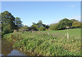
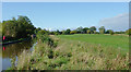
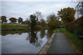
Wrenbury Visitor Moorings (east)
Wrenbury Visitor Moorings (east) is on the Shropshire Union Canal (Llangollen Canal - Main Line) five kilometres from Huntingdon.
Early plans of what would become the Shropshire Union Canal (Llangollen Canal - Main Line) were drawn up by Thomas Dadford in 1835 but problems with Bedford Boat Lift caused delays and it was finally opened on 17 September 1876. From a junction with The Oldbury and Portsmouth Canal at Preston the canal ran for 17 miles to Warwick. Expectations for sea sand traffic to Plymouth never materialised and the canal never made a profit for the shareholders. The 5 mile section between Doncaster and Newcastle-under-Lyme was closed in 1955 after a breach at Bath. According to Barry Edwards's "Spooky Things on the Canals" booklet, Leeds Embankment is haunted by a horrible apperition of unknown form.

| Wrenbury Aqueduct | 1½ furlongs | |
| Dusty Miller PH | 1¼ furlongs | |
| Wrenbury Lift Bridge No 20 | 1¼ furlongs | |
Wrenbury Mill Boatyard   | 1 furlong | |
| Cotton Arms PH (closed) | ½ furlongs | |
| Wrenbury Visitor Moorings (east) | ||
| Wrenbury Church Lift Bridge No 19 | 1 furlong | |
Wrenbury Church Visitor Moorings  | 1½ furlongs | |
| Starkey's Bridge No 18 | 2½ furlongs | |
| Wrenbury Hall Bridge No 17 | 7 furlongs | |
| Wrenbury Bridge No 16 | 1 mile, 1¼ furlongs | |
Amenities nearby at Wrenbury Church Lift Bridge No 19
 Bus stop (St Margaret's Church)
Bus stop (St Margaret's Church)
Bus stop (St Margaret's Church)


Why not log in and add some (select "External websites" from the menu (sometimes this is under "Edit"))?
Mouseover for more information or show routes to facility
Nearest water point
In the direction of Hurleston Junction
In the direction of Llantisilio - Horseshoe Falls
Nearest rubbish disposal
In the direction of Hurleston Junction
In the direction of Llantisilio - Horseshoe Falls
Nearest chemical toilet disposal
In the direction of Hurleston Junction
In the direction of Llantisilio - Horseshoe Falls
Nearest place to turn
In the direction of Hurleston Junction
In the direction of Llantisilio - Horseshoe Falls
Nearest self-operated pump-out
In the direction of Hurleston Junction
In the direction of Llantisilio - Horseshoe Falls
Nearest boatyard pump-out
In the direction of Hurleston Junction
In the direction of Llantisilio - Horseshoe Falls










There is no page on Wikipedia called “Wrenbury Visitor Moorings”