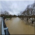
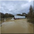
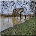
Longholme Way Bridge
River Great Ouse, Longholme Way, Bedford MK42 0BZ, United Kingdom

Longholme Way Bridge
is a minor waterways place
on the River Great Ouse (Canalized Section) between
Eaton Socon Lock No 8 (13 miles and ½ furlongs
and 5 locks
to the northeast) and
Bedford (6 furlongs
and 1 lock
to the west).
The nearest place in the direction of Eaton Socon Lock No 8 is Longholme Way Footbridge No 1;
¼ furlongs
away.
The nearest place in the direction of Bedford is Duck Mill Lock Weir Exit No 2 (Channel leading to the Weir);
2¼ furlongs
away.
Mooring here is unrated.
There is a bridge here which takes a major road over the canal.
| Priory Marina | 2½ furlongs | |
| Duck Mill Lock Weir Exit No 3 | 2 furlongs | |
| Fenlake Meadow GOBA Moorings | 1¾ furlongs | |
| Longholme Way Footbridge No 2 | ½ furlongs | |
| Longholme Way Footbridge No 1 | ¼ furlongs | |
| Longholme Way Bridge | ||
| Duck Mill Lock Weir Exit No 2 | 2¼ furlongs | |
| Bedford Town Moorings No 1 | 2¾ furlongs | |
| Cardington Road Footbridge | 3½ furlongs | |
| Duck Mill Lock Weir Exit No 1 | 4¼ furlongs | |
| Duck Mill Lock | 4½ furlongs | |
Amenities here
Amenities nearby at Longholme Way Footbridge No 1
Amenities in Bedford
Amenities at other places in Bedford
- Great Ouse Navigation | boating, moorings, navigation notices — associated with River Great Ouse
- Information regarding the Great Ouse navigation and tributaries.
- Information for boaters on the River Great Ouse - GOV.UK — associated with River Great Ouse
- River Great Ouse: bridge heights, locks, overhead power lines and facilities.
- Facebook Account — associated with River Great Ouse
- Anglian Waterways Manager Facebook Account
- Facebook Anglian Waterways Page — associated with River Great Ouse
- Facebook Page for Environment Agency Anglian Waterways
Mouseover for more information or show routes to facility
Nearest water point
In the direction of Brownshill Staunch (Lock)
St Neots Priory Centre Mooring — 14 miles, 2 furlongs and 6 locks away
On this waterway in the direction of Brownshill Staunch (Lock)Nearest rubbish disposal
In the direction of Brownshill Staunch (Lock)
St Neots Priory Centre Mooring — 14 miles, 2 furlongs and 6 locks away
On this waterway in the direction of Brownshill Staunch (Lock)Nearest place to turn
In the direction of Kempston Mill
Duck Mill Lock Weir Exit No 1 — 4¼ furlongs away
On this waterway in the direction of Kempston Mill
Duck Mill Lock Weir Entrance No 2 — 4½ furlongs and 1 lock away
On this waterway in the direction of Kempston Mill
In the direction of Brownshill Staunch (Lock)
Priory Marina — 2½ furlongs away
On this waterway in the direction of Brownshill Staunch (Lock)
Cardington Lock Weir Exit No 2 — 1 mile, 6½ furlongs and 1 lock away
On this waterway in the direction of Brownshill Staunch (Lock)
Site of Old Mills Lock — 5 miles, 6¼ furlongs and 3 locks away
On this waterway in the direction of Brownshill Staunch (Lock)
Great Barford Lock Weir Exit — 6 miles, 4¼ furlongs and 4 locks away
On this waterway in the direction of Brownshill Staunch (Lock)
Roxton Lock Weir Exit — 8 miles, 6½ furlongs and 5 locks away
On this waterway in the direction of Brownshill Staunch (Lock)
Eynesbury Manor Marina — 12 miles, 5½ furlongs and 5 locks away
On this waterway in the direction of Brownshill Staunch (Lock)
River Mill Marina — 13 miles, ¼ furlongs and 5 locks away
On this waterway in the direction of Brownshill Staunch (Lock)
St Neots Marina — 14 miles, ¾ furlongs and 6 locks away
On this waterway in the direction of Brownshill Staunch (Lock)
St Neots Lock Weir Entrance — 15 miles, ¾ furlongs and 6 locks away
On this waterway in the direction of Brownshill Staunch (Lock)
Mill Lane Bridge Winding Hole — 15 miles, 3½ furlongs and 7 locks away
On this waterway in the direction of Brownshill Staunch (Lock)
St Neots Lock Weir Exit — 15 miles, 7¼ furlongs and 7 locks away
On this waterway in the direction of Brownshill Staunch (Lock)
Offord Lock Weir Exit No 3 — 19 miles, 7¾ furlongs and 8 locks away
On this waterway in the direction of Brownshill Staunch (Lock)No information
CanalPlan has no information on any of the following facilities within range:chemical toilet disposal
self-operated pump-out
boatyard pump-out
Direction of TV transmitter (From Wolfbane Cybernetic)
There is no page on Wikipedia called “Longholme Way Bridge”
Wikipedia pages that might relate to Longholme Way Bridge
[List of electoral wards in England by constituency]
Goodshaw, Greensclough, Hareholme, Healey and Whitworth, Helmshore, Irwell, Longholme, Marsh House, North Turton with Tockholes, Stacksteads, Sudell, Sunnyhurst
[Organisation of the Methodist Church of Great Britain]
Royton Circuit; Stockport Circuit; Stretford & Urmston Circuit; Whaley Bridge Uniting Partnership Newcastle upon Tyne District Bede Circuit; Chester-le-Street
Results of Google Search
Bedford, Newnham Bridge 1897 - Francis FrithAt this time the bridge has very rustic balustrades. The scene is very different today: the bridge was rebuilt in the 1930s in concrete with cast concrete panelled parapets, and behind is the roaring road bridge of Longholme Way. This chapter's tour of the river banks is now completed, and we return to the town centre for the ...
This bridge carrying Longholme Way over the Great Ouse and its flood plain in Bedford was reconstructed to replace the existing degraded prestressed- concrete structure. Bailey bridges had been installed as a temporary measure. A single two lane carriageway was carried with a wide footway providing the necessary ...
Jun 5, 2015 ... Bedford Town Centre Transport Strategy : ST15226-1/1. Figure 3.18 Breakdown of actual vehicle trips entering or exiting the external cordon area (PM Peak Hour ) ...31. Figure 3.19 Longholme Way Bridge (ANPR Site 5) AM Peak Hour Traffic Distribution ..........................................32. Figure 3.20 Town Bridge ...
Jan 27, 2016 ... There will be clearly signed diversion route, but drivers will be diverted via the A6 Ampthill Road, Rope Walk, Longholme Way, Newnham Avenue and A4280 Goldington Road to re-join the A421 at Renhold interchange. The work is dependent on suitable weather conditions, and dates may be subject to ...
Renew bridge decking and approaches. Longholme Way. Narrow underpass connecting. Embankment Gardens to Aspects Leisure. Centre. ‡. Improve underpass and surface connection as part of Aspects development proposals. ‡. Improve surfacing, detailing to footpaths beneath Longholme Way. Newnham. ‡. Reinforce ...
Jan 6, 2018 ... View 24 photos for 1201 Waybridge Way, Weddington, NC 28104 a 6 bed, 3 bath , 5084 Sq. Ft. single_family built in 2007 that sold on Today.
All towing vehicles should take the fourth exit, the A5140 Longholme Way, cross the river, take the first left into the embankment then immediately left again over the white bridge onto Longholme Island. No vehicles are allowed to park on the grass between the Embankment and the river. Boats can be left on trestles here, Â ...
Draw and documents for Bedford Sprint Regatta 2012. Due to the Olympic Torch Relay. Major traffic restrictions will be in place on Sunday 8th July – the Town Bridge and the Embankment will close at 06.00. Longholme Way, Barkers Lane and Newnham Ave will close at 09.00 until approx 11.00. Only towing vehicles or  ...
Software solutions for matter management, e-Billing and compliance for legal departments. More than 30 years of experience. Contact us today for a demo.
Sep 30, 2017 ... Stanley Thurston's Family Funfair - Longholme Way Bedford 2017 - Duration: 3: 18. Franks' Fairground Video's 3,058 views · 3:18. Bob Wilson Funfairs' Waltzer Onride @ Funland at The Tropicana 2016 - Duration: 3:06. Fair Rides Euphoria 1,253 views · 3:06 · STRATFORD WONDER WORLD FUNFAIR ...


![Canada Geese and young on the River Great Ouse. Taken from the [[809246]], these geese were heading for the bank of the river for some grazing http://www.geograph.org.uk/photo/809252 . by Robin Drayton – 11 May 2008](https://s1.geograph.org.uk/photos/80/92/809265_8ae8f412_120x120.jpg)


