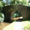
Brynich Bridge No 164
A40 Field Bridge
Monmouthshire & Brecon Canal towpath, Groesffordd LD3 7SH, United Kingdom

Brynich Bridge No 164
is a minor waterways place
on the Monmouthshire and Brecon Canal between
Brynich Aqueduct No 2 (southern end) (Also called River Usk Aqueduct) (6½ furlongs
and 1 lock
to the east) and
Theatre Basin (End of navigation and Brecon town centre) (1 mile and 3¾ furlongs
to the west).
The nearest place in the direction of Brynich Aqueduct No 2 (southern end) is Cefn Brynich Aqueduct No 1;
½ furlongs
away.
The nearest place in the direction of Theatre Basin is Brecon Flyover Bridge No 164A (Brynich Bridge Long Road Bridge (68yds) under the A40 dual carriageway);
1½ furlongs
away.
There may be access to the towpath here.
Mooring here is unrated.
There is a bridge here which takes a track over the canal.
| Brynich Aqueduct No 2 (southern end) | 6½ furlongs | |
| Brynich Aqueduct No 2 (northern end) | 6¼ furlongs | |
| Cefn Brynich Bridge No 163 | 5¼ furlongs | |
| Brynich Lock No 69 | 5¼ furlongs | |
| Cefn Brynich Aqueduct No 1 | ½ furlongs | |
| Brynich Bridge No 164 | ||
| Brecon Flyover Bridge No 164A | 1½ furlongs | |
| Watton Road Bridge No 165 | 1 mile, ¾ furlongs | |
| Gasworks Lane Road Bridge No 166 | 1 mile, 3 furlongs | |
| Dadfords Bridge Winding Hole | 1 mile, 3¼ furlongs | |
| Dadfords Bridge No 167 | 1 mile, 3½ furlongs | |
There are no links to external websites from here.
Why not log in and add some (select "External websites" from the menu (sometimes this is under "Edit"))?
Why not log in and add some (select "External websites" from the menu (sometimes this is under "Edit"))?
Mouseover for more information or show routes to facility
Nearest water point
In the direction of Five Locks Road
Brynich Aqueduct No 2 (southern end) — 6½ furlongs and 1 lock away
On this waterway in the direction of Five Locks Road
Govilon Wharf — 19 miles, 1¼ furlongs and 6 locks away
On this waterway in the direction of Five Locks Road
Govilon Visitor Moorings — 19 miles, 2 furlongs and 6 locks away
On this waterway in the direction of Five Locks RoadNearest place to turn
In the direction of Five Locks Road
Brynich Turn Bridge Winding Hole — 7½ furlongs and 1 lock away
On this waterway in the direction of Five Locks Road
Storehouse Bridge Winding Hole — 2 miles, ¾ furlongs and 1 lock away
On this waterway in the direction of Five Locks Road
Pencelli Winding Hole — 3 miles, 2 furlongs and 1 lock away
On this waterway in the direction of Five Locks Road
Beacon Park Boats — 14 miles, 1 furlong and 6 locks away
On this waterway in the direction of Five Locks Road
Pen-Pedair Heol Winding Hole — 15 miles, ¾ furlongs and 6 locks away
On this waterway in the direction of Five Locks Road
Malford Grove Winding Hole — 16 miles, 6½ furlongs and 6 locks away
On this waterway in the direction of Five Locks Road
Govilon Winding Hole — 19 miles, 1½ furlongs and 6 locks away
On this waterway in the direction of Five Locks Road
In the direction of Theatre Basin
Dadfords Bridge Winding Hole — 1 mile, 3¼ furlongs away
On this waterway in the direction of Theatre Basin
Theatre Basin — 1 mile, 3¾ furlongs away
On this waterway in the direction of Theatre BasinNo information
CanalPlan has no information on any of the following facilities within range:rubbish disposal
chemical toilet disposal
self-operated pump-out
boatyard pump-out
Direction of TV transmitter (From Wolfbane Cybernetic)
There is no page on Wikipedia called “Brynich Bridge”
Wikipedia pages that might relate to Brynich Bridge
[River Usk]
miles downstream is Lock Bridge which carries the B4558 over the river and immediately downstream again is the substantial Brynich Aqueduct bringing the
[Monmouthshire and Brecon Canal]
2 km) below Brecon, the canal crosses the River Usk on an aqueduct at Brynich, and a final lock brings the total rise to 68 ft (21 m). The River Usk
[Llanfrynach]
community includes the hamlets of Llanhamlach and Groesffordd. The Cefn Brynich Canal Bridge Aqueduct over the Usk is a Grade II* listed structure. The community
[Crumlin Arm (Monmouthshire canal)]
Newport to Green Meadow Bridge, Crosskeys. 1.5 miles (2.4 km) of canal between Pontywaun Aqueduct (Pontywaun) to Darren Bridge (Risca) is still navigable
[Pontymoile Basin]
and Theatre Basin A40(T) Road bridges 69 Brynich lock Brynich aqueduct Nant Menasgin aqueduct B4558 Cross Keys bridge, Pencelli Afon Caerfanell aqueduct
[List of Roman-to-modern scheduled monuments in Powys (Brecknockshire)]
NPRN: not yet identified. CPAT PRN not yet identified. Cadw SAM: BR185: Brynich Aqueduct (Brecknock & Abergavenny Canal) coflein NPRN: not yet identified
[Grade II* listed buildings in Powys]
3408972233637 (Cefn Brynich Canal Bridge Aqueduct) Aqueduct Situated crossing the Usk some 180m downstream of the Lock Bridge on the road to Llanfrynach
Results of Google Search
Apr 13, 2008 ... No, a lot! We had reckoned on six miles from Brecon to the ... Cyclists Dismount by Brynich Bridge 164 ... "Vaila" and Cefn Brynich Bridge 163
Bridge 164A. 35 minutes. Bench with a view of the hills. 45 minutes. Bench just before Brynich Lock. 55 minutes. Bridge number 165 by. Morrisons petrol station.
Brecon to Brynich Aqueduct (Bridge 167 - 162) ... locks, a stretch of around 3km, but please note that there is a lack of resting areas between bridge 164 and 163. ... The towpath is smooth and hard with no considerable linear or cross slope.
Jul 7, 2015 ... 3. Pant y Goitre Bridge. 4. Crickhowell and Llangynidr Bridges. 5. Brynich Aqueduct. 6. Abercamlais Suspension Bridge. 7. Llandeilo Bridge. 8.
Jan 3, 2017 ... Milford Haven to Brecon Gas Pipeline Archive: Ref. No. MHB ... Brecon Bridge I Usk Road Bridge I Llanfeas Bridge, Brecon, c.1920: NPRN 23764; Brecon ... 1965: NPRN 164; St. Bride's I St Bridget's Church, 1965: NPRN 155Â ...


![Railings at Weir No 1, Mon & Brec Canal. The water from the weir flows a short distance in to the Brynich [[6812688]]. by M J Roscoe – 15 April 2021](https://s2.geograph.org.uk/geophotos/06/81/20/6812010_41d28708_120x120.jpg)


![Under footbridge over the Brynich. Stream under bridge [[6818900]] just before it flow into River Usk. by M J Roscoe – 15 April 2021](https://s2.geograph.org.uk/geophotos/06/81/90/6819006_15d5a310_120x120.jpg)


