CanalPlanAC

Stroud Railway Viaduct

 
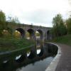
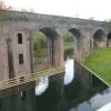
New cut under the Swindon to Stroud railway.
Dr Newton's Way, Rodborough GL5 2AP, United Kingdom (A419)
 
Information about the place
Stroud Railway Viaduct is a minor waterways place on the Cotswold Canals (Thames and Severn Canal - Wide section) between Bourne Lock No 8 (Rescued 1995) (2 miles and 2½ furlongs and 5 locks to the southeast) and Site of Entrance to Wallbridge Basin (The junction between the Stroudwater Navigation and the Thames & Severn Canal.) (4¾ furlongs and 2 locks to the west).
 
 
The nearest place in the direction of Bourne Lock No 8 is River Frome Aqueduct; 1 furlong away.
 
The nearest place in the direction of Site of Entrance to Wallbridge Basin is Capel's Mill New Canal Channel; ¼ furlongs away.

Mooring here is unrated.

There is a bridge here which takes a railway over the canal.


Amenities

Amenities here

 Waitrose
 Waitrose Ltd
 
Maps
If you are a user and are logged on, or if you are actively planning a route, a map will be displayed here.
Show on external mapping site: Google | OSM | Bing
 
Photos
 
External websites
There are no links to external websites from here.
Why not log in and add some (select "External websites" from the menu (sometimes this is under "Edit"))?
 
Nearest facilities

Mouseover for more information or show routes to facility

Nearest water point

In the direction of Site of Entrance to Wallbridge Basin

Saul Junction Marina7 miles, 2¾ furlongs and 14 locks away
Travel to Site of Entrance to Wallbridge Basin, then on the Cotswold Canals (Stroudwater Navigation - Un-navigable Section) to Walk Bridge, then on the Cotswold Canals (Stroudwater Navigation - Navigable Section) to Saul Junction Marina
Saul Junction Winding Hole7 miles, 4 furlongs and 14 locks away
Travel to Site of Entrance to Wallbridge Basin, then on the Cotswold Canals (Stroudwater Navigation - Un-navigable Section) to Walk Bridge, then on the Cotswold Canals (Stroudwater Navigation - Navigable Section) to Saul Junction, then on the Gloucester and Sharpness Canal to Saul Junction Winding Hole
Cotswold Canals Trust Visitor Centre - Saul Junction7 miles, 4¾ furlongs and 14 locks away
Travel to Site of Entrance to Wallbridge Basin, then on the Cotswold Canals (Stroudwater Navigation - Un-navigable Section) to Walk Bridge, then on the Cotswold Canals (Stroudwater Navigation - Navigable Section) to Saul Junction, then on the Gloucester and Sharpness Canal to Cotswold Canals Trust Visitor Centre - Saul Junction
Fretherne Bridge8 miles, 2 furlongs and 14 locks away
Travel to Site of Entrance to Wallbridge Basin, then on the Cotswold Canals (Stroudwater Navigation - Un-navigable Section) to Walk Bridge, then on the Cotswold Canals (Stroudwater Navigation - Navigable Section) to Saul Junction, then on the Gloucester and Sharpness Canal to Fretherne Bridge
Splatt Bridge9 miles, 2¾ furlongs and 14 locks away
Travel to Site of Entrance to Wallbridge Basin, then on the Cotswold Canals (Stroudwater Navigation - Un-navigable Section) to Walk Bridge, then on the Cotswold Canals (Stroudwater Navigation - Navigable Section) to Saul Junction, then on the Gloucester and Sharpness Canal to Splatt Bridge
Patch Bridge11 miles, 1¾ furlongs and 14 locks away
Travel to Site of Entrance to Wallbridge Basin, then on the Cotswold Canals (Stroudwater Navigation - Un-navigable Section) to Walk Bridge, then on the Cotswold Canals (Stroudwater Navigation - Navigable Section) to Saul Junction, then on the Gloucester and Sharpness Canal to Patch Bridge
Sellars Bridge11 miles, 1¾ furlongs and 14 locks away
Travel to Site of Entrance to Wallbridge Basin, then on the Cotswold Canals (Stroudwater Navigation - Un-navigable Section) to Walk Bridge, then on the Cotswold Canals (Stroudwater Navigation - Navigable Section) to Saul Junction, then on the Gloucester and Sharpness Canal to Sellars Bridge
Purton Lower Bridge13 miles, 5¼ furlongs and 14 locks away
Travel to Site of Entrance to Wallbridge Basin, then on the Cotswold Canals (Stroudwater Navigation - Un-navigable Section) to Walk Bridge, then on the Cotswold Canals (Stroudwater Navigation - Navigable Section) to Saul Junction, then on the Gloucester and Sharpness Canal to Purton Lower Bridge
Llanthony Pontoons14 miles, 7¾ furlongs and 14 locks away
Travel to Site of Entrance to Wallbridge Basin, then on the Cotswold Canals (Stroudwater Navigation - Un-navigable Section) to Walk Bridge, then on the Cotswold Canals (Stroudwater Navigation - Navigable Section) to Saul Junction, then on the Gloucester and Sharpness Canal to Llanthony Pontoons
Llanthony Road Bridge15 miles, ½ furlongs and 14 locks away
Travel to Site of Entrance to Wallbridge Basin, then on the Cotswold Canals (Stroudwater Navigation - Un-navigable Section) to Walk Bridge, then on the Cotswold Canals (Stroudwater Navigation - Navigable Section) to Saul Junction, then on the Gloucester and Sharpness Canal to Llanthony Road Bridge
Gloucester Waterways Museum Arm15 miles, 1 furlong and 14 locks away
Travel to Site of Entrance to Wallbridge Basin, then on the Cotswold Canals (Stroudwater Navigation - Un-navigable Section) to Walk Bridge, then on the Cotswold Canals (Stroudwater Navigation - Navigable Section) to Saul Junction, then on the Gloucester and Sharpness Canal to Gloucester Waterways Museum Arm
Gloucester Dock Lock15 miles, 1¾ furlongs and 14 locks away
Travel to Site of Entrance to Wallbridge Basin, then on the Cotswold Canals (Stroudwater Navigation - Un-navigable Section) to Walk Bridge, then on the Cotswold Canals (Stroudwater Navigation - Navigable Section) to Saul Junction, then on the Gloucester and Sharpness Canal to Gloucester Dock Lock

Nearest rubbish disposal

In the direction of Site of Entrance to Wallbridge Basin

Saul Junction Marina7 miles, 2¾ furlongs and 14 locks away
Travel to Site of Entrance to Wallbridge Basin, then on the Cotswold Canals (Stroudwater Navigation - Un-navigable Section) to Walk Bridge, then on the Cotswold Canals (Stroudwater Navigation - Navigable Section) to Saul Junction Marina
Saul Junction Winding Hole7 miles, 4 furlongs and 14 locks away
Travel to Site of Entrance to Wallbridge Basin, then on the Cotswold Canals (Stroudwater Navigation - Un-navigable Section) to Walk Bridge, then on the Cotswold Canals (Stroudwater Navigation - Navigable Section) to Saul Junction, then on the Gloucester and Sharpness Canal to Saul Junction Winding Hole
Fretherne Bridge8 miles, 2 furlongs and 14 locks away
Travel to Site of Entrance to Wallbridge Basin, then on the Cotswold Canals (Stroudwater Navigation - Un-navigable Section) to Walk Bridge, then on the Cotswold Canals (Stroudwater Navigation - Navigable Section) to Saul Junction, then on the Gloucester and Sharpness Canal to Fretherne Bridge
Parkend Bridge9 miles, ½ furlongs and 14 locks away
Travel to Site of Entrance to Wallbridge Basin, then on the Cotswold Canals (Stroudwater Navigation - Un-navigable Section) to Walk Bridge, then on the Cotswold Canals (Stroudwater Navigation - Navigable Section) to Saul Junction, then on the Gloucester and Sharpness Canal to Parkend Bridge
Splatt Bridge9 miles, 2¾ furlongs and 14 locks away
Travel to Site of Entrance to Wallbridge Basin, then on the Cotswold Canals (Stroudwater Navigation - Un-navigable Section) to Walk Bridge, then on the Cotswold Canals (Stroudwater Navigation - Navigable Section) to Saul Junction, then on the Gloucester and Sharpness Canal to Splatt Bridge
Patch Bridge11 miles, 1¾ furlongs and 14 locks away
Travel to Site of Entrance to Wallbridge Basin, then on the Cotswold Canals (Stroudwater Navigation - Un-navigable Section) to Walk Bridge, then on the Cotswold Canals (Stroudwater Navigation - Navigable Section) to Saul Junction, then on the Gloucester and Sharpness Canal to Patch Bridge
Sellars Bridge11 miles, 1¾ furlongs and 14 locks away
Travel to Site of Entrance to Wallbridge Basin, then on the Cotswold Canals (Stroudwater Navigation - Un-navigable Section) to Walk Bridge, then on the Cotswold Canals (Stroudwater Navigation - Navigable Section) to Saul Junction, then on the Gloucester and Sharpness Canal to Sellars Bridge
Purton Lower Bridge13 miles, 5¼ furlongs and 14 locks away
Travel to Site of Entrance to Wallbridge Basin, then on the Cotswold Canals (Stroudwater Navigation - Un-navigable Section) to Walk Bridge, then on the Cotswold Canals (Stroudwater Navigation - Navigable Section) to Saul Junction, then on the Gloucester and Sharpness Canal to Purton Lower Bridge
Sharpness Barge Arm15 miles, ½ furlongs and 14 locks away
Travel to Site of Entrance to Wallbridge Basin, then on the Cotswold Canals (Stroudwater Navigation - Un-navigable Section) to Walk Bridge, then on the Cotswold Canals (Stroudwater Navigation - Navigable Section) to Saul Junction, then on the Gloucester and Sharpness Canal to Sharpness Barge Arm
Llanthony Road Bridge15 miles, ½ furlongs and 14 locks away
Travel to Site of Entrance to Wallbridge Basin, then on the Cotswold Canals (Stroudwater Navigation - Un-navigable Section) to Walk Bridge, then on the Cotswold Canals (Stroudwater Navigation - Navigable Section) to Saul Junction, then on the Gloucester and Sharpness Canal to Llanthony Road Bridge

Nearest chemical toilet disposal

In the direction of Site of Entrance to Wallbridge Basin

Saul Junction Marina7 miles, 2¾ furlongs and 14 locks away
Travel to Site of Entrance to Wallbridge Basin, then on the Cotswold Canals (Stroudwater Navigation - Un-navigable Section) to Walk Bridge, then on the Cotswold Canals (Stroudwater Navigation - Navigable Section) to Saul Junction Marina
Cotswold Canals Trust Visitor Centre - Saul Junction7 miles, 4¾ furlongs and 14 locks away
Travel to Site of Entrance to Wallbridge Basin, then on the Cotswold Canals (Stroudwater Navigation - Un-navigable Section) to Walk Bridge, then on the Cotswold Canals (Stroudwater Navigation - Navigable Section) to Saul Junction, then on the Gloucester and Sharpness Canal to Cotswold Canals Trust Visitor Centre - Saul Junction
Sharpness Barge Arm15 miles, ½ furlongs and 14 locks away
Travel to Site of Entrance to Wallbridge Basin, then on the Cotswold Canals (Stroudwater Navigation - Un-navigable Section) to Walk Bridge, then on the Cotswold Canals (Stroudwater Navigation - Navigable Section) to Saul Junction, then on the Gloucester and Sharpness Canal to Sharpness Barge Arm
Llanthony Road Bridge15 miles, ½ furlongs and 14 locks away
Travel to Site of Entrance to Wallbridge Basin, then on the Cotswold Canals (Stroudwater Navigation - Un-navigable Section) to Walk Bridge, then on the Cotswold Canals (Stroudwater Navigation - Navigable Section) to Saul Junction, then on the Gloucester and Sharpness Canal to Llanthony Road Bridge

Nearest place to turn

In the direction of Bourne Mill Bridge

Brimscombe Port2 miles, 1¼ furlongs and 5 locks away
On this waterway in the direction of Bourne Mill Bridge
Latton Junction19 miles, 4¾ furlongs and 37 locks away
Travel to Bourne Mill Bridge, then on the Cotswold Canals (Thames and Severn Canal - Wide/long lock section) to Bourne Bridge, then on the Cotswold Canals (Thames and Severn Canal - Main section) to Latton Junction

In the direction of Site of Entrance to Wallbridge Basin

Ryeford Winding Hole2 miles, 5¼ furlongs and 6 locks away
Travel to Site of Entrance to Wallbridge Basin, then on the Cotswold Canals (Stroudwater Navigation - Un-navigable Section) to Ryeford Winding Hole
The Ocean3 miles, 5 furlongs and 6 locks away
Travel to Site of Entrance to Wallbridge Basin, then on the Cotswold Canals (Stroudwater Navigation - Un-navigable Section) to The Ocean
Saul Junction Winding Hole7 miles, 4 furlongs and 14 locks away
Travel to Site of Entrance to Wallbridge Basin, then on the Cotswold Canals (Stroudwater Navigation - Un-navigable Section) to Walk Bridge, then on the Cotswold Canals (Stroudwater Navigation - Navigable Section) to Saul Junction, then on the Gloucester and Sharpness Canal to Saul Junction Winding Hole
Pegthorne Bridge Winding Hole8 miles, ¾ furlongs and 14 locks away
Travel to Site of Entrance to Wallbridge Basin, then on the Cotswold Canals (Stroudwater Navigation - Un-navigable Section) to Walk Bridge, then on the Cotswold Canals (Stroudwater Navigation - Navigable Section) to Saul Junction, then on the Gloucester and Sharpness Canal to Pegthorne Bridge Winding Hole
Quedgeley Oil Depot11 miles, 3¼ furlongs and 14 locks away
Travel to Site of Entrance to Wallbridge Basin, then on the Cotswold Canals (Stroudwater Navigation - Un-navigable Section) to Walk Bridge, then on the Cotswold Canals (Stroudwater Navigation - Navigable Section) to Saul Junction, then on the Gloucester and Sharpness Canal to Quedgeley Oil Depot
Monk Meadow Dock14 miles, 5½ furlongs and 14 locks away
Travel to Site of Entrance to Wallbridge Basin, then on the Cotswold Canals (Stroudwater Navigation - Un-navigable Section) to Walk Bridge, then on the Cotswold Canals (Stroudwater Navigation - Navigable Section) to Saul Junction, then on the Gloucester and Sharpness Canal to Monk Meadow Dock
Sharpness Barge Arm15 miles, ½ furlongs and 14 locks away
Travel to Site of Entrance to Wallbridge Basin, then on the Cotswold Canals (Stroudwater Navigation - Un-navigable Section) to Walk Bridge, then on the Cotswold Canals (Stroudwater Navigation - Navigable Section) to Saul Junction, then on the Gloucester and Sharpness Canal to Sharpness Barge Arm
Gloucester Docks15 miles, 1¼ furlongs and 14 locks away
Travel to Site of Entrance to Wallbridge Basin, then on the Cotswold Canals (Stroudwater Navigation - Un-navigable Section) to Walk Bridge, then on the Cotswold Canals (Stroudwater Navigation - Navigable Section) to Saul Junction, then on the Gloucester and Sharpness Canal to Gloucester Docks Travel to Site of Entrance to Wallbridge Basin, then on the Cotswold Canals (Stroudwater Navigation - Un-navigable Section) to Walk Bridge, then on the Cotswold Canals (Stroudwater Navigation - Navigable Section) to Saul Junction, then on the Gloucester and Sharpness Canal to Waterways Office (South Wales and Severn Waterways) - Canal & River Trust
Gloucester / Sharpness - Severn Junction15 miles, 2 furlongs and 15 locks away
Travel to Site of Entrance to Wallbridge Basin, then on the Cotswold Canals (Stroudwater Navigation - Un-navigable Section) to Walk Bridge, then on the Cotswold Canals (Stroudwater Navigation - Navigable Section) to Saul Junction, then on the Gloucester and Sharpness Canal to Gloucester / Sharpness - Severn Junction
Upper Parting Junction17 miles, 6¾ furlongs and 15 locks away
Travel to Site of Entrance to Wallbridge Basin, then on the Cotswold Canals (Stroudwater Navigation - Un-navigable Section) to Walk Bridge, then on the Cotswold Canals (Stroudwater Navigation - Navigable Section) to Saul Junction, then on the Gloucester and Sharpness Canal to Gloucester / Sharpness - Severn Junction, then on the River Severn (main river - Worcester to Gloucester) to Upper Parting Junction
Over Winding Hole17 miles, 2 furlongs and 16 locks away
Travel to Site of Entrance to Wallbridge Basin, then on the Cotswold Canals (Stroudwater Navigation - Un-navigable Section) to Walk Bridge, then on the Cotswold Canals (Stroudwater Navigation - Navigable Section) to Saul Junction, then on the Gloucester and Sharpness Canal to Gloucester / Sharpness - Severn Junction, then on the River Severn (old river navigation) to Lower Parting, then on the River Severn (Maisemore Channel - Southern Section) to Over Junction, then on the Hereford and Gloucester Canal to Over Winding Hole
Direction of TV transmitter (From Wolfbane Cybernetic)
 
 
Geograph
 
Wikipedia

There is no page on Wikipedia called “Stroud Railway Viaduct”

Wikipedia pages that might relate to Stroud Railway Viaduct
[Crumlin Viaduct] The Crumlin Viaduct was a railway viaduct located above the village of Crumlin in South Wales, originally built to carry the Taff Vale Extension of the [Garabit viaduct] The Garabit Viaduct (Viaduc de Garabit in French) is a railway arch bridge spanning the Truyère, near Ruynes-en-Margeride, Cantal, France, in the mountainous [Knaresborough Viaduct] Knaresborough Viaduct is a viaduct in the North Yorkshire town of Knaresborough, England. The viaduct carries the Harrogate line over the River Nidd in [Holborn Viaduct railway station] Holborn Viaduct was a railway station in the City of London, providing local and commuter services. It was located to the southeast of Holborn Viaduct, and [Cornwall Railway viaducts] of the timber viaducts by all-masonry structures began in the 1870s but a few remained in service until the 1930s. The Cornwall Railway linked Plymouth [Wharncliffe Viaduct] The Wharncliffe Viaduct is a brick-built viaduct that carries the Great Western Main Line railway across the Brent Valley, between Hanwell and Southall [Huckford Viaduct] Paddington. The viaduct was constructed during 1902 by the Great Western Railway as part of the Wootton Bassett to Patchway railway line. Its construction [The Great Northern Railway Trail] the viaduct there was opened, along with a second stretch between the former Queensbury railway station and a point just south of Thornton Viaduct. The [Edgware, Highgate and London Railway] terrain in the area traversed by the railway, the line made extensive use of cuttings, embankments and viaducts. Particularly notable were the cutting [History of Stroud Green] Stroud Green in London, England, is a suburb adjacent to Finsbury Park in the northern part of Greater London. While most of the area (east and north)
 
Google

Results of Google Search

Stroud (Midland) railway station - Wikipedia
Stroud railway station served the town of Stroud, in Gloucestershire, England. The station was on a short 1.25 mi-long branch from Dudbridge on the ...
Unusual meandering canal and magnificent railway viaduct - Dr ...
Dr Newtons Way Bridge: Unusual meandering canal and magnificent railway viaduct - See 5 traveller reviews, 4 candid photos, and great deals for Stroud, UK,  ...
Capel's Mill - Thames & Severn Canal
Jun 10, 2018 ... The original canal line was lost when the Stroud bypass (Dr Newton's Way) was built in ... Capel's Mill - Railway Viaduct & New Canal Channel.
Dr Newtons Way Bridge (Stroud) - 2019 All You Need to Know ...
Walking down from Waitrose in Stroud, you come out at the Dr Newtons Way Bridge, that crossed .... Unusual meandering canal and magnificent railway viaduct.
Chalford viaduct to be repaired | Stroud News and Journal
Oct 11, 2018 ... An old railway bridge in Chalford is to receive urgent repair work.
Bridge, near Waitrose - Review of Dr Newtons Way Bridge, Stroud ...
If you want to look at this in some detail then park your car in the Waitrose car park, and pop across the road (other car parks are available) The Railway viaduct ...
Railway history of the Golden Valley Line
Jan 25, 2016 ... In a blog for Global Railway Review, Daniel Davis delves into the history of ... of use, as the alternative of the Severn railway bridge between Lydney and ... the Sapperton railway tunnel and down the Golden Valley to Stroud), ...
Lovely area - Review of Dr Newtons Way Bridge, Stroud, England ...
Dr Newtons Way Bridge: Lovely area - See 4 traveler reviews, 4 candid photos ... take in the tow paths, canal, and the great Railway Viaduct that runs above you.
Railway Viaduct, Dr Newton's Way, Stroud © Roger May cc-by-sa ...
Feb 20, 2012 ... SO8504 :: Railway Viaduct, Dr Newton's Way, Stroud, near to Stroud, Gloucestershire, Great Britain by Roger May.
How To Find Us
From Stroud town centre pick up and follow signs to Painswick out on the A46. You go under the railway viaduct past the Apollo Cinema, turning left at the ...