CanalPlanAC

Gloucester Waterways Museum Arm

 
Also known as: Barge Arm
Main Basin, Llanthony Road, Gloucester GL1 2LG, United Kingdom
 
Information about the place
 
 
The nearest place in the direction of Saul Junction is Llanthony Road Bridge; ½ furlongs away.

Mooring here is unrated.

Facilities: water point.


Amenities

Amenities here

 Tank

Amenities nearby at Llanthony Road Bridge

 Brewhouse & Kitchen
 The Lord High Constable of England
 
Maps
If you are a user and are logged on, or if you are actively planning a route, a map will be displayed here.
Show on external mapping site: Google | OSM | Bing
 
Additional information

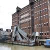
The Barge Arm is located at the side of Llanthony Warehouse which houses the Gloucester Waterways Museum.
Moored in the Arm are Wye, Northwich, Sabrina, Oak and Concretia Along with Steam Dredger No. 5 and Spindrift.

 
Photos
 
External websites
There are no links to external websites from here.
Why not log in and add some (select "External websites" from the menu (sometimes this is under "Edit"))?
 
Nearest facilities

Mouseover for more information or show routes to facility

Nearest water point

The nearest water point is here. Others are at:

In the direction of Sharpness Junction

Llanthony Road Bridge½ furlongs away
On this waterway in the direction of Sharpness Junction
Llanthony Pontoons1¼ furlongs away
On this waterway in the direction of Sharpness Junction
Sellars Bridge3 miles, 7¼ furlongs away
On this waterway in the direction of Sharpness Junction
Saul Junction Winding Hole7 miles, 5¾ furlongs away
On this waterway in the direction of Sharpness Junction
Saul Junction Marina7 miles, 6½ furlongs away
Travel to Saul Junction, then on the Cotswold Canals (Stroudwater Navigation - Navigable Section) to Saul Junction Marina On this waterway in the direction of Sharpness Junction
Fretherne Bridge8 miles, 3½ furlongs away
On this waterway in the direction of Sharpness Junction
Splatt Bridge9 miles, 4½ furlongs away
On this waterway in the direction of Sharpness Junction
Patch Bridge11 miles, 3¼ furlongs away
On this waterway in the direction of Sharpness Junction
Purton Lower Bridge13 miles, 6¾ furlongs away
On this waterway in the direction of Sharpness Junction

In the direction of Gloucester / Sharpness - Severn Junction

Gloucester Dock Lock¾ furlongs away
On this waterway in the direction of Gloucester / Sharpness - Severn Junction
Tewkesbury Lower Lode11 miles, 6¾ furlongs and 1 lock away
Travel to Gloucester / Sharpness - Severn Junction, then on the River Severn (main river - Worcester to Gloucester) to Tewkesbury Lower Lode
Upper Lode Lock No 512 miles, 5 furlongs and 1 lock away
Travel to Gloucester / Sharpness - Severn Junction, then on the River Severn (main river - Worcester to Gloucester) to Upper Lode Lock No 5
Tewkesbury Services13 miles, 3 furlongs and 3 locks away
Travel to Gloucester / Sharpness - Severn Junction, then on the River Severn (main river - Worcester to Gloucester) to Tewkesbury Junction, then on the River Avon - Warwickshire (Lower Avon Navigation) to Tewkesbury Services
Bredon16 miles, 6¾ furlongs and 3 locks away
Travel to Gloucester / Sharpness - Severn Junction, then on the River Severn (main river - Worcester to Gloucester) to Tewkesbury Junction, then on the River Avon - Warwickshire (Lower Avon Navigation) to Bredon
Strensham Lock18 miles, 7 furlongs and 3 locks away
Travel to Gloucester / Sharpness - Severn Junction, then on the River Severn (main river - Worcester to Gloucester) to Tewkesbury Junction, then on the River Avon - Warwickshire (Lower Avon Navigation) to Strensham Lock

Nearest rubbish disposal

In the direction of Sharpness Junction

Llanthony Road Bridge½ furlongs away
On this waterway in the direction of Sharpness Junction
Sellars Bridge3 miles, 7¼ furlongs away
On this waterway in the direction of Sharpness Junction
Parkend Bridge6 miles, ½ furlongs away
On this waterway in the direction of Sharpness Junction
Saul Junction Winding Hole7 miles, 5¾ furlongs away
On this waterway in the direction of Sharpness Junction
Saul Junction Marina7 miles, 6½ furlongs away
Travel to Saul Junction, then on the Cotswold Canals (Stroudwater Navigation - Navigable Section) to Saul Junction Marina
Fretherne Bridge8 miles, 3½ furlongs away
On this waterway in the direction of Sharpness Junction
Splatt Bridge9 miles, 4½ furlongs away
On this waterway in the direction of Sharpness Junction
Patch Bridge11 miles, 3¼ furlongs away
On this waterway in the direction of Sharpness Junction
Purton Lower Bridge13 miles, 6¾ furlongs away
On this waterway in the direction of Sharpness Junction
Sharpness Barge Arm15 miles, 2 furlongs away
On this waterway in the direction of Sharpness Junction

In the direction of Gloucester / Sharpness - Severn Junction

Tewkesbury Services13 miles, 3 furlongs and 3 locks away
Travel to Gloucester / Sharpness - Severn Junction, then on the River Severn (main river - Worcester to Gloucester) to Tewkesbury Junction, then on the River Avon - Warwickshire (Lower Avon Navigation) to Tewkesbury Services

Nearest chemical toilet disposal

In the direction of Sharpness Junction

Llanthony Road Bridge½ furlongs away
On this waterway in the direction of Sharpness Junction
Saul Junction Marina7 miles, 6½ furlongs away
Travel to Saul Junction, then on the Cotswold Canals (Stroudwater Navigation - Navigable Section) to Saul Junction Marina On this waterway in the direction of Sharpness Junction
Sharpness Barge Arm15 miles, 2 furlongs away
On this waterway in the direction of Sharpness Junction

Nearest place to turn

In the direction of Gloucester / Sharpness - Severn Junction

Gloucester Docks¼ furlongs away
On this waterway in the direction of Gloucester / Sharpness - Severn Junction On this waterway in the direction of Gloucester / Sharpness - Severn Junction
Gloucester / Sharpness - Severn Junction1 furlong and 1 lock away
On this waterway in the direction of Gloucester / Sharpness - Severn Junction
Upper Parting Junction2 miles, 5¾ furlongs and 1 lock away
Travel to Gloucester / Sharpness - Severn Junction, then on the River Severn (main river - Worcester to Gloucester) to Upper Parting Junction
Over Winding Hole2 miles, 1 furlong and 2 locks away
Travel to Gloucester / Sharpness - Severn Junction, then on the River Severn (old river navigation) to Lower Parting, then on the River Severn (Maisemore Channel - Southern Section) to Over Junction, then on the Hereford and Gloucester Canal to Over Winding Hole
Upper Lode Lock Weir Exit12 miles, 3 furlongs and 1 lock away
Travel to Gloucester / Sharpness - Severn Junction, then on the River Severn (main river - Worcester to Gloucester) to Upper Lode Lock Weir Exit
Upper Lode Lock Weir Entrance12 miles, 5¾ furlongs and 2 locks away
Travel to Gloucester / Sharpness - Severn Junction, then on the River Severn (main river - Worcester to Gloucester) to Upper Lode Lock Weir Entrance
Avon Lock Junction13 miles, 2¾ furlongs and 3 locks away
Travel to Gloucester / Sharpness - Severn Junction, then on the River Severn (main river - Worcester to Gloucester) to Tewkesbury Junction, then on the River Avon - Warwickshire (Lower Avon Navigation) to Avon Lock Junction
Abbey Mill Tewkesbury13 miles, 3¾ furlongs and 3 locks away
Travel to Gloucester / Sharpness - Severn Junction, then on the River Severn (main river - Worcester to Gloucester) to Tewkesbury Junction, then on the River Avon - Warwickshire (Lower Avon Navigation) to Avon Lock Junction, then on the River Avon - Warwickshire (Mill Avon) to Abbey Mill Tewkesbury
Tewkesbury Marina Entrance No 213 miles, 6¾ furlongs and 3 locks away
Travel to Gloucester / Sharpness - Severn Junction, then on the River Severn (main river - Worcester to Gloucester) to Tewkesbury Junction, then on the River Avon - Warwickshire (Lower Avon Navigation) to Tewkesbury Marina Entrance No 2

In the direction of Sharpness Junction

Monk Meadow Dock3½ furlongs away
On this waterway in the direction of Sharpness Junction
Quedgeley Oil Depot3 miles, 6 furlongs away
On this waterway in the direction of Sharpness Junction
Pegthorne Bridge Winding Hole7 miles, ¼ furlongs away
On this waterway in the direction of Sharpness Junction
Saul Junction Winding Hole7 miles, 5¾ furlongs away
On this waterway in the direction of Sharpness Junction
Sharpness Barge Arm15 miles, 2 furlongs away
On this waterway in the direction of Sharpness Junction
The Ocean11 miles, 4 furlongs and 8 locks away
Travel to Saul Junction, then on the Cotswold Canals (Stroudwater Navigation - Navigable Section) to Walk Bridge, then on the Cotswold Canals (Stroudwater Navigation - Un-navigable Section) to The Ocean
Ryeford Winding Hole12 miles, 3¾ furlongs and 8 locks away
Travel to Saul Junction, then on the Cotswold Canals (Stroudwater Navigation - Navigable Section) to Walk Bridge, then on the Cotswold Canals (Stroudwater Navigation - Un-navigable Section) to Ryeford Winding Hole
Brimscombe Port17 miles, 2¼ furlongs and 19 locks away
Travel to Saul Junction, then on the Cotswold Canals (Stroudwater Navigation - Navigable Section) to Walk Bridge, then on the Cotswold Canals (Stroudwater Navigation - Un-navigable Section) to Site of Entrance to Wallbridge Basin, then on the Cotswold Canals (Thames and Severn Canal - Wide section) to Brimscombe Port

Nearest self-operated pump-out

In the direction of Sharpness Junction

Llanthony Pontoons1¼ furlongs away
On this waterway in the direction of Sharpness Junction On this waterway in the direction of Sharpness Junction
Purton Lower Bridge13 miles, 6¾ furlongs away
On this waterway in the direction of Sharpness Junction

Nearest boatyard pump-out

In the direction of Sharpness Junction

Saul Junction Marina7 miles, 6½ furlongs away
Travel to Saul Junction, then on the Cotswold Canals (Stroudwater Navigation - Navigable Section) to Saul Junction Marina
Patch Bridge11 miles, 3¼ furlongs away
On this waterway in the direction of Sharpness Junction
Direction of TV transmitter (From Wolfbane Cybernetic)
 
 
Geograph
 
Wikipedia

There is no page on Wikipedia called “Gloucester Waterways Museum Arm”

Wikipedia pages that might relate to Gloucester Waterways Museum Arm
[British Waterways] charitable arm The Waterways Trust, British Waterways maintained a museum of its history at the National Waterways Museum's three sites at Gloucester Docks [Canals of the United Kingdom] Midlands Gloucester Waterways Museum Kennet & Avon Canal Museum, Devizes, Wiltshire Linlithgow Canal Centre, Scotland Llangollen Canal Museum, North Wales [Cumberland Basin (London)] Roger W (November 2014). "Victorian London by Canal". Waterways World. p. 51. Inland Waterways Association, Discovering the Regent's Canal[permanent dead [Canal & River Trust] over the responsibilities of the state-owned British Waterways. The concept of a National Waterways Conservancy was first championed and articulated in [National Historic Fleet] As of September 2014 there are 206 vessels on the register, including museum ships, those still in active or commercial service, and a number currently [List of transport museums] National Tramway Museum, near Matlock, Derbyshire – Trams National Waterways Museum, Gloucester – Inland waterways collection Newark Air Museum, Nottinghamshire [Tuncurry, New South Wales] QuickStats. Retrieved 21 March 2013. Great Lakes Historical and Maritime Museum. "TUNCURRY'S WORKING WATERFRONT – Wright's mill and shipyard". Retrieved [Tinonee, New South Wales] the major ports such as Sydney and further afield. The Tinonee Historical Museum is being established to cover local history. The old post office serves [New Jersey] Arabic Paterson, Jersey City Armenian Bergen County Bahasa Indonesia Gloucester City, Middlesex, Somerset, and Union counties Bengali Paterson Cantonese [Monarch's Way] Charmouth The King stayed overnight on 22 September 1651 at the Queen's Armes before taking passage; the plan fell through and the King beat a hasty retreat
 
Google