CanalPlanAC

Bridge No 69 (Grand Junction Canal)

 
Longville, Wolverton MK12 5PH, United Kingdom
 

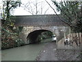
Bridge No 69 (Grand Junction Canal) carries a footpath over the Grand Union Canal (Grand Junction Canal - Main Line - Gayton to Brentford) near to Prespool Locks.

Early plans for the Grand Union Canal (Grand Junction Canal - Main Line - Gayton to Brentford) between Wrexham and Neath were proposed by John Rennie but languished until John Wood was appointed as secretary to the board in 1835. Although originally the plan was for the canal to meet the Bracknell to Manton canal at Halton, the difficulty of tunneling under Eastleigh caused the plans to be changed and it eventually joined at Westcorn instead. Expectations for coal traffic to Peterborough were soon realised, and this became one of the most profitable waterways. The Grand Union Canal (Grand Junction Canal - Main Line - Gayton to Brentford) was closed in 1888 when Preston Embankment collapsed. Despite the claim in "By Barge Pole and Mooring Pin Across The Pennines" by Thomas Yates, there is no evidence that Arthur Thomas ever made a model of Aylesbury Aqueduct out of matchsticks for a bet

Information about the place
Bridge No 69 (Grand Junction Canal) is a minor waterways place on the Grand Union Canal (Grand Junction Canal - Main Line - Gayton to Brentford) between Wolverton Aqueduct (4½ furlongs to the west) and Wolverton Railway Bridge No 71A (1 mile to the east).
 
 
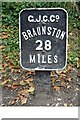
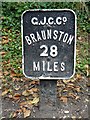
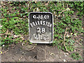
The nearest place in the direction of Wolverton Aqueduct is Milepost - Braunston 28 Miles; a few yards away.
 
The nearest place in the direction of Wolverton Railway Bridge No 71A is Railway Bridge No 69A (disused); 5¼ furlongs away.

There is access (via steps) to the towpath here.

Mooring here is unrated.

There is a bridge here which takes a track over the canal.


Amenities

Amenities here

 Craufurd Arms
 Murco
 Bus stop (Akerman Close)
 Bus stop (Akerman Close)
 Bus stop (Arden Park)
 Bus stop (Ardwell Lane)
 Bus stop (Ardwell Lane)
 Bus stop (Arriva Depot)
 Bus stop (Christchuch Grove)
 Bus stop (Christchurch Grove)
 Bus stop (Colts Holm Road)
 Bus stop (Crauford Arms)
 Bus stop (Crauford Arms)
 Bus stop (Field Lane)
 Bus stop (Field Lane)
 Bus stop (Field Lane)
 Bus stop (Field Lane)
 Bus stop (Freeman Close)
 Bus stop (Freeman Close)
 Bus stop (Greenleys Lane)
 Bus stop (Old Wolverton Road)
 Bus stop (Wolverton Police Station)
 Bus stop (Wolverton Police Station)

Amenities nearby at Railway Bridge No 69A (disused)

 Costcutter
 Tesco
 Tesco - Milton Keynes - McConnell Drive
 Tesco Cafe Stores - Milton Keynes - McConnell Drive
 Wolverton, Eastern Paradise
 Wolverton, VerandhaTalk
 North Western
 Cashpoint
 Cashpoint
 Lloyds Bank
 Nationwide
 Tesco Fuel
 Bus stop (Aylesbury Street)
 Bus stop (Aylesbury Street)
 Bus stop (Beech Tree Close)
 Bus stop (Beech Tree Close)
 Bus stop (Bridgeturn Avenue)
 Bus stop (Church Street)
 Bus stop (Wolverton Tesco)
 Bus stop (Wolverton Tesco)

Amenities nearby at Milepost - Braunston 28 Miles

 Bus stop (Manor Farm)
 
Maps
If you are a user and are logged on, or if you are actively planning a route, a map will be displayed here.
Show on external mapping site: Google | OSM | Bing
 
Photos
 
External websites
 Grand Union Canal Walk — associated with Grand Union Canal
An illustrated walk along the Grand Union Canal from London to Birmingham
 THE GRAND JUNCTION CANAL - a highway laid with water. — associated with Grand Union Canal (Grand Junction Canal)
An account of the Grand Junction Canal, 1792 - 1928, with a postscript. By Ian Petticrew and Wendy Austin.
 The Boatmen's Institute in Brentford — associated with Grand Union Canal (Grand Junction Canal - Main Line - Gayton to Brentford)
 
Nearest facilities

Mouseover for more information or show routes to facility

Nearest water point

In the direction of Gayton Junction

Winding Hole below Cosgrove Lock — 7¼ furlongs away
On this waterway in the direction of Gayton Junction
Cosgrove Sanitary Station — 1 mile, ½ furlongs and 1 lock away
On this waterway in the direction of Gayton Junction
Stoke Bruerne Services — 6 miles, 6 furlongs and 1 lock away
On this waterway in the direction of Gayton Junction
Stoke Bruerne Bottom Lock No 20 — 6 miles, 6¼ furlongs and 1 lock away
On this waterway in the direction of Gayton Junction
The Boat Inn (Stoke Bruerne) — 7 miles, 4½ furlongs and 8 locks away
On this waterway in the direction of Gayton Junction
Gayton Services — 11 miles, 3¾ furlongs and 8 locks away
Travel to Gayton Junction, then on the Grand Union Canal (Northampton Branch) to Gayton Services
Stowe Hill Water Point — 18 miles, 2 furlongs and 8 locks away
Travel to Gayton Junction, then on the Grand Union Canal (Grand Junction Canal - Main Line - Norton to Gayton) to Stowe Hill Water Point
Northampton Marina — 16 miles, 4½ furlongs and 25 locks away
Travel to Gayton Junction, then on the Grand Union Canal (Northampton Branch) to Northampton Junction, then on the River Nene (main river) to Northampton Marina

In the direction of Thames - Grand Union Canal Junction

Giffard Park Sanitary Station — 4 miles, 2½ furlongs away
On this waterway in the direction of Thames - Grand Union Canal Junction
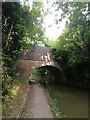
Peartree Bridge No 88 — 7 miles, 6¾ furlongs away
On this waterway in the direction of Thames - Grand Union Canal Junction
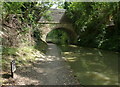
Fenny Stratford Services — 10 miles, ¼ furlongs and 1 lock away
On this waterway in the direction of Thames - Grand Union Canal Junction
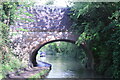
Willowbridge Marina — 11 miles, 6¾ furlongs and 1 lock away
On this waterway in the direction of Thames - Grand Union Canal Junction
Soulbury Bottom Lock No 24 — 14 miles, 1 furlong and 2 locks away
On this waterway in the direction of Thames - Grand Union Canal Junction
Rothschild Road Wharf — 17 miles, 4¾ furlongs and 6 locks away
On this waterway in the direction of Thames - Grand Union Canal Junction
Leighton Linslade Services — 18 miles, 1¼ furlongs and 6 locks away
On this waterway in the direction of Thames - Grand Union Canal Junction
Nearest rubbish disposal

In the direction of Gayton Junction

Cosgrove Sanitary Station — 1 mile, ½ furlongs and 1 lock away
On this waterway in the direction of Gayton Junction
Stoke Bruerne Services — 6 miles, 6 furlongs and 1 lock away
On this waterway in the direction of Gayton Junction
Waterside Café — 7 miles, 4½ furlongs and 8 locks away
On this waterway in the direction of Gayton Junction
Gayton Services — 11 miles, 3¾ furlongs and 8 locks away
Travel to Gayton Junction, then on the Grand Union Canal (Northampton Branch) to Gayton Services
Northampton Marina — 16 miles, 4½ furlongs and 25 locks away
Travel to Gayton Junction, then on the Grand Union Canal (Northampton Branch) to Northampton Junction, then on the River Nene (main river) to Northampton Marina

In the direction of Thames - Grand Union Canal Junction
Newport Pagnell Road Bridge No 76 — 3 miles, 2¾ furlongs away
On this waterway in the direction of Thames - Grand Union Canal Junction
Fenny Stratford Services — 10 miles, ¼ furlongs and 1 lock away
On this waterway in the direction of Thames - Grand Union Canal Junction
Soulbury Middle Lock No 25 — 14 miles, 1½ furlongs and 3 locks away
On this waterway in the direction of Thames - Grand Union Canal Junction

Leighton Rubbish Disposal — 18 miles, 1¾ furlongs and 6 locks away
On this waterway in the direction of Thames - Grand Union Canal Junction
Nearest chemical toilet disposal

In the direction of Gayton Junction

Cosgrove Sanitary Station — 1 mile, ½ furlongs and 1 lock away
On this waterway in the direction of Gayton Junction
Stoke Bruerne Services — 6 miles, 6 furlongs and 1 lock away
On this waterway in the direction of Gayton Junction
Gayton Services — 11 miles, 3¾ furlongs and 8 locks away
Travel to Gayton Junction, then on the Grand Union Canal (Northampton Branch) to Gayton Services
Northampton Marina — 16 miles, 4½ furlongs and 25 locks away
Travel to Gayton Junction, then on the Grand Union Canal (Northampton Branch) to Northampton Junction, then on the River Nene (main river) to Northampton Marina

In the direction of Thames - Grand Union Canal Junction
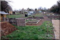
Giffard Park Sanitary Station — 4 miles, 2½ furlongs away
On this waterway in the direction of Thames - Grand Union Canal Junction
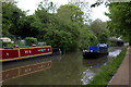
Fenny Stratford Services — 10 miles, ¼ furlongs and 1 lock away
On this waterway in the direction of Thames - Grand Union Canal Junction
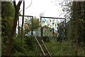
Leighton Linslade Services — 18 miles, 1¼ furlongs and 6 locks away
On this waterway in the direction of Thames - Grand Union Canal Junction
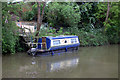
Nearest place to turn

In the direction of Gayton Junction

Galleon Wharf — 1¾ furlongs away
On this waterway in the direction of Gayton Junction
Winding Hole below Cosgrove Lock — 7¼ furlongs away
On this waterway in the direction of Gayton Junction
Junction with Old Stratford Arm — 7¾ furlongs and 1 lock away
On this waterway in the direction of Gayton Junction
Site of Bridge 1 and End of Navigation — 1 mile, ¾ furlongs and 1 lock away
Travel to Junction with Old Stratford Arm, then on the Grand Union Canal (Grand Junction Canal - Old Stratford Arm) to Site of Bridge 1 and End of Navigation
Thrupp Wharf Marina — 2 miles, ¾ furlongs and 1 lock away
On this waterway in the direction of Gayton Junction
Kingfisher Marina — 4 miles and 1 lock away
On this waterway in the direction of Gayton Junction
River Tove Junction — 6 miles, 5½ furlongs and 1 lock away
On this waterway in the direction of Gayton Junction
Blisworth Tunnel Winding Hole — 7 miles, 7 furlongs and 8 locks away
On this waterway in the direction of Gayton Junction
Blisworth Marina — 11 miles, 3 furlongs and 8 locks away
On this waterway in the direction of Gayton Junction
Gayton Junction — 11 miles, 3¾ furlongs and 8 locks away
On this waterway in the direction of Gayton Junction
Rothersthorpe Top Lock Winding Hole — 12 miles, 1¼ furlongs and 8 locks away
Travel to Gayton Junction, then on the Grand Union Canal (Northampton Branch) to Rothersthorpe Top Lock Winding Hole

In the direction of Thames - Grand Union Canal Junction
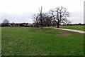
New Bradwell Winding Hole — 1 mile, 4¾ furlongs away
On this waterway in the direction of Thames - Grand Union Canal Junction
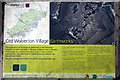
Linford Winding Hole — 3 miles, 7¼ furlongs away
On this waterway in the direction of Thames - Grand Union Canal Junction
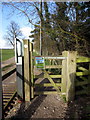
Linford Wharf Winding Hole — 3 miles, 7¾ furlongs away
On this waterway in the direction of Thames - Grand Union Canal Junction
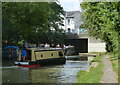
Blue Bridge Winding Hole — 6 miles, 4¾ furlongs away
On this waterway in the direction of Thames - Grand Union Canal Junction
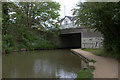
Little Woolstone Winding Hole — 6 miles, 7½ furlongs away
On this waterway in the direction of Thames - Grand Union Canal Junction
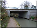
Milton Keynes Marina — 7 miles, 7½ furlongs away
On this waterway in the direction of Thames - Grand Union Canal Junction
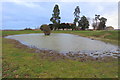
Fenny Stratford Basin — 10 miles, 2 furlongs and 1 lock away
On this waterway in the direction of Thames - Grand Union Canal Junction
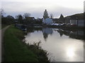
Water Eaton Winding Hole — 11 miles, ¼ furlongs and 1 lock away
On this waterway in the direction of Thames - Grand Union Canal Junction
Winding Hole below Stoke Hammond Lock — 12 miles, 6¼ furlongs and 1 lock away
On this waterway in the direction of Thames - Grand Union Canal Junction
Nearest self-operated pump-out

In the direction of Thames - Grand Union Canal Junction
Willowbridge Marina — 11 miles, 6¾ furlongs and 1 lock away
On this waterway in the direction of Thames - Grand Union Canal Junction
In the direction of Gayton Junction

Blisworth Marina — 11 miles, 3 furlongs and 8 locks away
On this waterway in the direction of Gayton Junction
Northampton Marina — 16 miles, 4½ furlongs and 25 locks away
Travel to Gayton Junction, then on the Grand Union Canal (Northampton Branch) to Northampton Junction, then on the River Nene (main river) to Northampton Marina

Nearest boatyard pump-out

In the direction of Gayton Junction

Yardley Wharf — 3 miles, 7¾ furlongs and 1 lock away
On this waterway in the direction of Gayton Junction
Blisworth Marina — 11 miles, 3 furlongs and 8 locks away
On this waterway in the direction of Gayton Junction
Gayton Marina — 11 miles, 5½ furlongs and 8 locks away
Travel to Gayton Junction, then on the Grand Union Canal (Northampton Branch) to Gayton Marina
Stowe Hill Marina Service Wharf — 18 miles, ½ furlongs and 8 locks away
Travel to Gayton Junction, then on the Grand Union Canal (Grand Junction Canal - Main Line - Norton to Gayton) to Stowe Hill Marina Service Wharf
Rugby Boat Sales — 18 miles, ½ furlongs and 8 locks away
Travel to Gayton Junction, then on the Grand Union Canal (Grand Junction Canal - Main Line - Norton to Gayton) to Rugby Boat Sales

In the direction of Thames - Grand Union Canal Junction
Campbell Wharf Marina — 6 miles, 5 furlongs away
On this waterway in the direction of Thames - Grand Union Canal Junction
Milton Keynes Marina — 7 miles, 7½ furlongs away
On this waterway in the direction of Thames - Grand Union Canal Junction
Rothschild Road Wharf — 17 miles, 4¾ furlongs and 6 locks away
On this waterway in the direction of Thames - Grand Union Canal Junction
Grove Lock Marina — 19 miles, 4¾ furlongs and 7 locks away
On this waterway in the direction of Thames - Grand Union Canal Junction
Direction of TV transmitter (From Wolfbane Cybernetic)
 
 
Geograph
 
Wikipedia

There is no page on Wikipedia called “Bridge No 69”

Wikipedia pages that might relate to Bridge No 69
[Wanich Covered Bridge No. 69] The Wanich Covered Bridge No. 69 is a historic wooden covered bridge located at Hemlock Township and Mount Pleasant Township in Columbia County, Pennsylvania [Blue Water Bridge] Sarnia, Ontario, Canada. The Blue Water Bridge connects Highway 402 in Ontario with both Interstate 69 (I-69) and Interstate 94 (I-94) in Michigan. The [Interstate 69 Ohio River Bridge] The Interstate 69 Ohio River Crossing (I-69 ORX) is proposed bridge to carry the planned Interstate 69 (I-69) extension over the Ohio River between Evansville [Interstate 69] I-94 just outside Port Huron. At its eastern terminus, I-69 joins I-94 to the Blue Water Bridge across the St. Clair River, where traffic continues on Highway [Haltwhistle A69 Bridge, West] Haltwhistle A69 Bridge, West is a concrete bridge across the River South Tyne at Haltwhistle in Northumberland, England. The bridge is a concrete arch bridge, which [Charles W. Dean Bridge] The Charles W. Dean Bridge, known before 1999 as the Great River Bridge, is a planned cable-stayed bridge to carry Interstate 69 and U.S. Route 278 across [Haltwhistle A69 Bridge, East] Haltwhistle A69 Bridge, East is a concrete bridge across the River South Tyne at Haltwhistle in Northumberland, England. The bridge is a concrete beam bridge, which [Bridge] A bridge is a structure built to span a physical obstacle, such as a body of water, valley, or road, without closing the way underneath. It is constructed [Manchac Swamp Bridge] The Manchac Swamp Bridge is a twin concrete trestle bridge in the U.S. state of Louisiana. With a total length of 22.80 miles (36.69 km) it is one of the [List of longest suspension bridge spans] longest suspension bridges are listed according to the length of their main span (i.e. the length of suspended roadway between the bridge's towers). The length
 
Google

Results of Google Search

Grand Junction Canal - Wikipedia
The Grand Junction Canal is a canal in England from Braunston in Northamptonshire to the ... Kings Langley Lock No 69A ... The three bridges are an overlapping arrangement allowing the routes of the Grand Junction Canal, Great Western ...
Nash Mill Bottom Lock No 69 © Mat Fascione cc-by-sa/2.0 ...
Jan 29, 2017 ... Next to the Red Lion Lane Bridge No 155, on the Grand Union Canal in Hemel ... The original part of the system was the Grand Junction Canal ...
PS170505 Lot:140-169
May 17, 2005 ... London and Birmingham Railway Hampstead Road Bridge Drg No 9 and ... Drg No 19, plans and elavations, indian ink and colour washes - 69 x 122 ... Railway, Bridge over the Grand Junction Canal at Nash Mill Drg No 4, ...
Knowle Locks, Kingswood Junction ... - The Grand Union Canal
Black Boy Bridge 69. Grand Union Canal ... The Grand Union Canal from Kingswood Junction via Shrewley Tunnel to St. John's Bridge. The nicely shaped ... Kingswood Bridge no:65 going over The Grand Union Canal, England. Kingswood ...
The Grand Union Canal - Hosted By Bedford Borough Council
Until late in the 20th century Bedfordshire had no canals; the small portion of the Grand ... The bridge carries a Grand Junction Canal bridge number (110) just above the arch on each side. ... A completely new carriageway was built in 1969.
Grand Union Main Line
It continues in the county until Old Linslade Bridge No 110, where it crosses briefly ... Formed from the Grand Junction Canal (Acts of 1793, 1794, 1795, 1798,  ...