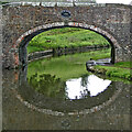
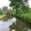
Clay House Bridge No 25
Caunsall ¼ mile west
Westley Court Care Home, Austcliffe Lane, Wyre Forest DY10 3RT, United Kingdom

Clay House Bridge No 25
is a minor waterways place
on the Staffordshire and Worcestershire Canal (Main Line: Stourport to Stourton) between
Stourton Junction (Junction of the Staffordshire and Worcestershire Canal (Main Line) and the Stourbridge Canal.) (3 miles and 7¾ furlongs
and 4 locks
to the north) and
Kidderminster (3 miles and 7½ furlongs
and 3 locks
to the southwest).
The nearest place in the direction of Stourton Junction is Caunsall Bridge No 26;
2¼ furlongs
away.
The nearest place in the direction of Kidderminster is Austcliffe Bridge No 24;
2 furlongs
away.
There may be access to the towpath here.
Mooring here is unrated.
There is a bridge here which takes pedestrian traffic over the canal.
| Whittington Horse Bridge No 28 | 1 mile, 4 furlongs | |
| Whittington Lock No 10 | 1 mile, 2¼ furlongs | |
| Whittington Bridge No 27 | 1 mile, 2 furlongs | |
| Staffordshire & Worcestershire County Boundary | 5½ furlongs | |
| Caunsall Bridge No 26 | 2¼ furlongs | |
| Clay House Bridge No 25 | ||
| Austcliffe Bridge No 24 | 2 furlongs | |
| Austcliffe | 2¾ furlongs | |
| Cookley Tunnel (eastern entrance) | 6¼ furlongs | |
| Cookley Tunnel (western entrance) | 6½ furlongs | |
| Cookley Forge Towpath Bridge | 7 furlongs | |
There are no links to external websites from here.
Why not log in and add some (select "External websites" from the menu (sometimes this is under "Edit"))?
Mouseover for more information or show routes to facility
Nearest water point
In the direction of Stourton Junction
Kinver Services — 2 miles, 3 furlongs and 2 locks away
On this waterway in the direction of Stourton Junction
Stewponey Water Point — 3 miles, 6¾ furlongs and 4 locks away
On this waterway in the direction of Stourton Junction
Greensforge Wharf Services — 6 miles, 6½ furlongs and 7 locks away
Travel to Stourton Junction, then on the Staffordshire and Worcestershire Canal (Main Line: Stourton to Aldersley) to Greensforge Wharf Services
Stourbridge Visitor Moorings — 6 miles, 7¾ furlongs and 8 locks away
Travel to Stourton Junction, then on the Stourbridge Canals (Main Line) to Wordsley Junction, then on the Stourbridge Canals (Stourbridge Branch) to Stourbridge Visitor Moorings
Autherley Stop Lock Water Point — 17 miles, 3 furlongs and 23 locks away
Travel to Stourton Junction, then on the Staffordshire and Worcestershire Canal (Main Line: Stourton to Aldersley) to Aldersley Junction, then on the Staffordshire and Worcestershire Canal (Main Line: Aldersley to Autherley) to Autherley Junction, then on the Shropshire Union Canal (Birmingham and Liverpool Junction Canal - Main Line) to Autherley Stop Lock Water Point
Blowers Green Pumphouse — 12 miles, 5½ furlongs and 33 locks away
Travel to Stourton Junction, then on the Stourbridge Canals (Main Line) to Black Delph, then on the Birmingham Canal Navigations (Dudley Canal No 1 - Through Route) to Parkhead Junction, then on the Birmingham Canal Navigations (Dudley Canal No 2 - Coombeswood ) to Blowers Green Pumphouse
Bumble Hole Visitor Centre — 15 miles, 1¾ furlongs and 33 locks away
Travel to Stourton Junction, then on the Stourbridge Canals (Main Line) to Black Delph, then on the Birmingham Canal Navigations (Dudley Canal No 1 - Through Route) to Parkhead Junction, then on the Birmingham Canal Navigations (Dudley Canal No 2 - Coombeswood ) to Bumble Hole Visitor Centre
Dudley Tunnel (northern entrance) — 14 miles, 5½ furlongs and 36 locks away
Travel to Stourton Junction, then on the Stourbridge Canals (Main Line) to Black Delph, then on the Birmingham Canal Navigations (Dudley Canal No 1 - Through Route) to Pensnett Junction, then on the Birmingham Canal Navigations (Dudley Canal No 1 - Dudley Tunnel) to Dudley Tunnel (northern entrance)
Dudley Canal & Tunnel Trust Footbridge — 14 miles, 6¼ furlongs and 36 locks away
Travel to Stourton Junction, then on the Stourbridge Canals (Main Line) to Black Delph, then on the Birmingham Canal Navigations (Dudley Canal No 1 - Through Route) to Pensnett Junction, then on the Birmingham Canal Navigations (Dudley Canal No 1 - Dudley Tunnel) to Dudley Tunnel (northern entrance), then on the Birmingham Canal Navigations (Dudley Canal No 1 - Birmingham End) to Dudley Canal & Tunnel Trust Footbridge
Black Country Museum — 14 miles, 6½ furlongs and 36 locks away
Travel to Stourton Junction, then on the Stourbridge Canals (Main Line) to Black Delph, then on the Birmingham Canal Navigations (Dudley Canal No 1 - Through Route) to Pensnett Junction, then on the Birmingham Canal Navigations (Dudley Canal No 1 - Dudley Tunnel) to Dudley Tunnel (northern entrance), then on the Birmingham Canal Navigations (Dudley Canal No 1 - Birmingham End) to Black Country Museum
Todds End Customer Service Facility — 14 miles, 6¾ furlongs and 36 locks away
Travel to Stourton Junction, then on the Stourbridge Canals (Main Line) to Black Delph, then on the Birmingham Canal Navigations (Dudley Canal No 1 - Through Route) to Pensnett Junction, then on the Birmingham Canal Navigations (Dudley Canal No 1 - Dudley Tunnel) to Dudley Tunnel (northern entrance), then on the Birmingham Canal Navigations (Dudley Canal No 1 - Birmingham End) to Todds End Customer Service Facility
Hawne Basin — 17 miles, 7½ furlongs and 33 locks away
Travel to Stourton Junction, then on the Stourbridge Canals (Main Line) to Black Delph, then on the Birmingham Canal Navigations (Dudley Canal No 1 - Through Route) to Parkhead Junction, then on the Birmingham Canal Navigations (Dudley Canal No 2 - Coombeswood ) to Hawne Basin
C&RT Bradley Workshops — 19 miles, 4¾ furlongs and 36 locks away
Travel to Stourton Junction, then on the Stourbridge Canals (Main Line) to Black Delph, then on the Birmingham Canal Navigations (Dudley Canal No 1 - Through Route) to Pensnett Junction, then on the Birmingham Canal Navigations (Dudley Canal No 1 - Dudley Tunnel) to Dudley Tunnel (northern entrance), then on the Birmingham Canal Navigations (Dudley Canal No 1 - Birmingham End) to Tipton Junction, then on the Birmingham Canal Navigations (Old Main Line) to Tipton Factory Junction, then on the Birmingham Canal Navigations (Main Line) to Deepfields Junction, then on the Birmingham Canal Navigations (Wednesbury Oak Loop) to C&RT Bradley Workshops
Broad Street Basin — 18 miles, 5¼ furlongs and 43 locks away
Travel to Stourton Junction, then on the Staffordshire and Worcestershire Canal (Main Line: Stourton to Aldersley) to Aldersley Junction, then on the Birmingham Canal Navigations (Main Line) to Broad Street Basin
In the direction of York Street Bridge
Caldwall Mill Bridge No 14 — 4 miles, 4 furlongs and 4 locks away
On this waterway in the direction of York Street Bridge
Upper Basin Waterpoint — 8 miles, 2½ furlongs and 7 locks away
Travel to York Street Bridge, then on the Staffordshire and Worcestershire Canal (Stourport Basins: Narrow Route) to Upper Basin Waterpoint
Lincomb Lock — 9 miles, 5¾ furlongs and 9 locks away
Travel to York Street Bridge, then on the Staffordshire and Worcestershire Canal (Stourport Basins: Narrow Route) to Stourport Upper Basin, then on the Staffordshire and Worcestershire Canal (Stourport Basins: Broad Route) to Severn - Stourport Broad Locks Entrance, then on the River Severn (main river - Stourport to Worcester) to Lincomb Lock
Holt Lock (Holt Fleet) — 13 miles, 7½ furlongs and 10 locks away
Travel to York Street Bridge, then on the Staffordshire and Worcestershire Canal (Stourport Basins: Narrow Route) to Stourport Upper Basin, then on the Staffordshire and Worcestershire Canal (Stourport Basins: Broad Route) to Severn - Stourport Broad Locks Entrance, then on the River Severn (main river - Stourport to Worcester) to Holt Lock (Holt Fleet)Nearest rubbish disposal
In the direction of Stourton Junction
Kinver Services — 2 miles, 3 furlongs and 2 locks away
On this waterway in the direction of Stourton Junction
Greensforge Wharf Services — 6 miles, 6½ furlongs and 7 locks away
Travel to Stourton Junction, then on the Staffordshire and Worcestershire Canal (Main Line: Stourton to Aldersley) to Greensforge Wharf Services
Stourbridge Basin — 7 miles, 1¾ furlongs and 8 locks away
Travel to Stourton Junction, then on the Stourbridge Canals (Main Line) to Wordsley Junction, then on the Stourbridge Canals (Stourbridge Branch) to Stourbridge Basin
Bratch Bottom Lock No 23 — 10 miles, 3¾ furlongs and 13 locks away
Travel to Stourton Junction, then on the Staffordshire and Worcestershire Canal (Main Line: Stourton to Aldersley) to Bratch Bottom Lock No 23
Delph Bottom Lock No 8 — 10 miles, 4¾ furlongs and 24 locks away
Travel to Stourton Junction, then on the Stourbridge Canals (Main Line) to Black Delph, then on the Birmingham Canal Navigations (Dudley Canal No 1 - Through Route) to Delph Bottom Lock No 8
Autherley Junction Bridge No 1 — 17 miles, 2¼ furlongs and 22 locks away
Travel to Stourton Junction, then on the Staffordshire and Worcestershire Canal (Main Line: Stourton to Aldersley) to Aldersley Junction, then on the Staffordshire and Worcestershire Canal (Main Line: Aldersley to Autherley) to Autherley Junction, then on the Shropshire Union Canal (Birmingham and Liverpool Junction Canal - Main Line) to Autherley Junction Bridge No 1
Waterfront Services (Dudley) — 11 miles, 4½ furlongs and 32 locks away
Travel to Stourton Junction, then on the Stourbridge Canals (Main Line) to Black Delph, then on the Birmingham Canal Navigations (Dudley Canal No 1 - Through Route) to Waterfront Services (Dudley)
Blowers Green Bridge — 12 miles, 5¾ furlongs and 33 locks away
Travel to Stourton Junction, then on the Stourbridge Canals (Main Line) to Black Delph, then on the Birmingham Canal Navigations (Dudley Canal No 1 - Through Route) to Parkhead Junction, then on the Birmingham Canal Navigations (Dudley Canal No 2 - Coombeswood ) to Blowers Green Bridge
Black Country Museum — 14 miles, 6½ furlongs and 36 locks away
Travel to Stourton Junction, then on the Stourbridge Canals (Main Line) to Black Delph, then on the Birmingham Canal Navigations (Dudley Canal No 1 - Through Route) to Pensnett Junction, then on the Birmingham Canal Navigations (Dudley Canal No 1 - Dudley Tunnel) to Dudley Tunnel (northern entrance), then on the Birmingham Canal Navigations (Dudley Canal No 1 - Birmingham End) to Black Country Museum
Hawne Basin — 17 miles, 7½ furlongs and 33 locks away
Travel to Stourton Junction, then on the Stourbridge Canals (Main Line) to Black Delph, then on the Birmingham Canal Navigations (Dudley Canal No 1 - Through Route) to Parkhead Junction, then on the Birmingham Canal Navigations (Dudley Canal No 2 - Coombeswood ) to Hawne Basin
Wolverhampton Lock No 9 — 17 miles, 7¾ furlongs and 34 locks away
Travel to Stourton Junction, then on the Staffordshire and Worcestershire Canal (Main Line: Stourton to Aldersley) to Aldersley Junction, then on the Birmingham Canal Navigations (Main Line) to Wolverhampton Lock No 9
C&RT Bradley Workshops — 19 miles, 4¾ furlongs and 36 locks away
Travel to Stourton Junction, then on the Stourbridge Canals (Main Line) to Black Delph, then on the Birmingham Canal Navigations (Dudley Canal No 1 - Through Route) to Pensnett Junction, then on the Birmingham Canal Navigations (Dudley Canal No 1 - Dudley Tunnel) to Dudley Tunnel (northern entrance), then on the Birmingham Canal Navigations (Dudley Canal No 1 - Birmingham End) to Tipton Junction, then on the Birmingham Canal Navigations (Old Main Line) to Tipton Factory Junction, then on the Birmingham Canal Navigations (Main Line) to Deepfields Junction, then on the Birmingham Canal Navigations (Wednesbury Oak Loop) to C&RT Bradley Workshops
Broad Street Basin — 18 miles, 5¼ furlongs and 43 locks away
Travel to Stourton Junction, then on the Staffordshire and Worcestershire Canal (Main Line: Stourton to Aldersley) to Aldersley Junction, then on the Birmingham Canal Navigations (Main Line) to Broad Street Basin
In the direction of York Street Bridge
Upper Basin Waterpoint — 8 miles, 2½ furlongs and 7 locks away
Travel to York Street Bridge, then on the Staffordshire and Worcestershire Canal (Stourport Basins: Narrow Route) to Upper Basin WaterpointNearest chemical toilet disposal
In the direction of Stourton Junction
Kinver Services — 2 miles, 3 furlongs and 2 locks away
On this waterway in the direction of Stourton Junction
Greensforge Wharf Services — 6 miles, 6½ furlongs and 7 locks away
Travel to Stourton Junction, then on the Staffordshire and Worcestershire Canal (Main Line: Stourton to Aldersley) to Greensforge Wharf Services
Stourbridge Basin — 7 miles, 1¾ furlongs and 8 locks away
Travel to Stourton Junction, then on the Stourbridge Canals (Main Line) to Wordsley Junction, then on the Stourbridge Canals (Stourbridge Branch) to Stourbridge Basin
Waterfront Services (Dudley) — 11 miles, 4½ furlongs and 32 locks away
Travel to Stourton Junction, then on the Stourbridge Canals (Main Line) to Black Delph, then on the Birmingham Canal Navigations (Dudley Canal No 1 - Through Route) to Waterfront Services (Dudley)
Blowers Green Pumphouse — 12 miles, 5½ furlongs and 33 locks away
Travel to Stourton Junction, then on the Stourbridge Canals (Main Line) to Black Delph, then on the Birmingham Canal Navigations (Dudley Canal No 1 - Through Route) to Parkhead Junction, then on the Birmingham Canal Navigations (Dudley Canal No 2 - Coombeswood ) to Blowers Green Pumphouse
Dudley Tunnel (northern entrance) — 14 miles, 5½ furlongs and 36 locks away
Travel to Stourton Junction, then on the Stourbridge Canals (Main Line) to Black Delph, then on the Birmingham Canal Navigations (Dudley Canal No 1 - Through Route) to Pensnett Junction, then on the Birmingham Canal Navigations (Dudley Canal No 1 - Dudley Tunnel) to Dudley Tunnel (northern entrance)
Black Country Museum — 14 miles, 6½ furlongs and 36 locks away
Travel to Stourton Junction, then on the Stourbridge Canals (Main Line) to Black Delph, then on the Birmingham Canal Navigations (Dudley Canal No 1 - Through Route) to Pensnett Junction, then on the Birmingham Canal Navigations (Dudley Canal No 1 - Dudley Tunnel) to Dudley Tunnel (northern entrance), then on the Birmingham Canal Navigations (Dudley Canal No 1 - Birmingham End) to Black Country Museum
Todds End Customer Service Facility — 14 miles, 6¾ furlongs and 36 locks away
Travel to Stourton Junction, then on the Stourbridge Canals (Main Line) to Black Delph, then on the Birmingham Canal Navigations (Dudley Canal No 1 - Through Route) to Pensnett Junction, then on the Birmingham Canal Navigations (Dudley Canal No 1 - Dudley Tunnel) to Dudley Tunnel (northern entrance), then on the Birmingham Canal Navigations (Dudley Canal No 1 - Birmingham End) to Todds End Customer Service Facility
Hawne Basin — 17 miles, 7½ furlongs and 33 locks away
Travel to Stourton Junction, then on the Stourbridge Canals (Main Line) to Black Delph, then on the Birmingham Canal Navigations (Dudley Canal No 1 - Through Route) to Parkhead Junction, then on the Birmingham Canal Navigations (Dudley Canal No 2 - Coombeswood ) to Hawne Basin
Broad Street Basin — 18 miles, 5¼ furlongs and 43 locks away
Travel to Stourton Junction, then on the Staffordshire and Worcestershire Canal (Main Line: Stourton to Aldersley) to Aldersley Junction, then on the Birmingham Canal Navigations (Main Line) to Broad Street Basin
In the direction of York Street Bridge
Caldwall Mill Bridge No 14 — 4 miles, 4 furlongs and 4 locks away
On this waterway in the direction of York Street Bridge
Upper Basin Waterpoint — 8 miles, 2½ furlongs and 7 locks away
Travel to York Street Bridge, then on the Staffordshire and Worcestershire Canal (Stourport Basins: Narrow Route) to Upper Basin Waterpoint
Stourport Marina — 9 miles, 2½ furlongs and 9 locks away
Travel to York Street Bridge, then on the Staffordshire and Worcestershire Canal (Stourport Basins: Narrow Route) to Stourport Upper Basin, then on the Staffordshire and Worcestershire Canal (Stourport Basins: Broad Route) to Severn - Stourport Broad Locks Entrance, then on the River Severn (main river - Stourport to Worcester) to Stourport MarinaNearest place to turn
In the direction of Stourton Junction
Whittington Winding Hole — 1 mile, 4¼ furlongs and 1 lock away
On this waterway in the direction of Stourton Junction
Hyde Lock Winding Hole — 2 miles, 6¼ furlongs and 3 locks away
On this waterway in the direction of Stourton Junction
Stourton Junction — 3 miles, 7¾ furlongs and 4 locks away
On this waterway in the direction of Stourton Junction
Gothersley Winding Hole — 5 miles, 3¾ furlongs and 4 locks away
Travel to Stourton Junction, then on the Staffordshire and Worcestershire Canal (Main Line: Stourton to Aldersley) to Gothersley Winding Hole
Winding Hole above Stourton Top Lock — 4 miles, 2¾ furlongs and 8 locks away
Travel to Stourton Junction, then on the Stourbridge Canals (Main Line) to Winding Hole above Stourton Top Lock
Ashwood Basin — 6 miles, 3 furlongs and 6 locks away
Travel to Stourton Junction, then on the Staffordshire and Worcestershire Canal (Main Line: Stourton to Aldersley) to Ashwood Basin
Wordsley Junction — 5 miles, 7¾ furlongs and 8 locks away
Travel to Stourton Junction, then on the Stourbridge Canals (Main Line) to Wordsley Junction
Winding Hole below Hinksford Lock — 7 miles, 6½ furlongs and 7 locks away
Travel to Stourton Junction, then on the Staffordshire and Worcestershire Canal (Main Line: Stourton to Aldersley) to Winding Hole below Hinksford Lock
Old Dry Dock Winding Hole — 6 miles, 7¼ furlongs and 8 locks away
Travel to Stourton Junction, then on the Stourbridge Canals (Main Line) to Wordsley Junction, then on the Stourbridge Canals (Stourbridge Branch) to Old Dry Dock Winding Hole
Stourbridge Winding Hole — 7 miles, 1¾ furlongs and 8 locks away
Travel to Stourton Junction, then on the Stourbridge Canals (Main Line) to Wordsley Junction, then on the Stourbridge Canals (Stourbridge Branch) to Stourbridge Winding Hole
In the direction of York Street Bridge
Cookley Forge Towpath Bridge — 7 furlongs away
On this waterway in the direction of York Street Bridge
Debdale Lock Winding Hole — 1 mile away
On this waterway in the direction of York Street Bridge
Lea Lane Winding Hole — 1 mile, 5¼ furlongs and 1 lock away
On this waterway in the direction of York Street Bridge
Broadwaters Aqueduct Winding Hole — 3 miles, 1¼ furlongs and 3 locks away
On this waterway in the direction of York Street Bridge
Kidderminster — 3 miles, 7½ furlongs and 3 locks away
On this waterway in the direction of York Street Bridge
Academy Winding Hole — 4 miles, 1¾ furlongs and 4 locks away
On this waterway in the direction of York Street Bridge
Pratt's Wharf — 6 miles, ½ furlongs and 6 locks away
On this waterway in the direction of York Street Bridge
Former Railway Interchange Basin — 7 miles, 4¼ furlongs and 6 locks away
On this waterway in the direction of York Street Bridge
Stourport Upper Basin — 8 miles, 2½ furlongs and 7 locks away
Travel to York Street Bridge, then on the Staffordshire and Worcestershire Canal (Stourport Basins: Narrow Route) to Stourport Upper Basin
Stourport Clock Basin — 8 miles, 3 furlongs and 7 locks away
Travel to York Street Bridge, then on the Staffordshire and Worcestershire Canal (Stourport Basins: Narrow Route) to Stourport Clock BasinNearest self-operated pump-out
In the direction of Stourton Junction
Kinver Services — 2 miles, 3 furlongs and 2 locks away
On this waterway in the direction of Stourton Junction
Dudley Tunnel (northern entrance) — 14 miles, 5½ furlongs and 36 locks away
Travel to Stourton Junction, then on the Stourbridge Canals (Main Line) to Black Delph, then on the Birmingham Canal Navigations (Dudley Canal No 1 - Through Route) to Pensnett Junction, then on the Birmingham Canal Navigations (Dudley Canal No 1 - Dudley Tunnel) to Dudley Tunnel (northern entrance)
Black Country Museum — 14 miles, 6½ furlongs and 36 locks away
Travel to Stourton Junction, then on the Stourbridge Canals (Main Line) to Black Delph, then on the Birmingham Canal Navigations (Dudley Canal No 1 - Through Route) to Pensnett Junction, then on the Birmingham Canal Navigations (Dudley Canal No 1 - Dudley Tunnel) to Dudley Tunnel (northern entrance), then on the Birmingham Canal Navigations (Dudley Canal No 1 - Birmingham End) to Black Country Museum
Todds End Customer Service Facility — 14 miles, 6¾ furlongs and 36 locks away
Travel to Stourton Junction, then on the Stourbridge Canals (Main Line) to Black Delph, then on the Birmingham Canal Navigations (Dudley Canal No 1 - Through Route) to Pensnett Junction, then on the Birmingham Canal Navigations (Dudley Canal No 1 - Dudley Tunnel) to Dudley Tunnel (northern entrance), then on the Birmingham Canal Navigations (Dudley Canal No 1 - Birmingham End) to Todds End Customer Service FacilityNearest boatyard pump-out
In the direction of Stourton Junction
Oxley Marine — 17 miles, 1¼ furlongs and 22 locks away
Travel to Stourton Junction, then on the Staffordshire and Worcestershire Canal (Main Line: Stourton to Aldersley) to Aldersley Junction, then on the Staffordshire and Worcestershire Canal (Main Line: Aldersley to Autherley) to Oxley Marine
Autherley Wharf — 17 miles, 2¾ furlongs and 23 locks away
Travel to Stourton Junction, then on the Staffordshire and Worcestershire Canal (Main Line: Stourton to Aldersley) to Aldersley Junction, then on the Staffordshire and Worcestershire Canal (Main Line: Aldersley to Autherley) to Autherley Junction, then on the Shropshire Union Canal (Birmingham and Liverpool Junction Canal - Main Line) to Autherley Wharf
Withymoor Island Service Wharf — 14 miles, 6½ furlongs and 33 locks away
Travel to Stourton Junction, then on the Stourbridge Canals (Main Line) to Black Delph, then on the Birmingham Canal Navigations (Dudley Canal No 1 - Through Route) to Parkhead Junction, then on the Birmingham Canal Navigations (Dudley Canal No 2 - Coombeswood ) to Withymoor Island Service Wharf
Hawne Basin — 17 miles, 7½ furlongs and 33 locks away
Travel to Stourton Junction, then on the Stourbridge Canals (Main Line) to Black Delph, then on the Birmingham Canal Navigations (Dudley Canal No 1 - Through Route) to Parkhead Junction, then on the Birmingham Canal Navigations (Dudley Canal No 2 - Coombeswood ) to Hawne Basin
In the direction of York Street Bridge
Stourport Upper Basin — 8 miles, 2½ furlongs and 7 locks away
Travel to York Street Bridge, then on the Staffordshire and Worcestershire Canal (Stourport Basins: Narrow Route) to Stourport Upper Basin
Upper Staircase Lock Landing Pontoon — 8 miles, 3¼ furlongs and 7 locks away
Travel to York Street Bridge, then on the Staffordshire and Worcestershire Canal (Stourport Basins: Narrow Route) to Upper Staircase Lock Landing Pontoon
Stourport Marina — 9 miles, 2½ furlongs and 9 locks away
Travel to York Street Bridge, then on the Staffordshire and Worcestershire Canal (Stourport Basins: Narrow Route) to Stourport Upper Basin, then on the Staffordshire and Worcestershire Canal (Stourport Basins: Broad Route) to Severn - Stourport Broad Locks Entrance, then on the River Severn (main river - Stourport to Worcester) to Stourport MarinaDirection of TV transmitter (From Wolfbane Cybernetic)
There is no page on Wikipedia called “Clay House Bridge”
Wikipedia pages that might relate to Clay House Bridge
[Bridge of Clay]
Bridge of Clay is a 2018 novel by Australian author Markus Zusak. It revolves around five brothers coming to terms with the disappearance of their father
[Bill Clay]
the U.S. House of Representatives for 32 years. Clay was born in St. Louis, Missouri, the son of Luella S. (Hyatt) and Irving Charles Clay. He graduated
[Henry Clay]
Henry Clay Sr. (April 12, 1777 – June 29, 1852) was an American attorney and statesman who represented Kentucky in both the Senate and House. He was the
[Clay Aiken]
– Clay Aiken Clay Aiken – UNICEF Celebrity Ambassador Clay Aiken at IMDb Clay Aiken at the Internet Broadway Database Clay Aiken at AllMusic Clay Aiken
[London Bridge]
2019. The abutments of modern London Bridge rest several metres above natural embankments of gravel, sand and clay. From the late Neolithic era the southern
[Quick clay]
Quick clay, also known as Leda clay and Champlain Sea clay in Canada, is any of several distinctively sensitive glaciomarine clays found in Canada, Norway
[Howrah Bridge]
considerable. A good place for the bridge was at Pulta Ghat "about a dozen miles north of Calcutta" where a "bed of stiff clay existed at no great depth under
[Markus Zusak]
Literature. In March 2016 Zusak talked about his then unfinished novel Bridge of Clay. He stated that the book was 90% finished but that, "... I’m a completely
[Todd Bridges]
charges of making a bomb threat. In 1989, Bridges was arrested and tried for the attempted murder of Kenneth "Tex" Clay, a Los Angeles-area drug dealer who
[One Night in Miami...]
Bundini Brown Beau Bridges as Mr. Carlton. He is based on a real acquaintance of Brown's, who made him stay on the porch of his house and would not let
Results of Google Search
Clay House Bridge No 25 © Mat Fascione :: Geograph Britain and ...May 14, 2019 ... SO8580 :: Clay House Bridge No 25, near to Caunsall, Worcestershire, Great Britain by Mat Fascione.
Oct 18, 2008 ... No higher resolution available. ... English: Canal and Clay House Bridge, Caunsall, Worcestershire This is bridge No 25 on the Staffordshire ...
Short Title. Designating bridge no. 14 (030) in Clay county as the Clay county Vietnam veterans bridge. Summary of Legislation ... Wed, Feb 25, 2015, House, Final Action - Passed; Yea: 121 Nay: 0, 288. Fri, Feb 20, 2015, House, Committee  ...
Aug 24, 1990 ... Actor Todd Bridges was acquitted Thursday on charges of shooting a drug dealer eight times in a South-Central Los Angeles rock house. ... Bridges was accused of wounding Kenneth (Tex) Clay, a convicted Texas drug dealer, ... Bridges 25, of Sun Valley, had been brought to trial late last year for the same ...
Dec 10, 1973 ... Listing Text. WOLVERLEY & COOKLEY CP STAFFORDSHIRE & WORCESTERSHIRE SO 88 SE CANAL 3/146 Clay House Bridge (No 25)
617700, Amaco White Art Clay, No.25 with No Talc, Low Fire. Quick View. 617700, Amaco White Art Clay, No.25 with No Talc, Low Fire, 50lbs. $35.00. Compare.
Dec 1, 2017 ... replacing the bridge over Hangtown Creek (Bridge No. ... 25. Figure 7. Dedication Inscription on Front Elevation, Druid Monument, view east . ... Clay Street will be realigned through the existing Ivy House parking lot. This will ...
Not long after, he learned that Church Street Station Studios was accepting ... New Clay House was the only stable home that Brenda, in her fifties, had ever known. ... For a while, Brenda walked every day across the Lee Bridge from the shelter ... of the first residents to move into New Clay House and lived there for 25 years ...
NEW, KC District, Clay County Bridge Replacement BRO-B024(27), 2/24/20, 3/26 /20 ... NEW, NW District, Daviess County, Construction of Bridge No. ... SE District , Iron County, 3 Span (25'-28'-25') Bridge With a 16" Thick, Cast-in-Place ...


![Clay House Bridge south-east of Caunsall, Worcestershire. Looking south-west at Clay House Bridge, No 25 across the Staffordshire and Worcestershire Canal. This is a farmer's accommodation bridge with no public access.[[[4746290]]] by Roger D Kidd – 29 May 2015](https://s1.geograph.org.uk/geophotos/04/74/71/4747165_97d80a60_120x120.jpg)

![Clay House Bridge south-east of Caunsall, Worcestershire. Looking south-west towards Clay House Bridge, No 25 across the Staffordshire and Worcestershire Canal. This is a farmer's accommodation bridge with no public access.[[[4747149]]] by Roger D Kidd – 29 May 2015](https://s0.geograph.org.uk/geophotos/04/74/71/4747160_27b4ad1e_120x120.jpg)

![Clay House Bridge (detail) near Caunsall, Worcestershire. Looking south-west at Clay House Bridge, No 25 across the Staffordshire and Worcestershire Canal. This is a farmer's accommodation bridge with no public access.[[[4746290]]] by Roger D Kidd – 29 May 2015](https://s1.geograph.org.uk/geophotos/04/74/71/4747149_b75f142a_120x120.jpg)


![Name plaque on Clay House Bridge near Caunsall. The bridges on the Staffordshire & Worcesterashire Canal are named and numbered. This is number 25 and named Clay House Bridge. There no longer seems to be a building called Clay House in the vicinity.[[2734311]]. by P L Chadwick – 18 December 2011](https://s2.geograph.org.uk/geophotos/02/73/42/2734290_caa369ff_120x120.jpg)


![Clay House Bridge near Caunsall. A bridge over the Staffs & Worcs Canal, which connects two fields.[[2734290]]. by P L Chadwick – 18 December 2011](https://s3.geograph.org.uk/geophotos/02/73/43/2734311_7166357e_120x120.jpg)


![Looking towards Clay House Bridge, near Caunsall. Looking along the Staffordshire & Worcestershire Canal towards Clay House Bridge.[[2734311]]. by P L Chadwick – 18 December 2011](https://s1.geograph.org.uk/geophotos/02/73/51/2735161_41b2b818_120x120.jpg)