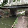
Coxheath Bridge
is a minor waterways place
on the Basingstoke Canal between
Woodham Junction (Junction of Basingstoke Canal with River Wey) (22 miles and 4¼ furlongs
and 29 locks
to the east) and
Odiham Castle Stop (End of Navigation) (8 miles and ¾ furlongs
to the west).
The nearest place in the direction of Woodham Junction is The Fox and Hounds (Crookham);
2¾ furlongs
away.
The nearest place in the direction of Odiham Castle Stop is Malthouse Bridge;
1¾ furlongs
away.
There may be access to the towpath here.
Mooring here is unrated.
There is a bridge here which takes a minor road over the canal.
Pondtail Pipe Bridge | 1 mile, 7¼ furlongs | |
Old Pondtail Bridge | 1 mile, 7¼ furlongs | |
Reading Road South Bridge | 7¼ furlongs | |
Fleet Town Football Ground | 5¼ furlongs | |
The Fox and Hounds (Crookham) | 2¾ furlongs | |
Coxheath Bridge | ||
Malthouse Bridge | 1¾ furlongs | |
Crookham Swing Bridge | 5 furlongs | |
Poulters Bridge | 6½ furlongs | |
Crondall Bridge Winding Hole | 1 mile, ½ furlongs | |
Crondall Bridge | 1 mile, ¾ furlongs |
There are no links to external websites from here.
Why not log in and add some (select "External websites" from the menu (sometimes this is under "Edit"))?
Mouseover for more information or show routes to facility
Nearest water point
In the direction of Odiham Castle Stop
Barley Mow Bridge — 3 miles, 6¼ furlongs away
On this waterway in the direction of Odiham Castle Stop
In the direction of Woodham Junction
The Fox and Hounds (Crookham) — 2¾ furlongs away
On this waterway in the direction of Woodham Junction
Ash Lock Canal Depot — 6 miles, 1 furlong away
On this waterway in the direction of Woodham Junction
Mytchett Bridge — 9 miles, 3½ furlongs and 1 lock away
On this waterway in the direction of Woodham Junction
Canal Centre Swing Bridge — 9 miles, 4½ furlongs and 1 lock away
On this waterway in the direction of Woodham Junction
Arthur's Bridge — 17 miles, 6¾ furlongs and 23 locks away
On this waterway in the direction of Woodham JunctionNearest rubbish disposal
In the direction of Woodham Junction
Ash Lock Canal Depot — 6 miles, 1 furlong away
On this waterway in the direction of Woodham Junction
Mytchett Bridge — 9 miles, 3½ furlongs and 1 lock away
On this waterway in the direction of Woodham Junction
Canal Centre Swing Bridge — 9 miles, 4½ furlongs and 1 lock away
On this waterway in the direction of Woodham Junction
Arthur's Bridge — 17 miles, 6¾ furlongs and 23 locks away
On this waterway in the direction of Woodham JunctionNearest chemical toilet disposal
In the direction of Woodham Junction
Canal Centre Swing Bridge — 9 miles, 4½ furlongs and 1 lock away
On this waterway in the direction of Woodham Junction
Arthur's Bridge — 17 miles, 6¾ furlongs and 23 locks away
On this waterway in the direction of Woodham JunctionNearest place to turn
In the direction of Odiham Castle Stop
Crondall Bridge Winding Hole — 1 mile, ½ furlongs away
On this waterway in the direction of Odiham Castle Stop
Blacksmiths Bridge Winding Hole — 2 miles, 5¾ furlongs away
On this waterway in the direction of Odiham Castle Stop
Colt Hill Bridge Winding Hole — 6 miles, 3¼ furlongs away
On this waterway in the direction of Odiham Castle Stop
Whitewater Winding Hole — 8 miles, ½ furlongs away
On this waterway in the direction of Odiham Castle Stop
In the direction of Woodham Junction
Pondtail Bridge Winding Hole — 1 mile, 7¼ furlongs away
On this waterway in the direction of Woodham Junction
Eelmoor Bridge Winding Hole — 3 miles, 2 furlongs away
On this waterway in the direction of Woodham Junction
Wharf Bridge (Aldershot) Winding Hole — 4 miles, 5½ furlongs away
On this waterway in the direction of Woodham Junction
Ash Lock Canal Depot — 6 miles, 1 furlong away
On this waterway in the direction of Woodham Junction
Ash Wharf Bridge Winding Hole — 7 miles, 1¼ furlongs and 1 lock away
On this waterway in the direction of Woodham Junction
Great Bottom Flash — 8 miles, 2 furlongs and 1 lock away
On this waterway in the direction of Woodham Junction
Winter's Close Winding Hole — 8 miles, 5 furlongs and 1 lock away
On this waterway in the direction of Woodham Junction
Anglers' Flash — 8 miles, 6¼ furlongs and 1 lock away
On this waterway in the direction of Woodham Junction
Potter's Wharf — 9 miles, 2¾ furlongs and 1 lock away
On this waterway in the direction of Woodham Junction
Lock No 26 Winding Hole — 12 miles, 1½ furlongs and 4 locks away
On this waterway in the direction of Woodham Junction
Frimley Lock Winding Hole — 13 miles, ¾ furlongs and 10 locks away
On this waterway in the direction of Woodham Junction
Frimley Bottom Lock Winding Hole — 13 miles, 7¼ furlongs and 14 locks away
On this waterway in the direction of Woodham Junction
Connaught Crescent Winding Hole — 14 miles, 2 furlongs and 15 locks away
On this waterway in the direction of Woodham Junction
Hermitage Bridge Winding Hole — 15 miles, 5¼ furlongs and 18 locks away
On this waterway in the direction of Woodham Junction
Blackhorse Road Winding Hole — 15 miles, 6½ furlongs and 18 locks away
On this waterway in the direction of Woodham Junction
Arthurs Bridge Winding Hole — 17 miles, 7 furlongs and 23 locks away
On this waterway in the direction of Woodham JunctionNearest self-operated pump-out
In the direction of Woodham Junction
Mytchett Bridge — 9 miles, 3½ furlongs and 1 lock away
On this waterway in the direction of Woodham Junction
Canal Centre Swing Bridge — 9 miles, 4½ furlongs and 1 lock away
On this waterway in the direction of Woodham JunctionNo information
CanalPlan has no information on any of the following facilities within range:boatyard pump-out
Direction of TV transmitter (From Wolfbane Cybernetic)
There is no page on Wikipedia called “Coxheath Bridge”
Wikipedia pages that might relate to Coxheath Bridge
[Basingstoke Canal]
Greywell and Brookwood Lye and a short stretch between Monument Bridge and Scotland Bridge in Woking. It is the most botanically rich aquatic area in England
[Maidstone and The Weald (UK Parliament constituency)]
Borough of Maidstone wards of Allington, Barming, Boughton Monchelsea, Bridge, Coxheath, East, Farleigh, Heath, High Street, Loose, Marden, North, South, Staplehurst
[List of communities in the Cape Breton Regional Municipality]
Castle Bay (21) Catalone (62) Catalone Gut (48) Christmas Island (53) Coxheath (2,404) Dalem Lake (78) Dominion (2,142) Donkin (658) Dutch Brook (214)
[2014 Maidstone Borough Council election]
results for Bridge Ward". Maidstone Borough Council. "Election results for Boxley Ward". Maidstone Borough Council. "Election results for Coxheath and Hunton
[List of schools in Nova Scotia]
School (pr to 5); 7430 Hornes Road, Albert Bridge Riverview Rural High School (10 to 12); 57 Coxheath Road, Coxheath Robin Foote Elementary School (pr to 5);
[List of places in Kent]
Broomfield • Caring • Chainhurst • Chart Sutton • Chegworth • Collier Street • Coxheath • Detling • Downswood • East Barming • East Farleigh • East Sutton • Fairbourne
[South East England]
Similarly there is the South East Coast Ambulance Service on the B2163 at Coxheath (for Kent), on the A217 at Banstead (for Surrey), and on the A277 in Lewes
[Cape Breton Regional Council]
North Sydney, Leitches Creek, Point Edward, North West Arm, Balls Creek, Coxheath (west), Blacketts Lake, Beechmont, Gillis Lake, Frenchvale, Northside East
[History of cricket to 1725]
match at Coxheath is the earliest known example of an "odds" game as two Coxheath players were against four Maidstone players; the Coxheath two won. It
[Sydney River]
name for its estuary, Baie d’Espagnols. It separates the communities of Coxheath and Westmount, on the north bank of the river, from Howie Centre, Sydney
Results of Google Search
London Bridge (Station) to Coxheath - 5 ways to travel via , and train ...The cheapest way to get from London Bridge (Station) to Coxheath costs only £7, and the quickest way takes just 57 mins. Find the travel option that best suits ...
Coxheath Bridge. This three (3) plate girder bridge is located on Coxheath Rd, in Syndey, Nova Scotia. Weighing in at over 200 Tons, this bridge was fabricated ...
English: Coxheath Bridge, Basingstoke Canal The bridge carries a minor road in Fleet. In this photograph, stop planks have been put in underneath the bridge to ...
Coxheath Bridge and Footbridge. Built c.1970 to replace an earlier bridge. Coxheath Bridge and Footbridge. A separate footbridge has been built alongside the ...
File:Coxheath Bridge, Basingstoke Canal - geograph.org.uk - 478362.jpg ... English: Coxheath Bridge, Basingstoke Canal The bridge carries a minor metalled ...
The purpose of this paper is to demonstrate innovative methods to resolve design challenges using the case study of the Coxheath Road Bridge over Highway ...
597 Hillside Road in Albert Bridge: 211-Albert Bridge / Mira Residential for ... 815 Coxheath Road in Coxheath: 202-Sydney River / Coxheath Residential for ...
Mar 6, 2007 ... The Nova Scotia Department of Transportation (TPW) needed to reconstruct the Coxheath Road Bridge over Highway #125 in Sydney, Nova ...
2010–present: The Borough of Maidstone wards of Allington, Barming, Bridge, Coxheath & Hunton, East, Fant, Heath, High Street, Loose, Marden & Yalding, North ...
American Airlines · Big Gut Bridge · Cheticamp Bridge · Confederation Bridge · Coxheath Bridge · Dry River Bridge · Fredericton Bridge · Hamilton Pedestrian ...