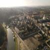
Pont de la Rue Hoche
is a minor waterways place
on the Canal de Briare between
Montargis (1.46 kilometres
and 2 locks
to the northwest) and
Briare-Henri IV Junction (The Canal Henri IV and the Canal Latéral à la Loire unite to form The Canal de Briare.) (50.15 kilometres
and 28 locks
to the south).
The nearest place in the direction of Montargis is Ecluse 33 de la Marolle;
0.47 kilometres
away.
The nearest place in the direction of Briare-Henri IV Junction is Pont de Route Nationale 7 (Amilly);
1.35 kilometres
away.
There may not be access to the towpath here.
Mooring here is unrated.
There is a bridge here which takes a road over the canal.
| Pont de la Reinette | 0.76 km | |
| Ecluse 34 de la Reinette | 0.73 km | |
| Passerelle Victor Hugo (Montargis) | 0.58 km | |
| Pont a Pied de la Marolle | 0.50 km | |
| Ecluse 33 de la Marolle | 0.47 km | |
| Pont de la Rue Hoche | ||
| Pont de Route Nationale 7 (Amilly) | 1.35 km | |
| Pont du Moulin Bardin | 1.63 km | |
| Pont Ferroviaire Montargis - Nogent-sur-Vernisson | 2.77 km | |
| Pont de la Tuilerie | 3.96 km | |
| Ecluse 32 de la Tuilerie | 3.98 km | |
- VisuRiS — associated with Waterways of Mainland Europe
- The official inland waterway resource for Belgium with actual traffic and planned operations on the waterways. Also has voyage planning and notices to mariners
Mouseover for more information or show routes to facility
Nearest water point
In the direction of Ecluse 36 de Buges
Montargis — 1.46 km and 2 locks away
On this waterway in the direction of Ecluse 36 de BugesNo information
CanalPlan has no information on any of the following facilities within range:rubbish disposal
chemical toilet disposal
place to turn
self-operated pump-out
boatyard pump-out
There is no page on Wikipedia called “Pont de la Rue Hoche”
Wikipedia pages that might relate to Pont de la Rue Hoche
[Pont de l'Alma]
French Civil Service used the Pont de la Tournelle, not the Pont de l'Alma, to gauge flood levels, and since 1868 uses the Pont d'Austerlitz. The bridge underwent
[Place de la Concorde]
the Rue Royale. The eastern one houses the Naval Ministry, and the western one is the Hôtel de Crillon. The Rue Royale leads to the Église de la Madeleine
[Pont de la Concorde (Paris)]
The Pont de la Concorde is an arch bridge across the Seine in Paris connecting the Quai des Tuileries at the Place de la Concorde (on the Rive Droite)
[Arc de Triomphe]
25 July 1799 La bataille de Jemmappes, 6 November 1792 Le passage du pont d'Arcole, 15 November 1796 La prise d'Alexandrie, 3 July 1798 La bataille d'Austerlitz
[La Madeleine, Paris]
Place de la Concorde, to the east is the Place Vendôme, and to the west Saint-Augustin, Paris. The site of this edifice, centred at the end of rue Royale
[Place Charles de Gaulle]
following: Avenue de Wagram (thus called since the Second Empire) and Boulevard de l'Étoile or Boulevard Bezons before Avenue Hoche: Avenue de la Reine-Hortense
[Élysée Palace]
Rue du Faubourg Saint-Honoré), and backing onto royal property, the Grand Cours through the Champs-Élysées. He sold this in 1718 to Louis Henri de La
[Hôtel de Crillon]
neoclassical palaces in what would become the Place de la Concorde. The two identical buildings, separated by the rue Royale, were initially designed to be offices
[Parc Monceau]
arrondissement of Paris, France, at the junction of Boulevard de Courcelles, Rue de Prony and Rue Georges Berger. At the main entrance is a rotunda. The park
[Gare Saint-Lazare]
Artnet. Retrieved 4 September 2008. "On the Pont de l'Europe". Archived from the original (JPG) on 9 April 2008. "La gare St Lazare". Aëlore (in French). 4

