CanalPlanAC

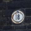
Firth Street Bridge No 18

 
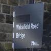
Wakefield Road Sand Street, Wakefield Road, Huddersfield HD1 3AQ, United Kingdom
 
Information about the place
Firth Street Bridge No 18 is a minor waterways place on the Huddersfield Narrow Canal between Golcar (2 miles and 5¾ furlongs and 12 locks to the west) and Aspley Basin (Huddersfield) (Moorings for Huddersfield and Junction of Huddersfield Broad and Narrow Canals) (¼ furlongs to the northeast).
 
 
The nearest place in the direction of Golcar is University Arm; ½ furlongs away.

This is a pinch point. The normal maximum dimensions for a boat on this waterway are 72 feet long, 7 feet wide, 6 feet and 11 inches high and 2 feet and 11 inches deep, but to pass through here the maximum dimensions are 6 feet and 11 inches high.

Mooring here is unrated.

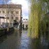
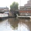
There is a bridge here which takes a dual carriageway over the canal.


Amenities

Amenities nearby at Aspley Basin (Huddersfield)

 ASDA
 Lidl
 Sainsbury's
 Aspley Wharf Marina Ltd
 Gulf

Amenities nearby at University Arm

 Lord Wilson Unit
 Yates's 40 -
 Subway Sandwich Shop
 
Maps
If you are a user and are logged on, or if you are actively planning a route, a map will be displayed here.
Show on external mapping site: Google | OSM | Bing
 
Navigational Notes

Some editions of Nicholsons Guides show this as Bridge 20

 
Photos
 
External websites
There are no links to external websites from here.
Why not log in and add some (select "External websites" from the menu (sometimes this is under "Edit"))?
 
Nearest facilities

Mouseover for more information or show routes to facility

Nearest water point

In the direction of Ashton-under-Lyne Junction

Waterside Lock No 21E4 miles, 5½ furlongs and 20 locks away
On this waterway in the direction of Ashton-under-Lyne Junction
Slaithwaite Winding Hole4 miles, 6 furlongs and 21 locks away
On this waterway in the direction of Ashton-under-Lyne Junction
Standedge Tunnel (eastern entrance)8 miles, 1 furlong and 42 locks away
On this waterway in the direction of Ashton-under-Lyne Junction
Standedge Tunnel (western entrance)11 miles, 2¾ furlongs and 42 locks away
On this waterway in the direction of Ashton-under-Lyne Junction
Wool Road Bridge No 7013 miles, 2¾ furlongs and 51 locks away
On this waterway in the direction of Ashton-under-Lyne Junction
Grove Road Bridge No 9619 miles, 2¾ furlongs and 66 locks away
On this waterway in the direction of Ashton-under-Lyne Junction

In the direction of Aspley Basin (Huddersfield)

Aspley Basin (Huddersfield)¼ furlongs away
On this waterway in the direction of Aspley Basin (Huddersfield)
Shepley Bridge Sanitary Station6 miles, 4¾ furlongs and 11 locks away
Travel to Aspley Basin (Huddersfield), then on the Huddersfield Broad Canal to Cooper Bridge Junction, then on the Calder and Hebble Navigation (Main Line) to Shepley Bridge Sanitary Station
Brighouse Basin5 miles, 6½ furlongs and 13 locks away
Travel to Aspley Basin (Huddersfield), then on the Huddersfield Broad Canal to Cooper Bridge Junction, then on the Calder and Hebble Navigation (Main Line) to Brighouse Basin
Salterhebble Sanitary Station10 miles, ½ furlongs and 22 locks away
Travel to Aspley Basin (Huddersfield), then on the Huddersfield Broad Canal to Cooper Bridge Junction, then on the Calder and Hebble Navigation (Main Line) to Salterhebble Sanitary Station
Broad Cut Low Lock No 313 miles, 1¾ furlongs and 19 locks away
Travel to Aspley Basin (Huddersfield), then on the Huddersfield Broad Canal to Cooper Bridge Junction, then on the Calder and Hebble Navigation (Main Line) to Broad Cut Low Lock No 3
Salterhebble Junction10 miles, 1 furlong and 23 locks away
Travel to Aspley Basin (Huddersfield), then on the Huddersfield Broad Canal to Cooper Bridge Junction, then on the Calder and Hebble Navigation (Main Line) to Salterhebble Junction
Sowerby Bridge Basin12 miles, 2¾ furlongs and 23 locks away
Travel to Aspley Basin (Huddersfield), then on the Huddersfield Broad Canal to Cooper Bridge Junction, then on the Calder and Hebble Navigation (Main Line) to Salterhebble Junction, then on the Calder and Hebble Navigation (Main Line) to Sowerby Bridge Basin
Ramsdens Bridge Sanitary Station18 miles, 5½ furlongs and 23 locks away
Travel to Aspley Basin (Huddersfield), then on the Huddersfield Broad Canal to Cooper Bridge Junction, then on the Calder and Hebble Navigation (Main Line) to Fall Ing Junction, then on the Aire and Calder Navigation (Wakefield Section) to Ramsdens Bridge Sanitary Station
Stanley Ferry Water Point18 miles, 6¼ furlongs and 23 locks away
Travel to Aspley Basin (Huddersfield), then on the Huddersfield Broad Canal to Cooper Bridge Junction, then on the Calder and Hebble Navigation (Main Line) to Fall Ing Junction, then on the Aire and Calder Navigation (Wakefield Section) to Stanley Ferry Water Point
Hebden Bridge Services17 miles, 6¼ furlongs and 30 locks away
Travel to Aspley Basin (Huddersfield), then on the Huddersfield Broad Canal to Cooper Bridge Junction, then on the Calder and Hebble Navigation (Main Line) to Salterhebble Junction, then on the Calder and Hebble Navigation (Main Line) to Sowerby Bridge Junction, then on the Rochdale Canal to Hebden Bridge Services

Nearest rubbish disposal

In the direction of Ashton-under-Lyne Junction

Pickle Lock No 22E4 miles, 6½ furlongs and 21 locks away
On this waterway in the direction of Ashton-under-Lyne Junction
Wool Road Visitor Mooring13 miles, 3 furlongs and 51 locks away
On this waterway in the direction of Ashton-under-Lyne Junction

In the direction of Aspley Basin (Huddersfield)

Aspley Basin (Huddersfield)¼ furlongs away
On this waterway in the direction of Aspley Basin (Huddersfield)
Shepley Bridge Sanitary Station6 miles, 4¾ furlongs and 11 locks away
Travel to Aspley Basin (Huddersfield), then on the Huddersfield Broad Canal to Cooper Bridge Junction, then on the Calder and Hebble Navigation (Main Line) to Shepley Bridge Sanitary Station
Brighouse Lower Basin Visitor Moorings5 miles, 6¼ furlongs and 12 locks away
Travel to Aspley Basin (Huddersfield), then on the Huddersfield Broad Canal to Cooper Bridge Junction, then on the Calder and Hebble Navigation (Main Line) to Brighouse Lower Basin Visitor Moorings
Horbury Basin Residential Moorings & Sanitary Station11 miles, 1¼ furlongs and 18 locks away
Travel to Aspley Basin (Huddersfield), then on the Huddersfield Broad Canal to Cooper Bridge Junction, then on the Calder and Hebble Navigation (Main Line) to Horbury Basin Residential Moorings & Sanitary Station
Salterhebble Sanitary Station10 miles, ½ furlongs and 22 locks away
Travel to Aspley Basin (Huddersfield), then on the Huddersfield Broad Canal to Cooper Bridge Junction, then on the Calder and Hebble Navigation (Main Line) to Salterhebble Sanitary Station
Sowerby Bridge Basin12 miles, 2¾ furlongs and 23 locks away
Travel to Aspley Basin (Huddersfield), then on the Huddersfield Broad Canal to Cooper Bridge Junction, then on the Calder and Hebble Navigation (Main Line) to Salterhebble Junction, then on the Calder and Hebble Navigation (Main Line) to Sowerby Bridge Basin
Ramsdens Bridge Visitor Moorings18 miles, 6 furlongs and 23 locks away
Travel to Aspley Basin (Huddersfield), then on the Huddersfield Broad Canal to Cooper Bridge Junction, then on the Calder and Hebble Navigation (Main Line) to Fall Ing Junction, then on the Aire and Calder Navigation (Wakefield Section) to Ramsdens Bridge Visitor Moorings
Hebden Bridge Services17 miles, 6¼ furlongs and 30 locks away
Travel to Aspley Basin (Huddersfield), then on the Huddersfield Broad Canal to Cooper Bridge Junction, then on the Calder and Hebble Navigation (Main Line) to Salterhebble Junction, then on the Calder and Hebble Navigation (Main Line) to Sowerby Bridge Junction, then on the Rochdale Canal to Hebden Bridge Services

Nearest chemical toilet disposal

In the direction of Ashton-under-Lyne Junction

Waterside Lock No 21E4 miles, 5½ furlongs and 20 locks away
On this waterway in the direction of Ashton-under-Lyne Junction
Pickle Lock No 22E4 miles, 6½ furlongs and 21 locks away
On this waterway in the direction of Ashton-under-Lyne Junction
Wool Road Bridge No 7013 miles, 2¾ furlongs and 51 locks away
On this waterway in the direction of Ashton-under-Lyne Junction
Grove Road Bridge No 9619 miles, 2¾ furlongs and 66 locks away
On this waterway in the direction of Ashton-under-Lyne Junction

In the direction of Aspley Basin (Huddersfield)

Aspley Basin (Huddersfield)¼ furlongs away
On this waterway in the direction of Aspley Basin (Huddersfield)
Shepley Bridge Sanitary Station6 miles, 4¾ furlongs and 11 locks away
Travel to Aspley Basin (Huddersfield), then on the Huddersfield Broad Canal to Cooper Bridge Junction, then on the Calder and Hebble Navigation (Main Line) to Shepley Bridge Sanitary Station
Brighouse Basin5 miles, 6½ furlongs and 13 locks away
Travel to Aspley Basin (Huddersfield), then on the Huddersfield Broad Canal to Cooper Bridge Junction, then on the Calder and Hebble Navigation (Main Line) to Brighouse Basin
Savile Town Wharf and Basin (Dewsbury)10 miles, ¼ furlongs and 15 locks away
Travel to Aspley Basin (Huddersfield), then on the Huddersfield Broad Canal to Cooper Bridge Junction, then on the Calder and Hebble Navigation (Main Line) to Dewsbury Arm Junction, then on the Calder and Hebble Navigation (Dewsbury Old Cut) to Savile Town Wharf and Basin (Dewsbury)
Horbury Basin Residential Moorings & Sanitary Station11 miles, 1¼ furlongs and 18 locks away
Travel to Aspley Basin (Huddersfield), then on the Huddersfield Broad Canal to Cooper Bridge Junction, then on the Calder and Hebble Navigation (Main Line) to Horbury Basin Residential Moorings & Sanitary Station
Salterhebble Sanitary Station10 miles, ½ furlongs and 22 locks away
Travel to Aspley Basin (Huddersfield), then on the Huddersfield Broad Canal to Cooper Bridge Junction, then on the Calder and Hebble Navigation (Main Line) to Salterhebble Sanitary Station
Sowerby Bridge Basin12 miles, 2¾ furlongs and 23 locks away
Travel to Aspley Basin (Huddersfield), then on the Huddersfield Broad Canal to Cooper Bridge Junction, then on the Calder and Hebble Navigation (Main Line) to Salterhebble Junction, then on the Calder and Hebble Navigation (Main Line) to Sowerby Bridge Basin
Ramsdens Bridge Sanitary Station18 miles, 5½ furlongs and 23 locks away
Travel to Aspley Basin (Huddersfield), then on the Huddersfield Broad Canal to Cooper Bridge Junction, then on the Calder and Hebble Navigation (Main Line) to Fall Ing Junction, then on the Aire and Calder Navigation (Wakefield Section) to Ramsdens Bridge Sanitary Station
Hebden Bridge Services17 miles, 6¼ furlongs and 30 locks away
Travel to Aspley Basin (Huddersfield), then on the Huddersfield Broad Canal to Cooper Bridge Junction, then on the Calder and Hebble Navigation (Main Line) to Salterhebble Junction, then on the Calder and Hebble Navigation (Main Line) to Sowerby Bridge Junction, then on the Rochdale Canal to Hebden Bridge Services

Nearest place to turn

In the direction of Ashton-under-Lyne Junction

University Arm½ furlongs away
On this waterway in the direction of Ashton-under-Lyne Junction
Isis Lock Winding Hole2 miles, 1¼ furlongs and 8 locks away
On this waterway in the direction of Ashton-under-Lyne Junction
Linthwaite Winding Hole3 miles, 5½ furlongs and 16 locks away
On this waterway in the direction of Ashton-under-Lyne Junction
Slaithwaite Winding Hole4 miles, 6 furlongs and 21 locks away
On this waterway in the direction of Ashton-under-Lyne Junction

In the direction of Aspley Basin (Huddersfield)

Aspley Basin (Huddersfield)¼ furlongs away
On this waterway in the direction of Aspley Basin (Huddersfield)
Anchor Street Winding Hole5¼ furlongs away
Travel to Aspley Basin (Huddersfield), then on the Huddersfield Broad Canal to Anchor Street Winding Hole
New Road Winding Hole1 mile, ½ furlongs away
Travel to Aspley Basin (Huddersfield), then on the Huddersfield Broad Canal to New Road Winding Hole
Deighton Road Bridge Winding Hole2 miles, 2¼ furlongs and 5 locks away
Travel to Aspley Basin (Huddersfield), then on the Huddersfield Broad Canal to Deighton Road Bridge Winding Hole
Cooper Bridge Junction3 miles, 4¼ furlongs and 9 locks away
Travel to Aspley Basin (Huddersfield), then on the Huddersfield Broad Canal to Cooper Bridge Junction
Battye Weir Entrance4 miles, 1¼ furlongs and 10 locks away
Travel to Aspley Basin (Huddersfield), then on the Huddersfield Broad Canal to Cooper Bridge Junction, then on the Calder and Hebble Navigation (Main Line) to Battye Weir Entrance
Shepley Bridge Marina6 miles, 5 furlongs and 11 locks away
Travel to Aspley Basin (Huddersfield), then on the Huddersfield Broad Canal to Cooper Bridge Junction, then on the Calder and Hebble Navigation (Main Line) to Shepley Bridge Marina
Brighouse Basin5 miles, 6½ furlongs and 13 locks away
Travel to Aspley Basin (Huddersfield), then on the Huddersfield Broad Canal to Cooper Bridge Junction, then on the Calder and Hebble Navigation (Main Line) to Brighouse Basin
Ganny Winding Hole6 miles, 4 furlongs and 14 locks away
Travel to Aspley Basin (Huddersfield), then on the Huddersfield Broad Canal to Cooper Bridge Junction, then on the Calder and Hebble Navigation (Main Line) to Ganny Winding Hole
Dewsbury Arm Junction9 miles, ¼ furlongs and 15 locks away
Travel to Aspley Basin (Huddersfield), then on the Huddersfield Broad Canal to Cooper Bridge Junction, then on the Calder and Hebble Navigation (Main Line) to Dewsbury Arm Junction
Savile Town Wharf and Basin (Dewsbury)10 miles, ¼ furlongs and 15 locks away
Travel to Aspley Basin (Huddersfield), then on the Huddersfield Broad Canal to Cooper Bridge Junction, then on the Calder and Hebble Navigation (Main Line) to Dewsbury Arm Junction, then on the Calder and Hebble Navigation (Dewsbury Old Cut) to Savile Town Wharf and Basin (Dewsbury)
Horbury Basin Residential Moorings & Sanitary Station11 miles, 1¼ furlongs and 18 locks away
Travel to Aspley Basin (Huddersfield), then on the Huddersfield Broad Canal to Cooper Bridge Junction, then on the Calder and Hebble Navigation (Main Line) to Horbury Basin Residential Moorings & Sanitary Station
Salterhebble Wharf10 miles and 21 locks away
Travel to Aspley Basin (Huddersfield), then on the Huddersfield Broad Canal to Cooper Bridge Junction, then on the Calder and Hebble Navigation (Main Line) to Salterhebble Wharf
Salterhebble Bottom Basin Visitor Moorings10 miles, ¼ furlongs and 21 locks away
Travel to Aspley Basin (Huddersfield), then on the Huddersfield Broad Canal to Cooper Bridge Junction, then on the Calder and Hebble Navigation (Main Line) to Salterhebble Bottom Basin Visitor Moorings
Salterhebble Sanitary Station10 miles, ½ furlongs and 22 locks away
Travel to Aspley Basin (Huddersfield), then on the Huddersfield Broad Canal to Cooper Bridge Junction, then on the Calder and Hebble Navigation (Main Line) to Salterhebble Sanitary Station
Waller Bridge Winding Hole13 miles and 19 locks away
Travel to Aspley Basin (Huddersfield), then on the Huddersfield Broad Canal to Cooper Bridge Junction, then on the Calder and Hebble Navigation (Main Line) to Waller Bridge Winding Hole

Nearest self-operated pump-out

In the direction of Ashton-under-Lyne Junction

Slaithwaite Winding Hole4 miles, 6 furlongs and 21 locks away
On this waterway in the direction of Ashton-under-Lyne Junction
Wool Road Bridge No 7013 miles, 2¾ furlongs and 51 locks away
On this waterway in the direction of Ashton-under-Lyne Junction

In the direction of Aspley Basin (Huddersfield)

Ramsdens Bridge Sanitary Station18 miles, 5½ furlongs and 23 locks away
Travel to Aspley Basin (Huddersfield), then on the Huddersfield Broad Canal to Cooper Bridge Junction, then on the Calder and Hebble Navigation (Main Line) to Fall Ing Junction, then on the Aire and Calder Navigation (Wakefield Section) to Ramsdens Bridge Sanitary Station
Hebden Bridge Services17 miles, 6¼ furlongs and 30 locks away
Travel to Aspley Basin (Huddersfield), then on the Huddersfield Broad Canal to Cooper Bridge Junction, then on the Calder and Hebble Navigation (Main Line) to Salterhebble Junction, then on the Calder and Hebble Navigation (Main Line) to Sowerby Bridge Junction, then on the Rochdale Canal to Hebden Bridge Services

Nearest boatyard pump-out

Direction of TV transmitter (From Wolfbane Cybernetic)
 
 
Geograph
 
Wikipedia

There is no page on Wikipedia called “Firth Street Bridge”

Wikipedia pages that might relate to Firth Street Bridge
[Forth Bridge] The Forth Bridge is a cantilever railway bridge across the Firth of Forth in the east of Scotland, 9 miles (14 kilometres) west of central Edinburgh. Completed [Forth Road Bridge] longest suspension bridge in the world outside the United States. The bridge spans the Firth of Forth, connecting Edinburgh, at South Queensferry, to Fife, at [Queensferry Crossing] Crossing) is a road bridge in Scotland. It was built alongside the existing Forth Road Bridge and carries the M90 motorway across the Firth of Forth between [Bonar Bridge] Dornoch, at the other extreme of the Dornoch Firth bridge that takes the A9 over the Dornoch Firth from Tain here. The village is a transport hub for [Truss bridge] A truss bridge is a bridge whose load-bearing superstructure is composed of a truss, a structure of connected elements, usually forming triangular units [Firth Park (ward)] Firth Park ward—which includes the districts of Firth Park, Longley, Parson Cross and parts of Wincobank—is one of the 28 electoral wards in City of Sheffield [Swing bridge] England docks branch bridge – rail Kennet and Avon Canal at Tyle Mill Lock, Sulhamstead, Berkshire Kincardine Bridge – crossing the Firth of Forth from Falkirk [River Ness] river discharges into the eastern end of the Beauly Firth, which is a continuation of the Moray Firth, at Kessock. The northern section of the Caledonian [North Queensferry] a village in Fife, Scotland, situated on the Firth of Forth where the Forth Bridge the Forth Road Bridge, and the Queensferry Crossing all meet the Fife [The Railway Man (film)] the 1995 autobiography of the same name by Eric Lomax, and stars Colin Firth, Nicole Kidman, Jeremy Irvine, and Stellan Skarsgård. It premiered at the
 
Google

Results of Google Search

London City Airport (LCY) to 20 Frith Street - 6 ways to travel via ...
Dec 21, 2020 ... The cheapest way to get from London City Airport (LCY) to 20 Frith Street costs only £1, and the quickest way ... What is the national COVID-19 helpline number in 20 Frith Street? ... Park Plaza Westminster Bridge London.
Village of Firth : About Firth : History
Firth was incorporated on January 20, 1879. ... There was still no sign of a town in 1866, only a family named Givens living here. ... In the 1950's a sewage system was installed, and Main Street got a coat of asphalt. ... He then journeyed west to Kansas and began working for the Fort Scott Railroad on bridge projects.
Angel Station to 20 Frith Street - 4 ways to travel via , and subway ...
How to get from Angel Station to 20 Frith Street by subway, bus, taxi or foot ... What is the national COVID-19 helpline number in 20 Frith Street? The national ...
4004 Duke Firth Street, Land O Lakes, FL 34638 | Compass
Nov 16, 2020 ... 4004 Duke Firth Street, Land O Lakes, FL 34638 is a single family home not ... Sold 11/15/20 ... Parcel Number: 18-26-20-0070-00700-0310.
Fifth Avenue - Wikipedia
Fifth Avenue is a major thoroughfare in the borough of Manhattan in New York City. It stretches ... The midtown blocks were largely a residential area until the turn of the 20th century, when they were ... Traffic crosses the river on the Madison Avenue Bridge. Fifth ... There is no dedicated bike lane along most of Fifth Avenue.
4039 Duke Firth Street, Land O Lakes, FL 34638 | Compass
Jul 27, 2020 ... 4039 Duke Firth Street, Land O Lakes, FL 34638 is a single family home not currently ... Sold 7/26/20 ... Association Approval Required: No.
20 Fifth Ave. in Greenwich Village : Sales, Rentals, Floorplans ...
Disclaimer: School attendance zone boundaries are not guaranteed to be accurate – they are provided by a third party and subject to change. Check with the ...
Act of Dec. 14, 1992,PL 894, No. 143 Cl. 86
(20) City of Pittsburgh, Mission Street Bridge West No.60, Bridge ... (18) Sparta Township, T-880 on Firth Road over Britton Run, Bridge Replacement. 139,000.
Traffic Alerts Listing
(In effect - 2/10/12) Firth Sterling Avenue & South Capitol Street (Road Work) ... Capitol Street and Suitland Parkway × 10 am Friday, January 20 through 10 am ... Southbound Anacostia Freeway Exit Ramp to South Capitol Street [Bridge No.