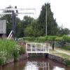
Pencelli Court Lift Bridge No 155
is a major waterways place
on the Monmouthshire and Brecon Canal between
Cross Keys Bridge No 153 (1½ furlongs
to the east) and
Ty-Newydd Upper Bridge No 160 (1 mile and 3½ furlongs
to the northwest).
The nearest place in the direction of Cross Keys Bridge No 153 is Pencelli Winding Hole;
½ furlongs
away.
The nearest place in the direction of Ty-Newydd Upper Bridge No 160 is Low Bridge No 156;
2½ furlongs
away.
Mooring here is unrated.
There is a lift bridge here.
| Castle Bridge No 152 | 3¼ furlongs | |
| Cross Keys Bridge No 153 | 1½ furlongs | |
| Royal Oak PH | 1¼ furlongs | |
| Pencelli Bridge No 154 | ¾ furlongs | |
| Pencelli Winding Hole | ½ furlongs | |
| Pencelli Court Lift Bridge No 155 | ||
| Low Bridge No 156 | 2½ furlongs | |
| Llanbrynean Bridge No 157 | 5¾ furlongs | |
| Nant Menascin Aqueduct No 3 | 7½ furlongs | |
| Storehouse Bridge Winding Hole | 1 mile, ¾ furlongs | |
| Storehouse Bridge No 158 | 1 mile, 1 furlong | |
There are no links to external websites from here.
Why not log in and add some (select "External websites" from the menu (sometimes this is under "Edit"))?
Why not log in and add some (select "External websites" from the menu (sometimes this is under "Edit"))?
Mouseover for more information or show routes to facility
Nearest water point
In the direction of Five Locks Road
Govilon Wharf — 15 miles, 7¾ furlongs and 5 locks away
On this waterway in the direction of Five Locks Road
Govilon Visitor Moorings — 16 miles, ¾ furlongs and 5 locks away
On this waterway in the direction of Five Locks Road
In the direction of Theatre Basin
Brynich Aqueduct No 2 (southern end) — 2 miles, 2¾ furlongs away
On this waterway in the direction of Theatre BasinNearest place to turn
In the direction of Five Locks Road
Pencelli Winding Hole — ½ furlongs away
On this waterway in the direction of Five Locks Road
Beacon Park Boats — 10 miles, 7½ furlongs and 5 locks away
On this waterway in the direction of Five Locks Road
Pen-Pedair Heol Winding Hole — 11 miles, 7¼ furlongs and 5 locks away
On this waterway in the direction of Five Locks Road
Malford Grove Winding Hole — 13 miles, 5¼ furlongs and 5 locks away
On this waterway in the direction of Five Locks Road
Govilon Winding Hole — 16 miles and 5 locks away
On this waterway in the direction of Five Locks Road
Llanfoist Wharf — 17 miles, 1¼ furlongs and 5 locks away
On this waterway in the direction of Five Locks Road
In the direction of Theatre Basin
Storehouse Bridge Winding Hole — 1 mile, ¾ furlongs away
On this waterway in the direction of Theatre Basin
Brynich Turn Bridge Winding Hole — 2 miles, 2 furlongs away
On this waterway in the direction of Theatre Basin
Dadfords Bridge Winding Hole — 4 miles, 4¾ furlongs and 1 lock away
On this waterway in the direction of Theatre Basin
Theatre Basin — 4 miles, 5¼ furlongs and 1 lock away
On this waterway in the direction of Theatre BasinNo information
CanalPlan has no information on any of the following facilities within range:rubbish disposal
chemical toilet disposal
self-operated pump-out
boatyard pump-out
Direction of TV transmitter (From Wolfbane Cybernetic)
There is no page on Wikipedia called “Pencelli Court Lift Bridge”
Results of Google Search
Pencelli Court Lift Bridge No 155 is a major waterways feature on the Monmouthshire and Brecon Canal between Cross Keys Bridge No 153 (1½ furlongs to the ...


![Pencelli Court farmyard. The stone building behind the two vehicles is the front of a historic granary [[6549549]] viewed across canal draw bridge, 155. by M J Roscoe – 24 July 2020](https://s1.geograph.org.uk/geophotos/06/54/95/6549581_fa221f35_120x120.jpg)


![Pencelli Court. The listed 1691 farmhouse https://cadwpublic-api.azurewebsites.net/reports/listedbuilding/FullReport?lang=&id=6735 also appears in [[[7200547]]].](https://s3.geograph.org.uk/geophotos/07/20/05/7200551_4b1005c7_120x120.jpg)
![Pencelli Court. On the right is the listed farmhouse, of 1691 https://cadwpublic-api.azurewebsites.net/reports/listedbuilding/FullReport?lang=&id=6735 , with attached byre. On the left is another byre, shown in [[[7200470]]] https://cadwpublic-api.azurewebsites.net/reports/listedbuilding/FullReport?lang=&id=6736 . The gable end of the barn in that image is also visible. by Derek Harper – 23 June 2021](https://s3.geograph.org.uk/geophotos/07/20/05/7200547_0c979d59_120x120.jpg)


![Canal slipway and canoe launching area. The Taff Trail leaves the canal here via bridge 154, out of shot to left, [[6548783]] and heads up the road. by M J Roscoe – 24 July 2020](https://s1.geograph.org.uk/geophotos/06/54/88/6548817_43577443_120x120.jpg)


![Monmouthshire & Brecon canal at Pencelli. Attached to the parapet of the bridge is an interesting notice: [[1996873]] by Gareth James – 02 August 2010](https://s3.geograph.org.uk/geophotos/01/99/68/1996875_4deea043_120x120.jpg)
![Stile, Usk Valley Walk. Looking right from [[[7200566]]], as Talybont-on-Usk footpath 15/1 starts its journey with a stile to leave the Taff Trail. by Derek Harper – 23 June 2021](https://s3.geograph.org.uk/geophotos/07/20/06/7200679_e3992a72_120x120.jpg)


![Usk Valley Walk meets Mon & Brec Canal. The Walk comes down to the stile turns to left of picture and along canalside road to cross Pencelli Bridge [[6549783]] to tow path. by M J Roscoe – 24 July 2020](https://s3.geograph.org.uk/geophotos/06/54/95/6549523_1f4233f1_120x120.jpg)


![Pencelli Bridge, No 154. The Taff Trail leaves the tow path here and goes left over this road bridge to join a minor road [[6548813]]. The Usk Valley Walk comes over the bridge in the opposite direction to join the tow path on the far side of the bridge. by M J Roscoe – 24 July 2020](https://s3.geograph.org.uk/geophotos/06/54/87/6548783_2f0d88ac_120x120.jpg)
![Junction on Taff Trail. The trail follows the lane on the left and ahead towards Pencelli; the no through road on the right is shown at [[[7200238]]]. The end of a listed barn https://cadwpublic-api.azurewebsites.net/reports/listedbuilding/FullReport?lang=&id=6736 at Pencelli Court can be seen. by Derek Harper – 23 June 2021](https://s1.geograph.org.uk/geophotos/07/20/03/7200333_28a043be_120x120.jpg)