CanalPlanAC

Calthorpe Winding Hole 

 
Bankside, Bodicote OX16 9SN, United Kingdom
 

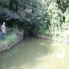
Calthorpe Winding Hole is on the Oxford Canal (Southern Section - Main Line) between Newcester and Barford.

Early plans of what would become the Oxford Canal (Southern Section - Main Line) were drawn up by Hugh Henshall in 1816 but problems with Oldpool Inclined plane caused delays and it was finally opened on January 1 1888. Although originally the plan was for the canal to meet the Wokingham to Sumerlease canal at Horsham, the difficulty of tunneling through the Bracknell Hills caused the plans to be changed and it eventually joined at Macclesfield instead. Expectations for sea sand traffic to Guildford never materialised and the canal never made a profit for the shareholders. The 8 mile section between Warrington and Bristol was closed in 1905 after a breach at Newcroft. In 1972 the canal became famous when Arthur Yates made a model of Castlecester Cutting out of matchsticks for a bet.

Information about the place
Calthorpe Winding Hole is a minor waterways place on the Oxford Canal (Southern Section - Main Line) between Somerton Bridge No 196 (8 miles and 4 furlongs and 5 locks to the southeast) and Concorde Avenue Bridge No 165 (5½ furlongs to the northwest).
 
 
The nearest place in the direction of Somerton Bridge No 196 is Site of Swingbridge No 169; 1¾ furlongs away.
 
The nearest place in the direction of Concorde Avenue Bridge No 165 is Tramway Road Pipe Bridge; 2 furlongs away.

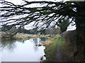
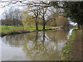
Mooring here is ok (a perfectly adequate mooring). Long term mooring are to the north of the winding hole. To the south the towpath is "rurally managed" and in the summer months a strimmer may be required to allow access on and off your boat. There are a couple of scaffold poles sunk into the bank to use as mooring points.

You can wind here.


Amenities

Amenities here

 Cashpoint
 Sainsburys Fuel
 Wm Morrison Supermarkets Banbury 106
 Bus stop (Chalker Way North)
 Bus stop (Coppice Close)
 Bus stop (Coppice Close)
 Bus stop (Elmscote Road)
 Bus stop (Elmscote Road)
 Bus stop (Grange Road)
 Bus stop (Grange Road)
 Bus stop (Newbold Close)
 Bus stop (Sainsbury's)
 Bus stop (St Johns School)

Amenities nearby at Site of Swingbridge No 169

 Bus stop (Ashridge Close)
 Bus stop (Ashridge Close)
 Bus stop (Blenheim Road)
 Bus stop (Blenheim Road)
 Bus stop (Farm Way)
 Bus stop (Farm Way)
 Bus stop (Laurel Close)
 Bus stop (Laurel Close)
 Bus stop (Mayfield Road)
 Bus stop (Mayfield Road)
 Bus stop (Whimbrel Way)
 Bus stop (Whimbrel Way)

Amenities nearby at Tramway Road Pipe Bridge

 Sainsbury's
 Sainsburys
 Sainsburys - Oxford Road - Banbury OX16 9XA
 Travis Perkins
 Bus stop (Hightown Gardens for Hospital)
 Bus stop (Hightown Gardens for Hospital)
 Bus stop (Newbold Close)
 Bus stop (Samuelson House)
 Bus stop (Springfield Avenue)
 Bus stop (Springfield Avenue)
 Bus stop (Western Crescent)
 Bus stop (Western Crescent)
 
Maps
If you are a user and are logged on, or if you are actively planning a route, a map will be displayed here.
Show on external mapping site: Google | OSM | Bing
 
Navigational Notes

NO mooring allowed opposite the winding hole.

 
Photos
 
External websites
 Oxford Canal Walk - Part One - Oxford to Thrupp - YouTube — associated with Oxford Canal
A walk along the Oxford Canal (Southern Section) from Oxford to Thrupp Wide
 
Nearest facilities

Mouseover for more information or show routes to facility

Nearest water point

In the direction of Napton Junction

Cherwell Street Facilities — 5½ furlongs away
On this waterway in the direction of Napton Junction
Banbury Lock No 29 — 5¾ furlongs away
On this waterway in the direction of Napton Junction
Sovereign Wharf — 7¾ furlongs and 1 lock away
On this waterway in the direction of Napton Junction
Cropredy Services — 5 miles, 1½ furlongs and 4 locks away
On this waterway in the direction of Napton Junction
Cropredy Marina (southern basin) — 5 miles, 6 furlongs and 5 locks away
On this waterway in the direction of Napton Junction
Cropredy Marina (northern basins) — 5 miles, 6½ furlongs and 5 locks away
On this waterway in the direction of Napton Junction
Fenny Compton Wharf — 11 miles, 4 furlongs and 13 locks away
On this waterway in the direction of Napton Junction
Marston Doles Water Point — 18 miles, 7¾ furlongs and 13 locks away
On this waterway in the direction of Napton Junction

In the direction of End of Hythe Bridge Arm

Aynho Wharf — 6 miles, ¼ furlongs and 4 locks away
On this waterway in the direction of End of Hythe Bridge Arm
Heyford Wharf — 12 miles, ½ furlongs and 7 locks away
On this waterway in the direction of End of Hythe Bridge Arm
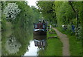
Heyford Wharf Bridge No 206 — 12 miles, ¾ furlongs and 7 locks away
On this waterway in the direction of End of Hythe Bridge Arm
Thrupp Cruising Club — 19 miles, 5 furlongs and 12 locks away
On this waterway in the direction of End of Hythe Bridge Arm
Aubreys Lift Bridge No 221 — 19 miles, 5¼ furlongs and 12 locks away
On this waterway in the direction of End of Hythe Bridge Arm
Nearest rubbish disposal

In the direction of Napton Junction

Cherwell Street Facilities — 5½ furlongs away
On this waterway in the direction of Napton Junction
Sovereign Wharf — 7¾ furlongs and 1 lock away
On this waterway in the direction of Napton Junction
Cropredy Services — 5 miles, 1½ furlongs and 4 locks away
On this waterway in the direction of Napton Junction
Cropredy Marina (southern basin) — 5 miles, 6 furlongs and 5 locks away
On this waterway in the direction of Napton Junction
Cropredy Marina (northern basins) — 5 miles, 6½ furlongs and 5 locks away
On this waterway in the direction of Napton Junction
Fenny Compton Marina — 11 miles, 1¼ furlongs and 13 locks away
On this waterway in the direction of Napton Junction

In the direction of End of Hythe Bridge Arm
Aynho Wharf — 6 miles, ¼ furlongs and 4 locks away
On this waterway in the direction of End of Hythe Bridge Arm
Heyford Wharf — 12 miles, ½ furlongs and 7 locks away
On this waterway in the direction of End of Hythe Bridge Arm
Heyford Wharf Bridge No 206 — 12 miles, ¾ furlongs and 7 locks away
On this waterway in the direction of End of Hythe Bridge Arm
Thrupp Cruising Club — 19 miles, 5 furlongs and 12 locks away
On this waterway in the direction of End of Hythe Bridge Arm
Aubreys Lift Bridge No 221 — 19 miles, 5¼ furlongs and 12 locks away
On this waterway in the direction of End of Hythe Bridge Arm
Nearest chemical toilet disposal

In the direction of Napton Junction

Cherwell Street Facilities — 5½ furlongs away
On this waterway in the direction of Napton Junction
Sovereign Wharf — 7¾ furlongs and 1 lock away
On this waterway in the direction of Napton Junction
Cropredy Services — 5 miles, 1½ furlongs and 4 locks away
On this waterway in the direction of Napton Junction
Cropredy Marina (southern basin) — 5 miles, 6 furlongs and 5 locks away
On this waterway in the direction of Napton Junction
Fenny Compton Marina — 11 miles, 1¼ furlongs and 13 locks away
On this waterway in the direction of Napton Junction

In the direction of End of Hythe Bridge Arm
Thrupp Cruising Club — 19 miles, 5 furlongs and 12 locks away
On this waterway in the direction of End of Hythe Bridge Arm

Nearest place to turn

In the direction of Napton Junction

Grimsbury Wharf — 1 mile, 3 furlongs and 1 lock away
On this waterway in the direction of Napton Junction
Southam Road Winding Hole — 1 mile, 4¼ furlongs and 1 lock away
On this waterway in the direction of Napton Junction
Southam Road Footbridge Arm — 1 mile, 7 furlongs and 1 lock away
On this waterway in the direction of Napton Junction
Cropredy Services — 5 miles, 1½ furlongs and 4 locks away
On this waterway in the direction of Napton Junction
Cropredy Marina (southern basin) — 5 miles, 6 furlongs and 5 locks away
On this waterway in the direction of Napton Junction
Cropredy Marina (northern basins) — 5 miles, 6½ furlongs and 5 locks away
On this waterway in the direction of Napton Junction
Clattercote Bridge Winding Hole — 7 miles, 1¼ furlongs and 8 locks away
On this waterway in the direction of Napton Junction
Fenny Compton Marina — 11 miles, 1¼ furlongs and 13 locks away
On this waterway in the direction of Napton Junction
Fenny Compton Wharf — 11 miles, 4 furlongs and 13 locks away
On this waterway in the direction of Napton Junction

In the direction of End of Hythe Bridge Arm
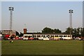
Twyford Wharf Winding Hole — 2 miles, ¾ furlongs and 1 lock away
On this waterway in the direction of End of Hythe Bridge Arm
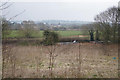
Winding Hole above Nell Bridge Lock — 4 miles, 5¾ furlongs and 2 locks away
On this waterway in the direction of End of Hythe Bridge Arm
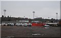
Aynho Wharf — 6 miles, ¼ furlongs and 4 locks away
On this waterway in the direction of End of Hythe Bridge Arm
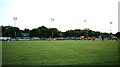
Somerton Deep Lock Winding Hole — 7 miles, 6½ furlongs and 4 locks away
On this waterway in the direction of End of Hythe Bridge Arm
Heyford Wharf Winding Hole — 12 miles, ½ furlongs and 7 locks away
On this waterway in the direction of End of Hythe Bridge Arm
Heyford Wharf — 12 miles, ½ furlongs and 7 locks away
On this waterway in the direction of End of Hythe Bridge Arm

The Cleeves Winding Hole — 12 miles, 4½ furlongs and 7 locks away
On this waterway in the direction of End of Hythe Bridge Arm
Kirtlington Winding Hole — 15 miles, 3 furlongs and 9 locks away
On this waterway in the direction of End of Hythe Bridge Arm
Enslow Winding Hole — 17 miles, ½ furlongs and 10 locks away
On this waterway in the direction of End of Hythe Bridge Arm
Shipton Weir Junction — 18 miles, 4½ furlongs and 11 locks away
On this waterway in the direction of End of Hythe Bridge Arm
Thrupp Wide — 19 miles, 5 furlongs and 12 locks away
On this waterway in the direction of End of Hythe Bridge Arm

Nearest self-operated pump-out

In the direction of Napton Junction

Cropredy Marina (southern basin) — 5 miles, 6 furlongs and 5 locks away
On this waterway in the direction of Napton Junction
Fenny Compton Marina — 11 miles, 1¼ furlongs and 13 locks away
On this waterway in the direction of Napton Junction

In the direction of End of Hythe Bridge Arm
Thrupp Cruising Club — 19 miles, 5 furlongs and 12 locks away
On this waterway in the direction of End of Hythe Bridge Arm
Aubreys Lift Bridge No 221 — 19 miles, 5¼ furlongs and 12 locks away
On this waterway in the direction of End of Hythe Bridge Arm

Nearest boatyard pump-out

In the direction of Napton Junction

Sovereign Wharf — 7¾ furlongs and 1 lock away
On this waterway in the direction of Napton Junction
Cropredy Marina (southern basin) — 5 miles, 6 furlongs and 5 locks away
On this waterway in the direction of Napton Junction

In the direction of End of Hythe Bridge Arm

Twyford Wharf — 2 miles, 1 furlong and 1 lock away
On this waterway in the direction of End of Hythe Bridge Arm
Aynho Wharf — 6 miles, ¼ furlongs and 4 locks away
On this waterway in the direction of End of Hythe Bridge Arm
Heyford Wharf — 12 miles, ½ furlongs and 7 locks away
On this waterway in the direction of End of Hythe Bridge Arm
Enslow Wharf — 17 miles, 1½ furlongs and 10 locks away
On this waterway in the direction of End of Hythe Bridge Arm
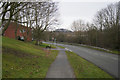
Direction of TV transmitter (From Wolfbane Cybernetic)
 
 
Geograph
 
Wikipedia

There is no page on Wikipedia called “Calthorpe Winding Hole”

Wikipedia pages that might relate to Calthorpe Winding Hole
[Norwich] (1807–1887), born in Norwich, a prolific and successful playwright William Calthorpe, purchased Erpingham manor in St.Martin's at the Palace, Norwich in 1447
 
Google

Results of Google Search

Winding hole - Wikipedia
A winding hole is a widened area of a canal used for turning a canal boat such as a narrowboat. Contents. 1 Etymology; 2 History; 3 Use; 4 See also ...
Journey Planner - Route
Calthorpe Winding Hole, N, N, 29.08. Calthorpe Winding Hole, N, N, 29.47. Samuelson Bridge 168 (Tramway Rd), 90, N, 29.73. Albion Bridge 166 (Bridge St ) ...
Wondering what a Winding Hole is? we explain!
Jul 6, 2020 ... A winding hole is a widened area of a canal (usually in the United Kingdom), used for turning a canal boat such as a narrowboat.
Mapping boating facilities and winding holes | Canal & River Trust
May 13, 2016 ... Mapping boating facilities and winding holes. In this blog the boating team explain why keeping our maps up to date is so important and ask for ...