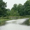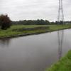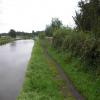
Calder Aqueduct No 52
Over the River Calder
Ray Lane, Wyre PR3 1GB, United Kingdom
Address is taken from a point 550 yards away.
Address is taken from a point 550 yards away.

Calder Aqueduct No 52
is a place on the waterways
on the Lancaster Canal (Main Line) between
Ribble Link - Lancaster Canal Junction (13 miles
to the south) and
Lodge Hill Junction (Junction with Lancaster Canal - Glasson Dock Branch) (9 miles and 4¾ furlongs
to the north).
The nearest place in the direction of Ribble Link - Lancaster Canal Junction is Stubbins Bridge No 51;
2¾ furlongs
away.
The nearest place in the direction of Lodge Hill Junction is Catterall Bridge No 53;
¼ furlongs
away.
Mooring here is unrated.
There is a small aqueduct or underbridge here which takes a river under the canal.
| Green Man Field Bridge No 48 | 1 mile, 4 furlongs | |
| Claughton Lane Bridge No 49 | 1 mile, 2¾ furlongs | |
| Towncroft Bridge No 50 | 7¼ furlongs | |
| Stubbings Aqueduct | 3¼ furlongs | |
| Stubbins Bridge No 51 | 2¾ furlongs | |
| Calder Aqueduct No 52 | ||
| Catterall Bridge No 53 | ¼ furlongs | |
| Catterall Bridge Winding Hole | ¾ furlongs | |
| Ray Lane Bridge No 54 | 2½ furlongs | |
| Dobsons Bridge No 55 | 5¼ furlongs | |
| Bowgreave Field Bridge No 56 | 1 mile | |
There are no links to external websites from here.
Why not log in and add some (select "External websites" from the menu (sometimes this is under "Edit"))?
Why not log in and add some (select "External websites" from the menu (sometimes this is under "Edit"))?
Mouseover for more information or show routes to facility
Nearest water point
In the direction of Preston Terminus
Bilsborrow Winding Hole — 2 miles, 5½ furlongs away
On this waterway in the direction of Preston Terminus
Swill Brook Basin — 7 miles, 2 furlongs away
On this waterway in the direction of Preston Terminus
Blackleach Lane Marina — 7 miles, 5¼ furlongs away
On this waterway in the direction of Preston Terminus
Woodplumpton Road Bridge No 12 — 13 miles, 7¼ furlongs away
On this waterway in the direction of Preston Terminus
In the direction of Tewitfield
Moss Lane Bridge No 63 — 2 miles, 3¼ furlongs away
On this waterway in the direction of Tewitfield
Ratcliffe Bridge No 75 — 6 miles, 4¼ furlongs away
On this waterway in the direction of Tewitfield
Lodge Hill Junction — 9 miles, 4¾ furlongs away
On this waterway in the direction of Tewitfield
Brows Bridge No 8 — 12 miles, ¾ furlongs and 6 locks away
Travel to Lodge Hill Junction, then on the Lancaster Canal (Glasson Branch) to Brows Bridge No 8
Glasson Visitor Moorings — 12 miles, 1½ furlongs and 6 locks away
Travel to Lodge Hill Junction, then on the Lancaster Canal (Glasson Branch) to Glasson Visitor Moorings
Glasson Basin — 12 miles, 2¾ furlongs and 6 locks away
Travel to Lodge Hill Junction, then on the Lancaster Canal (Glasson Branch) to Glasson BasinNearest rubbish disposal
In the direction of Preston Terminus
Bilsborrow Winding Hole — 2 miles, 5½ furlongs away
On this waterway in the direction of Preston Terminus
Woodplumpton Road Bridge No 12 — 13 miles, 7¼ furlongs away
On this waterway in the direction of Preston TerminusNearest chemical toilet disposal
In the direction of Preston Terminus
Bilsborrow Winding Hole — 2 miles, 5½ furlongs away
On this waterway in the direction of Preston Terminus
Woodplumpton Road Bridge No 12 — 13 miles, 7¼ furlongs away
On this waterway in the direction of Preston TerminusNearest place to turn
In the direction of Preston Terminus
Bilsborrow Winding Hole — 2 miles, 5½ furlongs away
On this waterway in the direction of Preston Terminus
White Horse Winding Hole — 3 miles, 6½ furlongs away
On this waterway in the direction of Preston Terminus
Park Head Winding Hole — 4 miles, 6¾ furlongs away
On this waterway in the direction of Preston Terminus
Hollowforth Winding Hole — 5 miles, 5 furlongs away
On this waterway in the direction of Preston Terminus
Moons Bridge Marina — 5 miles, 5¾ furlongs away
On this waterway in the direction of Preston Terminus
Swill Brook Basin — 7 miles, 2 furlongs away
On this waterway in the direction of Preston Terminus
Salwick Hall Winding Hole — 10 miles, 1½ furlongs away
On this waterway in the direction of Preston Terminus
In the direction of Tewitfield
Catterall Bridge Winding Hole — ¾ furlongs away
On this waterway in the direction of Tewitfield
Greenhalgh Castle Bridge Winding Hole — 1 mile, 1½ furlongs away
On this waterway in the direction of Tewitfield
Dimples Bridge Winding Hole — 1 mile, 3½ furlongs away
On this waterway in the direction of Tewitfield
The Moorings Basin — 2 miles, 1¼ furlongs away
On this waterway in the direction of Tewitfield
Kepple Lane Bridge Winding Hole — 2 miles, 1¾ furlongs away
On this waterway in the direction of Tewitfield
Moss Lane Bridge Winding Hole (south) — 2 miles, 3¼ furlongs away
On this waterway in the direction of Tewitfield
Moss Lane Bridge Winding Hole (north) — 2 miles, 3¼ furlongs away
On this waterway in the direction of Tewitfield
Cathouse Bridge Winding Hole — 2 miles, 5¼ furlongs away
On this waterway in the direction of Tewitfield
Bells Bridge Winding Hole — 3 miles, 7¾ furlongs away
On this waterway in the direction of Tewitfield
Ratcliffe Bridge Winding Hole — 6 miles, 3¼ furlongs away
On this waterway in the direction of Tewitfield
Richmond Bridge Winding Hole — 8 miles away
On this waterway in the direction of Tewitfield
Lodge Hill Junction — 9 miles, 4¾ furlongs away
On this waterway in the direction of Tewitfield
Galgate Basin Wharf — 9 miles, 7¾ furlongs away
On this waterway in the direction of TewitfieldNo information
CanalPlan has no information on any of the following facilities within range:self-operated pump-out
boatyard pump-out
Direction of TV transmitter (From Wolfbane Cybernetic)
There is no page on Wikipedia called “Calder Aqueduct”
Wikipedia pages that might relate to Calder Aqueduct
[Navigable aqueduct]
cast-iron aqueducts followed, such as the single-span Stanley Ferry Aqueduct on the Calder and Hebble Navigation in 1839, with its innovative 50-metre (160 ft)
[Stanley Ferry Aqueduct]
Stanley Ferry Aqueduct was built between 1836 and 1839 to take the Aire and Calder Navigation over the River Calder in West Yorkshire, England. It is
[River Calder, Wyre]
villages of Oakenclough and Calder Vale before passing under the M6 motorway, West Coast Main Line and under the Calder Aqueduct on Lancaster Canal. It meets
[Burnley Embankment]
have passed Burnley on the northern side of the River Calder, crossing at Whalley via an aqueduct. Burnley would have been connected by a branch heading
[Croton Aqueduct]
The Croton Aqueduct or Old Croton Aqueduct was a large and complex water distribution system constructed for New York City between 1837 and 1842. The
[Listed buildings in Catterall]
Lancaster Canal and the River Calder run through the parish, and the listed buildings associated with these are bridges and an aqueduct. The other listed buildings
[Canals of the United Kingdom]
and Calder company, who conceived the trains of nineteen coal-filled "Tom Pudding" compartment boats that were pulled along the Aire and Calder Navigation
[Aire and Calder Navigation]
The Aire and Calder Navigation is the canalised section of the Rivers Aire and Calder in West Yorkshire, England. The first improvements to the rivers
[Lancaster Canal]
on the level ground from Preston to Tewitfield, and in 1794 on the Lune Aqueduct, which was built of stone, although Rennie thought brick should have been
[East Calder]
Calder is a village located in West Lothian, Scotland, about a mile east of Mid Calder and a mile west of Wilkieston. It forms part of 'the Calders (together
Results of Google Search
Bridge 52, Calder Aqueduct and weir, Lancaster Canal, Catterall ...Apr 20, 2015 ... By 1797 a 42.4 mile length from Preston north to Tewitfield was opened and Bridge No.52, the Calder Aqueduct and weir, designed by Rennie, is ...
Above are cast iron panels with moulded borders inscribed with the distances in miles to Garstang and to Preston. Bridge No. 52, Calder Aqueduct and Weir 53° 53 ...
Sep 30, 2018 ... taken 2 years ago, near to Catterall, Lancashire, Great Britain. Calder Aqueduct No 52. Carrying the Lancaster Canal across the River Calder.
Looking to the North, the Lancaster Canal seen from Calder Aqueduct No.52. Les regards portés vers le Nord, le Canal de Lancaster vu du Pont Canal n°52 de ...
Posted Jan 19, 2014 at 10:52 PM ... Park, Tampa Bay Downs, Calder or Aqueduct, but unlike Aqueduct the races will not be canceled because of snow or cold.
... Boundary Stone,south of Potters Brook bridge · Bowers House, Bowers Lane · Bridge 52, Calder Aqueduct and weir, Lancaster Canal · Brock Aqueduct (no.
Nov 22, 2009 ... 18:52 | Aqueduct | Sunday 22nd November 2009 | Maiden Special Weight. ... 18: 52 Aqueduct (USA) 22 Nov 2009 ... to No Rhyme Or Reason.
Calder Aqueduct No 52. Over the River Calder 14 miles and 4 furlongs 0 locks. Catterall Bridge No 53 14 miles and 4¼ furlongs 0 locks. Ray Lane Bridge No 54 ...


![Lancaster Canal [site of Garstang Station]. This is looking north. The gantry just right of centre is on the main West Coast railway line and this is the site of the long gone Garstang and Catterall Station [now a Coal Merchant's yard] by David Medcalf – 21 May 2005](https://s0.geograph.org.uk/photos/01/18/011804_24a6f597_120x120.jpg)


