
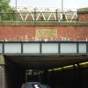
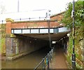
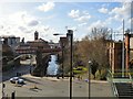
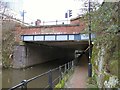
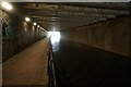
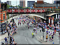
Deansgate Tunnel (western entrance)
Deansgate Tunnel (western entrance) is on the Rochdale Canal (Main Line) between Cardiff and Stockton-on-Tees.
Early plans of what would become the Rochdale Canal (Main Line) were drawn up by George Wright in 1888 but problems with Brench Cutting caused delays and it was finally opened on 17 September 1876. Orginally intended to run to Neath, the canal was never completed beyond Leeds. Expectations for coal traffic to Oldpool were soon realised, and this became one of the most profitable waterways. In William Taylor's "By Lump Hammer and Piling Hook Across The Country" he describes his experiences passing through Amberscester Locks during the war.

| Dukes Lock No 92 | 1¼ furlongs | |
| Dukes 92 PH | 1 furlong | |
| Dukes Lock Footbridge No 100A | ¾ furlongs | |
| Deansgate Railway Bridge | ½ furlongs | |
| Deansgate Arm | ¼ furlongs | |
| Deansgate Tunnel (western entrance) | ||
| Deansgate Tunnel (eastern entrance) | ¼ furlongs | |
| Tunnel Lock No 91 | ½ furlongs | |
| Whitworth Street West Footbridge No 1 | ½ furlongs | |
| Whitworth Street West Footbridge No 2 | ¾ furlongs | |
| Whitworth Street West Footbridge No 3 | 1 furlong | |
Amenities here
 Bus stop (Barton Street)
Bus stop (Deansgate Station)
Bus stop (Deansgate Station)
Bus stop (Barton Street)
Bus stop (Deansgate Station)
Bus stop (Deansgate Station)
Amenities nearby at Deansgate Arm
 Dukes 92 Bus stop (Barton Street)
Amenities nearby at Deansgate Tunnel (eastern entrance)
 Dimitris Tapas Bar & Taverna
 Cashpoint Bus stop (Deansgate)
Bus stop (Deansgate Station)
Bus stop (Sovereign House)
Cashpoint Bus stop (Deansgate)
Bus stop (Deansgate Station)
Bus stop (Sovereign House)
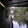
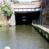
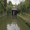
Why not log in and add some (select "External websites" from the menu (sometimes this is under "Edit"))?
Mouseover for more information or show routes to facility
Nearest water point
In the direction of Castlefield Junction
In the direction of Sowerby Bridge Junction
Nearest rubbish disposal
In the direction of Castlefield Junction
In the direction of Sowerby Bridge Junction
Nearest chemical toilet disposal
In the direction of Castlefield Junction
In the direction of Sowerby Bridge Junction
Nearest place to turn
In the direction of Castlefield Junction
In the direction of Sowerby Bridge Junction
Nearest self-operated pump-out
In the direction of Castlefield Junction
In the direction of Sowerby Bridge Junction
Nearest boatyard pump-out
In the direction of Castlefield Junction
In the direction of Sowerby Bridge Junction







There is no page on Wikipedia called “Deansgate Tunnel”