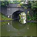
Icknield Pipe Bridge
Icknield Port Road, Birmingham B16, United Kingdom

Icknield Pipe Bridge
is a minor waterways place
on the Birmingham Canal Navigations (Icknield Port Road Wharf Loop) between
Icknield Wharf (a few yards
to the northwest) and
Sandy Turn (Eastern end of Icknield Port Road Wharf Loop) (3 furlongs
to the east).
The nearest place in the direction of Sandy Turn is Rotton Park Feeder;
¼ furlongs
away.
Mooring here is unrated.
There is a bridge here which takes a pipe over the canal.
Rotton Park Junction | 3 furlongs | |
Icknield Port Road Wharf Bridge | ¾ furlongs | |
Former Canal Feeder (Infilled) | ½ furlongs | |
Icknield Wharf | a few yards | |
Icknield Pipe Bridge | ||
Rotton Park Feeder | ¼ furlongs | |
Osier Street Bridge | ¾ furlongs | |
Rotton Park Corporation Wharf | 1½ furlongs | |
Sandy Turn | 3 furlongs |
Amenities nearby at Rotton Park Feeder
- Birmingham Canal Walks — associated with Birmingham Canal Navigations
- Sixteen walks along the Birmingham Canal Navigations with a detailed description, history and photographs.
Mouseover for more information or show routes to facility
Nearest water point
In the direction of Rotton Park Junction
Handsworth Wharf Winding Hole — 3 miles, 2½ furlongs and 3 locks away
Travel to Rotton Park Junction, then on the Birmingham Canal Navigations (Main Line) to Smethwick Junction, then on the Birmingham Canal Navigations (Old Main Line) to Engine Arm Junction, then on the Birmingham Canal Navigations (Engine Arm) to Handsworth Wharf Winding Hole
Bumble Hole Visitor Centre — 9 miles, 2¾ furlongs away
Travel to Rotton Park Junction, then on the Birmingham Canal Navigations (Main Line) to Dudley Port Junction, then on the Birmingham Canal Navigations (Netherton Tunnel Branch) to Windmill End Junction, then on the Birmingham Canal Navigations (Dudley Canal No 2 - Coombeswood ) to Bumble Hole Visitor Centre
Todds End Customer Service Facility — 7 miles, 7½ furlongs and 3 locks away
Travel to Rotton Park Junction, then on the Birmingham Canal Navigations (Main Line) to Smethwick Junction, then on the Birmingham Canal Navigations (Old Main Line) to Tipton Junction, then on the Birmingham Canal Navigations (Dudley Canal No 1 - Birmingham End) to Todds End Customer Service Facility
Black Country Museum — 7 miles, 7¾ furlongs and 3 locks away
Travel to Rotton Park Junction, then on the Birmingham Canal Navigations (Main Line) to Smethwick Junction, then on the Birmingham Canal Navigations (Old Main Line) to Tipton Junction, then on the Birmingham Canal Navigations (Dudley Canal No 1 - Birmingham End) to Black Country Museum
Dudley Canal & Tunnel Trust Footbridge — 8 miles and 3 locks away
Travel to Rotton Park Junction, then on the Birmingham Canal Navigations (Main Line) to Smethwick Junction, then on the Birmingham Canal Navigations (Old Main Line) to Tipton Junction, then on the Birmingham Canal Navigations (Dudley Canal No 1 - Birmingham End) to Dudley Canal & Tunnel Trust Footbridge
Dudley Tunnel (northern entrance) — 8 miles, ¾ furlongs and 3 locks away
Travel to Rotton Park Junction, then on the Birmingham Canal Navigations (Main Line) to Smethwick Junction, then on the Birmingham Canal Navigations (Old Main Line) to Tipton Junction, then on the Birmingham Canal Navigations (Dudley Canal No 1 - Birmingham End) to Dudley Tunnel (northern entrance)
Blowers Green Pumphouse — 11 miles, 7 furlongs away
Travel to Rotton Park Junction, then on the Birmingham Canal Navigations (Main Line) to Dudley Port Junction, then on the Birmingham Canal Navigations (Netherton Tunnel Branch) to Windmill End Junction, then on the Birmingham Canal Navigations (Dudley Canal No 2 - Coombeswood ) to Blowers Green Pumphouse
C&RT Bradley Workshops — 11 miles, 3 furlongs and 3 locks away
Travel to Rotton Park Junction, then on the Birmingham Canal Navigations (Main Line) to Deepfields Junction, then on the Birmingham Canal Navigations (Wednesbury Oak Loop) to C&RT Bradley Workshops
Lower Ocker Hill Branch Junction — 7 miles, 1¼ furlongs and 8 locks away
Travel to Rotton Park Junction, then on the Birmingham Canal Navigations (Main Line) to Pudding Green Junction, then on the Birmingham Canal Navigations (Wednesbury Old Canal - Main Line) to Ryders Green Junction, then on the Birmingham Canal Navigations (Walsall Canal) to Lower Ocker Hill Branch Junction
Broad Street Basin — 13 miles, ¼ furlongs and 3 locks away
Travel to Rotton Park Junction, then on the Birmingham Canal Navigations (Main Line) to Broad Street Basin
In the direction of Sandy Turn
Cambrian Wharf Services — 1 mile, 3¾ furlongs away
Travel to Sandy Turn, then on the Birmingham Canal Navigations (Main Line) to Deep Cuttings Junction, then on the Birmingham Canal Navigations (Newhall Branch) to Cambrian Wharf Services
Worcester Bar — 1 mile, 4½ furlongs away
Travel to Sandy Turn, then on the Birmingham Canal Navigations (Main Line) to Worcester Bar
Holliday Wharf — 1 mile, 6½ furlongs away
Travel to Sandy Turn, then on the Birmingham Canal Navigations (Main Line) to Worcester Bar, then on the Worcester and Birmingham Canal (Birmingham to King's Norton) to Holliday Wharf
King's Norton Water Point — 7 miles, 1¼ furlongs away
Travel to Sandy Turn, then on the Birmingham Canal Navigations (Main Line) to Worcester Bar, then on the Worcester and Birmingham Canal (Birmingham to King's Norton) to King's Norton Junction, then on the Worcester and Birmingham Canal (Diglis Basin to King's Norton Junction) to King's Norton Water Point
Hawne Basin — 7 miles, 6¼ furlongs away
Travel to Sandy Turn, then on the Birmingham Canal Navigations (Main Line) to Worcester Bar, then on the Worcester and Birmingham Canal (Birmingham to King's Norton) to New Selly Oak Junction, then on the Birmingham Canal Navigations (Dudley Canal No 2 - Lapal Canal - Original Line East End ) to Somery Road Bridge, then on the Birmingham Canal Navigations (Dudley Canal No 2 - Lapal Canal - Abandoned Line ) to Lapal Canal - New line Diverges From Original Route, then on the Birmingham Canal Navigations (Dudley Canal No 2 - Lapal Canal - Original Line West End ) to Coombeswood, then on the Birmingham Canal Navigations (Dudley Canal No 2 - Coombeswood ) to Hawne Basin
Yardley Wood Water Point — 9 miles, 5¼ furlongs away
Travel to Sandy Turn, then on the Birmingham Canal Navigations (Main Line) to Worcester Bar, then on the Worcester and Birmingham Canal (Birmingham to King's Norton) to King's Norton Junction, then on the Stratford-on-Avon Canal (Northern Section) to Yardley Wood Water Point
Hopwood Visitor Moorings — 10 miles, 2½ furlongs away
Travel to Sandy Turn, then on the Birmingham Canal Navigations (Main Line) to Worcester Bar, then on the Worcester and Birmingham Canal (Birmingham to King's Norton) to King's Norton Junction, then on the Worcester and Birmingham Canal (Diglis Basin to King's Norton Junction) to Hopwood Visitor Moorings
Earlswood Reservoir Feeder — 13 miles, 6¼ furlongs away
Travel to Sandy Turn, then on the Birmingham Canal Navigations (Main Line) to Worcester Bar, then on the Worcester and Birmingham Canal (Birmingham to King's Norton) to King's Norton Junction, then on the Stratford-on-Avon Canal (Northern Section) to Earlswood Reservoir Feeder
Waring's Green Wharf — 14 miles, 6¼ furlongs away
Travel to Sandy Turn, then on the Birmingham Canal Navigations (Main Line) to Worcester Bar, then on the Worcester and Birmingham Canal (Birmingham to King's Norton) to King's Norton Junction, then on the Stratford-on-Avon Canal (Northern Section) to Waring's Green Wharf
Tardebigge Wharf — 15 miles, 6¼ furlongs away
Travel to Sandy Turn, then on the Birmingham Canal Navigations (Main Line) to Worcester Bar, then on the Worcester and Birmingham Canal (Birmingham to King's Norton) to King's Norton Junction, then on the Worcester and Birmingham Canal (Diglis Basin to King's Norton Junction) to Tardebigge WharfNearest rubbish disposal
In the direction of Rotton Park Junction
Handsworth Wharf Winding Hole — 3 miles, 2½ furlongs and 3 locks away
Travel to Rotton Park Junction, then on the Birmingham Canal Navigations (Main Line) to Smethwick Junction, then on the Birmingham Canal Navigations (Old Main Line) to Engine Arm Junction, then on the Birmingham Canal Navigations (Engine Arm) to Handsworth Wharf Winding Hole
Black Country Museum — 7 miles, 7¾ furlongs and 3 locks away
Travel to Rotton Park Junction, then on the Birmingham Canal Navigations (Main Line) to Smethwick Junction, then on the Birmingham Canal Navigations (Old Main Line) to Tipton Junction, then on the Birmingham Canal Navigations (Dudley Canal No 1 - Birmingham End) to Black Country Museum
Blowers Green Bridge — 11 miles, 6¾ furlongs away
Travel to Rotton Park Junction, then on the Birmingham Canal Navigations (Main Line) to Dudley Port Junction, then on the Birmingham Canal Navigations (Netherton Tunnel Branch) to Windmill End Junction, then on the Birmingham Canal Navigations (Dudley Canal No 2 - Coombeswood ) to Blowers Green Bridge
Waterfront Services (Dudley) — 13 miles and 1 lock away
Travel to Rotton Park Junction, then on the Birmingham Canal Navigations (Main Line) to Dudley Port Junction, then on the Birmingham Canal Navigations (Netherton Tunnel Branch) to Windmill End Junction, then on the Birmingham Canal Navigations (Dudley Canal No 2 - Coombeswood ) to Parkhead Junction, then on the Birmingham Canal Navigations (Dudley Canal No 1 - Through Route) to Waterfront Services (Dudley)
C&RT Bradley Workshops — 11 miles, 3 furlongs and 3 locks away
Travel to Rotton Park Junction, then on the Birmingham Canal Navigations (Main Line) to Deepfields Junction, then on the Birmingham Canal Navigations (Wednesbury Oak Loop) to C&RT Bradley Workshops
Lower Ocker Hill Branch Junction — 7 miles, 1¼ furlongs and 8 locks away
Travel to Rotton Park Junction, then on the Birmingham Canal Navigations (Main Line) to Pudding Green Junction, then on the Birmingham Canal Navigations (Wednesbury Old Canal - Main Line) to Ryders Green Junction, then on the Birmingham Canal Navigations (Walsall Canal) to Lower Ocker Hill Branch Junction
Broad Street Basin — 13 miles, ¼ furlongs and 3 locks away
Travel to Rotton Park Junction, then on the Birmingham Canal Navigations (Main Line) to Broad Street Basin
Perry Barr Top Lock Services — 12 miles, 6½ furlongs and 8 locks away
Travel to Rotton Park Junction, then on the Birmingham Canal Navigations (Main Line) to Pudding Green Junction, then on the Birmingham Canal Navigations (Wednesbury Old Canal - Main Line) to Ryders Green Junction, then on the Birmingham Canal Navigations (Walsall Canal) to Tame Valley Junction, then on the Birmingham Canal Navigations (Tame Valley Canal) to Perry Barr Top Lock Services
Delph Bottom Lock No 8 — 13 miles, 7¾ furlongs and 8 locks away
Travel to Rotton Park Junction, then on the Birmingham Canal Navigations (Main Line) to Dudley Port Junction, then on the Birmingham Canal Navigations (Netherton Tunnel Branch) to Windmill End Junction, then on the Birmingham Canal Navigations (Dudley Canal No 2 - Coombeswood ) to Parkhead Junction, then on the Birmingham Canal Navigations (Dudley Canal No 1 - Through Route) to Delph Bottom Lock No 8
Wolverhampton Lock No 9 — 13 miles, 5¾ furlongs and 11 locks away
Travel to Rotton Park Junction, then on the Birmingham Canal Navigations (Main Line) to Wolverhampton Lock No 9
Longwood Junction — 13 miles, 4 furlongs and 17 locks away
Travel to Rotton Park Junction, then on the Birmingham Canal Navigations (Main Line) to Pudding Green Junction, then on the Birmingham Canal Navigations (Wednesbury Old Canal - Main Line) to Ryders Green Junction, then on the Birmingham Canal Navigations (Walsall Canal) to Tame Valley Junction, then on the Birmingham Canal Navigations (Tame Valley Canal) to Tame Valley - Rushall Junction, then on the Birmingham Canal Navigations (Rushall Canal) to Longwood Junction
Aldridge Marina — 16 miles, 7¾ furlongs and 17 locks away
Travel to Rotton Park Junction, then on the Birmingham Canal Navigations (Main Line) to Pudding Green Junction, then on the Birmingham Canal Navigations (Wednesbury Old Canal - Main Line) to Ryders Green Junction, then on the Birmingham Canal Navigations (Walsall Canal) to Tame Valley Junction, then on the Birmingham Canal Navigations (Tame Valley Canal) to Tame Valley - Rushall Junction, then on the Birmingham Canal Navigations (Rushall Canal) to Longwood Junction, then on the Birmingham Canal Navigations (Daw End Branch) to Aldridge Marina
LMS Railway Interchange Basins — 19 miles, 2 furlongs and 17 locks away
Travel to Rotton Park Junction, then on the Birmingham Canal Navigations (Main Line) to Pudding Green Junction, then on the Birmingham Canal Navigations (Wednesbury Old Canal - Main Line) to Ryders Green Junction, then on the Birmingham Canal Navigations (Walsall Canal) to Tame Valley Junction, then on the Birmingham Canal Navigations (Tame Valley Canal) to Tame Valley - Rushall Junction, then on the Birmingham Canal Navigations (Rushall Canal) to Longwood Junction, then on the Birmingham Canal Navigations (Daw End Branch) to Catshill Junction, then on the Birmingham Canal Navigations (Wyrley and Essington Canal) to LMS Railway Interchange Basins
In the direction of Sandy Turn
Cambrian Wharf Services — 1 mile, 3¾ furlongs away
Travel to Sandy Turn, then on the Birmingham Canal Navigations (Main Line) to Deep Cuttings Junction, then on the Birmingham Canal Navigations (Newhall Branch) to Cambrian Wharf Services
Worcester Bar — 1 mile, 4½ furlongs away
Travel to Sandy Turn, then on the Birmingham Canal Navigations (Main Line) to Worcester Bar
Hawne Basin — 7 miles, 6¼ furlongs away
Travel to Sandy Turn, then on the Birmingham Canal Navigations (Main Line) to Worcester Bar, then on the Worcester and Birmingham Canal (Birmingham to King's Norton) to New Selly Oak Junction, then on the Birmingham Canal Navigations (Dudley Canal No 2 - Lapal Canal - Original Line East End ) to Somery Road Bridge, then on the Birmingham Canal Navigations (Dudley Canal No 2 - Lapal Canal - Abandoned Line ) to Lapal Canal - New line Diverges From Original Route, then on the Birmingham Canal Navigations (Dudley Canal No 2 - Lapal Canal - Original Line West End ) to Coombeswood, then on the Birmingham Canal Navigations (Dudley Canal No 2 - Coombeswood ) to Hawne Basin
Farmers Bridge Lock No 8 — 1 mile, 7¼ furlongs and 7 locks away
Travel to Sandy Turn, then on the Birmingham Canal Navigations (Main Line) to Deep Cuttings Junction, then on the Birmingham Canal Navigations (Newhall Branch) to Farmers Bridge Junction, then on the Birmingham Canal Navigations (Birmingham and Fazeley Canal - Main Line) to Farmers Bridge Lock No 8
Waring's Green Wharf — 14 miles, 6¼ furlongs away
Travel to Sandy Turn, then on the Birmingham Canal Navigations (Main Line) to Worcester Bar, then on the Worcester and Birmingham Canal (Birmingham to King's Norton) to King's Norton Junction, then on the Stratford-on-Avon Canal (Northern Section) to Waring's Green Wharf
Tardebigge Wharf — 15 miles, 6¼ furlongs away
Travel to Sandy Turn, then on the Birmingham Canal Navigations (Main Line) to Worcester Bar, then on the Worcester and Birmingham Canal (Birmingham to King's Norton) to King's Norton Junction, then on the Worcester and Birmingham Canal (Diglis Basin to King's Norton Junction) to Tardebigge Wharf
Minworth Services — 7 miles, 4¾ furlongs and 25 locks away
Travel to Sandy Turn, then on the Birmingham Canal Navigations (Main Line) to Deep Cuttings Junction, then on the Birmingham Canal Navigations (Newhall Branch) to Farmers Bridge Junction, then on the Birmingham Canal Navigations (Birmingham and Fazeley Canal - Main Line) to Minworth ServicesNearest chemical toilet disposal
In the direction of Rotton Park Junction
Handsworth Wharf Winding Hole — 3 miles, 2½ furlongs and 3 locks away
Travel to Rotton Park Junction, then on the Birmingham Canal Navigations (Main Line) to Smethwick Junction, then on the Birmingham Canal Navigations (Old Main Line) to Engine Arm Junction, then on the Birmingham Canal Navigations (Engine Arm) to Handsworth Wharf Winding Hole
Todds End Customer Service Facility — 7 miles, 7½ furlongs and 3 locks away
Travel to Rotton Park Junction, then on the Birmingham Canal Navigations (Main Line) to Smethwick Junction, then on the Birmingham Canal Navigations (Old Main Line) to Tipton Junction, then on the Birmingham Canal Navigations (Dudley Canal No 1 - Birmingham End) to Todds End Customer Service Facility
Black Country Museum — 7 miles, 7¾ furlongs and 3 locks away
Travel to Rotton Park Junction, then on the Birmingham Canal Navigations (Main Line) to Smethwick Junction, then on the Birmingham Canal Navigations (Old Main Line) to Tipton Junction, then on the Birmingham Canal Navigations (Dudley Canal No 1 - Birmingham End) to Black Country Museum
Dudley Tunnel (northern entrance) — 8 miles, ¾ furlongs and 3 locks away
Travel to Rotton Park Junction, then on the Birmingham Canal Navigations (Main Line) to Smethwick Junction, then on the Birmingham Canal Navigations (Old Main Line) to Tipton Junction, then on the Birmingham Canal Navigations (Dudley Canal No 1 - Birmingham End) to Dudley Tunnel (northern entrance)
Blowers Green Pumphouse — 11 miles, 7 furlongs away
Travel to Rotton Park Junction, then on the Birmingham Canal Navigations (Main Line) to Dudley Port Junction, then on the Birmingham Canal Navigations (Netherton Tunnel Branch) to Windmill End Junction, then on the Birmingham Canal Navigations (Dudley Canal No 2 - Coombeswood ) to Blowers Green Pumphouse
Waterfront Services (Dudley) — 13 miles and 1 lock away
Travel to Rotton Park Junction, then on the Birmingham Canal Navigations (Main Line) to Dudley Port Junction, then on the Birmingham Canal Navigations (Netherton Tunnel Branch) to Windmill End Junction, then on the Birmingham Canal Navigations (Dudley Canal No 2 - Coombeswood ) to Parkhead Junction, then on the Birmingham Canal Navigations (Dudley Canal No 1 - Through Route) to Waterfront Services (Dudley)
Lower Ocker Hill Branch Junction — 7 miles, 1¼ furlongs and 8 locks away
Travel to Rotton Park Junction, then on the Birmingham Canal Navigations (Main Line) to Pudding Green Junction, then on the Birmingham Canal Navigations (Wednesbury Old Canal - Main Line) to Ryders Green Junction, then on the Birmingham Canal Navigations (Walsall Canal) to Lower Ocker Hill Branch Junction
Broad Street Basin — 13 miles, ¼ furlongs and 3 locks away
Travel to Rotton Park Junction, then on the Birmingham Canal Navigations (Main Line) to Broad Street Basin
Perry Barr Top Lock Services — 12 miles, 6½ furlongs and 8 locks away
Travel to Rotton Park Junction, then on the Birmingham Canal Navigations (Main Line) to Pudding Green Junction, then on the Birmingham Canal Navigations (Wednesbury Old Canal - Main Line) to Ryders Green Junction, then on the Birmingham Canal Navigations (Walsall Canal) to Tame Valley Junction, then on the Birmingham Canal Navigations (Tame Valley Canal) to Perry Barr Top Lock Services
Sneyd Wharf — 14 miles, 2½ furlongs and 16 locks away
Travel to Rotton Park Junction, then on the Birmingham Canal Navigations (Main Line) to Pudding Green Junction, then on the Birmingham Canal Navigations (Wednesbury Old Canal - Main Line) to Ryders Green Junction, then on the Birmingham Canal Navigations (Walsall Canal) to Walsall Junction, then on the Birmingham Canal Navigations (Walsall Junction Canal) to Birchills Junction, then on the Birmingham Canal Navigations (Wyrley and Essington Canal) to Sneyd Wharf
Longwood Junction — 13 miles, 4 furlongs and 17 locks away
Travel to Rotton Park Junction, then on the Birmingham Canal Navigations (Main Line) to Pudding Green Junction, then on the Birmingham Canal Navigations (Wednesbury Old Canal - Main Line) to Ryders Green Junction, then on the Birmingham Canal Navigations (Walsall Canal) to Tame Valley Junction, then on the Birmingham Canal Navigations (Tame Valley Canal) to Tame Valley - Rushall Junction, then on the Birmingham Canal Navigations (Rushall Canal) to Longwood Junction
In the direction of Sandy Turn
Cambrian Wharf Services — 1 mile, 3¾ furlongs away
Travel to Sandy Turn, then on the Birmingham Canal Navigations (Main Line) to Deep Cuttings Junction, then on the Birmingham Canal Navigations (Newhall Branch) to Cambrian Wharf Services
Worcester Bar — 1 mile, 4½ furlongs away
Travel to Sandy Turn, then on the Birmingham Canal Navigations (Main Line) to Worcester Bar
Holliday Wharf — 1 mile, 6½ furlongs away
Travel to Sandy Turn, then on the Birmingham Canal Navigations (Main Line) to Worcester Bar, then on the Worcester and Birmingham Canal (Birmingham to King's Norton) to Holliday Wharf
Hawne Basin — 7 miles, 6¼ furlongs away
Travel to Sandy Turn, then on the Birmingham Canal Navigations (Main Line) to Worcester Bar, then on the Worcester and Birmingham Canal (Birmingham to King's Norton) to New Selly Oak Junction, then on the Birmingham Canal Navigations (Dudley Canal No 2 - Lapal Canal - Original Line East End ) to Somery Road Bridge, then on the Birmingham Canal Navigations (Dudley Canal No 2 - Lapal Canal - Abandoned Line ) to Lapal Canal - New line Diverges From Original Route, then on the Birmingham Canal Navigations (Dudley Canal No 2 - Lapal Canal - Original Line West End ) to Coombeswood, then on the Birmingham Canal Navigations (Dudley Canal No 2 - Coombeswood ) to Hawne Basin
Earlswood Reservoir Feeder — 13 miles, 6¼ furlongs away
Travel to Sandy Turn, then on the Birmingham Canal Navigations (Main Line) to Worcester Bar, then on the Worcester and Birmingham Canal (Birmingham to King's Norton) to King's Norton Junction, then on the Stratford-on-Avon Canal (Northern Section) to Earlswood Reservoir Feeder
Waring's Green Wharf — 14 miles, 6¼ furlongs away
Travel to Sandy Turn, then on the Birmingham Canal Navigations (Main Line) to Worcester Bar, then on the Worcester and Birmingham Canal (Birmingham to King's Norton) to King's Norton Junction, then on the Stratford-on-Avon Canal (Northern Section) to Waring's Green Wharf
Tardebigge Wharf — 15 miles, 6¼ furlongs away
Travel to Sandy Turn, then on the Birmingham Canal Navigations (Main Line) to Worcester Bar, then on the Worcester and Birmingham Canal (Birmingham to King's Norton) to King's Norton Junction, then on the Worcester and Birmingham Canal (Diglis Basin to King's Norton Junction) to Tardebigge Wharf
Swallow Wharf — 17 miles, 3½ furlongs away
Travel to Sandy Turn, then on the Birmingham Canal Navigations (Main Line) to Worcester Bar, then on the Worcester and Birmingham Canal (Birmingham to King's Norton) to King's Norton Junction, then on the Stratford-on-Avon Canal (Northern Section) to Swallow Wharf
Cuckoo Wharf — 4 miles, 4 furlongs and 24 locks away
Travel to Sandy Turn, then on the Birmingham Canal Navigations (Main Line) to Deep Cuttings Junction, then on the Birmingham Canal Navigations (Newhall Branch) to Farmers Bridge Junction, then on the Birmingham Canal Navigations (Birmingham and Fazeley Canal - Main Line) to Cuckoo WharfNearest place to turn
In the direction of Rotton Park Junction
Rotton Park Junction — 3 furlongs away
On this waterway in the direction of Rotton Park Junction
Hockley Port Junction — 1 mile away
Travel to Rotton Park Junction, then on the Birmingham Canal Navigations (Soho Loop) to Hockley Port Junction
Winson Green Junction — 1 mile, 1½ furlongs away
Travel to Rotton Park Junction, then on the Birmingham Canal Navigations (Main Line) to Winson Green Junction
Hockley Port Interchange Basins — 1 mile, 3 furlongs away
Travel to Rotton Park Junction, then on the Birmingham Canal Navigations (Soho Loop) to Hockley Port Junction, then on the Birmingham Canal Navigations (Birmingham Heath, or Soho, Branch) to Hockley Port Interchange Basins
Smethwick Junction — 2 miles, 1½ furlongs away
Travel to Rotton Park Junction, then on the Birmingham Canal Navigations (Main Line) to Smethwick Junction
Bromford Junction — 4 miles, 3 furlongs away
Travel to Rotton Park Junction, then on the Birmingham Canal Navigations (Main Line) to Bromford Junction
Pudding Green Junction — 5 miles, 1½ furlongs away
Travel to Rotton Park Junction, then on the Birmingham Canal Navigations (Main Line) to Pudding Green Junction
Albion Junction — 5 miles, 5½ furlongs away
Travel to Rotton Park Junction, then on the Birmingham Canal Navigations (Main Line) to Albion Junction
Handsworth Wharf Winding Hole — 3 miles, 2½ furlongs and 3 locks away
Travel to Rotton Park Junction, then on the Birmingham Canal Navigations (Main Line) to Smethwick Junction, then on the Birmingham Canal Navigations (Old Main Line) to Engine Arm Junction, then on the Birmingham Canal Navigations (Engine Arm) to Handsworth Wharf Winding Hole
Dudley Port Junction — 6 miles, 3 furlongs away
Travel to Rotton Park Junction, then on the Birmingham Canal Navigations (Main Line) to Dudley Port Junction
Swan Bridge Winding Hole — 6 miles, 3½ furlongs away
Travel to Rotton Park Junction, then on the Birmingham Canal Navigations (Main Line) to Pudding Green Junction, then on the Birmingham Canal Navigations (Wednesbury Old Canal - Main Line) to Ryders Green Junction, then on the Birmingham Canal Navigations (Wednesbury Old Canal - Un-navigable) to Swan Bridge Winding Hole
In the direction of Sandy Turn
Sandy Turn — 3 furlongs away
On this waterway in the direction of Sandy Turn
Monument Lane Basin — 4¾ furlongs away
Travel to Sandy Turn, then on the Birmingham Canal Navigations (Main Line) to Monument Lane Basin
Old Turn Junction — 1 mile, 2 furlongs away
Travel to Sandy Turn, then on the Birmingham Canal Navigations (Main Line) to Old Turn Junction
Deep Cuttings Junction — 1 mile, 2¼ furlongs away
Travel to Sandy Turn, then on the Birmingham Canal Navigations (Main Line) to Deep Cuttings Junction
Gas Street Basin (Old Wharf) — 1 mile, 4¼ furlongs away
Travel to Sandy Turn, then on the Birmingham Canal Navigations (Main Line) to Gas Street Basin (Old Wharf)
Gas Street Basin — 1 mile, 5 furlongs away
Travel to Sandy Turn, then on the Birmingham Canal Navigations (Main Line) to Worcester Bar, then on the Worcester and Birmingham Canal (Birmingham to King's Norton) to Gas Street Basin
The Vale Winding Hole — 3 miles away
Travel to Sandy Turn, then on the Birmingham Canal Navigations (Main Line) to Worcester Bar, then on the Worcester and Birmingham Canal (Birmingham to King's Norton) to The Vale Winding Hole
Selly Oak Winding Hole — 4 miles, 6½ furlongs away
Travel to Sandy Turn, then on the Birmingham Canal Navigations (Main Line) to Worcester Bar, then on the Worcester and Birmingham Canal (Birmingham to King's Norton) to Selly Oak Winding Hole
King's Norton Junction — 7 miles, ½ furlongs away
Travel to Sandy Turn, then on the Birmingham Canal Navigations (Main Line) to Worcester Bar, then on the Worcester and Birmingham Canal (Birmingham to King's Norton) to King's Norton JunctionNearest self-operated pump-out
In the direction of Sandy Turn
Lapworth Services — 19 miles, 5¾ furlongs and 19 locks away
Travel to Sandy Turn, then on the Birmingham Canal Navigations (Main Line) to Worcester Bar, then on the Worcester and Birmingham Canal (Birmingham to King's Norton) to King's Norton Junction, then on the Stratford-on-Avon Canal (Northern Section) to Kingswood Junction (south), then on the Stratford-on-Avon Canal (Southern Section) to Lapworth Services
In the direction of Rotton Park Junction
Handsworth Wharf Winding Hole — 3 miles, 2½ furlongs and 3 locks away
Travel to Rotton Park Junction, then on the Birmingham Canal Navigations (Main Line) to Smethwick Junction, then on the Birmingham Canal Navigations (Old Main Line) to Engine Arm Junction, then on the Birmingham Canal Navigations (Engine Arm) to Handsworth Wharf Winding Hole
Todds End Customer Service Facility — 7 miles, 7½ furlongs and 3 locks away
Travel to Rotton Park Junction, then on the Birmingham Canal Navigations (Main Line) to Smethwick Junction, then on the Birmingham Canal Navigations (Old Main Line) to Tipton Junction, then on the Birmingham Canal Navigations (Dudley Canal No 1 - Birmingham End) to Todds End Customer Service Facility
Black Country Museum — 7 miles, 7¾ furlongs and 3 locks away
Travel to Rotton Park Junction, then on the Birmingham Canal Navigations (Main Line) to Smethwick Junction, then on the Birmingham Canal Navigations (Old Main Line) to Tipton Junction, then on the Birmingham Canal Navigations (Dudley Canal No 1 - Birmingham End) to Black Country Museum
Dudley Tunnel (northern entrance) — 8 miles, ¾ furlongs and 3 locks away
Travel to Rotton Park Junction, then on the Birmingham Canal Navigations (Main Line) to Smethwick Junction, then on the Birmingham Canal Navigations (Old Main Line) to Tipton Junction, then on the Birmingham Canal Navigations (Dudley Canal No 1 - Birmingham End) to Dudley Tunnel (northern entrance)
Lower Ocker Hill Branch Junction — 7 miles, 1¼ furlongs and 8 locks away
Travel to Rotton Park Junction, then on the Birmingham Canal Navigations (Main Line) to Pudding Green Junction, then on the Birmingham Canal Navigations (Wednesbury Old Canal - Main Line) to Ryders Green Junction, then on the Birmingham Canal Navigations (Walsall Canal) to Lower Ocker Hill Branch Junction
Aldridge Marina — 16 miles, 7¾ furlongs and 17 locks away
Travel to Rotton Park Junction, then on the Birmingham Canal Navigations (Main Line) to Pudding Green Junction, then on the Birmingham Canal Navigations (Wednesbury Old Canal - Main Line) to Ryders Green Junction, then on the Birmingham Canal Navigations (Walsall Canal) to Tame Valley Junction, then on the Birmingham Canal Navigations (Tame Valley Canal) to Tame Valley - Rushall Junction, then on the Birmingham Canal Navigations (Rushall Canal) to Longwood Junction, then on the Birmingham Canal Navigations (Daw End Branch) to Aldridge MarinaNearest boatyard pump-out
In the direction of Rotton Park Junction
Withymoor Island Service Wharf — 9 miles, 6 furlongs away
Travel to Rotton Park Junction, then on the Birmingham Canal Navigations (Main Line) to Dudley Port Junction, then on the Birmingham Canal Navigations (Netherton Tunnel Branch) to Windmill End Junction, then on the Birmingham Canal Navigations (Dudley Canal No 2 - Coombeswood ) to Withymoor Island Service Wharf
Oxley Marine — 15 miles, 2¼ furlongs and 24 locks away
Travel to Rotton Park Junction, then on the Birmingham Canal Navigations (Main Line) to Aldersley Junction, then on the Staffordshire and Worcestershire Canal (Main Line: Aldersley to Autherley) to Oxley Marine
Autherley Wharf — 15 miles, 3¾ furlongs and 25 locks away
Travel to Rotton Park Junction, then on the Birmingham Canal Navigations (Main Line) to Aldersley Junction, then on the Staffordshire and Worcestershire Canal (Main Line: Aldersley to Autherley) to Autherley Junction, then on the Shropshire Union Canal (Birmingham and Liverpool Junction Canal - Main Line) to Autherley Wharf
In the direction of Sandy Turn
Sherborne Wharf Services — 1 mile, ¼ furlongs away
Travel to Sandy Turn, then on the Birmingham Canal Navigations (Main Line) to Sherborne Wharf Services
Hawne Basin — 7 miles, 6¼ furlongs away
Travel to Sandy Turn, then on the Birmingham Canal Navigations (Main Line) to Worcester Bar, then on the Worcester and Birmingham Canal (Birmingham to King's Norton) to New Selly Oak Junction, then on the Birmingham Canal Navigations (Dudley Canal No 2 - Lapal Canal - Original Line East End ) to Somery Road Bridge, then on the Birmingham Canal Navigations (Dudley Canal No 2 - Lapal Canal - Abandoned Line ) to Lapal Canal - New line Diverges From Original Route, then on the Birmingham Canal Navigations (Dudley Canal No 2 - Lapal Canal - Original Line West End ) to Coombeswood, then on the Birmingham Canal Navigations (Dudley Canal No 2 - Coombeswood ) to Hawne Basin
Earlswood Reservoir Feeder — 13 miles, 6¼ furlongs away
Travel to Sandy Turn, then on the Birmingham Canal Navigations (Main Line) to Worcester Bar, then on the Worcester and Birmingham Canal (Birmingham to King's Norton) to King's Norton Junction, then on the Stratford-on-Avon Canal (Northern Section) to Earlswood Reservoir Feeder
Waring's Green Wharf — 14 miles, 6¼ furlongs away
Travel to Sandy Turn, then on the Birmingham Canal Navigations (Main Line) to Worcester Bar, then on the Worcester and Birmingham Canal (Birmingham to King's Norton) to King's Norton Junction, then on the Stratford-on-Avon Canal (Northern Section) to Waring's Green Wharf
Swallow Wharf — 17 miles, 3½ furlongs away
Travel to Sandy Turn, then on the Birmingham Canal Navigations (Main Line) to Worcester Bar, then on the Worcester and Birmingham Canal (Birmingham to King's Norton) to King's Norton Junction, then on the Stratford-on-Avon Canal (Northern Section) to Swallow Wharf
Barston Lane Bridge No 76 — 12 miles, 7¼ furlongs and 25 locks away
Travel to Sandy Turn, then on the Birmingham Canal Navigations (Main Line) to Deep Cuttings Junction, then on the Birmingham Canal Navigations (Newhall Branch) to Farmers Bridge Junction, then on the Birmingham Canal Navigations (Birmingham and Fazeley Canal - Main Line) to Aston Junction, then on the Birmingham Canal Navigations (Birmingham and Fazeley Canal - Digbeth Branch) to Proof House Junction, then on the Grand Union Canal (Warwick and Birmingham Canal) to Camp Hill Top Lock Winding Hole, then on the Grand Union Canal (Warwick and Birmingham Canal: widened section - Main Line) to Barston Lane Bridge No 76Direction of TV transmitter (From Wolfbane Cybernetic)
There is no page on Wikipedia called “Icknield Pipe Bridge”
Wikipedia pages that might relate to Icknield Pipe Bridge
[Kings Norton]
settlement, including Roman pottery and a Roman ditch at Parsons Hill, near Icknield Street. Kings Norton derives its origin from the basic Early English Nor
[Economics of English towns and trade in the Middle Ages]
crossing England: Ermine Street, the Fosse Way, Icknield Street and Watling Street. A large number of bridges were built during the 12th century to improve
[History of Birmingham]
settlement, which would have been adjacent to the crossing of the River Tame by Icknield Street at Perry Barr. Roman military roads have been identified converging
[Jewellery Quarter]
these roads. Warstone Lane, now Warstone Lane, Hall Street and part of Icknield Street, connected the Wolverhampton road to the Dudley road. Ladywood Road
[Cirencester Town railway station]
Town. A fire broke out on 7 April 1948 in the packing office when a stove pipe overheated and ignited the ceiling joists. The damage was confined to ceiling
[Wendover Arm Canal]
sufficient headroom for navigation. The Trust argued that an 18-inch (460 mm) pipe to carry away rain water from the road would be insufficient in storm conditions
[Aylesbury Canal Society]
Bridge. There are three pipe bridges: one between Lock No.6 and Bridge No.2, one between Bridges Nos.15 and 16, and one between Lock No.16 and Bridge
[Gloucestershire Warwickshire Railway]
the trackbed further south. The primary impediments are a) a bowstring bridge over Honeybourne Way (located at 51°54′09″N 2°05′11″W / 51.90245°N 2.086434°W
[Economy of England in the Middle Ages]
crossing England: Ermine Street, the Fosse Way, Icknield Street and Watling Street. A large number of bridges were built during the 12th century to improve
[History of Hertfordshire]
including Watling Street and Ermine Street. The ancient trackway, the Icknield Way also runs through Hertfordshire. These are three of the "four highways"
Results of Google Search
Pipe bridges - ScanmastPipe bridges. When electricity, liquid, gas, oil or anything else needs to be transported from one building to another, our standard masts make superb carriers when installed horizontally. The flexible structure is very strong in relation to its weight and can span long distances. It's supported by vertical sections and equipped ...
Coordinates: 54°32′02″N 1°19′23″W#xfeff; / #xfeff;54.534°N 1.323°W#xfeff; / 54.534; -1.323. Preston Pipe Bridge. Preston Pipe Bridge-1200.jpg. Preston Pipe Bridge over the River Tees. Coordinates · 54°32′1.1″N 1°19′24″W#xfeff; / #xfeff;54.533639°N 1.32333° W#xfeff; / 54.533639; -1.32333. Carries, Water supply pipes. Crosses, River Tees.
Lynn Valley Pipe Bridge. The pipe bridge is one of the additional entrances to Lynn Canyon Park and Rice Lake. You will find the pipe bridge at the end of a dirt road that turns off of the top of Lynn Valley Road. The pipe bridge is a bridge built overtop of a pipe that crosses the canyon.
Jan 3, 2018 ... At CDG we are a trusted source for providing custom pipe bridges and utility bridges for our clients. These structures are designed and built to support multiple utilities where there is a desire or need to elevate the utility and an existing structure is not available or is insufficient. Our team of engineers is not ...
Structural steel pipe racks typically support pipes, power cables and instrument cable trays in petrochemical, chemical and power plants. Occasionally, pipe racks may also support mechanical equipment, vessels and valve access platforms. Main pipe racks generally transfer material between equipment and storage or ...
EPIC's modular pipe bridge design & industrial piping systems result in a compressed project timeline. We utilize pre-fitted, pre-tested and pre-heat traced/ insulation. EPIC projects minimize downtime at existing facilities, ensuring the fastest completion time and the highest quality construction. Learn more about our modular ...
This bridge was not a Listed Structure. LittleTring Road travels north-north-east, downhill from Tring having crossed the Upper Icknield Way.The road ... all that and we announced these plans at the inquiry to show the Inspector that restoration is not just a pipe dream, (pipe dream - get it?) Provided the Trust can find ways of ...
Design & Installed Structural Pipe Bridge; Allows for chemical acidic slurry to be disposed of efficiently. ↠Aluminum Fabrication (previous entry). (next entry) Industrial Racking →. Related Entries. Stainless Cage · Corrugated Coating Machine · Lifting Beam · Generator Transport Container ...
Hemco Industries offers pre-engineered and customizable steel, industrial pipe bridge systems. Our pipe bridges have been utilized to support some of the most valued chemicals across the country. Hemco pipe bridges/pipe racks are designed to support multiple pipes where adequate structure is not available.
GatorBridge will custom design any utility bridge to meet your needs. From pipe bridges to maintenance bridges, we are the experts in industrial bridge design.