CanalPlanAC

Cooper Bridge Flood Lock Visitor Moorings 

 
Calderdale, West Yorkshire, England, United Kingdom
 

Cooper Bridge Flood Lock Visitor Moorings is on the Calder and Hebble Navigation (Main Line) a few miles from Halton.

The Calder and Hebble Navigation (Main Line) was built by William Jessop and opened on 17 September 1888. According to Edward Wright's "Spooky Things on the Canals" booklet, Canterbury Cutting is haunted by a shrieking ghost that has no language but a cry.

Information about the place
Cooper Bridge Flood Lock Visitor Moorings is a place on the waterways on the Calder and Hebble Navigation (Main Line) between Mirfield (2 miles and 2¾ furlongs and 2 locks to the east) and Cooper Bridge Junction (Junction of the Huddersfield Broad Canal and the Calder and Hebble Navigation) (½ furlongs to the northwest).
 
 
The nearest place in the direction of Mirfield is Cooper Bridge No 12; ½ furlongs away.
 
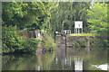
The nearest place in the direction of Cooper Bridge Junction is Cooper Bridge Flood Gates; ½ furlongs away.

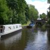
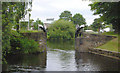
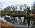
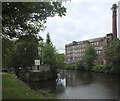
Mooring here is good (a nice place to moor), mooring rings or bollards are available. Mooring is limited to 48 hours. 120 feet of mooring. Would be rated excellent if it weren't for an underwater ledge about 1' wide. Busy road at the end furthest from the flood gates.


Amenities

Amenities nearby at Cooper Bridge No 12

 Bus stop (Cooper Bridge)
 Bus stop (Cooper Bridge)

Amenities nearby at Cooper Bridge Flood Gates

 Bus stop (Wakefield Road)
 Bus stop (Wakefield Road)
 
Maps
If you are a user and are logged on, or if you are actively planning a route, a map will be displayed here.
Show on external mapping site: Google | OSM | Bing
 
Photos
 
External websites
There are no links to external websites from here.
Why not log in and add some (select "External websites" from the menu (sometimes this is under "Edit"))?
 
Nearest facilities

Mouseover for more information or show routes to facility

Nearest water point

In the direction of Salterhebble Junction

Brighouse Basin — 2 miles, 3 furlongs and 4 locks away
On this waterway in the direction of Salterhebble Junction
Aspley Basin (Huddersfield) — 3 miles, 4½ furlongs and 9 locks away
Travel to Cooper Bridge Junction, then on the Huddersfield Broad Canal to Aspley Basin (Huddersfield)
Salterhebble Sanitary Station — 6 miles, 5 furlongs and 13 locks away
On this waterway in the direction of Salterhebble Junction
Salterhebble Junction — 6 miles, 5¼ furlongs and 14 locks away
On this waterway in the direction of Salterhebble Junction
Sowerby Bridge Basin — 8 miles, 7¼ furlongs and 14 locks away
Travel to Salterhebble Junction, then on the Calder and Hebble Navigation (Main Line) to Sowerby Bridge Basin
Hebden Bridge Services — 14 miles, 2½ furlongs and 21 locks away
Travel to Salterhebble Junction, then on the Calder and Hebble Navigation (Main Line) to Sowerby Bridge Junction, then on the Rochdale Canal (Main Line) to Hebden Bridge Services
Waterside Lock No 21E — 8 miles, 2¼ furlongs and 29 locks away
Travel to Cooper Bridge Junction, then on the Huddersfield Broad Canal to Aspley Basin (Huddersfield), then on the Huddersfield Narrow Canal to Waterside Lock No 21E
Slaithwaite Winding Hole — 8 miles, 2¾ furlongs and 30 locks away
Travel to Cooper Bridge Junction, then on the Huddersfield Broad Canal to Aspley Basin (Huddersfield), then on the Huddersfield Narrow Canal to Slaithwaite Winding Hole
Baltimore Marina — 18 miles, 2 furlongs and 30 locks away
Travel to Salterhebble Junction, then on the Calder and Hebble Navigation (Main Line) to Sowerby Bridge Junction, then on the Rochdale Canal (Main Line) to Baltimore Marina
Fielden Wharf & Services — 18 miles, 5 furlongs and 31 locks away
Travel to Salterhebble Junction, then on the Calder and Hebble Navigation (Main Line) to Sowerby Bridge Junction, then on the Rochdale Canal (Main Line) to Fielden Wharf & Services
Standedge Tunnel (eastern entrance) — 11 miles, 5¾ furlongs and 51 locks away
Travel to Cooper Bridge Junction, then on the Huddersfield Broad Canal to Aspley Basin (Huddersfield), then on the Huddersfield Narrow Canal to Standedge Tunnel (eastern entrance)
Standedge Tunnel (western entrance) — 14 miles, 7¾ furlongs and 51 locks away
Travel to Cooper Bridge Junction, then on the Huddersfield Broad Canal to Aspley Basin (Huddersfield), then on the Huddersfield Narrow Canal to Standedge Tunnel (western entrance)

In the direction of Fall Ing Junction
Shepley Bridge Sanitary Station — 3 miles and 2 locks away
On this waterway in the direction of Fall Ing Junction
Broad Cut Low Lock No 3 — 9 miles, 5 furlongs and 10 locks away
On this waterway in the direction of Fall Ing Junction
Ramsdens Bridge Sanitary Station — 15 miles, ¾ furlongs and 14 locks away
Travel to Fall Ing Junction, then on the Aire and Calder Navigation (Wakefield Section) to Ramsdens Bridge Sanitary Station
Ramsdens Swing Bridge — 15 miles, ¾ furlongs and 14 locks away
Travel to Fall Ing Junction, then on the Aire and Calder Navigation (Wakefield Section) to Ramsdens Swing Bridge
Stanley Ferry Water Point — 15 miles, 1½ furlongs and 14 locks away
Travel to Fall Ing Junction, then on the Aire and Calder Navigation (Wakefield Section) to Stanley Ferry Water Point
King's Road Lock No 3 — 16 miles, 6¾ furlongs and 15 locks away
Travel to Fall Ing Junction, then on the Aire and Calder Navigation (Wakefield Section) to King's Road Lock No 3
Woodnook Lock No 6 — 18 miles, ¼ furlongs and 16 locks away
Travel to Fall Ing Junction, then on the Aire and Calder Navigation (Wakefield Section) to Woodnook Lock No 6
Fairies Hill Moorings — 18 miles, 3½ furlongs and 18 locks away
Travel to Fall Ing Junction, then on the Aire and Calder Navigation (Wakefield Section) to Fairies Hill Lock Junction, then on the Aire and Calder Navigation (Fairies Hill Mooring Arm) to Fairies Hill Moorings

Nearest rubbish disposal

In the direction of Salterhebble Junction

Brighouse Lower Basin Visitor Moorings — 2 miles, 2½ furlongs and 3 locks away
On this waterway in the direction of Salterhebble Junction
Aspley Basin (Huddersfield) — 3 miles, 4½ furlongs and 9 locks away
Travel to Cooper Bridge Junction, then on the Huddersfield Broad Canal to Aspley Basin (Huddersfield)
Salterhebble Sanitary Station — 6 miles, 5 furlongs and 13 locks away
On this waterway in the direction of Salterhebble Junction
Sowerby Bridge Basin — 8 miles, 7¼ furlongs and 14 locks away
Travel to Salterhebble Junction, then on the Calder and Hebble Navigation (Main Line) to Sowerby Bridge Basin
Hebden Bridge Services — 14 miles, 2½ furlongs and 21 locks away
Travel to Salterhebble Junction, then on the Calder and Hebble Navigation (Main Line) to Sowerby Bridge Junction, then on the Rochdale Canal (Main Line) to Hebden Bridge Services
Pickle Lock No 22E — 8 miles, 3¼ furlongs and 30 locks away
Travel to Cooper Bridge Junction, then on the Huddersfield Broad Canal to Aspley Basin (Huddersfield), then on the Huddersfield Narrow Canal to Pickle Lock No 22E
Fielden Wharf & Services — 18 miles, 5 furlongs and 31 locks away
Travel to Salterhebble Junction, then on the Calder and Hebble Navigation (Main Line) to Sowerby Bridge Junction, then on the Rochdale Canal (Main Line) to Fielden Wharf & Services
Wool Road Visitor Mooring — 16 miles, 7¾ furlongs and 60 locks away
Travel to Cooper Bridge Junction, then on the Huddersfield Broad Canal to Aspley Basin (Huddersfield), then on the Huddersfield Narrow Canal to Wool Road Visitor Mooring

In the direction of Fall Ing Junction
Shepley Bridge Sanitary Station — 3 miles and 2 locks away
On this waterway in the direction of Fall Ing Junction
Horbury Basin Residential Moorings & Sanitary Station — 7 miles, 4½ furlongs and 9 locks away
On this waterway in the direction of Fall Ing Junction
Ramsdens Swing Bridge — 15 miles, ¾ furlongs and 14 locks away
Travel to Fall Ing Junction, then on the Aire and Calder Navigation (Wakefield Section) to Ramsdens Swing Bridge
Ramsdens Bridge Visitor Moorings — 15 miles, 1¼ furlongs and 14 locks away
Travel to Fall Ing Junction, then on the Aire and Calder Navigation (Wakefield Section) to Ramsdens Bridge Visitor Moorings

Nearest chemical toilet disposal

In the direction of Salterhebble Junction

Brighouse Basin — 2 miles, 3 furlongs and 4 locks away
On this waterway in the direction of Salterhebble Junction
Aspley Basin (Huddersfield) — 3 miles, 4½ furlongs and 9 locks away
Travel to Cooper Bridge Junction, then on the Huddersfield Broad Canal to Aspley Basin (Huddersfield)
Salterhebble Sanitary Station — 6 miles, 5 furlongs and 13 locks away
On this waterway in the direction of Salterhebble Junction
Sowerby Bridge Basin — 8 miles, 7¼ furlongs and 14 locks away
Travel to Salterhebble Junction, then on the Calder and Hebble Navigation (Main Line) to Sowerby Bridge Basin
Hebden Bridge Services — 14 miles, 2½ furlongs and 21 locks away
Travel to Salterhebble Junction, then on the Calder and Hebble Navigation (Main Line) to Sowerby Bridge Junction, then on the Rochdale Canal (Main Line) to Hebden Bridge Services
Waterside Lock No 21E — 8 miles, 2¼ furlongs and 29 locks away
Travel to Cooper Bridge Junction, then on the Huddersfield Broad Canal to Aspley Basin (Huddersfield), then on the Huddersfield Narrow Canal to Waterside Lock No 21E
Pickle Lock No 22E — 8 miles, 3¼ furlongs and 30 locks away
Travel to Cooper Bridge Junction, then on the Huddersfield Broad Canal to Aspley Basin (Huddersfield), then on the Huddersfield Narrow Canal to Pickle Lock No 22E
Baltimore Marina — 18 miles, 2 furlongs and 30 locks away
Travel to Salterhebble Junction, then on the Calder and Hebble Navigation (Main Line) to Sowerby Bridge Junction, then on the Rochdale Canal (Main Line) to Baltimore Marina
Wool Road Visitor Mooring — 16 miles, 7¾ furlongs and 60 locks away
Travel to Cooper Bridge Junction, then on the Huddersfield Broad Canal to Aspley Basin (Huddersfield), then on the Huddersfield Narrow Canal to Wool Road Visitor Mooring

In the direction of Fall Ing Junction
Shepley Bridge Sanitary Station — 3 miles and 2 locks away
On this waterway in the direction of Fall Ing Junction
Savile Town Wharf and Basin (Dewsbury) — 6 miles, 3½ furlongs and 6 locks away
Travel to Dewsbury Arm Junction, then on the Calder and Hebble Navigation (Dewsbury Old Cut) to Savile Town Wharf and Basin (Dewsbury)
Horbury Basin Residential Moorings & Sanitary Station — 7 miles, 4½ furlongs and 9 locks away
On this waterway in the direction of Fall Ing Junction
Ramsdens Bridge Sanitary Station — 15 miles, ¾ furlongs and 14 locks away
Travel to Fall Ing Junction, then on the Aire and Calder Navigation (Wakefield Section) to Ramsdens Bridge Sanitary Station
Fairies Hill Moorings — 18 miles, 3½ furlongs and 18 locks away
Travel to Fall Ing Junction, then on the Aire and Calder Navigation (Wakefield Section) to Fairies Hill Lock Junction, then on the Aire and Calder Navigation (Fairies Hill Mooring Arm) to Fairies Hill Moorings

Nearest place to turn

In the direction of Salterhebble Junction

Cooper Bridge Junction — ½ furlongs away
On this waterway in the direction of Salterhebble Junction
Deighton Road Bridge Winding Hole — 1 mile, 2½ furlongs and 4 locks away
Travel to Cooper Bridge Junction, then on the Huddersfield Broad Canal to Deighton Road Bridge Winding Hole
Brighouse Basin — 2 miles, 3 furlongs and 4 locks away
On this waterway in the direction of Salterhebble Junction
Ganny Winding Hole — 3 miles, ¼ furlongs and 5 locks away
On this waterway in the direction of Salterhebble Junction
New Road Winding Hole — 2 miles, 4¼ furlongs and 9 locks away
Travel to Cooper Bridge Junction, then on the Huddersfield Broad Canal to New Road Winding Hole
Anchor Street Winding Hole — 2 miles, 7½ furlongs and 9 locks away
Travel to Cooper Bridge Junction, then on the Huddersfield Broad Canal to Anchor Street Winding Hole
Aspley Basin (Huddersfield) — 3 miles, 4½ furlongs and 9 locks away
Travel to Cooper Bridge Junction, then on the Huddersfield Broad Canal to Aspley Basin (Huddersfield)
University Arm — 3 miles, 5¼ furlongs and 9 locks away
Travel to Cooper Bridge Junction, then on the Huddersfield Broad Canal to Aspley Basin (Huddersfield), then on the Huddersfield Narrow Canal to University Arm
Salterhebble Wharf — 6 miles, 4¼ furlongs and 12 locks away
On this waterway in the direction of Salterhebble Junction
Salterhebble Bottom Basin Visitor Moorings — 6 miles, 4½ furlongs and 12 locks away
On this waterway in the direction of Salterhebble Junction
Salterhebble Sanitary Station — 6 miles, 5 furlongs and 13 locks away
On this waterway in the direction of Salterhebble Junction
Salterhebble Basin — 7 miles, 1¼ furlongs and 14 locks away
Travel to Salterhebble Junction, then on the Calder and Hebble Navigation (Halifax Branch) to Salterhebble Basin
Sterne Mill Winding Hole — 7 miles, 7¾ furlongs and 14 locks away
Travel to Salterhebble Junction, then on the Calder and Hebble Navigation (Main Line) to Sterne Mill Winding Hole

In the direction of Fall Ing Junction
Battye Weir Entrance — 4½ furlongs and 1 lock away
On this waterway in the direction of Fall Ing Junction
Shepley Bridge Marina — 3 miles, ¼ furlongs and 2 locks away
On this waterway in the direction of Fall Ing Junction
Dewsbury Arm Junction — 5 miles, 3½ furlongs and 6 locks away
On this waterway in the direction of Fall Ing Junction
Savile Town Wharf and Basin (Dewsbury) — 6 miles, 3½ furlongs and 6 locks away
Travel to Dewsbury Arm Junction, then on the Calder and Hebble Navigation (Dewsbury Old Cut) to Savile Town Wharf and Basin (Dewsbury)
Horbury Basin Residential Moorings & Sanitary Station — 7 miles, 4½ furlongs and 9 locks away
On this waterway in the direction of Fall Ing Junction
Waller Bridge Winding Hole — 9 miles, 3¼ furlongs and 10 locks away
On this waterway in the direction of Fall Ing Junction
Broad Cut Weir Entrance — 9 miles, 5¼ furlongs and 11 locks away
On this waterway in the direction of Fall Ing Junction

Nearest self-operated pump-out

Nearest boatyard pump-out

In the direction of Salterhebble Junction

Aspley Basin (Huddersfield) — 3 miles, 4½ furlongs and 9 locks away
Travel to Cooper Bridge Junction, then on the Huddersfield Broad Canal to Aspley Basin (Huddersfield)
Sowerby Bridge Basin — 8 miles, 7¼ furlongs and 14 locks away
Travel to Salterhebble Junction, then on the Calder and Hebble Navigation (Main Line) to Sowerby Bridge Basin
Pickwell and Arnold Boatyard — 17 miles, ½ furlongs and 27 locks away
Travel to Salterhebble Junction, then on the Calder and Hebble Navigation (Main Line) to Sowerby Bridge Junction, then on the Rochdale Canal (Main Line) to Pickwell and Arnold Boatyard

In the direction of Fall Ing Junction
Shepley Bridge Marina — 3 miles, ¼ furlongs and 2 locks away
On this waterway in the direction of Fall Ing Junction
Direction of TV transmitter (From Wolfbane Cybernetic)
 
 
Geograph
 
Wikipedia

There is no page on Wikipedia called “Cooper Bridge Flood Lock Visitor Moorings”

Wikipedia pages that might relate to Cooper Bridge Flood Lock Visitor Moorings
[Preston Dock] basin. The lock limits vessels over approximately 200 metres (660 ft) from entering the main basin. Following the closure of Preston Dock flood mitigation [RRS Discovery] BANZARE, Discovery was moored in London as a static training ship and visitor attraction until 1979 when she was placed in the care of the Maritime Trust [List of accidents and incidents involving military aircraft before 1925] The French Army's first airship, Patrie, is torn loose from temporary moorings at Souhesmes during a storm. After briefly touching down in Ireland, it
 
Google

Results of Google Search

Cooper Bridge Visitor Mooring | Canal & River Trust
Mooring restriction for winter mooring sites 2015-16 Cooper Bridge Visitor Moorings: 26/10/2015 – 29/02/2016 This year, winter moorings will run from 1 ...
September
Sep 25, 2018 ... ... do like to pretend not to ;-) By about 1.30, we'd reached the flood lock at Cooper Bridge and tied up on the visitor moorings for a spot of lunch.
cruise 15 2019
Once through this, we have squeeze Ellis into some VERY short locks ... right turn at cooper bridge and take sanctuary off the river into the flood lock mooring area. ... once more for until we tie up for the day Wakefield town visitor moorings.
Flood trapped guests, WRONG kind of flood gates ... - Narrowboat Ellis
Sep 25, 2018 ... ... do like to pretend not to ;-) By about 1.30, we'd reached the flood lock at Cooper Bridge and tied up on the visitor moorings for a spot of lunch.
cruise 1 2019
We'll begin our cruise from Wakefield visitor's moorings (not far from “The ... we moor for the night either around Mirfield or in the flood lock at Cooper Bridge.
Cruise 12 - 2019
We'll pick up our guests at Wakefield Visitor Moorings (near the Ruddy Duck ... we moor for the night either around Mirfield or in the flood lock at Cooper Bridge.
Cooper Bridge to Horbury Bridge 27th August | NB Lillyanne
Aug 27, 2015 ... A flood lock ahead of us was closed this morning for some maintenance until 11am, ... We pulled in at The Perseverance Pub visitor moorings.