CanalPlanAC

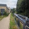
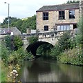
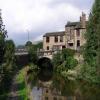
Pissmire Road Bridge No 10

 
Also known as: Halifax Road Bridge
A646, Calderdale HX7 5NX, United Kingdom (A646)
 
Information about the place
Pissmire Road Bridge No 10 is a minor waterways place on the Rochdale Canal between Walkley's Clog Mill (6¼ furlongs and 1 lock to the west) and Tuel Lane Tunnel (western entrance) (3 miles and 4¾ furlongs and 3 locks to the east).
 
 
The nearest place in the direction of Walkley's Clog Mill is Midgely Road Bridge No 11; ¾ furlongs away.
 
The nearest place in the direction of Tuel Lane Tunnel (western entrance) is Brearley Upper Bridge No 9 (This bridge was formerly a swing bridge.); 3 furlongs away.

There is access (suitable for wheels) to the towpath here.

Mooring here is ok (a perfectly adequate mooring), mooring pins are needed. A bit of road noise, some rings. Laundromat 5min walk.

There is a bridge here which takes a major road over the canal.


Amenities

Amenities nearby at Brearley Upper Bridge No 9

 E P S Hire Centres Ltd

Amenities nearby at Midgely Road Bridge No 11

 SEE ADDRESS
 Jon Duerden
 Mytholmroyd Station
 
Maps
If you are a user and are logged on, or if you are actively planning a route, a map will be displayed here.
Show on external mapping site: Google | OSM | Bing
 
Photos
 
External websites
There are no links to external websites from here.
Why not log in and add some (select "External websites" from the menu (sometimes this is under "Edit"))?
 
Nearest facilities

Mouseover for more information or show routes to facility

Nearest water point

In the direction of Castlefield Junction

Hebden Bridge Services1 mile, 4½ furlongs and 2 locks away
On this waterway in the direction of Castlefield Junction
Baltimore Marina5 miles, 4 furlongs and 11 locks away
On this waterway in the direction of Castlefield Junction
Fielden Wharf & Services5 miles, 7 furlongs and 12 locks away
On this waterway in the direction of Castlefield Junction
Travis Mill Lock No 287 miles, 4¼ furlongs and 21 locks away
On this waterway in the direction of Castlefield Junction
Littleborough Sanitary Station11 miles, 1½ furlongs and 40 locks away
On this waterway in the direction of Castlefield Junction

In the direction of Sowerby Bridge Junction

Sowerby Bridge Basin4 miles, ¾ furlongs and 5 locks away
Travel to Sowerby Bridge Junction, then on the Calder and Hebble Navigation (Main Line) to Sowerby Bridge Basin
Salterhebble Junction6 miles, ¾ furlongs and 5 locks away
Travel to Sowerby Bridge Junction, then on the Calder and Hebble Navigation (Main Line) to Salterhebble Junction
Salterhebble Sanitary Station6 miles, 1 furlong and 6 locks away
Travel to Sowerby Bridge Junction, then on the Calder and Hebble Navigation (Main Line) to Salterhebble Junction, then on the Calder and Hebble Navigation (Main Line) to Salterhebble Sanitary Station
Brighouse Basin10 miles, 3 furlongs and 15 locks away
Travel to Sowerby Bridge Junction, then on the Calder and Hebble Navigation (Main Line) to Salterhebble Junction, then on the Calder and Hebble Navigation (Main Line) to Brighouse Basin
Shepley Bridge Sanitary Station15 miles, 6 furlongs and 21 locks away
Travel to Sowerby Bridge Junction, then on the Calder and Hebble Navigation (Main Line) to Salterhebble Junction, then on the Calder and Hebble Navigation (Main Line) to Shepley Bridge Sanitary Station
Aspley Basin (Huddersfield)16 miles, 1½ furlongs and 28 locks away
Travel to Sowerby Bridge Junction, then on the Calder and Hebble Navigation (Main Line) to Salterhebble Junction, then on the Calder and Hebble Navigation (Main Line) to Cooper Bridge Junction, then on the Huddersfield Broad Canal to Aspley Basin (Huddersfield)

Nearest rubbish disposal

In the direction of Castlefield Junction

Hebden Bridge Services1 mile, 4½ furlongs and 2 locks away
On this waterway in the direction of Castlefield Junction
Fielden Wharf & Services5 miles, 7 furlongs and 12 locks away
On this waterway in the direction of Castlefield Junction
Littleborough Sanitary Station11 miles, 1½ furlongs and 40 locks away
On this waterway in the direction of Castlefield Junction

In the direction of Sowerby Bridge Junction

Sowerby Bridge Basin4 miles, ¾ furlongs and 5 locks away
Travel to Sowerby Bridge Junction, then on the Calder and Hebble Navigation (Main Line) to Sowerby Bridge Basin
Salterhebble Sanitary Station6 miles, 1 furlong and 6 locks away
Travel to Sowerby Bridge Junction, then on the Calder and Hebble Navigation (Main Line) to Salterhebble Junction, then on the Calder and Hebble Navigation (Main Line) to Salterhebble Sanitary Station
Brighouse Lower Basin Visitor Moorings10 miles, 3½ furlongs and 16 locks away
Travel to Sowerby Bridge Junction, then on the Calder and Hebble Navigation (Main Line) to Salterhebble Junction, then on the Calder and Hebble Navigation (Main Line) to Brighouse Lower Basin Visitor Moorings
Shepley Bridge Sanitary Station15 miles, 6 furlongs and 21 locks away
Travel to Sowerby Bridge Junction, then on the Calder and Hebble Navigation (Main Line) to Salterhebble Junction, then on the Calder and Hebble Navigation (Main Line) to Shepley Bridge Sanitary Station
Aspley Basin (Huddersfield)16 miles, 1½ furlongs and 28 locks away
Travel to Sowerby Bridge Junction, then on the Calder and Hebble Navigation (Main Line) to Salterhebble Junction, then on the Calder and Hebble Navigation (Main Line) to Cooper Bridge Junction, then on the Huddersfield Broad Canal to Aspley Basin (Huddersfield)

Nearest chemical toilet disposal

In the direction of Castlefield Junction

Hebden Bridge Services1 mile, 4½ furlongs and 2 locks away
On this waterway in the direction of Castlefield Junction
Baltimore Marina5 miles, 4 furlongs and 11 locks away
On this waterway in the direction of Castlefield Junction
Littleborough Sanitary Station11 miles, 1½ furlongs and 40 locks away
On this waterway in the direction of Castlefield Junction

In the direction of Sowerby Bridge Junction

Sowerby Bridge Basin4 miles, ¾ furlongs and 5 locks away
Travel to Sowerby Bridge Junction, then on the Calder and Hebble Navigation (Main Line) to Sowerby Bridge Basin
Salterhebble Sanitary Station6 miles, 1 furlong and 6 locks away
Travel to Sowerby Bridge Junction, then on the Calder and Hebble Navigation (Main Line) to Salterhebble Junction, then on the Calder and Hebble Navigation (Main Line) to Salterhebble Sanitary Station
Brighouse Basin10 miles, 3 furlongs and 15 locks away
Travel to Sowerby Bridge Junction, then on the Calder and Hebble Navigation (Main Line) to Salterhebble Junction, then on the Calder and Hebble Navigation (Main Line) to Brighouse Basin
Shepley Bridge Sanitary Station15 miles, 6 furlongs and 21 locks away
Travel to Sowerby Bridge Junction, then on the Calder and Hebble Navigation (Main Line) to Salterhebble Junction, then on the Calder and Hebble Navigation (Main Line) to Shepley Bridge Sanitary Station
Aspley Basin (Huddersfield)16 miles, 1½ furlongs and 28 locks away
Travel to Sowerby Bridge Junction, then on the Calder and Hebble Navigation (Main Line) to Salterhebble Junction, then on the Calder and Hebble Navigation (Main Line) to Cooper Bridge Junction, then on the Huddersfield Broad Canal to Aspley Basin (Huddersfield)
Savile Town Wharf and Basin (Dewsbury)19 miles, 1½ furlongs and 25 locks away
Travel to Sowerby Bridge Junction, then on the Calder and Hebble Navigation (Main Line) to Salterhebble Junction, then on the Calder and Hebble Navigation (Main Line) to Dewsbury Arm Junction, then on the Calder and Hebble Navigation (Dewsbury Old Cut) to Savile Town Wharf and Basin (Dewsbury)

Nearest place to turn

In the direction of Castlefield Junction

Walkley's Clog Mill6¼ furlongs and 1 lock away
On this waterway in the direction of Castlefield Junction
Hebden Bridge Wharf1 mile, 4¼ furlongs and 2 locks away
On this waterway in the direction of Castlefield Junction
Rawden Mill Lock Winding Hole2 miles, 6¼ furlongs and 5 locks away
On this waterway in the direction of Castlefield Junction
Winding Hole below Holmcoat Lock3 miles, 5¾ furlongs and 7 locks away
On this waterway in the direction of Castlefield Junction
Stoodley Bridge Winding Hole4 miles and 8 locks away
On this waterway in the direction of Castlefield Junction
Lobb Mill Lock Winding Hole4 miles, 4¾ furlongs and 9 locks away
On this waterway in the direction of Castlefield Junction
Baltimore Winding Hole5 miles, 3¾ furlongs and 11 locks away
On this waterway in the direction of Castlefield Junction
Todmorden Bridge Winding Hole5 miles, 7¼ furlongs and 12 locks away
On this waterway in the direction of Castlefield Junction
Winding Hole between Nip Square and Winterbutlee Locks7 miles, 5¾ furlongs and 23 locks away
On this waterway in the direction of Castlefield Junction

In the direction of Sowerby Bridge Junction

Winding Hole below Lock No 51 mile, 1 furlong and 2 locks away
On this waterway in the direction of Sowerby Bridge Junction
Tower Hill Winding Hole3 miles, 4 furlongs and 2 locks away
On this waterway in the direction of Sowerby Bridge Junction
Sowerby Bridge Winding Hole3 miles, 6 furlongs and 4 locks away
On this waterway in the direction of Sowerby Bridge Junction
Sowerby Bridge Junction3 miles, 7¾ furlongs and 5 locks away
On this waterway in the direction of Sowerby Bridge Junction
Sterne Mill Winding Hole4 miles, 6¼ furlongs and 5 locks away
Travel to Sowerby Bridge Junction, then on the Calder and Hebble Navigation (Main Line) to Sterne Mill Winding Hole
Salterhebble Basin6 miles, 4¾ furlongs and 5 locks away
Travel to Sowerby Bridge Junction, then on the Calder and Hebble Navigation (Main Line) to Salterhebble Junction, then on the Calder and Hebble Navigation (Halifax Branch) to Salterhebble Basin
Salterhebble Sanitary Station6 miles, 1 furlong and 6 locks away
Travel to Sowerby Bridge Junction, then on the Calder and Hebble Navigation (Main Line) to Salterhebble Junction, then on the Calder and Hebble Navigation (Main Line) to Salterhebble Sanitary Station
Salterhebble Bottom Basin Visitor Moorings6 miles, 1½ furlongs and 7 locks away
Travel to Sowerby Bridge Junction, then on the Calder and Hebble Navigation (Main Line) to Salterhebble Junction, then on the Calder and Hebble Navigation (Main Line) to Salterhebble Bottom Basin Visitor Moorings
Salterhebble Wharf6 miles, 1¾ furlongs and 7 locks away
Travel to Sowerby Bridge Junction, then on the Calder and Hebble Navigation (Main Line) to Salterhebble Junction, then on the Calder and Hebble Navigation (Main Line) to Salterhebble Wharf
Ganny Winding Hole9 miles, 5¾ furlongs and 14 locks away
Travel to Sowerby Bridge Junction, then on the Calder and Hebble Navigation (Main Line) to Salterhebble Junction, then on the Calder and Hebble Navigation (Main Line) to Ganny Winding Hole
Brighouse Basin10 miles, 3 furlongs and 15 locks away
Travel to Sowerby Bridge Junction, then on the Calder and Hebble Navigation (Main Line) to Salterhebble Junction, then on the Calder and Hebble Navigation (Main Line) to Brighouse Basin

Nearest self-operated pump-out

In the direction of Castlefield Junction

Hebden Bridge Services1 mile, 4½ furlongs and 2 locks away
On this waterway in the direction of Castlefield Junction

Nearest boatyard pump-out

In the direction of Castlefield Junction

Pickwell and Arnold Boatyard4 miles, 2½ furlongs and 8 locks away
On this waterway in the direction of Castlefield Junction

In the direction of Sowerby Bridge Junction

Sowerby Bridge Basin4 miles, ¾ furlongs and 5 locks away
Travel to Sowerby Bridge Junction, then on the Calder and Hebble Navigation (Main Line) to Sowerby Bridge Basin
Shepley Bridge Marina15 miles, 6¼ furlongs and 21 locks away
Travel to Sowerby Bridge Junction, then on the Calder and Hebble Navigation (Main Line) to Salterhebble Junction, then on the Calder and Hebble Navigation (Main Line) to Shepley Bridge Marina
Aspley Basin (Huddersfield)16 miles, 1½ furlongs and 28 locks away
Travel to Sowerby Bridge Junction, then on the Calder and Hebble Navigation (Main Line) to Salterhebble Junction, then on the Calder and Hebble Navigation (Main Line) to Cooper Bridge Junction, then on the Huddersfield Broad Canal to Aspley Basin (Huddersfield)
Direction of TV transmitter (From Wolfbane Cybernetic)
 
 
Geograph
 
Wikipedia

There is no page on Wikipedia called “Pissmire Road Bridge”

Wikipedia pages that might relate to Pissmire Road Bridge
[A. Murray MacKay Bridge] The A. Murray MacKay Bridge, known locally as "the new bridge", is a suspension bridge linking the Halifax Peninsula with Dartmouth, Nova Scotia, and [Halifax Harbour Bridges] Halifax Harbour Bridges is the operating name of a Nova Scotia provincial Crown corporation legally named the Halifax-Dartmouth Bridge Commission. The [Halifax, West Yorkshire] Halifax (/ˈhælɪfæks/) is a historic market, mill and minster town in the Metropolitan Borough of Calderdale in West Yorkshire, England. It is the administrative [North Bridge, Halifax] town to roads to Bradford and Leeds. Replacing an earlier six arch stone bridge it was raised to allow the subsequent construction of the Halifax High Level [Angus L. Macdonald Bridge] Angus L. Macdonald Bridge is a suspension bridge crossing Halifax Harbour in Nova Scotia, Canada; it opened on April 2, 1955. The bridge is one of two suspension [Granada Bridge (Ormond Beach)] The Granada Bridge is a high-clearance bridge that spans the Halifax River and Intracoastal Waterway, linking the mainland and beach peninsula parts of [Halifax railway station (England)] station is via a cobbled road bridge from opposite the bottom of Horton Street. A campaign, run by the local newspaper the Halifax Evening Courier, was started [Ogdensburg–Prescott International Bridge] as the Halifax harbour due to the undeniable similarities between the Ogdensburg-Prescott bridge and the A. Murray MacKay Bridge in the Halifax harbour [Broadway Bridge (Daytona Beach)] The Broadway Bridge is a segmental bridge that spans the Halifax River and Intracoastal Waterway in downtown Daytona Beach, Florida, carrying U.S. Route [Halifax River] 2nd Earl of Halifax (for whom Halifax, Nova Scotia, Canada is also named), during the British occupation of Florida (1763–1784). The Halifax River originates
 
Google

Results of Google Search

File:Halifax Road Bridge 10, Rochdale Canal, Mytholmroyd ...
Feb 24, 2020 ... No higher resolution available. ... (required by the license), Dr Neil Clifton / Halifax Road Bridge 10, Rochdale Canal, Mytholmroyd / CC BY-SA ...
THE BEST 10 Automotive near Halifax Rd, Ripponden HX6, United ...
“Had a problem with my car and stoneywood sorted it no problem, with no ... Unit 10, Salford, XGM M50 1DG ... Halifax Road, Sowerby Bridge, XWY HX6 3HW.
The Rochdale Canal between Sowerby Bridge and Castlefield ...
Luddenfoot HALIFAX HX2 6HS, Map, Closed. Halifax Road Bridge No 10, The White Lion Burnley Road Mytholmroyd HEBDEN BRIDGE HX7 5LN, Map, Closed .
March 10, 2020 Halifax Regional Council | Halifax
Mar 10, 2020 ... Award Tender No. 20-218 Shore Road Bridge Replacement and Paving Cow Bay Road to Oceanlea Drive to the lowest bidder meeting ...
A. Murray MacKay Bridge - Wikipedia
The A. Murray MacKay Bridge, known locally as "the new bridge", is a suspension bridge linking the Halifax Peninsula with Dartmouth, Nova Scotia, and opened on July 10, 1970. It is one of two suspension bridges crossing Halifax Harbour, its counterpart, ... The building of the MacKay Bridge, along with Highway 111, initiated a ...
THE BEST 10 Fish & Chips near 17A Halifax Rd, Todmorden OL14 ...
Best Fish & Chips in 17A Halifax Rd, Todmorden OL14 5AG, United Kingdom - Grandma Pollard ... 19 Burnley Road, Hebden Bridge, XWY HX7 5LH ... “If you're looking for first class fish and chips in Burnley then look no further than Frydays.
THE 10 CLOSEST Hotels to Sowerby Bridge Canalside, Halifax ...
Hotels near Sowerby Bridge Canalside, Halifax on Tripadvisor: Find 17678 traveler ... Huddersfield Road | Salterhebble Hill, Halifax HX3 0QT, England ... we were a little apprehensive and it was a very hot day and no tables available outside.
Current Road Conditions - 511
Halifax Dartmouth Bridge Commission Activity ... East Pubnico - Oak Park Road restricted to 10 tonne until further notice. ... Annapolis East: The Brickton Bridge on Mt Hanley Road will be closed for construction from September 17- January 22, 2021 ... This work will include lane reductions, but no road closures are planned.
Chapter 12 - ELECTIONS | Code of Ordinances | Danville, VA ...
87-12.7, § 1, 12-15-87; Ord. No. 2004-10.07, 10-7-04). Sec. 12-12. - Ward No. ... Bridge with Dan River; thence northerly along Union Street Bridge Road to Henry Road ... 9 shall be in the Glenwood Recreation Center located on Halifax Road.