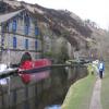
Gauxholme Highest Lock No 24
is a minor waterways place
on the Rochdale Canal between
Hollings Lock No 27 (Walsden) (5 furlongs
and 2 locks
to the southeast) and
Walkley's Clog Mill (5 miles and 7¼ furlongs
and 16 locks
to the east).
The nearest place in the direction of Hollings Lock No 27 is Gauxholme Aqueduct;
¼ furlongs
away.
The nearest place in the direction of Walkley's Clog Mill is Gauxholme Arch Bridge No 31;
¼ furlongs
away.
There may be access to the towpath here.
Mooring here is unrated.
There is a bridge here which takes pedestrian traffic over the canal.
This is a lock, the rise of which is not known.
Copperas House Aqueduct | 1¼ furlongs | |
Gauxholme Railway Bridge | 1 furlong | |
Site of Gauxholme Wharf Basin | ¼ furlongs | |
Gauxholme Wharf | ¼ furlongs | |
Gauxholme Aqueduct | ¼ furlongs | |
Gauxholme Highest Lock No 24 | ||
Gauxholme Arch Bridge No 31 | ¼ furlongs | |
Gauxholme Middle Lock No 23 | ¾ furlongs | |
Gauxholme Lowest Lock No 22 | 1¼ furlongs | |
Site of Shade Mill | 1¼ furlongs | |
Gauxholme Railway Viaduct | 1½ furlongs |
There are no links to external websites from here.
Why not log in and add some (select "External websites" from the menu (sometimes this is under "Edit"))?
Mouseover for more information or show routes to facility
Nearest water point
In the direction of Castlefield Junction
Travis Mill Lock No 28 — 6¾ furlongs and 4 locks away
On this waterway in the direction of Castlefield Junction
Littleborough Sanitary Station — 4 miles, 4 furlongs and 23 locks away
On this waterway in the direction of Castlefield Junction
New Islington Marina — 19 miles, 7¾ furlongs and 58 locks away
Travel to New Islington Marina Entrance, then on the Rochdale Canal (Main Line) to Cotton Field Wharf Marina, then on the Rochdale Canal (New Islington Marina Arm) to New Islington Marina
In the direction of Sowerby Bridge Junction
Fielden Wharf & Services — 6½ furlongs and 6 locks away
On this waterway in the direction of Sowerby Bridge Junction
Baltimore Marina — 1 mile, 1½ furlongs and 7 locks away
On this waterway in the direction of Sowerby Bridge Junction
Hebden Bridge Services — 5 miles, 1 furlong and 16 locks away
On this waterway in the direction of Sowerby Bridge Junction
Sowerby Bridge Basin — 10 miles, 6½ furlongs and 23 locks away
Travel to Sowerby Bridge Junction, then on the Calder and Hebble Navigation (Main Line) to Sowerby Bridge Basin
Salterhebble Junction — 12 miles, 6¼ furlongs and 23 locks away
Travel to Sowerby Bridge Junction, then on the Calder and Hebble Navigation (Main Line) to Salterhebble Junction
Salterhebble Sanitary Station — 12 miles, 6½ furlongs and 24 locks away
Travel to Sowerby Bridge Junction, then on the Calder and Hebble Navigation (Main Line) to Salterhebble Junction, then on the Calder and Hebble Navigation (Main Line) to Salterhebble Sanitary Station
Brighouse Basin — 17 miles, ½ furlongs and 33 locks away
Travel to Sowerby Bridge Junction, then on the Calder and Hebble Navigation (Main Line) to Salterhebble Junction, then on the Calder and Hebble Navigation (Main Line) to Brighouse BasinNearest rubbish disposal
In the direction of Castlefield Junction
Littleborough Sanitary Station — 4 miles, 4 furlongs and 23 locks away
On this waterway in the direction of Castlefield Junction
In the direction of Sowerby Bridge Junction
Fielden Wharf & Services — 6½ furlongs and 6 locks away
On this waterway in the direction of Sowerby Bridge Junction
Hebden Bridge Services — 5 miles, 1 furlong and 16 locks away
On this waterway in the direction of Sowerby Bridge Junction
Sowerby Bridge Basin — 10 miles, 6½ furlongs and 23 locks away
Travel to Sowerby Bridge Junction, then on the Calder and Hebble Navigation (Main Line) to Sowerby Bridge Basin
Salterhebble Sanitary Station — 12 miles, 6½ furlongs and 24 locks away
Travel to Sowerby Bridge Junction, then on the Calder and Hebble Navigation (Main Line) to Salterhebble Junction, then on the Calder and Hebble Navigation (Main Line) to Salterhebble Sanitary Station
Brighouse Lower Basin Visitor Moorings — 17 miles, 1 furlong and 34 locks away
Travel to Sowerby Bridge Junction, then on the Calder and Hebble Navigation (Main Line) to Salterhebble Junction, then on the Calder and Hebble Navigation (Main Line) to Brighouse Lower Basin Visitor MooringsNearest chemical toilet disposal
In the direction of Castlefield Junction
Littleborough Sanitary Station — 4 miles, 4 furlongs and 23 locks away
On this waterway in the direction of Castlefield Junction
In the direction of Sowerby Bridge Junction
Baltimore Marina — 1 mile, 1½ furlongs and 7 locks away
On this waterway in the direction of Sowerby Bridge Junction
Hebden Bridge Services — 5 miles, 1 furlong and 16 locks away
On this waterway in the direction of Sowerby Bridge Junction
Sowerby Bridge Basin — 10 miles, 6½ furlongs and 23 locks away
Travel to Sowerby Bridge Junction, then on the Calder and Hebble Navigation (Main Line) to Sowerby Bridge Basin
Salterhebble Sanitary Station — 12 miles, 6½ furlongs and 24 locks away
Travel to Sowerby Bridge Junction, then on the Calder and Hebble Navigation (Main Line) to Salterhebble Junction, then on the Calder and Hebble Navigation (Main Line) to Salterhebble Sanitary Station
Brighouse Basin — 17 miles, ½ furlongs and 33 locks away
Travel to Sowerby Bridge Junction, then on the Calder and Hebble Navigation (Main Line) to Salterhebble Junction, then on the Calder and Hebble Navigation (Main Line) to Brighouse BasinNearest place to turn
In the direction of Castlefield Junction
Winding Hole between Nip Square and Winterbutlee Locks — 1 mile, ¼ furlongs and 6 locks away
On this waterway in the direction of Castlefield Junction
Lightbank Lock Winding Hole — 1 mile, 3¼ furlongs and 8 locks away
On this waterway in the direction of Castlefield Junction
Bottomley Road Winding Hole — 1 mile, 5 furlongs and 9 locks away
On this waterway in the direction of Castlefield Junction
Summit Pound Winding Hole — 2 miles, 3¼ furlongs and 13 locks away
On this waterway in the direction of Castlefield Junction
Bent House Bridge Winding Hole — 4 miles, 1¼ furlongs and 22 locks away
On this waterway in the direction of Castlefield Junction
Bent House Winding Hole — 4 miles, 2¼ furlongs and 22 locks away
On this waterway in the direction of Castlefield Junction
Littleborough Winding Hole — 5 miles and 25 locks away
On this waterway in the direction of Castlefield Junction
Moss Upper Lock Winding Hole — 8 miles, 3 furlongs and 26 locks away
On this waterway in the direction of Castlefield Junction
In the direction of Sowerby Bridge Junction
Todmorden Bridge Winding Hole — 6½ furlongs and 6 locks away
On this waterway in the direction of Sowerby Bridge Junction
Baltimore Winding Hole — 1 mile, 2 furlongs and 7 locks away
On this waterway in the direction of Sowerby Bridge Junction
Lobb Mill Lock Winding Hole — 2 miles, ¾ furlongs and 9 locks away
On this waterway in the direction of Sowerby Bridge Junction
Stoodley Bridge Winding Hole — 2 miles, 5¾ furlongs and 10 locks away
On this waterway in the direction of Sowerby Bridge Junction
Winding Hole below Holmcoat Lock — 2 miles, 7¾ furlongs and 11 locks away
On this waterway in the direction of Sowerby Bridge Junction
Rawden Mill Lock Winding Hole — 3 miles, 7¼ furlongs and 13 locks away
On this waterway in the direction of Sowerby Bridge Junction
Hebden Bridge Wharf — 5 miles, 1¼ furlongs and 16 locks away
On this waterway in the direction of Sowerby Bridge Junction
Walkley's Clog Mill — 5 miles, 7¼ furlongs and 17 locks away
On this waterway in the direction of Sowerby Bridge Junction
Winding Hole below Lock No 5 — 7 miles, 6½ furlongs and 20 locks away
On this waterway in the direction of Sowerby Bridge Junction
Tower Hill Winding Hole — 10 miles, 1½ furlongs and 20 locks away
On this waterway in the direction of Sowerby Bridge Junction
Sowerby Bridge Winding Hole — 10 miles, 3½ furlongs and 22 locks away
On this waterway in the direction of Sowerby Bridge Junction
Sowerby Bridge Junction — 10 miles, 5½ furlongs and 23 locks away
On this waterway in the direction of Sowerby Bridge JunctionNearest self-operated pump-out
In the direction of Castlefield Junction
New Islington Marina — 19 miles, 7¾ furlongs and 58 locks away
Travel to New Islington Marina Entrance, then on the Rochdale Canal (Main Line) to Cotton Field Wharf Marina, then on the Rochdale Canal (New Islington Marina Arm) to New Islington Marina
In the direction of Sowerby Bridge Junction
Hebden Bridge Services — 5 miles, 1 furlong and 16 locks away
On this waterway in the direction of Sowerby Bridge JunctionNearest boatyard pump-out
In the direction of Sowerby Bridge Junction
Pickwell and Arnold Boatyard — 2 miles, 3¼ furlongs and 10 locks away
On this waterway in the direction of Sowerby Bridge Junction
Sowerby Bridge Basin — 10 miles, 6½ furlongs and 23 locks away
Travel to Sowerby Bridge Junction, then on the Calder and Hebble Navigation (Main Line) to Sowerby Bridge BasinDirection of TV transmitter (From Wolfbane Cybernetic)
There is no page on Wikipedia called “Gauxholme Highest Lock”
Wikipedia pages that might relate to Gauxholme Highest Lock
[Rochdale Canal]
now has 91. Locks 3 and 4 have been replaced with a single deep lock, Tuel Lane Lock, which is numbered 3/4. The Rochdale Canal was conceived in 1776
[Listed buildings in Todmorden (inner area)]
retrieved 19 February 2020 Historic England, "Rochdale Canal Lock 24 (Gauxholme Highest Lock), Todmorden (1278603)", National Heritage List for England, retrieved
[Listed buildings in Todmorden (outer areas)]
Heritage List for England, retrieved 24 February 2020 Historic England, "Gauxholme Stones Farmhouse, Todmorden (1230550)", National Heritage List for England
Results of Google Search
Aug 29, 2010 ... SD9223 :: Gauxholme Highest Lock No 24, Rochdale Canal, near to Todmorden, Calderdale, Great Britain by Alexander P Kapp.
Feb 29, 2020 ... ... the photograph, and at this point the canal itself bends round to the right, where Gauxholme Highest Lock No 24 is immediately encountered.
Mar 12, 2009 ... SD9223 :: Gauxholme Highest Lock No 24 - Rochdale Canal - Bacup Road, near to Todmorden, Calderdale, Great Britain by Betty Longbottom.
ROCHDALE CANAL LOCK 24 GAUXHOLME HIGHEST LOCK. 1 contribution ... The above map is for quick reference purposes only and may not be to scale.
Jun 29, 2012 ... This lock is named Gauxholme Highest Lock and as the name suggests this is the middle lock of a set of 3 situated in the small village of ...
Gauxholme Highest Lock 24 is between the two Gauxholme railway viaducts. Looking back to Gauxholme Railway Viaduct No. Bridge 31a, with the arches on ...
The Rochdale Canal is in Northern England, between Manchester and Sowerby Bridge, part of ... 24, Gauxholme Highest Lock ... As a result of having no summit tunnel, there were more locks, and the summit pound ... The summit pound is 600 feet (183 m) above sea level, and is one of the highest summit pounds in Britain.