
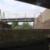
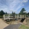
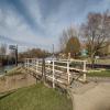
Diglis Bottom Swing Bridge No 1
is a minor waterways place
on the Worcester and Birmingham Canal (Diglis Junction to Diglis Basin) between
Diglis Junction (Junction of Worcester and Birmingham Canal with River Severn) (¼ furlongs
to the west) and
Diglis Lock No 2 (¾ furlongs
and 1 lock
to the northeast).
The nearest place in the direction of Diglis Lock No 2 is Diglis Bottom Lock No 1;
a few yards
away.
Mooring here is unrated.
There is a swing bridge here.
| Diglis Junction | ¼ furlongs | |
| Diglis Bottom Swing Bridge No 1 | ||
| Diglis Bottom Lock No 1 | a few yards | |
| Diglis Locks Middle Basin | ¼ furlongs | |
| Diglis Lock No 2 | ¾ furlongs | |
| Diglis Basin | ¾ furlongs | |
Amenities in Worcester
Amenities at other places in Worcester
There are no links to external websites from here.
Why not log in and add some (select "External websites" from the menu (sometimes this is under "Edit"))?
Why not log in and add some (select "External websites" from the menu (sometimes this is under "Edit"))?
Mouseover for more information or show routes to facility
Nearest water point
In the direction of Diglis Basin
Diglis Services — 1½ furlongs and 2 locks away
Travel to Diglis Basin, then on the Worcester and Birmingham Canal (Diglis Basin to King's Norton Junction) to Diglis Services
Lowesmoor Basin — 1 mile, 1 furlong and 4 locks away
Travel to Diglis Basin, then on the Worcester and Birmingham Canal (Diglis Basin to King's Norton Junction) to Lowesmoor Basin
Hanbury Boatyard — 9 miles, ½ furlongs and 16 locks away
Travel to Diglis Basin, then on the Worcester and Birmingham Canal (Diglis Basin to King's Norton Junction) to Hanbury Boatyard
Droitwich Spa Marina — 9 miles, 4½ furlongs and 19 locks away
Travel to Diglis Basin, then on the Worcester and Birmingham Canal (Diglis Basin to King's Norton Junction) to Hanbury Junction, then on the Droitwich Canals (Droitwich Junction Canal) to Droitwich Spa Marina
Stoke Works Water Point — 11 miles, 5½ furlongs and 22 locks away
Travel to Diglis Basin, then on the Worcester and Birmingham Canal (Diglis Basin to King's Norton Junction) to Stoke Works Water Point
Tardebigge Wharf — 15 miles, 6 furlongs and 58 locks away
Travel to Diglis Basin, then on the Worcester and Birmingham Canal (Diglis Basin to King's Norton Junction) to Tardebigge Wharf
In the direction of Diglis Junction
Diglis Locks — 2¾ furlongs away
Travel to Diglis Junction, then on the River Severn (main river - Worcester to Gloucester) to Diglis Locks
Worcester Trip Boat Moorings — 6¼ furlongs away
Travel to Diglis Junction, then on the River Severn (main river - Stourport to Worcester) to Worcester Trip Boat Moorings
Holt Lock (Holt Fleet) — 7 miles, 3¼ furlongs and 1 lock away
Travel to Diglis Junction, then on the River Severn (main river - Stourport to Worcester) to Holt Lock (Holt Fleet)
Lincomb Lock — 11 miles, 5 furlongs and 2 locks away
Travel to Diglis Junction, then on the River Severn (main river - Stourport to Worcester) to Lincomb Lock
Upper Basin Waterpoint — 13 miles, ¼ furlongs and 5 locks away
Travel to Diglis Junction, then on the River Severn (main river - Stourport to Worcester) to Severn - Stourport Broad Locks Entrance, then on the Staffordshire and Worcestershire Canal (Stourport Basins: Broad Route) to Stourport Upper Basin, then on the Staffordshire and Worcestershire Canal (Stourport Basins: Narrow Route) to Upper Basin Waterpoint
Upper Lode Lock No 5 — 16 miles, 4½ furlongs and 1 lock away
Travel to Diglis Junction, then on the River Severn (main river - Worcester to Gloucester) to Upper Lode Lock No 5
Tewkesbury Services — 16 miles, 2¼ furlongs and 2 locks away
Travel to Diglis Junction, then on the River Severn (main river - Worcester to Gloucester) to Tewkesbury Junction, then on the River Avon - Warwickshire (Lower Avon Navigation) to Tewkesbury Services
Netherwich Basin — 9 miles, 7¼ furlongs and 9 locks away
Travel to Diglis Junction, then on the River Severn (main river - Stourport to Worcester) to Hawford Junction, then on the Droitwich Canals (Droitwich Barge Canal) to Netherwich Basin
Tewkesbury Lower Lode — 17 miles, 2¾ furlongs and 2 locks away
Travel to Diglis Junction, then on the River Severn (main river - Worcester to Gloucester) to Tewkesbury Lower Lode
Bredon — 19 miles, 6 furlongs and 2 locks away
Travel to Diglis Junction, then on the River Severn (main river - Worcester to Gloucester) to Tewkesbury Junction, then on the River Avon - Warwickshire (Lower Avon Navigation) to Bredon
Caldwall Mill Bridge No 14 — 16 miles, 6½ furlongs and 8 locks away
Travel to Diglis Junction, then on the River Severn (main river - Stourport to Worcester) to Severn - Stourport Broad Locks Entrance, then on the Staffordshire and Worcestershire Canal (Stourport Basins: Broad Route) to Stourport Upper Basin, then on the Staffordshire and Worcestershire Canal (Stourport Basins: Narrow Route) to York Street Bridge, then on the Staffordshire and Worcestershire Canal (Main Line: Stourport to Stourton) to Caldwall Mill Bridge No 14Nearest rubbish disposal
In the direction of Diglis Basin
Diglis Basin — ¾ furlongs and 2 locks away
On this waterway in the direction of Diglis Basin
Lowesmoor Basin — 1 mile, 1 furlong and 4 locks away
Travel to Diglis Basin, then on the Worcester and Birmingham Canal (Diglis Basin to King's Norton Junction) to Lowesmoor Basin
Droitwich Spa Marina — 9 miles, 4½ furlongs and 19 locks away
Travel to Diglis Basin, then on the Worcester and Birmingham Canal (Diglis Basin to King's Norton Junction) to Hanbury Junction, then on the Droitwich Canals (Droitwich Junction Canal) to Droitwich Spa Marina
Stoke Bottom Lock No 23 — 12 miles, 3½ furlongs and 22 locks away
Travel to Diglis Basin, then on the Worcester and Birmingham Canal (Diglis Basin to King's Norton Junction) to Stoke Bottom Lock No 23
Tardebigge Wharf — 15 miles, 6 furlongs and 58 locks away
Travel to Diglis Basin, then on the Worcester and Birmingham Canal (Diglis Basin to King's Norton Junction) to Tardebigge Wharf
In the direction of Diglis Junction
Sabrina Footbridge — 1 mile, ¼ furlongs away
Travel to Diglis Junction, then on the River Severn (main river - Stourport to Worcester) to Sabrina Footbridge
Upper Basin Waterpoint — 13 miles, ¼ furlongs and 5 locks away
Travel to Diglis Junction, then on the River Severn (main river - Stourport to Worcester) to Severn - Stourport Broad Locks Entrance, then on the Staffordshire and Worcestershire Canal (Stourport Basins: Broad Route) to Stourport Upper Basin, then on the Staffordshire and Worcestershire Canal (Stourport Basins: Narrow Route) to Upper Basin Waterpoint
Tewkesbury Services — 16 miles, 2¼ furlongs and 2 locks away
Travel to Diglis Junction, then on the River Severn (main river - Worcester to Gloucester) to Tewkesbury Junction, then on the River Avon - Warwickshire (Lower Avon Navigation) to Tewkesbury Services
Netherwich Basin — 9 miles, 7¼ furlongs and 9 locks away
Travel to Diglis Junction, then on the River Severn (main river - Stourport to Worcester) to Hawford Junction, then on the Droitwich Canals (Droitwich Barge Canal) to Netherwich BasinNearest chemical toilet disposal
In the direction of Diglis Basin
Diglis Services — 1½ furlongs and 2 locks away
Travel to Diglis Basin, then on the Worcester and Birmingham Canal (Diglis Basin to King's Norton Junction) to Diglis Services
Lowesmoor Basin — 1 mile, 1 furlong and 4 locks away
Travel to Diglis Basin, then on the Worcester and Birmingham Canal (Diglis Basin to King's Norton Junction) to Lowesmoor Basin
Droitwich Spa Marina — 9 miles, 4½ furlongs and 19 locks away
Travel to Diglis Basin, then on the Worcester and Birmingham Canal (Diglis Basin to King's Norton Junction) to Hanbury Junction, then on the Droitwich Canals (Droitwich Junction Canal) to Droitwich Spa Marina
Stoke Bottom Lock No 23 — 12 miles, 3½ furlongs and 22 locks away
Travel to Diglis Basin, then on the Worcester and Birmingham Canal (Diglis Basin to King's Norton Junction) to Stoke Bottom Lock No 23
Tardebigge Wharf — 15 miles, 6 furlongs and 58 locks away
Travel to Diglis Basin, then on the Worcester and Birmingham Canal (Diglis Basin to King's Norton Junction) to Tardebigge Wharf
In the direction of Diglis Junction
Stourport Marina — 12 miles, ¼ furlongs and 3 locks away
Travel to Diglis Junction, then on the River Severn (main river - Stourport to Worcester) to Stourport Marina
Upper Basin Waterpoint — 13 miles, ¼ furlongs and 5 locks away
Travel to Diglis Junction, then on the River Severn (main river - Stourport to Worcester) to Severn - Stourport Broad Locks Entrance, then on the Staffordshire and Worcestershire Canal (Stourport Basins: Broad Route) to Stourport Upper Basin, then on the Staffordshire and Worcestershire Canal (Stourport Basins: Narrow Route) to Upper Basin Waterpoint
Caldwall Mill Bridge No 14 — 16 miles, 6½ furlongs and 8 locks away
Travel to Diglis Junction, then on the River Severn (main river - Stourport to Worcester) to Severn - Stourport Broad Locks Entrance, then on the Staffordshire and Worcestershire Canal (Stourport Basins: Broad Route) to Stourport Upper Basin, then on the Staffordshire and Worcestershire Canal (Stourport Basins: Narrow Route) to York Street Bridge, then on the Staffordshire and Worcestershire Canal (Main Line: Stourport to Stourton) to Caldwall Mill Bridge No 14Nearest place to turn
In the direction of Diglis Basin
Lowesmoor Basin — 1 mile, 1 furlong and 4 locks away
Travel to Diglis Basin, then on the Worcester and Birmingham Canal (Diglis Basin to King's Norton Junction) to Lowesmoor Basin
Bilford Locks Winding Hole — 2 miles, 3 furlongs and 7 locks away
Travel to Diglis Basin, then on the Worcester and Birmingham Canal (Diglis Basin to King's Norton Junction) to Bilford Locks Winding Hole
In the direction of Diglis Junction
Diglis Junction — ¼ furlongs away
On this waterway in the direction of Diglis Junction
Diglis Locks Weir Exit — 3½ furlongs and 1 lock away
Travel to Diglis Junction, then on the River Severn (main river - Worcester to Gloucester) to Diglis Locks Weir Exit
Severn - Teme Junction — 1 mile, 1½ furlongs and 1 lock away
Travel to Diglis Junction, then on the River Severn (main river - Worcester to Gloucester) to Severn - Teme Junction
Bevere Lock Weir Exit — 3 miles, 6¾ furlongs away
Travel to Diglis Junction, then on the River Severn (main river - Stourport to Worcester) to Bevere Lock Weir Exit
Bevere Lock Weir Entrance — 4 miles, 1½ furlongs and 1 lock away
Travel to Diglis Junction, then on the River Severn (main river - Stourport to Worcester) to Bevere Lock Weir Entrance
Holt Lock Weir Exit — 7 miles, 2¼ furlongs and 1 lock away
Travel to Diglis Junction, then on the River Severn (main river - Stourport to Worcester) to Holt Lock Weir Exit
Holt Lock Weir Entrance — 7 miles, 5½ furlongs and 2 locks away
Travel to Diglis Junction, then on the River Severn (main river - Stourport to Worcester) to Holt Lock Weir Entrance
Ladywood Top Lock Winding Hole — 7 miles, 1 furlong and 9 locks away
Travel to Diglis Junction, then on the River Severn (main river - Stourport to Worcester) to Hawford Junction, then on the Droitwich Canals (Droitwich Barge Canal) to Ladywood Top Lock Winding Hole
Severn - Stourport Narrow Locks Entrance — 12 miles, 7½ furlongs and 3 locks away
Travel to Diglis Junction, then on the River Severn (main river - Stourport to Worcester) to Severn - Stourport Narrow Locks Entrance
Stourport Lower Basin - between Broad Locks — 12 miles, 7½ furlongs and 4 locks away
Travel to Diglis Junction, then on the River Severn (main river - Stourport to Worcester) to Severn - Stourport Broad Locks Entrance, then on the Staffordshire and Worcestershire Canal (Stourport Basins: Broad Route) to Stourport Lower Basin - between Broad Locks
Stourport Lower Basin - between Narrow Locks — 12 miles, 7¾ furlongs and 4 locks away
Travel to Diglis Junction, then on the River Severn (main river - Stourport to Worcester) to Severn - Stourport Broad Locks Entrance, then on the Staffordshire and Worcestershire Canal (Stourport Basins: Broad Route) to Stourport Lower Basin - between Broad Locks, then on the Staffordshire and Worcestershire Canal (Stourport Basins: Broad Locks to Narrow Locks to Stourport Lower Basin - between Narrow Locks
Upper Lode Lock Weir Entrance — 16 miles, 3½ furlongs and 1 lock away
Travel to Diglis Junction, then on the River Severn (main river - Worcester to Gloucester) to Upper Lode Lock Weir Entrance
Stourport Upper Basin — 13 miles, ¼ furlongs and 5 locks away
Travel to Diglis Junction, then on the River Severn (main river - Stourport to Worcester) to Severn - Stourport Broad Locks Entrance, then on the Staffordshire and Worcestershire Canal (Stourport Basins: Broad Route) to Stourport Upper Basin
Stourport Clock Basin — 13 miles, ½ furlongs and 5 locks away
Travel to Diglis Junction, then on the River Severn (main river - Stourport to Worcester) to Severn - Stourport Broad Locks Entrance, then on the Staffordshire and Worcestershire Canal (Stourport Basins: Broad Route) to Stourport Upper Basin, then on the Staffordshire and Worcestershire Canal (Stourport Basins: Narrow Route) to Stourport Clock Basin
Avon Lock Junction — 16 miles, 2 furlongs and 2 locks away
Travel to Diglis Junction, then on the River Severn (main river - Worcester to Gloucester) to Tewkesbury Junction, then on the River Avon - Warwickshire (Lower Avon Navigation) to Avon Lock Junction
Winding Hole (east of Salwarpe Road Bridge) — 9 miles, 5¾ furlongs and 9 locks away
Travel to Diglis Junction, then on the River Severn (main river - Stourport to Worcester) to Hawford Junction, then on the Droitwich Canals (Droitwich Barge Canal) to Winding Hole (east of Salwarpe Road Bridge)
Abbey Mill Tewkesbury — 16 miles, 3 furlongs and 2 locks away
Travel to Diglis Junction, then on the River Severn (main river - Worcester to Gloucester) to Tewkesbury Junction, then on the River Avon - Warwickshire (Lower Avon Navigation) to Avon Lock Junction, then on the River Avon - Warwickshire (Mill Avon) to Abbey Mill Tewkesbury
Netherwich Basin — 9 miles, 7¼ furlongs and 9 locks away
Travel to Diglis Junction, then on the River Severn (main river - Stourport to Worcester) to Hawford Junction, then on the Droitwich Canals (Droitwich Barge Canal) to Netherwich BasinNearest self-operated pump-out
In the direction of Diglis Basin
Diglis Services — 1½ furlongs and 2 locks away
Travel to Diglis Basin, then on the Worcester and Birmingham Canal (Diglis Basin to King's Norton Junction) to Diglis Services
Droitwich Spa Marina — 9 miles, 4½ furlongs and 19 locks away
Travel to Diglis Basin, then on the Worcester and Birmingham Canal (Diglis Basin to King's Norton Junction) to Hanbury Junction, then on the Droitwich Canals (Droitwich Junction Canal) to Droitwich Spa MarinaNearest boatyard pump-out
In the direction of Diglis Basin
Lowesmoor Basin — 1 mile, 1 furlong and 4 locks away
Travel to Diglis Basin, then on the Worcester and Birmingham Canal (Diglis Basin to King's Norton Junction) to Lowesmoor Basin
Dunhampstead Boatyard — 7 miles, 2 furlongs and 16 locks away
Travel to Diglis Basin, then on the Worcester and Birmingham Canal (Diglis Basin to King's Norton Junction) to Dunhampstead Boatyard
Hanbury Boatyard — 9 miles, ½ furlongs and 16 locks away
Travel to Diglis Basin, then on the Worcester and Birmingham Canal (Diglis Basin to King's Norton Junction) to Hanbury Boatyard
In the direction of Diglis Junction
Stourport Marina — 12 miles, ¼ furlongs and 3 locks away
Travel to Diglis Junction, then on the River Severn (main river - Stourport to Worcester) to Stourport Marina
Stourport Upper Basin — 13 miles, ¼ furlongs and 5 locks away
Travel to Diglis Junction, then on the River Severn (main river - Stourport to Worcester) to Severn - Stourport Broad Locks Entrance, then on the Staffordshire and Worcestershire Canal (Stourport Basins: Broad Route) to Stourport Upper Basin
Upper Staircase Lock Landing Pontoon — 13 miles, ¾ furlongs and 5 locks away
Travel to Diglis Junction, then on the River Severn (main river - Stourport to Worcester) to Severn - Stourport Broad Locks Entrance, then on the Staffordshire and Worcestershire Canal (Stourport Basins: Broad Route) to Stourport Upper Basin, then on the Staffordshire and Worcestershire Canal (Stourport Basins: Narrow Route) to Upper Staircase Lock Landing PontoonDirection of TV transmitter (From Wolfbane Cybernetic)
There is no page on Wikipedia called “Diglis Bottom Swing Bridge”
Wikipedia pages that might relate to Diglis Bottom Swing Bridge
[Staffordshire and Worcestershire Canal]
2019), to improve the River Severn immediately below Stourport as far as Diglis, to improve navigation to and from the canal. At Stourport there were four
[A38 road]
involved the world's largest sideways bridge slide at the time for the 410 metres (1,350 ft), 5,500 tonne bridge. This required the road to be closed for
[Droitwich Canal]
which funded work in Vines Park, including a mooring basin, while a new swing bridge was funded by an award from Shell. The following year, the Manpower Services



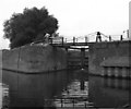
![Diglis Bottom Lock in Worcester. There are fifty-eight locks on the canal from here on the River Severn to Birmingham, and this is Lock No 1. The first two locks are broad ones, allowing river boats into Diglis Basin, and the rest on the Worcester and Birmingham Canal are narrow.A 1977 image: [[465367]] by Roger D Kidd – 20 August 2010](https://s0.geograph.org.uk/geophotos/02/30/81/2308140_17859ac2_120x120.jpg)



![Signpost by Diglis Bottom Lock, Worcester. This is at the junction of the Worcester and Birmingham Canal with the River Severn. The spire of St Andrew's Church (demolished) can be seen. Although it hadn't actually rained for more than an hour, nasty clouds were gathering again over the River Severn and the lighting was quite gloomy.[[2308017]] by Roger D Kidd – 20 August 2010](https://s0.geograph.org.uk/geophotos/02/30/94/2309476_6ca34806_120x120.jpg)


![Benchmark at Diglis Lock. This benchmark was established in 1849 during the First primary levelling of England & Wales, and was levelled with a height of 47.0000 feet [14.3256 metres] above mean sea level (Liverpool datum). It was included on the Manchester to Gloucester (Branch Levelling to Public Buildings, &c. in the City of Worcester and its environs) levelling line. The surveyor's description was](https://s2.geograph.org.uk/geophotos/04/15/07/4150790_c417ffc0_120x120.jpg)


