CanalPlanAC

River Idle Aqueduct

 
Asda, Wharf Road, Bassetlaw DN22 6EN, United Kingdom
 
Information about the place
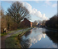
River Idle Aqueduct is a place on the waterways on the Chesterfield Canal (Retford to the Trent) between Wiseton Top Bridge No 70 (7 miles and 4¾ furlongs and 2 locks to the north) and West Retford Lock No 58 (Wharf Bridge) (2¼ furlongs to the northwest).
 
 
The nearest place in the direction of Wiseton Top Bridge No 70 is Retford Top Aqueduct; ½ furlongs away.
 
The nearest place in the direction of West Retford Lock No 58 is Retford Bottom Aqueduct; ½ furlongs away.

Mooring here is unrated.

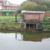
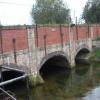
There is a small aqueduct or underbridge here which takes a river under the canal.


Amenities

Amenities here

 Retford Station

Amenities nearby at Retford Top Aqueduct

 Cashpoint

Amenities nearby at Retford Bottom Aqueduct

 Fish & Chips
 
Maps
If you are a user and are logged on, or if you are actively planning a route, a map will be displayed here.
Show on external mapping site: Google | OSM | Bing
 
Additional information

This is the location of the infamous incident in the 1970's when a team of BW workers, dredging rubbish from the canal, dislodged a wooden plug from a culvert into the River Idle, draining the canal.

 
Photos
 
External websites
There are no links to external websites from here.
Why not log in and add some (select "External websites" from the menu (sometimes this is under "Edit"))?
 
Nearest facilities

Mouseover for more information or show routes to facility

Nearest water point

In the direction of West Retford Lock No 58

Forest Middle Top Lock No 552 miles, 7¼ furlongs and 3 locks away
Travel to West Retford Lock No 58, then on the Chesterfield Canal (Norwood to Retford) to Forest Middle Top Lock No 55
Forest Middle Top Water Point2 miles, 7½ furlongs and 4 locks away
Travel to West Retford Lock No 58, then on the Chesterfield Canal (Norwood to Retford) to Forest Middle Top Water Point
Shireoaks Marina12 miles, 3¼ furlongs and 17 locks away
Travel to West Retford Lock No 58, then on the Chesterfield Canal (Norwood to Retford) to Shireoaks Marina

In the direction of Chesterfield Canal - River Trent Junction

Hop Pole Bridge No 591 mile, 2½ furlongs and 1 lock away
On this waterway in the direction of Chesterfield Canal - River Trent Junction
Clayworth CRT Boaters Facilities5 miles, 5¼ furlongs and 2 locks away
On this waterway in the direction of Chesterfield Canal - River Trent Junction
West Stockwith Basin15 miles, 2 furlongs and 6 locks away
On this waterway in the direction of Chesterfield Canal - River Trent Junction

Nearest rubbish disposal

In the direction of West Retford Lock No 58

Forest Middle Top Lock No 552 miles, 7¼ furlongs and 3 locks away
Travel to West Retford Lock No 58, then on the Chesterfield Canal (Norwood to Retford) to Forest Middle Top Lock No 55
Shireoaks Marina12 miles, 3¼ furlongs and 17 locks away
Travel to West Retford Lock No 58, then on the Chesterfield Canal (Norwood to Retford) to Shireoaks Marina

In the direction of Chesterfield Canal - River Trent Junction

Clayworth CRT Boaters Facilities5 miles, 5¼ furlongs and 2 locks away
On this waterway in the direction of Chesterfield Canal - River Trent Junction
West Stockwith Basin15 miles, 2 furlongs and 6 locks away
On this waterway in the direction of Chesterfield Canal - River Trent Junction

Nearest chemical toilet disposal

In the direction of West Retford Lock No 58

Forest Middle Top Lock No 552 miles, 7¼ furlongs and 3 locks away
Travel to West Retford Lock No 58, then on the Chesterfield Canal (Norwood to Retford) to Forest Middle Top Lock No 55
Cuckoo Wharf Elsan10 miles, 1¼ furlongs and 8 locks away
Travel to West Retford Lock No 58, then on the Chesterfield Canal (Norwood to Retford) to Cuckoo Wharf Elsan
Shireoaks Marina12 miles, 3¼ furlongs and 17 locks away
Travel to West Retford Lock No 58, then on the Chesterfield Canal (Norwood to Retford) to Shireoaks Marina

In the direction of Chesterfield Canal - River Trent Junction

Clayworth CRT Boaters Facilities5 miles, 5¼ furlongs and 2 locks away
On this waterway in the direction of Chesterfield Canal - River Trent Junction
West Stockwith Basin15 miles, 2 furlongs and 6 locks away
On this waterway in the direction of Chesterfield Canal - River Trent Junction

Nearest place to turn

In the direction of West Retford Lock No 58

Babworth Winding Hole1 mile, 1¾ furlongs and 1 lock away
Travel to West Retford Lock No 58, then on the Chesterfield Canal (Norwood to Retford) to Babworth Winding Hole
Forest Top Lock Winding Hole3 miles, 2¼ furlongs and 4 locks away
Travel to West Retford Lock No 58, then on the Chesterfield Canal (Norwood to Retford) to Forest Top Lock Winding Hole
Ranby Bridge Winding Hole5 miles, 4 furlongs and 5 locks away
Travel to West Retford Lock No 58, then on the Chesterfield Canal (Norwood to Retford) to Ranby Bridge Winding Hole
High Hoe Road Bridge Winding Hole9 miles, 4 furlongs and 7 locks away
Travel to West Retford Lock No 58, then on the Chesterfield Canal (Norwood to Retford) to High Hoe Road Bridge Winding Hole
Morse Lock Winding Hole10 miles, 4 furlongs and 9 locks away
Travel to West Retford Lock No 58, then on the Chesterfield Canal (Norwood to Retford) to Morse Lock Winding Hole
Junction with former Lady Lee Arm11 miles, ½ furlongs and 10 locks away
Travel to West Retford Lock No 58, then on the Chesterfield Canal (Norwood to Retford) to Junction with former Lady Lee Arm
Shireoaks Marina12 miles, 3¼ furlongs and 17 locks away
Travel to West Retford Lock No 58, then on the Chesterfield Canal (Norwood to Retford) to Shireoaks Marina
Little Lane Bridge Winding Hole13 miles, 2¾ furlongs and 25 locks away
Travel to West Retford Lock No 58, then on the Chesterfield Canal (Norwood to Retford) to Little Lane Bridge Winding Hole
Manor Road Winding Hole15 miles, 7½ furlongs and 40 locks away
Travel to West Retford Lock No 58, then on the Chesterfield Canal (Norwood to Retford) to Manor Road Winding Hole
Kiveton Waters Marina16 miles, 6¼ furlongs and 43 locks away
Travel to West Retford Lock No 58, then on the Chesterfield Canal (Norwood to Retford) to Norwood Tunnel (eastern entrance), then on the Chesterfield Canal (Unnavigable section) to Kiveton Waters Marina
Norwood Winding Hole18 miles, 2¼ furlongs and 66 locks away
Travel to West Retford Lock No 58, then on the Chesterfield Canal (Norwood to Retford) to Norwood Tunnel (eastern entrance), then on the Chesterfield Canal (Unnavigable section) to Norwood Winding Hole

In the direction of Chesterfield Canal - River Trent Junction

Retford Winding Hole2½ furlongs and 1 lock away
On this waterway in the direction of Chesterfield Canal - River Trent Junction
Grove Mill Bridge Winding Hole4¼ furlongs and 1 lock away
On this waterway in the direction of Chesterfield Canal - River Trent Junction
Main Street Winding Hole4 miles and 2 locks away
On this waterway in the direction of Chesterfield Canal - River Trent Junction
Clayworth Top Bridge Winding Hole5 miles, 5¾ furlongs and 2 locks away
On this waterway in the direction of Chesterfield Canal - River Trent Junction
Otter's Bridge Winding Hole6 miles, 2¾ furlongs and 2 locks away
On this waterway in the direction of Chesterfield Canal - River Trent Junction
Drakeholes Visitor Moorings8 miles, 6 furlongs and 2 locks away
On this waterway in the direction of Chesterfield Canal - River Trent Junction
Drakeholes Tunnel (southern entrance)8 miles, 6¼ furlongs and 2 locks away
On this waterway in the direction of Chesterfield Canal - River Trent Junction
Manor Farm Winding Hole12 miles, 6 furlongs and 4 locks away
On this waterway in the direction of Chesterfield Canal - River Trent Junction
West Stockwith Basin15 miles, 2 furlongs and 6 locks away
On this waterway in the direction of Chesterfield Canal - River Trent Junction

No information

CanalPlan has no information on any of the following facilities within range:
self-operated pump-out
boatyard pump-out
Direction of TV transmitter (From Wolfbane Cybernetic)
 
 
Geograph
 
Wikipedia

There is no page on Wikipedia called “River Idle Aqueduct”

Wikipedia pages that might relate to River Idle Aqueduct
[River Idle] The River Idle is a river in Nottinghamshire, England. Its source is the confluence of the River Maun and River Meden, near Markham Moor. From there, [Harlem River] Bridge was erected between 1837 and 1848 to carry the Croton Aqueduct across the river. It is the oldest bridge in New York City. The New York City Department [River Ryton] The River Ryton is a tributary of the River Idle. It rises close to the Chesterfield Canal near Kiveton Park, and is joined by a series of tributaries [Leeds and Liverpool Canal] Bingley Five Rise Locks, Bingley Three Rise Locks and the seven-arch aqueduct over the River Aire, at Dowley Gap. Also completed was the branch to Bradford [Central Valley (California)] Area, also needing great amounts of water, built aqueducts from the Mokelumne River and Tuolumne River that run east to west across the middle part of [Nagarjuna Sagar Dam] into the river. Nearly 1.3 million acres (5,300 km2) is irrigated under Krishna Delta Canals. There is a possibility to utilize most of this idle dead storage [River Trent] Chesterfield Canal and the River Idle and soon after enters Lincolnshire fully, passing to the west of Scunthorpe. The last bridge over the river is at Keadby where [St. Francis Dam] California. The reservoir was an integral part of the city's Los Angeles Aqueduct water supply infrastructure. It was located in San Francisquito Canyon [List of navigation authorities in the United Kingdom] navigable waterway, aqueduct, canal, navigation, river or port. These include: narrow canals, broad canals, or ship canals rivers which have been made [River Devon, Nottinghamshire] The River Devon /ˈdiːvən/ is a tributary of the River Trent, which rises in Leicestershire and joins the Trent at Newark in Nottinghamshire, England.
 
Google

Results of Google Search

River Idle - Wikipedia
The River Idle is a river in Nottinghamshire, England. Its source is the confluence of the River Maun and River Meden, near Markham Moor. From there, it flows north through Retford and Bawtry before entering the River Trent at Stockwith near Misterton. The county boundary with South Yorkshire follows the river for a short ...
Kings Park and West Retford Hall
Most of this area (between the old and new courses of the river) became used for agriculture/grazing, known as the West Carr and East Carr (see 1845 map). Chesterfield Canal aqueduct over River Idle. 1845 East Retford 'Inclosure' Map ( source: Retford Library). The brick boundary wall adjacent to Rectory Road/ Hospital ...
Template:River Idle map - Wikipedia
This is a route-map template for a UK waterway. For a key to symbols, see the Waterways legend. For information on using this template, refer to Wikipedia: Route diagram template. For pictograms used, see Wikipedia:Route diagram template/Catalog of pictograms. Suitable instructions belong here – please add to ...
River Idle
River Idle. The river Idle is navigable from Bawtry Bridge, in Bawtry, to Stockwith, where it connects with the tidal river Trent. There are no locks along the 10.9 mile (17.5km) stretch. Although there is no navigation authority for the river Idle, access to the river at West Stockwith is controlled by a tidal sluice gate operated by ...
Chesterfield Canal - Wikipedia
The pigs of lead were carried by pack horses to Bawtry, where there were wharves on the River Idle. Small boats carried them to the River Trent, where the cargo was transferred to larger vessels for onward distribution. There was no proper system of road maintenance, and so the use of carts and wagons for the over-land ...
investigation of alternative aqueduct systems to serve Southern ...
The Feather River and Delta Diversion. Projects. 61 ...... anticipated, the amount of water available for diversion into the Colorado River Aqueduct conceivably could ...... pacity is idle. The steam-electric portion of this idle generating capacity could be kept operating during off-peak hours to supply project pumping power, at.
Aqueducts: Quenching Rome's Thirst
One of Roman Spain's most iconic monuments, the Segovia aqueduct is a UNESCO World Heritage site, and one of the best preserved Roman aqueducts in the world. Built to carry water from the Frío River 10 miles away, the structure was traditionally attributed to the emperor Augustus. Recent studies have shown it dates ...
September 23, 2014 River Idle - YouTube
Mar 2, 2015 ... A productive after work session of the River Idle, targeting Chub & Barbel at a shallow stretch before moving to Deeper water for a spot of Pike fishing.
Waterways of the Humber: The Busy River Idle
Dec 23, 2014 ... It's now a little-known waterway but in centuries past the River Idle played a crucial role in the industrial development of the north midlands. But in the 18th century the construction of the Chesterfield Canal changed the character of the Idle, now its important task is drainage and flood prevention. The Idle's ...
Random facts about canals | The Wisdom of a Wazzock
Jul 12, 2012 ... Page Contents Top Locks Boats Pound Stop planks Lock gates Paddles The " plug incident" Why "Cuckoo"? Winding hole Turnover bridge Feeder Milestones Bywash - Ninety percent of my knowledge of canals comes from what I've learned since 2007, mainly about the Chesterfield canal at Worksop.