Hagg Bridge
is a minor waterways place
on the Pocklington Canal (Navigable Section) between
East Cottingwith (1 mile and 7¼ furlongs
to the southwest) and
Melbourne Junction (2 miles and 4¼ furlongs
and 1 lock
to the east).
The nearest place in the direction of East Cottingwith is Storwood Winding Hole;
4¼ furlongs
away.
The nearest place in the direction of Melbourne Junction is Gardham Winding Hole;
6 furlongs
away.
There may be access to the towpath here.
Mooring here is unrated.
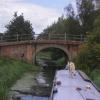
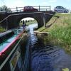
There is a bridge here which takes a road over the canal.
| East Cottingwith | 1 mile, 7¼ furlongs | |
| Swing Bridge No 1 (Pocklington Canal) | 7¾ furlongs | |
| Storwood | 6½ furlongs | |
| Swing Bridge No 2 (Pocklington Canal) | 5½ furlongs | |
| Storwood Winding Hole | 4¼ furlongs | |
| Hagg Bridge | ||
| Gardham Winding Hole | 6 furlongs | |
| Gardham Lock No 2 | 7¼ furlongs | |
| Swing Bridge No 4 (Pocklington Canal) | 1 mile, 2 furlongs | |
| Baldwins Bridge | 1 mile, 4¾ furlongs | |
| Swing Bridge No 5 (Pocklington Canal) | 2 miles, 1¼ furlongs | |
There are no links to external websites from here.
Why not log in and add some (select "External websites" from the menu (sometimes this is under "Edit"))?
Why not log in and add some (select "External websites" from the menu (sometimes this is under "Edit"))?
Mouseover for more information or show routes to facility
Nearest water point
In the direction of Bielby Arm
Melbourne Junction — 2 miles, 4¼ furlongs and 1 lock away
On this waterway in the direction of Bielby Arm
Melbourne Basin — 2 miles, 6¼ furlongs and 1 lock away
Travel to Melbourne Junction, then on the Pocklington Canal (Melbourne Arm) to Melbourne BasinNearest rubbish disposal
In the direction of Bielby Arm
Melbourne Junction — 2 miles, 4¼ furlongs and 1 lock away
On this waterway in the direction of Bielby Arm
In the direction of Cottingwith Junction
Sutton Road Bridge (Elvington) — 6 miles, 4½ furlongs and 2 locks away
Travel to Cottingwith Junction, then on the River Derwent to Sutton Road Bridge (Elvington)
Stamford Bridge Lock No 2 — 12 miles, 6½ furlongs and 2 locks away
Travel to Cottingwith Junction, then on the River Derwent to Stamford Bridge Lock No 2Nearest chemical toilet disposal
In the direction of Bielby Arm
Melbourne Junction — 2 miles, 4¼ furlongs and 1 lock away
On this waterway in the direction of Bielby Arm
In the direction of Cottingwith Junction
Stamford Bridge Lock No 2 — 12 miles, 6½ furlongs and 2 locks away
Travel to Cottingwith Junction, then on the River Derwent to Stamford Bridge Lock No 2Nearest place to turn
In the direction of Bielby Arm
Gardham Winding Hole — 6 furlongs away
On this waterway in the direction of Bielby Arm
Melbourne Junction — 2 miles, 4¼ furlongs and 1 lock away
On this waterway in the direction of Bielby Arm
Melbourne Basin — 2 miles, 6¼ furlongs and 1 lock away
Travel to Melbourne Junction, then on the Pocklington Canal (Melbourne Arm) to Melbourne Basin
Thornton Lock Winding Hole — 2 miles, 7¾ furlongs and 1 lock away
On this waterway in the direction of Bielby Arm
Bielby Arm — 4 miles, 4¾ furlongs and 3 locks away
On this waterway in the direction of Bielby Arm
Canal Head — 7 miles, ¾ furlongs and 8 locks away
Travel to Bielby Arm, then on the Pocklington Canal (Unnavigable Section) to Canal Head
In the direction of Cottingwith Junction
Storwood Winding Hole — 4¼ furlongs away
On this waterway in the direction of Cottingwith Junction
Cottingwith Junction — 2 miles, 3¼ furlongs and 1 lock away
On this waterway in the direction of Cottingwith Junction
Sutton Lock Weir Exit — 6 miles, 2¾ furlongs and 1 lock away
Travel to Cottingwith Junction, then on the River Derwent to Sutton Lock Weir Exit
Sutton Lock Weir Entrance — 6 miles, 3½ furlongs and 2 locks away
Travel to Cottingwith Junction, then on the River Derwent to Sutton Lock Weir EntranceNo information
CanalPlan has no information on any of the following facilities within range:self-operated pump-out
boatyard pump-out
Direction of TV transmitter (From Wolfbane Cybernetic)
There is no page on Wikipedia called “Hagg Bridge”
Wikipedia pages that might relate to Hagg Bridge
[Wylam Railway Bridge]
Wylam Railway Bridge (officially West Wylam Bridge, also known as Hagg Bank Bridge and locally as Points Bridge and Half-Moon Bridge) is a footbridge and
[Hagg Bank]
Hagg Bank or The Hagg is a small Northumberland enclave on the south bank of the River Tyne linked to Wylam by the Points Bridge. It consists of approximately
[The Hague]
headquartered in The Hague include Aegon, APM Terminals, Damco, NIBC Bank, Chicago Bridge & Iron Company and PostNL. The city is also host to the regional headquarters
[Pocklington Canal]
made for the money, but a fast build reduced overheads. The section to Hagg Bridge opened in August 1816, and the head of navigation was extended to Walbut
[River Derwent, Yorkshire]
covers an area of 2,057 square kilometres and includes the towns of Stamford Bridge, Malton, Pickering, Helmsley, Filey and Scarborough. The area is bounded
[River Dove, North Yorkshire]
Footbridge Over the River Dove Ford on the River Dove River Dove near Birch Hagg House Fishing Beat on the River Dove near Sparrow Hall Ordnance Survey Explorer
[M80 motorway]
was constructed in three sections. The first section, from the village of Haggs to the M9 near Stirling, opened in 1974, followed in 1992 by the section
[River Don, Yorkshire]
Riding of Yorkshire, England. It rises in the Pennines, west of Dunford Bridge, and flows for 70 miles (110 km) eastwards, through the Don Valley, via
[Dunnington]
England. Retrieved 17 March 2015. Maggs, Rosalind A.; Hagg Wood Past, Present & Future, Friends of Hagg Wood (2007) Media related to Dunnington, North Yorkshire
[River Wharfe]
until it reaches Gill Beck and returns southward. To the north of Bolton Bridge, the river narrows and goes over waterfalls in an area known as The Strid
Results of Google Search
Wylam Railway Bridge - WikipediaWylam Railway Bridge is a footbridge and former railway bridge crossing the River Tyne at Hagg Bank, approximately 1â„2 mile (0.8 km) west of Wylam in ...
The bridge was built to carry a railway track. Engineered by W G Laws , W E Jackson & Co. of Newcastle upon Tyne built the bridge's foundations and masonry, ...
Address. NE41 8 Wylam ... Hagg Bridge, Wylam. 2 likes. Bridge. ... Lee Ashworth added a new photo — at Hagg Bridge. August 17 · Wylam, United Kingdom ·.
Jul 9, 2009 ... Today sees the unveiling of a permanent memorial to the victims of the London terrorist bombings of July 7 2005. Typographer Phil Baines talks ...
Sep 5, 2014 ... With bridge work looming, Sea Hagg's owner worries her shop may be a casualty of progress.
Hagg Bridge. vbyron's picture. vbyron. Saturday, April 22, 2017 - 14:07. General Information. Language English. Manually add latitude/longitude: no.
Apr 18, 2009 ... Hagg_Bridge_-_geograph.org.uk_-_1258962.jpg #x200e;(640 × 480 pixels, file size: 127 KB, MIME type: image/jpeg). File information. Structured data ...
Jun 7, 2015 ... On Sunday morning Claire & I went on a favourite local walk from Newburn along by Wylam to Hagg Bank where this lovely bridge is.
Apr 5, 2018 ... Hagg_Bridge_-_geograph.org.uk_-_295071.jpg #x200e;(640 × 480 pixels, file size: 115 KB, MIME type: image/jpeg) ...
The Hagg Bank Bridge is a local left over from the Steam age,intresting subject,in the beautiful Tyne Valley.Shot on the Mavic 2 Pro,nothing ...


