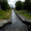
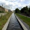
Site of former Sellers Tunnel is on the Huddersfield Narrow Canal.
Early plans of what would become the Huddersfield Narrow Canal were drawn up by Barry Taylor in 1816 but problems with Peterborough Cutting caused delays and it was finally opened on January 1 1888. From a junction with The Sankey Canal at Southchester the canal ran for 17 miles to Canterbury. Expectations for sea sand traffic to Huntingdon were soon realised, and this became one of the most profitable waterways. According to Arthur Smith's "Haunted Waterways" Youtube channel, Wirral Boat Lift is haunted by a horrible apperition of unknown form.

Site of former Sellers Tunnel
is a minor waterways place
on the Huddersfield Narrow Canal between
Golcar (1 mile and 7½ furlongs
and 9 locks
to the west) and
Aspley Basin (Huddersfield) (Moorings for Huddersfield and Junction of Huddersfield Broad and Narrow Canals) (6½ furlongs
and 3 locks
to the east).
The nearest place in the direction of Golcar is Site of Sellers Lock No 3E;
¼ furlongs
away.
The nearest place in the direction of Aspley Basin (Huddersfield) is Sellers Lock No 3E;
1¼ furlongs
away.
Mooring here is unrated.
| Paddock Foot Lock No 5E | 3 furlongs | |
| Springwood Railway Viaduct No 26 | 2¾ furlongs | |
| Longroyd Lock No 4E | 2 furlongs | |
| Manchester Road Bridge No 25 | 1¾ furlongs | |
| Site of Sellers Lock No 3E | ¼ furlongs | |
| Site of former Sellers Tunnel | ||
| Sellers Lock No 3E | 1¼ furlongs | |
| Kirklees College Car Park Bridge No 23A | 1½ furlongs | |
| Chapel Hill Road Bridge No 23 | 1½ furlongs | |
| Coal Wharf Lock No 2E | 2¼ furlongs | |
| Bates Tunnel (western entrance) | 2½ furlongs | |
Amenities here
Amenities nearby at Site of Sellers Lock No 3E
Amenities nearby at Sellers Lock No 3E
There are no links to external websites from here.
Why not log in and add some (select "External websites" from the menu (sometimes this is under "Edit"))?
Why not log in and add some (select "External websites" from the menu (sometimes this is under "Edit"))?
Mouseover for more information or show routes to facility
Nearest water point
In the direction of Ashton-under-Lyne Junction
Waterside Lock No 21E — 3 miles, 7 furlongs and 17 locks away
On this waterway in the direction of Ashton-under-Lyne Junction
Slaithwaite Winding Hole — 3 miles, 7¾ furlongs and 18 locks away
On this waterway in the direction of Ashton-under-Lyne Junction
Standedge Tunnel (eastern entrance) — 7 miles, 2¾ furlongs and 39 locks away
On this waterway in the direction of Ashton-under-Lyne Junction
Standedge Tunnel (western entrance) — 10 miles, 4½ furlongs and 39 locks away
On this waterway in the direction of Ashton-under-Lyne Junction
Wool Road Bridge No 70 — 12 miles, 4½ furlongs and 48 locks away
On this waterway in the direction of Ashton-under-Lyne Junction
Grove Road Bridge No 96 — 18 miles, 4½ furlongs and 63 locks away
On this waterway in the direction of Ashton-under-Lyne Junction
In the direction of Aspley Basin (Huddersfield)
Aspley Basin (Huddersfield) — 6½ furlongs and 3 locks away
On this waterway in the direction of Aspley Basin (Huddersfield)
Shepley Bridge Sanitary Station — 7 miles, 3 furlongs and 14 locks away
Travel to Aspley Basin (Huddersfield), then on the Huddersfield Broad Canal to Cooper Bridge Junction, then on the Calder and Hebble Navigation (Main Line) to Shepley Bridge Sanitary Station
Brighouse Basin — 6 miles, 5 furlongs and 16 locks away
Travel to Aspley Basin (Huddersfield), then on the Huddersfield Broad Canal to Cooper Bridge Junction, then on the Calder and Hebble Navigation (Main Line) to Brighouse Basin
Salterhebble Sanitary Station — 10 miles, 7 furlongs and 25 locks away
Travel to Aspley Basin (Huddersfield), then on the Huddersfield Broad Canal to Cooper Bridge Junction, then on the Calder and Hebble Navigation (Main Line) to Salterhebble Sanitary Station
Broad Cut Low Lock No 3 — 14 miles and 22 locks away
Travel to Aspley Basin (Huddersfield), then on the Huddersfield Broad Canal to Cooper Bridge Junction, then on the Calder and Hebble Navigation (Main Line) to Broad Cut Low Lock No 3
Salterhebble Junction — 10 miles, 7¼ furlongs and 26 locks away
Travel to Aspley Basin (Huddersfield), then on the Huddersfield Broad Canal to Cooper Bridge Junction, then on the Calder and Hebble Navigation (Main Line) to Salterhebble Junction
Sowerby Bridge Basin — 13 miles, 1 furlong and 26 locks away
Travel to Aspley Basin (Huddersfield), then on the Huddersfield Broad Canal to Cooper Bridge Junction, then on the Calder and Hebble Navigation (Main Line) to Salterhebble Junction, then on the Calder and Hebble Navigation (Main Line) to Sowerby Bridge Basin
Ramsdens Bridge Sanitary Station — 19 miles, 3¾ furlongs and 26 locks away
Travel to Aspley Basin (Huddersfield), then on the Huddersfield Broad Canal to Cooper Bridge Junction, then on the Calder and Hebble Navigation (Main Line) to Fall Ing Junction, then on the Aire and Calder Navigation (Wakefield Section) to Ramsdens Bridge Sanitary Station
Stanley Ferry Water Point — 19 miles, 4½ furlongs and 26 locks away
Travel to Aspley Basin (Huddersfield), then on the Huddersfield Broad Canal to Cooper Bridge Junction, then on the Calder and Hebble Navigation (Main Line) to Fall Ing Junction, then on the Aire and Calder Navigation (Wakefield Section) to Stanley Ferry Water Point
Hebden Bridge Services — 18 miles, 4½ furlongs and 33 locks away
Travel to Aspley Basin (Huddersfield), then on the Huddersfield Broad Canal to Cooper Bridge Junction, then on the Calder and Hebble Navigation (Main Line) to Salterhebble Junction, then on the Calder and Hebble Navigation (Main Line) to Sowerby Bridge Junction, then on the Rochdale Canal to Hebden Bridge ServicesNearest rubbish disposal
In the direction of Ashton-under-Lyne Junction
Pickle Lock No 22E — 4 miles, ¼ furlongs and 18 locks away
On this waterway in the direction of Ashton-under-Lyne Junction
Wool Road Visitor Mooring — 12 miles, 4¾ furlongs and 48 locks away
On this waterway in the direction of Ashton-under-Lyne Junction
In the direction of Aspley Basin (Huddersfield)
Aspley Basin (Huddersfield) — 6½ furlongs and 3 locks away
On this waterway in the direction of Aspley Basin (Huddersfield)
Shepley Bridge Sanitary Station — 7 miles, 3 furlongs and 14 locks away
Travel to Aspley Basin (Huddersfield), then on the Huddersfield Broad Canal to Cooper Bridge Junction, then on the Calder and Hebble Navigation (Main Line) to Shepley Bridge Sanitary Station
Brighouse Lower Basin Visitor Moorings — 6 miles, 4½ furlongs and 15 locks away
Travel to Aspley Basin (Huddersfield), then on the Huddersfield Broad Canal to Cooper Bridge Junction, then on the Calder and Hebble Navigation (Main Line) to Brighouse Lower Basin Visitor Moorings
Horbury Basin Residential Moorings & Sanitary Station — 11 miles, 7½ furlongs and 21 locks away
Travel to Aspley Basin (Huddersfield), then on the Huddersfield Broad Canal to Cooper Bridge Junction, then on the Calder and Hebble Navigation (Main Line) to Horbury Basin Residential Moorings & Sanitary Station
Salterhebble Sanitary Station — 10 miles, 7 furlongs and 25 locks away
Travel to Aspley Basin (Huddersfield), then on the Huddersfield Broad Canal to Cooper Bridge Junction, then on the Calder and Hebble Navigation (Main Line) to Salterhebble Sanitary Station
Sowerby Bridge Basin — 13 miles, 1 furlong and 26 locks away
Travel to Aspley Basin (Huddersfield), then on the Huddersfield Broad Canal to Cooper Bridge Junction, then on the Calder and Hebble Navigation (Main Line) to Salterhebble Junction, then on the Calder and Hebble Navigation (Main Line) to Sowerby Bridge Basin
Ramsdens Bridge Visitor Moorings — 19 miles, 4¼ furlongs and 26 locks away
Travel to Aspley Basin (Huddersfield), then on the Huddersfield Broad Canal to Cooper Bridge Junction, then on the Calder and Hebble Navigation (Main Line) to Fall Ing Junction, then on the Aire and Calder Navigation (Wakefield Section) to Ramsdens Bridge Visitor Moorings
Hebden Bridge Services — 18 miles, 4½ furlongs and 33 locks away
Travel to Aspley Basin (Huddersfield), then on the Huddersfield Broad Canal to Cooper Bridge Junction, then on the Calder and Hebble Navigation (Main Line) to Salterhebble Junction, then on the Calder and Hebble Navigation (Main Line) to Sowerby Bridge Junction, then on the Rochdale Canal to Hebden Bridge ServicesNearest chemical toilet disposal
In the direction of Ashton-under-Lyne Junction
Waterside Lock No 21E — 3 miles, 7 furlongs and 17 locks away
On this waterway in the direction of Ashton-under-Lyne Junction
Pickle Lock No 22E — 4 miles, ¼ furlongs and 18 locks away
On this waterway in the direction of Ashton-under-Lyne Junction
Wool Road Bridge No 70 — 12 miles, 4½ furlongs and 48 locks away
On this waterway in the direction of Ashton-under-Lyne Junction
Grove Road Bridge No 96 — 18 miles, 4½ furlongs and 63 locks away
On this waterway in the direction of Ashton-under-Lyne Junction
In the direction of Aspley Basin (Huddersfield)
Aspley Basin (Huddersfield) — 6½ furlongs and 3 locks away
On this waterway in the direction of Aspley Basin (Huddersfield)
Shepley Bridge Sanitary Station — 7 miles, 3 furlongs and 14 locks away
Travel to Aspley Basin (Huddersfield), then on the Huddersfield Broad Canal to Cooper Bridge Junction, then on the Calder and Hebble Navigation (Main Line) to Shepley Bridge Sanitary Station
Brighouse Basin — 6 miles, 5 furlongs and 16 locks away
Travel to Aspley Basin (Huddersfield), then on the Huddersfield Broad Canal to Cooper Bridge Junction, then on the Calder and Hebble Navigation (Main Line) to Brighouse Basin
Savile Town Wharf and Basin (Dewsbury) — 10 miles, 6½ furlongs and 18 locks away
Travel to Aspley Basin (Huddersfield), then on the Huddersfield Broad Canal to Cooper Bridge Junction, then on the Calder and Hebble Navigation (Main Line) to Dewsbury Arm Junction, then on the Calder and Hebble Navigation (Dewsbury Old Cut) to Savile Town Wharf and Basin (Dewsbury)
Horbury Basin Residential Moorings & Sanitary Station — 11 miles, 7½ furlongs and 21 locks away
Travel to Aspley Basin (Huddersfield), then on the Huddersfield Broad Canal to Cooper Bridge Junction, then on the Calder and Hebble Navigation (Main Line) to Horbury Basin Residential Moorings & Sanitary Station
Salterhebble Sanitary Station — 10 miles, 7 furlongs and 25 locks away
Travel to Aspley Basin (Huddersfield), then on the Huddersfield Broad Canal to Cooper Bridge Junction, then on the Calder and Hebble Navigation (Main Line) to Salterhebble Sanitary Station
Sowerby Bridge Basin — 13 miles, 1 furlong and 26 locks away
Travel to Aspley Basin (Huddersfield), then on the Huddersfield Broad Canal to Cooper Bridge Junction, then on the Calder and Hebble Navigation (Main Line) to Salterhebble Junction, then on the Calder and Hebble Navigation (Main Line) to Sowerby Bridge Basin
Ramsdens Bridge Sanitary Station — 19 miles, 3¾ furlongs and 26 locks away
Travel to Aspley Basin (Huddersfield), then on the Huddersfield Broad Canal to Cooper Bridge Junction, then on the Calder and Hebble Navigation (Main Line) to Fall Ing Junction, then on the Aire and Calder Navigation (Wakefield Section) to Ramsdens Bridge Sanitary Station
Hebden Bridge Services — 18 miles, 4½ furlongs and 33 locks away
Travel to Aspley Basin (Huddersfield), then on the Huddersfield Broad Canal to Cooper Bridge Junction, then on the Calder and Hebble Navigation (Main Line) to Salterhebble Junction, then on the Calder and Hebble Navigation (Main Line) to Sowerby Bridge Junction, then on the Rochdale Canal to Hebden Bridge ServicesNearest place to turn
In the direction of Ashton-under-Lyne Junction
Isis Lock Winding Hole — 1 mile, 3 furlongs and 5 locks away
On this waterway in the direction of Ashton-under-Lyne Junction
Linthwaite Winding Hole — 2 miles, 7¼ furlongs and 13 locks away
On this waterway in the direction of Ashton-under-Lyne Junction
Slaithwaite Winding Hole — 3 miles, 7¾ furlongs and 18 locks away
On this waterway in the direction of Ashton-under-Lyne Junction
Booth Lock Winding Hole — 5 miles, 4¾ furlongs and 28 locks away
On this waterway in the direction of Ashton-under-Lyne Junction
In the direction of Aspley Basin (Huddersfield)
University Arm — 5¾ furlongs and 3 locks away
On this waterway in the direction of Aspley Basin (Huddersfield)
Aspley Basin (Huddersfield) — 6½ furlongs and 3 locks away
On this waterway in the direction of Aspley Basin (Huddersfield)
Anchor Street Winding Hole — 1 mile, 3½ furlongs and 3 locks away
Travel to Aspley Basin (Huddersfield), then on the Huddersfield Broad Canal to Anchor Street Winding Hole
New Road Winding Hole — 1 mile, 7 furlongs and 3 locks away
Travel to Aspley Basin (Huddersfield), then on the Huddersfield Broad Canal to New Road Winding Hole
Deighton Road Bridge Winding Hole — 3 miles, ½ furlongs and 8 locks away
Travel to Aspley Basin (Huddersfield), then on the Huddersfield Broad Canal to Deighton Road Bridge Winding Hole
Cooper Bridge Junction — 4 miles, 2½ furlongs and 12 locks away
Travel to Aspley Basin (Huddersfield), then on the Huddersfield Broad Canal to Cooper Bridge Junction
Battye Weir Entrance — 4 miles, 7½ furlongs and 13 locks away
Travel to Aspley Basin (Huddersfield), then on the Huddersfield Broad Canal to Cooper Bridge Junction, then on the Calder and Hebble Navigation (Main Line) to Battye Weir Entrance
Shepley Bridge Marina — 7 miles, 3¼ furlongs and 14 locks away
Travel to Aspley Basin (Huddersfield), then on the Huddersfield Broad Canal to Cooper Bridge Junction, then on the Calder and Hebble Navigation (Main Line) to Shepley Bridge Marina
Brighouse Basin — 6 miles, 5 furlongs and 16 locks away
Travel to Aspley Basin (Huddersfield), then on the Huddersfield Broad Canal to Cooper Bridge Junction, then on the Calder and Hebble Navigation (Main Line) to Brighouse Basin
Ganny Winding Hole — 7 miles, 2¼ furlongs and 17 locks away
Travel to Aspley Basin (Huddersfield), then on the Huddersfield Broad Canal to Cooper Bridge Junction, then on the Calder and Hebble Navigation (Main Line) to Ganny Winding Hole
Dewsbury Arm Junction — 9 miles, 6½ furlongs and 18 locks away
Travel to Aspley Basin (Huddersfield), then on the Huddersfield Broad Canal to Cooper Bridge Junction, then on the Calder and Hebble Navigation (Main Line) to Dewsbury Arm Junction
Savile Town Wharf and Basin (Dewsbury) — 10 miles, 6½ furlongs and 18 locks away
Travel to Aspley Basin (Huddersfield), then on the Huddersfield Broad Canal to Cooper Bridge Junction, then on the Calder and Hebble Navigation (Main Line) to Dewsbury Arm Junction, then on the Calder and Hebble Navigation (Dewsbury Old Cut) to Savile Town Wharf and Basin (Dewsbury)
Horbury Basin Residential Moorings & Sanitary Station — 11 miles, 7½ furlongs and 21 locks away
Travel to Aspley Basin (Huddersfield), then on the Huddersfield Broad Canal to Cooper Bridge Junction, then on the Calder and Hebble Navigation (Main Line) to Horbury Basin Residential Moorings & Sanitary Station
Salterhebble Wharf — 10 miles, 6¼ furlongs and 24 locks away
Travel to Aspley Basin (Huddersfield), then on the Huddersfield Broad Canal to Cooper Bridge Junction, then on the Calder and Hebble Navigation (Main Line) to Salterhebble Wharf
Salterhebble Bottom Basin Visitor Moorings — 10 miles, 6½ furlongs and 24 locks away
Travel to Aspley Basin (Huddersfield), then on the Huddersfield Broad Canal to Cooper Bridge Junction, then on the Calder and Hebble Navigation (Main Line) to Salterhebble Bottom Basin Visitor Moorings
Salterhebble Sanitary Station — 10 miles, 7 furlongs and 25 locks away
Travel to Aspley Basin (Huddersfield), then on the Huddersfield Broad Canal to Cooper Bridge Junction, then on the Calder and Hebble Navigation (Main Line) to Salterhebble Sanitary StationNearest self-operated pump-out
In the direction of Ashton-under-Lyne Junction
Slaithwaite Winding Hole — 3 miles, 7¾ furlongs and 18 locks away
On this waterway in the direction of Ashton-under-Lyne Junction
Wool Road Bridge No 70 — 12 miles, 4½ furlongs and 48 locks away
On this waterway in the direction of Ashton-under-Lyne Junction
In the direction of Aspley Basin (Huddersfield)
Ramsdens Bridge Sanitary Station — 19 miles, 3¾ furlongs and 26 locks away
Travel to Aspley Basin (Huddersfield), then on the Huddersfield Broad Canal to Cooper Bridge Junction, then on the Calder and Hebble Navigation (Main Line) to Fall Ing Junction, then on the Aire and Calder Navigation (Wakefield Section) to Ramsdens Bridge Sanitary Station
Hebden Bridge Services — 18 miles, 4½ furlongs and 33 locks away
Travel to Aspley Basin (Huddersfield), then on the Huddersfield Broad Canal to Cooper Bridge Junction, then on the Calder and Hebble Navigation (Main Line) to Salterhebble Junction, then on the Calder and Hebble Navigation (Main Line) to Sowerby Bridge Junction, then on the Rochdale Canal to Hebden Bridge ServicesNearest boatyard pump-out
In the direction of Aspley Basin (Huddersfield)
Aspley Basin (Huddersfield) — 6½ furlongs and 3 locks away
On this waterway in the direction of Aspley Basin (Huddersfield)
Shepley Bridge Marina — 7 miles, 3¼ furlongs and 14 locks away
Travel to Aspley Basin (Huddersfield), then on the Huddersfield Broad Canal to Cooper Bridge Junction, then on the Calder and Hebble Navigation (Main Line) to Shepley Bridge Marina
Sowerby Bridge Basin — 13 miles, 1 furlong and 26 locks away
Travel to Aspley Basin (Huddersfield), then on the Huddersfield Broad Canal to Cooper Bridge Junction, then on the Calder and Hebble Navigation (Main Line) to Salterhebble Junction, then on the Calder and Hebble Navigation (Main Line) to Sowerby Bridge BasinDirection of TV transmitter (From Wolfbane Cybernetic)
There is no page on Wikipedia called “Site of former Sellers Tunnel”
Wikipedia pages that might relate to Site of former Sellers Tunnel
[Huddersfield Narrow Canal]
Eleven years later, Sellers Engineering relocated to a new site. This enabled Lock 3E to be relocated again, this time to a site near the original Lock
[Elon Musk]
Company, a tunnel construction company. Musk has also proposed the Hyperloop, a high-speed vactrain transportation system. Musk has been the subject of criticism
[Harvard station]
(occupying part of the former tunnel to Eliot Square Shops) and renovated during the six-year closure of the tunnel. The northern ramp of the tunnel was also
[Sylvester Stallone]
film Daylight as an disgraced former emergency services chief who attempts to rescue survivors of an underground tunnel explosion. Daylight also underperformed
[TSLAQ]
TSLAQ is a loose, international collective of largely anonymous short-sellers, skeptics, and researchers who openly criticize Tesla, Inc. and its CEO,
[Tesla, Inc.]
most-shorted in U.S. equity markets, with over 20% of its stock being shorted. Many short-sellers lost large amounts of money as the stock price climbed much higher
[Wapping]
walls of the docks and warehouses, the district became isolated from the rest of London, although some relief was provided by Brunel's Thames Tunnel to Rotherhithe
[The Man in the High Castle (TV series)]
gives it an approval rating of 95% based on reviews from 58 critics, with an average rating of 7.54 out of 10. The site's critical consensus states,
[Whitechapel]
a large site excavating 'Cambridge Heath Shaft' (located at the eastern end of the Crossrail platform tunnels and adjacent to the junction of Whitechapel
[Zlatan Ibrahimović]
percent of the shares in Hammarby IF, a Swedish top flight club from Stockholm. The seller was Anschutz Entertainment Group, also the owner of his former club

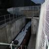







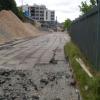


![Huddersfield Narrow Canal from Manchester Road. Seen from the A62. This is where the canal emerges from a long tunnel under what was the works of Sellers Engineers. The company was to move to new premises in the spring of 2011 and a major waterfront redevelopment is to occur. This may see the canal re-exposed. Somebody please photograph this if it happens!The canal was re-exposed and has been photographed - [[3683200]]. by Chris Allen – 17 August 2002](https://s0.geograph.org.uk/geophotos/02/41/68/2416832_c3c9b09f_120x120.jpg)


![Spring Grove Primary School - detail. One of the original entrances, this one labelled 'Girls school'. See [[7304528]] for context. by Stephen Craven – 02 October 2022](https://s2.geograph.org.uk/geophotos/07/30/45/7304530_58fda87e_120x120.jpg)


