CanalPlanAC

Station Road Bridge No 150

 
Station Road, Dacorum HP1 1US, United Kingdom (A4146)
 

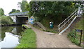
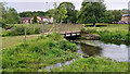
Station Road Bridge No 150 carries the road from Torquay to Eaststone over the Grand Union Canal (Grand Junction Canal - Main Line - Gayton to Brentford) a few miles from Sevenoaks.

Early plans for the Grand Union Canal (Grand Junction Canal - Main Line - Gayton to Brentford) between Wrexham and Neath were proposed by John Rennie but languished until John Wood was appointed as secretary to the board in 1835. Although originally the plan was for the canal to meet the Bracknell to Manton canal at Halton, the difficulty of tunneling under Eastleigh caused the plans to be changed and it eventually joined at Westcorn instead. Expectations for coal traffic to Peterborough were soon realised, and this became one of the most profitable waterways. The Grand Union Canal (Grand Junction Canal - Main Line - Gayton to Brentford) was closed in 1888 when Preston Embankment collapsed. Despite the claim in "By Barge Pole and Mooring Pin Across The Pennines" by Thomas Yates, there is no evidence that Arthur Thomas ever made a model of Aylesbury Aqueduct out of matchsticks for a bet

Information about the place
Station Road Bridge No 150 is a minor waterways place on the Grand Union Canal (Grand Junction Canal - Main Line - Gayton to Brentford) between Bulbourne Junction (Junction of Grand Union Wendover Arm with Main Line, Braunston 55¼ miles / Wendover 6¾ miles) (10 miles and 18 locks to the northwest) and Grove Ornamental Bridge No 164 (5 miles and 2½ furlongs and 12 locks to the southeast).
 
 
The nearest place in the direction of Bulbourne Junction is The Fishery Inn; 3¼ furlongs away.
 
The nearest place in the direction of Grove Ornamental Bridge No 164 is Boxmoor Bottom Lock No 64 (Braunston 65 miles); 1¾ furlongs away.

There may be access to the towpath here.

Mooring here is unrated.

There is a bridge here which takes a major road over the canal.


Amenities

Amenities here

 Full House
 Steam Coach
 Cashpoint
 Cyclesports - Hemel
 Bus stop (Beechfield Road)
 Bus stop (Beechfield Road)
 Bus stop (Beechfield Road North)
 Bus stop (Beechfield Road North)
 Bus stop (Beechfield Road South)
 Bus stop (Beechfield Road South)
 Bus stop (Combe Street)
 Bus stop (Combe Street)
 Bus stop (Hemel Hempstead School)
 Bus stop (Roughdown Road)
 Bus stop (Roughdown Road)
 Bus stop (St John's Church)
 Bus stop (Stratford Way)
 Bus stop (Stratford Way)
 Bus stop (Wharf Road)
 Bus stop (Woodland Avenue)

Amenities nearby at Boxmoor Bottom Lock No 64

 Banana Leaf
 Dragon Garden
 McDonalds
 Hemel Hempstead
 Wetherspoons
 Dominos Pizza
 Fish & Chips
 Cashpoint
 Cashpoint
 Cashpoint
 NatWest
 Nationwide
 Santander
 Bus stop (Bridge Street)
 Bus stop (Bridge Street)
 Bus stop (Marlowes)
 Bus stop (Park Road)
 Bus stop (Park Road)
 Bus stop (Riverside)
 Bus stop (St John's Church)

Amenities nearby at The Fishery Inn

 Post Office Arms
 The Fishery Inn
 Three Blackbirds
 Forest Services Ltd T/A Vg Merchants
 Texaco
 Hemel Hempstead Station
 Bus stop (Cowper Road)
 Bus stop (Cowper Road)
 Bus stop (Gravelhill Terrace)
 Bus stop (Gravelhill Terrace)
 Bus stop (Hanover Green)
 Bus stop (Hemel Hempstead Railway Station)
 Bus stop (Hemel Hempstead Railway Station)
 Bus stop (Hemel Hempstead Railway Station)
 Bus stop (Hemel Hempstead Railway Station)
 Bus stop (Hemel Hempstead Railway Station)
 Bus stop (Hemel Hempstead Railway Station)
 
Maps
If you are a user and are logged on, or if you are actively planning a route, a map will be displayed here.
Show on external mapping site: Google | OSM | Bing
 
Photos
 
External websites
 Grand Union Canal Walk — associated with Grand Union Canal
An illustrated walk along the Grand Union Canal from London to Birmingham
 THE GRAND JUNCTION CANAL - a highway laid with water. — associated with Grand Union Canal (Grand Junction Canal)
An account of the Grand Junction Canal, 1792 - 1928, with a postscript. By Ian Petticrew and Wendy Austin.
 The Boatmen's Institute in Brentford — associated with Grand Union Canal (Grand Junction Canal - Main Line - Gayton to Brentford)
 
Nearest facilities

Mouseover for more information or show routes to facility

Nearest water point

In the direction of Thames - Grand Union Canal Junction

Apsley Services — 7¼ furlongs and 2 locks away
On this waterway in the direction of Thames - Grand Union Canal Junction
Nash Mill Top Lock No 68 — 1 mile, 4½ furlongs and 4 locks away
On this waterway in the direction of Thames - Grand Union Canal Junction
Cassiobridge Water Point — 7 miles, ½ furlongs and 15 locks away
On this waterway in the direction of Thames - Grand Union Canal Junction
Bridgewater Basin — 7 miles, 1¾ furlongs and 16 locks away
On this waterway in the direction of Thames - Grand Union Canal Junction
Batchworth Junction — 9 miles, 4 furlongs and 19 locks away
On this waterway in the direction of Thames - Grand Union Canal Junction
Rickmansworth Basin Footbridge — 9 miles, 5¾ furlongs and 20 locks away
Travel to Batchworth Junction, then on the Grand Union Canal (Grand Junction Canal - Rickmansworth Branch) to Rickmansworth Basin Footbridge
Copper Mill Lock No 84 — 12 miles, ½ furlongs and 21 locks away
On this waterway in the direction of Thames - Grand Union Canal Junction
Denham Marina — 16 miles, 2½ furlongs and 26 locks away
On this waterway in the direction of Thames - Grand Union Canal Junction
Cowley Sanitary Station — 17 miles, 7¼ furlongs and 26 locks away
On this waterway in the direction of Thames - Grand Union Canal Junction
Packet Boat Marina Service Wharf — 18 miles, 5¼ furlongs and 27 locks away
On this waterway in the direction of Thames - Grand Union Canal Junction

In the direction of Gayton Junction

Bank Mill Service Station — 3 miles, 3½ furlongs and 8 locks away
On this waterway in the direction of Gayton Junction
Berkhamsted Services — 4 miles, 1¾ furlongs and 11 locks away
On this waterway in the direction of Gayton Junction
Cowroast Lock No 46 — 6 miles, 6¾ furlongs and 17 locks away
On this waterway in the direction of Gayton Junction
Winding Hole near Bulbourne Bridge — 9 miles, 5 furlongs and 18 locks away
On this waterway in the direction of Gayton Junction
Marsworth Services — 10 miles, 7¾ furlongs and 25 locks away
On this waterway in the direction of Gayton Junction
Slapton Wharf — 15 miles, 2¼ furlongs and 33 locks away
On this waterway in the direction of Gayton Junction
Aylesbury Circus Field Basin — 16 miles, ½ furlongs and 39 locks away
Travel to Marsworth Junction, then on the Grand Union Canal (Grand Junction Canal - Aylesbury Arm) to Aylesbury Circus Field Basin
Leighton Linslade Services — 19 miles and 36 locks away
On this waterway in the direction of Gayton Junction
Rothschild Road Wharf — 19 miles, 4½ furlongs and 36 locks away
On this waterway in the direction of Gayton Junction
Aylesbury Basin Visitor Moorings — 17 miles and 41 locks away
Travel to Marsworth Junction, then on the Grand Union Canal (Grand Junction Canal - Aylesbury Arm) to Aylesbury Basin Visitor Moorings

Nearest rubbish disposal

In the direction of Gayton Junction

Fisheries Lock No 63 — 3½ furlongs away
On this waterway in the direction of Gayton Junction
Berkhamsted Services — 4 miles, 1¾ furlongs and 11 locks away
On this waterway in the direction of Gayton Junction
Cowroast Lock No 46 — 6 miles, 6¾ furlongs and 17 locks away
On this waterway in the direction of Gayton Junction
Cowroast Marina — 6 miles, 7½ furlongs and 18 locks away
On this waterway in the direction of Gayton Junction
Marsworth Services — 10 miles, 7¾ furlongs and 25 locks away
On this waterway in the direction of Gayton Junction
Town Field Farm Bridge No 130 — 11 miles, 1½ furlongs and 25 locks away
On this waterway in the direction of Gayton Junction
Leighton Rubbish Disposal — 18 miles, 7½ furlongs and 36 locks away
On this waterway in the direction of Gayton Junction
Aylesbury Basin Visitor Moorings — 17 miles and 41 locks away
Travel to Marsworth Junction, then on the Grand Union Canal (Grand Junction Canal - Aylesbury Arm) to Aylesbury Basin Visitor Moorings

In the direction of Thames - Grand Union Canal Junction

Apsley Services — 7¼ furlongs and 2 locks away
On this waterway in the direction of Thames - Grand Union Canal Junction
Apsley Marina — 1 mile, 1¾ furlongs and 4 locks away
On this waterway in the direction of Thames - Grand Union Canal Junction
Rickmansworth Household Waste and Recycling Centre — 9 miles, 4½ furlongs and 19 locks away
On this waterway in the direction of Thames - Grand Union Canal Junction
Rickmansworth Rubbish Disposal — 9 miles, 5½ furlongs and 20 locks away
Travel to Batchworth Junction, then on the Grand Union Canal (Grand Junction Canal - Rickmansworth Branch) to Rickmansworth Rubbish Disposal
Rickmansworth Basin — 9 miles, 5½ furlongs and 20 locks away
Travel to Batchworth Junction, then on the Grand Union Canal (Grand Junction Canal - Rickmansworth Branch) to Rickmansworth Basin
Copper Mill Lane Rubbish Disposal — 12 miles, 1 furlong and 22 locks away
On this waterway in the direction of Thames - Grand Union Canal Junction
Iver Lane Bridge No 188 — 17 miles, 7 furlongs and 26 locks away
On this waterway in the direction of Thames - Grand Union Canal Junction
Packet Boat Marina Service Wharf — 18 miles, 5¼ furlongs and 27 locks away
On this waterway in the direction of Thames - Grand Union Canal Junction

Nearest chemical toilet disposal

In the direction of Thames - Grand Union Canal Junction

Apsley Services — 7¼ furlongs and 2 locks away
On this waterway in the direction of Thames - Grand Union Canal Junction
Apsley Marina — 1 mile, 1¾ furlongs and 4 locks away
On this waterway in the direction of Thames - Grand Union Canal Junction
Batchworth Junction — 9 miles, 4 furlongs and 19 locks away
On this waterway in the direction of Thames - Grand Union Canal Junction
Cowley Sanitary Station — 17 miles, 7¼ furlongs and 26 locks away
On this waterway in the direction of Thames - Grand Union Canal Junction
Benbow Way Bridge No 189 — 18 miles, 1¾ furlongs and 27 locks away
On this waterway in the direction of Thames - Grand Union Canal Junction
Packet Boat Marina Service Wharf — 18 miles, 5¼ furlongs and 27 locks away
On this waterway in the direction of Thames - Grand Union Canal Junction

In the direction of Gayton Junction

Cowroast Lock No 46 — 6 miles, 6¾ furlongs and 17 locks away
On this waterway in the direction of Gayton Junction
Cowroast Marina — 6 miles, 7½ furlongs and 18 locks away
On this waterway in the direction of Gayton Junction
Marsworth Services — 10 miles, 7¾ furlongs and 25 locks away
On this waterway in the direction of Gayton Junction
Leighton Linslade Services — 19 miles and 36 locks away
On this waterway in the direction of Gayton Junction
Aylesbury Basin Visitor Moorings — 17 miles and 41 locks away
Travel to Marsworth Junction, then on the Grand Union Canal (Grand Junction Canal - Aylesbury Arm) to Aylesbury Basin Visitor Moorings

Nearest place to turn

In the direction of Thames - Grand Union Canal Junction

Boxmoor Bottom Lock Winding Hole — 2 furlongs and 1 lock away
On this waterway in the direction of Thames - Grand Union Canal Junction
River Gade Junction — 2½ furlongs and 1 lock away
On this waterway in the direction of Thames - Grand Union Canal Junction
Apsley Bottom Lock Winding Hole — 1 mile, 1 furlong and 4 locks away
On this waterway in the direction of Thames - Grand Union Canal Junction
Nash Mill Top Lock Winding Hole — 1 mile, 4¼ furlongs and 4 locks away
On this waterway in the direction of Thames - Grand Union Canal Junction
Red Lion Lane Bridge Winding Hole — 1 mile, 5¾ furlongs and 6 locks away
On this waterway in the direction of Thames - Grand Union Canal Junction
Kings Langley Winding Hole — 2 miles, 1½ furlongs and 6 locks away
On this waterway in the direction of Thames - Grand Union Canal Junction
Toovey's Mill Arm — 2 miles, 4½ furlongs and 6 locks away
On this waterway in the direction of Thames - Grand Union Canal Junction
Home Park Arm — 3 miles, 1 furlong and 7 locks away
On this waterway in the direction of Thames - Grand Union Canal Junction
Hunton Bridge Winding Hole — 4 miles, 4 furlongs and 11 locks away
On this waterway in the direction of Thames - Grand Union Canal Junction
Junction 19 Winding Hole — 4 miles, 6½ furlongs and 11 locks away
On this waterway in the direction of Thames - Grand Union Canal Junction
Lady Capel's Winding Hole — 5 miles, ¾ furlongs and 12 locks away
On this waterway in the direction of Thames - Grand Union Canal Junction
Iron Bridge Lock Winding Hole — 6 miles, 3 furlongs and 14 locks away
On this waterway in the direction of Thames - Grand Union Canal Junction
Bridgewater Basin — 7 miles, 1¾ furlongs and 16 locks away
On this waterway in the direction of Thames - Grand Union Canal Junction
Common Moor Lock Winding Hole — 8 miles, 1½ furlongs and 17 locks away
On this waterway in the direction of Thames - Grand Union Canal Junction

In the direction of Gayton Junction

Winkwell Dock Winding Hole — 1 mile, 2¼ furlongs and 2 locks away
On this waterway in the direction of Gayton Junction
Bullbeggers Lane Winding Hole — 2 miles, 7¾ furlongs and 7 locks away
On this waterway in the direction of Gayton Junction
Cowroast Winding Hole — 6 miles, 7¼ furlongs and 18 locks away
On this waterway in the direction of Gayton Junction
Station Road Bridge Winding Hole — 8 miles, 1½ furlongs and 18 locks away
On this waterway in the direction of Gayton Junction
Winding Hole near Bulbourne Bridge — 9 miles, 5 furlongs and 18 locks away
On this waterway in the direction of Gayton Junction
Bulbourne Junction — 10 miles and 18 locks away
On this waterway in the direction of Gayton Junction

Nearest self-operated pump-out

In the direction of Thames - Grand Union Canal Junction

Apsley Marina — 1 mile, 1¾ furlongs and 4 locks away
On this waterway in the direction of Thames - Grand Union Canal Junction
Packet Boat Marina Service Wharf — 18 miles, 5¼ furlongs and 27 locks away
On this waterway in the direction of Thames - Grand Union Canal Junction
Packet Boat Marina — 18 miles, 7 furlongs and 27 locks away
Travel to Cowley Peachey Junction, then on the Grand Union Canal (Grand Junction Canal - Slough Arm) to Packet Boat Marina

In the direction of Gayton Junction

Cowroast Marina — 6 miles, 7½ furlongs and 18 locks away
On this waterway in the direction of Gayton Junction
Marsworth Services — 10 miles, 7¾ furlongs and 25 locks away
On this waterway in the direction of Gayton Junction

Nearest boatyard pump-out

In the direction of Thames - Grand Union Canal Junction

Bridgewater Basin — 7 miles, 1¾ furlongs and 16 locks away
On this waterway in the direction of Thames - Grand Union Canal Junction
Hillingdon Narrowboats Association — 12 miles and 21 locks away
On this waterway in the direction of Thames - Grand Union Canal Junction
Harefield Marina — 14 miles and 24 locks away
On this waterway in the direction of Thames - Grand Union Canal Junction
Denham Marina — 16 miles, 2½ furlongs and 26 locks away
On this waterway in the direction of Thames - Grand Union Canal Junction

In the direction of Gayton Junction

Cheddington Wharf — 12 miles, 3 furlongs and 27 locks away
On this waterway in the direction of Gayton Junction
Grove Lock Marina — 17 miles, 4½ furlongs and 35 locks away
On this waterway in the direction of Gayton Junction
Rothschild Road Wharf — 19 miles, 4½ furlongs and 36 locks away
On this waterway in the direction of Gayton Junction
Direction of TV transmitter (From Wolfbane Cybernetic)
 
 
Geograph
 
Wikipedia

Wikipedia has a page about Station Road Bridge

The Station Road Bridge, near Brecksville, Ohio, was built in 1882. It spans the Cuyahoga River between Cuyahoga County and Summit County, Ohio. It was listed on the National Register of Historic Places in 1979.

The bridge was documented in the Historic American Engineering Record in 1985.

It was built by the Massillon Bridge Company. It is a Pratt Whipple truss bridge, described as "a metal through truss of the double-intersection Pratt (Whipple) type. The essential features of the type are inclined end posts and diagonal (tension) members that extend across two panels. The bridge features an ornamental plate at the top chord at each approach which reads "Massillon Bridge Company / 82 / Builders, Massillon, Ohio".

The bridge is 128.6 feet (39.2 m) long with a single span covering 124 feet (38 m). It is 18.7 feet (5.7 m) wide carrying a roadway 14.95 feet (4.56 m) wide.

Other Wikipedia pages that might relate to Station Road Bridge
[Forth Road Bridge] Forth Road Bridge is a suspension bridge in east central Scotland. The bridge opened in 1964 and at the time was the longest suspension bridge in the [Lea Bridge Road] road are the Lea Valley Park, Lea Bridge railway station and the Baker's Arms area. Formerly the Lea Bridge Stadium was located along Lea Bridge Road [River Don Navigation] there is a road and pedestrian bridge across the river into Forge Island. Bridge Street Bridge (Chantry Bridge) is a single-span metal bridge that carries [List of road–rail bridges] Road–rail bridges are bridges shared by road and rail lines. Road and rail may be segregated so that trains may operate at the same time as cars (e.g [Bogibeel Bridge] Bogibeel bridge is a combined road and rail bridge over the Brahmaputra River in the northeastern Indian state of Assam between Dhemaji district and Dibrugarh [Digha–Sonpur Bridge] The Digha–Sonpur bridge (Hindi: दीघा-सोनपुर पुल) or J.P. Setu (Hindi: जेपी सेतु) is a rail-cum-road bridge across river Ganga, connecting Digha Ghat in [Blackfriars Bridge] Blackfriars Bridge is a road and foot traffic bridge over the River Thames in London, between Waterloo Bridge and Blackfriars Railway Bridge, carrying the [Tower Bridge] Tower Bridge is a combined bascule and suspension bridge in London, built between 1886 and 1894. The bridge crosses the River Thames close to the Tower [Hampton Roads Bridge–Tunnel] The Hampton Roads Bridge–Tunnel (HRBT) is a 3.5-mile (5.6 km)-long Hampton Roads crossing for Interstate 64 and U.S. Route 60. It is a four-lane facility
 
Google

Results of Google Search

Station Road Bridge Project | Amherst, MA - Official Website
Station Road Bridge Project Update - February 5, 2020. The Temporary Bridge is open. Permanent Bridge replacement plans have been submitted to MassDOT.
Station Road Bridge - Wikipedia
The Station Road Bridge, near Brecksville, Ohio, was built in 1882. It spans the Cuyahoga River between Cuyahoga County and Summit County, Ohio.
Amherst's Station Road Bridge remains closed despite hopes for ...
May 23, 2019 ... 5/18/19 - AMHERST - The Station Road bridge traversing Hop Brook ... Though there is no need to worry about the automobile, poison ivy ...
New Hop Brook bridge relinks Station Road in Amherst
Jul 16, 2019 ... AMHERST — It took longer than anticipated, but a new bridge over Hop Brook means people who drive on Station Road to get to and from their ...
Station Road Bridge No 150 © Mat Fascione :: Geograph Britain and ...
Jan 26, 2017 ... Station Road Bridge No 150. taken 5 years ago, near to Hemel Hempstead, Hertfordshire, Great Britain. More sizes. Station Road Bridge No ...
Roads & Bridges | Montgomery County, PA - Official Website
Get permit applications, view fees, and find out how the Roads and Bridges Department serves the county.
150 Dunwoody Village
This route operates East/West from Dunwoody station to Chamblee Dunwoody Rd. & Dunwoody Village Pkwy. along Hammond Dr., Ashford Dunwoody Rd., ...
Route Restrictions
Beginning July 23, 2018, Morgan Station Rd over I-70 (before exit 73) is restricted to ... Beginning June 24, 2019, I-695 over Cromwell Bridge Rd will be restricted to 14' 6” high ... No permit loads on MD 702 beyond MD 150; 5 ton restriction.
Station Road Bridge
The Station Road Bridge, near Brecksville, Ohio, was built in 1882. It spans the Cuyahoga River between Cuyahoga County and Summit County, Ohio.