CanalPlanAC

Heyford Wharf Bridge No 206

 
Also known as: Lower Heyford
Heyford, Station Road, Lower Heyford OX25 5PD, United Kingdom
 
Information about the place
Heyford Wharf Bridge No 206 is a minor waterways place on the Oxford Canal (Southern Section - Main Line) between Cleves Bridge No 207 (2¼ furlongs to the south) and Allen's Lock No 36 (Bridge leads to Upper Heyford village) (1 mile and 1½ furlongs to the northeast).
 
 
The nearest place in the direction of Allen's Lock No 36 is Heyford Wharf (Oxfordshire Narrowboats); ¼ furlongs away.

There is access (suitable for wheels) to the towpath here.

Mooring here is tolerable (it's just about possible if really necessary). The mooring are next to the main Cross Country Railway line with freight trains running overnight.

Facilities: rubbish disposal and water point.

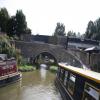
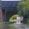
There is a bridge here which takes a road over the canal.

Dashwood's Bridge No 2091 mile, 3¼ furlongs
Dashwood's Lock No 371 mile, 3¼ furlongs
High Bush Bridge No 2081 mile, 1¼ furlongs
The Cleeves Winding Hole3¾ furlongs
Cleves Bridge No 2072¼ furlongs
Heyford Wharf Bridge No 206
Heyford Wharf¼ furlongs
Heyford Wharf Winding Hole¼ furlongs
Heyford Wharf Narrows¾ furlongs
Lower Heyford Visitor Moorings2 furlongs
Mill Lift Bridge No 2053½ furlongs
 
 
Amenities

Amenities here

 The Bell Inn
 Oxfordshire Narrowboats

Amenities nearby at Heyford Wharf

 Heyford Station
 
Maps
If you are a user and are logged on, or if you are actively planning a route, a map will be displayed here.
Show on external mapping site: Google | OSM | Bing
 
Additional information

General Waste on top of the bridge, recycling bins in the car park of wharf. There is a new road bridge alongside which leads to Lower Heyford village.

 
Photos
 
External websites
 Oxford Canal Walk - Part One - Oxford to Thrupp - YouTube — associated with Oxford Canal
A walk along the Oxford Canal (Southern Section) from Oxford to Thrupp Wide
 
Nearest facilities

Mouseover for more information or show routes to facility

Nearest water point

The nearest water point is here. Others are at:

In the direction of Napton Junction

Heyford Wharf¼ furlongs away
On this waterway in the direction of Napton Junction
Aynho Wharf6 miles, ½ furlongs and 3 locks away
On this waterway in the direction of Napton Junction
Cherwell Street Facilities12 miles, 6¼ furlongs and 7 locks away
On this waterway in the direction of Napton Junction
Banbury Lock No 2912 miles, 6½ furlongs and 7 locks away
On this waterway in the direction of Napton Junction
Sovereign Wharf13 miles, ½ furlongs and 8 locks away
On this waterway in the direction of Napton Junction
Cropredy Services17 miles, 2¼ furlongs and 11 locks away
On this waterway in the direction of Napton Junction
Cropredy Marina (southern basin)17 miles, 6¾ furlongs and 12 locks away
On this waterway in the direction of Napton Junction
Cropredy Marina (northern basins)17 miles, 7¼ furlongs and 12 locks away
On this waterway in the direction of Napton Junction

In the direction of End of Hythe Bridge Arm

Thrupp Cruising Club7 miles, 4¼ furlongs and 5 locks away
On this waterway in the direction of End of Hythe Bridge Arm
Aubreys Lift Bridge No 2217 miles, 4½ furlongs and 5 locks away
On this waterway in the direction of End of Hythe Bridge Arm
Langford Lane Bridge No 2248 miles, 1¾ furlongs and 5 locks away
On this waterway in the direction of End of Hythe Bridge Arm
Wolvercote Junction Water Point11 miles, 1½ furlongs and 7 locks away
On this waterway in the direction of End of Hythe Bridge Arm
Wolvercote Sanitary Station11 miles, 6 furlongs and 8 locks away
On this waterway in the direction of End of Hythe Bridge Arm
St Edwards Lift Bridge No 23812 miles, 6¾ furlongs and 9 locks away
On this waterway in the direction of End of Hythe Bridge Arm
Oxford Visitor Moorings14 miles, 3 furlongs and 9 locks away
On this waterway in the direction of End of Hythe Bridge Arm
Eynsham Lock14 miles, 5¼ furlongs and 9 locks away
Travel to Wolvercote Junction, then on the Oxford Canal (Duke's Cut) to Duke's Cut Junction, then on the River Thames (above Oxford) to Eynsham Lock

Nearest rubbish disposal

The nearest rubbish disposal is here. Others are at:

In the direction of Napton Junction

Heyford Wharf¼ furlongs away
On this waterway in the direction of Napton Junction
Aynho Wharf6 miles, ½ furlongs and 3 locks away
On this waterway in the direction of Napton Junction
Cherwell Street Facilities12 miles, 6¼ furlongs and 7 locks away
On this waterway in the direction of Napton Junction
Sovereign Wharf13 miles, ½ furlongs and 8 locks away
On this waterway in the direction of Napton Junction
Cropredy Services17 miles, 2¼ furlongs and 11 locks away
On this waterway in the direction of Napton Junction
Cropredy Marina (southern basin)17 miles, 6¾ furlongs and 12 locks away
On this waterway in the direction of Napton Junction
Cropredy Marina (northern basins)17 miles, 7¼ furlongs and 12 locks away
On this waterway in the direction of Napton Junction

In the direction of End of Hythe Bridge Arm

Thrupp Cruising Club7 miles, 4¼ furlongs and 5 locks away
On this waterway in the direction of End of Hythe Bridge Arm
Aubreys Lift Bridge No 2217 miles, 4½ furlongs and 5 locks away
On this waterway in the direction of End of Hythe Bridge Arm
Wolvercote Sanitary Station11 miles, 6 furlongs and 8 locks away
On this waterway in the direction of End of Hythe Bridge Arm
Eynsham Lock14 miles, 5¼ furlongs and 9 locks away
Travel to Wolvercote Junction, then on the Oxford Canal (Duke's Cut) to Duke's Cut Junction, then on the River Thames (above Oxford) to Eynsham Lock

Nearest chemical toilet disposal

In the direction of Napton Junction

Cherwell Street Facilities12 miles, 6¼ furlongs and 7 locks away
On this waterway in the direction of Napton Junction
Sovereign Wharf13 miles, ½ furlongs and 8 locks away
On this waterway in the direction of Napton Junction
Cropredy Services17 miles, 2¼ furlongs and 11 locks away
On this waterway in the direction of Napton Junction
Cropredy Marina (southern basin)17 miles, 6¾ furlongs and 12 locks away
On this waterway in the direction of Napton Junction

In the direction of End of Hythe Bridge Arm

Thrupp Cruising Club7 miles, 4¼ furlongs and 5 locks away
On this waterway in the direction of End of Hythe Bridge Arm
Wolvercote Sanitary Station11 miles, 6 furlongs and 8 locks away
On this waterway in the direction of End of Hythe Bridge Arm
Eynsham Lock14 miles, 5¼ furlongs and 9 locks away
Travel to Wolvercote Junction, then on the Oxford Canal (Duke's Cut) to Duke's Cut Junction, then on the River Thames (above Oxford) to Eynsham Lock

Nearest place to turn

In the direction of Napton Junction

Heyford Wharf¼ furlongs away
On this waterway in the direction of Napton Junction
Heyford Wharf Winding Hole¼ furlongs away
On this waterway in the direction of Napton Junction
Somerton Deep Lock Winding Hole4 miles, 2¼ furlongs and 3 locks away
On this waterway in the direction of Napton Junction
Aynho Wharf6 miles, ½ furlongs and 3 locks away
On this waterway in the direction of Napton Junction
Winding Hole above Nell Bridge Lock7 miles, 3 furlongs and 5 locks away
On this waterway in the direction of Napton Junction
Twyford Wharf Winding Hole10 miles and 6 locks away
On this waterway in the direction of Napton Junction
Calthorpe Winding Hole12 miles, ¾ furlongs and 7 locks away
On this waterway in the direction of Napton Junction
Grimsbury Wharf13 miles, 3¾ furlongs and 8 locks away
On this waterway in the direction of Napton Junction
Southam Road Winding Hole13 miles, 5 furlongs and 8 locks away
On this waterway in the direction of Napton Junction
Southam Road Footbridge Arm13 miles, 7¾ furlongs and 8 locks away
On this waterway in the direction of Napton Junction

In the direction of End of Hythe Bridge Arm

The Cleeves Winding Hole3¾ furlongs away
On this waterway in the direction of End of Hythe Bridge Arm
Kirtlington Winding Hole3 miles, 2¼ furlongs and 2 locks away
On this waterway in the direction of End of Hythe Bridge Arm
Enslow Winding Hole4 miles, 7¾ furlongs and 3 locks away
On this waterway in the direction of End of Hythe Bridge Arm
Shipton Weir Junction6 miles, 3¾ furlongs and 4 locks away
On this waterway in the direction of End of Hythe Bridge Arm
Thrupp Wide7 miles, 4¼ furlongs and 5 locks away
On this waterway in the direction of End of Hythe Bridge Arm
Wolvercote Junction11 miles, 2½ furlongs and 8 locks away
On this waterway in the direction of End of Hythe Bridge Arm
Bypass Reservoir Junction11 miles, 4¼ furlongs and 9 locks away
Travel to Wolvercote Junction, then on the Oxford Canal (Duke's Cut) to Bypass Reservoir Junction
Duke's Cut Junction12 miles, ¾ furlongs and 9 locks away
Travel to Wolvercote Junction, then on the Oxford Canal (Duke's Cut) to Duke's Cut Junction
Hythe Bridge Arm Winding Hole14 miles, 2¼ furlongs and 9 locks away
On this waterway in the direction of End of Hythe Bridge Arm
End of Hythe Bridge Arm14 miles, 3¼ furlongs and 9 locks away
On this waterway in the direction of End of Hythe Bridge Arm

Nearest self-operated pump-out

In the direction of Napton Junction

Cropredy Marina (southern basin)17 miles, 6¾ furlongs and 12 locks away
On this waterway in the direction of Napton Junction

In the direction of End of Hythe Bridge Arm

Thrupp Cruising Club7 miles, 4¼ furlongs and 5 locks away
On this waterway in the direction of End of Hythe Bridge Arm
Aubreys Lift Bridge No 2217 miles, 4½ furlongs and 5 locks away
On this waterway in the direction of End of Hythe Bridge Arm
Eynsham Lock14 miles, 5¼ furlongs and 9 locks away
Travel to Wolvercote Junction, then on the Oxford Canal (Duke's Cut) to Duke's Cut Junction, then on the River Thames (above Oxford) to Eynsham Lock

Nearest boatyard pump-out

In the direction of Napton Junction

Heyford Wharf¼ furlongs away
On this waterway in the direction of Napton Junction
Aynho Wharf6 miles, ½ furlongs and 3 locks away
On this waterway in the direction of Napton Junction
Twyford Wharf9 miles, 7¾ furlongs and 6 locks away
On this waterway in the direction of Napton Junction
Sovereign Wharf13 miles, ½ furlongs and 8 locks away
On this waterway in the direction of Napton Junction
Cropredy Marina (southern basin)17 miles, 6¾ furlongs and 12 locks away
On this waterway in the direction of Napton Junction

In the direction of End of Hythe Bridge Arm

Enslow Wharf5 miles, ¾ furlongs and 3 locks away
On this waterway in the direction of End of Hythe Bridge Arm
Oxford Cruisers Marina15 miles, 5 furlongs and 10 locks away
Travel to Wolvercote Junction, then on the Oxford Canal (Duke's Cut) to Duke's Cut Junction, then on the River Thames (above Oxford) to Oxford Cruisers Marina
Direction of TV transmitter (From Wolfbane Cybernetic)
 
 
Geograph
 
Wikipedia

There is no page on Wikipedia called “Heyford Wharf Bridge”

Wikipedia pages that might relate to Heyford Wharf Bridge
[Lower Heyford] Lower Heyford village on its north and west sides. Coal mined in Leicestershire and Warwickshire was unloaded on Heyford Wharf at Lower Heyford. An open [Grand Union Canal] tract to a white humpback bridge at Apsley, Hertfordshire The canal near Bugbrooke, Northamptonshire The canal near Nether Heyford, Northamptonshire Saddington [Nether Heyford] Nether Heyford is a village and civil parish in the South Northamptonshire district of Northamptonshire, England, close to the M1 motorway and the A5 [Vauxhall] been built to the south of Vauxhall Bridge at St George Wharf. Part of this development includes the St George Wharf Tower, completed in 2014. The MI6 building [Bugbrooke] Council's two-member "Heyfords and Bugbrooke" ward, covering the village as well as neighbouring Nether Heyford and Upper Heyford. From May 2013, the Northamptonshire [Stowe Nine Churches] bridge south eastward to sidings on the west side of the railway just to the north of the Nether Heyford to Litchborough road. Thus the canal wharf was [Sandford-on-Thames] riverside near Sandford Lock which is the site of the old wharf, and recreation areas off Heyford Hill Lane which also contain children's play equipment [Sutton Bridge] modern Port Sutton Bridge opened in 1987. It is a 62-acre dry cargo port and warehouse complex. The port provides a 350 metre long wharf accommodating between [Oxford Canal] through a bridge under Hythe Bridge Street to a turning basin and goods wharf south of Hythe Bridge Street. It then continued via a bridge under Worcester [River Nene] river now flows towards Northampton, passing through Flore and Nether Heyford, where it is joined by small streams on either bank. A little past Bugbrooke
 
Google

Results of Google Search

File:Heyford Wharf on the Oxford Canal - geograph.org.uk ...
Nov 7, 2008 ... No higher resolution available. ... English: Heyford Wharf and Heyford railway station at Lower Heyford, Oxfordshire, viewed from Bridge 206.
File:Lower Heyford canal bridge - geograph.org.uk - 98864.jpg ...
No higher resolution available. ... English: Bridge 206 over the Oxford Canal at Lower Heyford, Oxfordshire. The steel ... Beyond the bridges is Heyford Wharf.
Banbury & District Angling Association | Canal & River Trust
Bridge 206 Heyford Wharf to Bridge 152 Cropredy River Cherwell at Lower ... Canal & River Trust is a charity registered with the Charity Commission no.