CanalPlanAC

Waterworks Bridge No 9

 
Fobney Island Wetland Nature Reserve, Island Road, Reading RG2 0SF, United Kingdom
Address is taken from a point 456 yards away.
 
Information about the place
Waterworks Bridge No 9 is a minor waterways place on the River Kennet between High Bridge Reading (Jurisdiction for the River Kennet changes between the Canal & River Trust and the Environment Agency here.) (1 mile and 7¼ furlongs and 1 lock to the northeast) and Burghfield Bridge No 14 (Burghfield) (1 mile and 4¾ furlongs and 2 locks to the west).
 
 
The nearest place in the direction of High Bridge Reading is Fobney Lock Weir Exit (Channel leading to the Weir); ¼ furlongs away.
 
The nearest place in the direction of Burghfield Bridge No 14 is Fobney Lock No 105; a few yards away.

There may be access to the towpath here.

Mooring here is unrated.

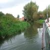
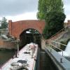
There is a bridge here which takes a minor road over the canal.


Amenities

Amenities nearby at Fobney Lock Weir Exit

 Reading Biobiesel
 
Maps
If you are a user and are logged on, or if you are actively planning a route, a map will be displayed here.
Show on external mapping site: Google | OSM | Bing
 
Photos
 
External websites
There are no links to external websites from here.
Why not log in and add some (select "External websites" from the menu (sometimes this is under "Edit"))?
 
Nearest facilities

Mouseover for more information or show routes to facility

Nearest water point

In the direction of Northcroft Lane Arm

Tyle Mill Lock C&RT Services5 miles, 4 furlongs and 6 locks away
On this waterway in the direction of Northcroft Lane Arm
Aldermaston Lock No 957 miles, 6½ furlongs and 9 locks away
On this waterway in the direction of Northcroft Lane Arm
Ham Manor Marina15 miles, 4½ furlongs and 18 locks away
On this waterway in the direction of Northcroft Lane Arm

In the direction of High Bridge Reading

Thames & Kennet Marina2 miles, 7½ furlongs and 2 locks away
Travel to High Bridge Reading, then on the River Thames (River Kennet) to Thames - Kennet Junction (Kennet Mouth), then on the River Thames (below Oxford) to Thames & Kennet Marina
Shiplake Lock7 miles, 4¼ furlongs and 3 locks away
Travel to High Bridge Reading, then on the River Thames (River Kennet) to Thames - Kennet Junction (Kennet Mouth), then on the River Thames (below Oxford) to Shiplake Lock
Cleeve Lock14 miles, 7¼ furlongs and 6 locks away
Travel to High Bridge Reading, then on the River Thames (River Kennet) to Thames - Kennet Junction (Kennet Mouth), then on the River Thames (below Oxford) to Cleeve Lock
Hurley Lock17 miles, 2½ furlongs and 6 locks away
Travel to High Bridge Reading, then on the River Thames (River Kennet) to Thames - Kennet Junction (Kennet Mouth), then on the River Thames (below Oxford) to Hurley Lock

Nearest rubbish disposal

In the direction of Northcroft Lane Arm

Tyle Mill Lock C&RT Services5 miles, 4 furlongs and 6 locks away
On this waterway in the direction of Northcroft Lane Arm
Aldermaston Lock No 957 miles, 6½ furlongs and 9 locks away
On this waterway in the direction of Northcroft Lane Arm
Ham Manor Marina15 miles, 4½ furlongs and 18 locks away
On this waterway in the direction of Northcroft Lane Arm

In the direction of High Bridge Reading

Shiplake Lock7 miles, 4¼ furlongs and 3 locks away
Travel to High Bridge Reading, then on the River Thames (River Kennet) to Thames - Kennet Junction (Kennet Mouth), then on the River Thames (below Oxford) to Shiplake Lock
Mapledurham Lock7 miles, 7½ furlongs and 3 locks away
Travel to High Bridge Reading, then on the River Thames (River Kennet) to Thames - Kennet Junction (Kennet Mouth), then on the River Thames (below Oxford) to Mapledurham Lock
Marsh Lock10 miles, 2¼ furlongs and 4 locks away
Travel to High Bridge Reading, then on the River Thames (River Kennet) to Thames - Kennet Junction (Kennet Mouth), then on the River Thames (below Oxford) to Marsh Lock
Hambleden Lock13 miles, 5 furlongs and 5 locks away
Travel to High Bridge Reading, then on the River Thames (River Kennet) to Thames - Kennet Junction (Kennet Mouth), then on the River Thames (below Oxford) to Hambleden Lock
Goring Lock14 miles, 2¼ furlongs and 5 locks away
Travel to High Bridge Reading, then on the River Thames (River Kennet) to Thames - Kennet Junction (Kennet Mouth), then on the River Thames (below Oxford) to Goring Lock
Hurley Lock17 miles, 2½ furlongs and 6 locks away
Travel to High Bridge Reading, then on the River Thames (River Kennet) to Thames - Kennet Junction (Kennet Mouth), then on the River Thames (below Oxford) to Hurley Lock
Marlow Lock19 miles, 5½ furlongs and 8 locks away
Travel to High Bridge Reading, then on the River Thames (River Kennet) to Thames - Kennet Junction (Kennet Mouth), then on the River Thames (below Oxford) to Marlow Lock

Nearest chemical toilet disposal

In the direction of Northcroft Lane Arm

Tyle Mill Lock C&RT Services5 miles, 4 furlongs and 6 locks away
On this waterway in the direction of Northcroft Lane Arm
Aldermaston Lock No 957 miles, 6½ furlongs and 9 locks away
On this waterway in the direction of Northcroft Lane Arm
Ham Manor Marina15 miles, 4½ furlongs and 18 locks away
On this waterway in the direction of Northcroft Lane Arm

In the direction of High Bridge Reading

Thames & Kennet Marina2 miles, 7½ furlongs and 2 locks away
Travel to High Bridge Reading, then on the River Thames (River Kennet) to Thames - Kennet Junction (Kennet Mouth), then on the River Thames (below Oxford) to Thames & Kennet Marina
Shiplake Lock7 miles, 4¼ furlongs and 3 locks away
Travel to High Bridge Reading, then on the River Thames (River Kennet) to Thames - Kennet Junction (Kennet Mouth), then on the River Thames (below Oxford) to Shiplake Lock
Mapledurham Lock7 miles, 7½ furlongs and 3 locks away
Travel to High Bridge Reading, then on the River Thames (River Kennet) to Thames - Kennet Junction (Kennet Mouth), then on the River Thames (below Oxford) to Mapledurham Lock
Hurley Lock17 miles, 2½ furlongs and 6 locks away
Travel to High Bridge Reading, then on the River Thames (River Kennet) to Thames - Kennet Junction (Kennet Mouth), then on the River Thames (below Oxford) to Hurley Lock

Nearest place to turn

In the direction of Northcroft Lane Arm

Winding Hole above Fobney Lock¼ furlongs and 1 lock away
On this waterway in the direction of Northcroft Lane Arm
Fobney Lock Weir Entrance4 furlongs and 1 lock away
On this waterway in the direction of Northcroft Lane Arm
Southcote Lock Weir Exit6 furlongs and 1 lock away
On this waterway in the direction of Northcroft Lane Arm
Burghfield Island Entrance No 11 mile, 3 furlongs and 2 locks away
On this waterway in the direction of Northcroft Lane Arm
Burghfield Island Entrance No 21 mile, 4¾ furlongs and 2 locks away
On this waterway in the direction of Northcroft Lane Arm
Burghfield Lock Weir Exit2 miles and 2 locks away
On this waterway in the direction of Northcroft Lane Arm
Burghfield Mill Winding Hole2 miles, 3¼ furlongs and 3 locks away
On this waterway in the direction of Northcroft Lane Arm
Winding Hole below Garston Lock3 miles, 2¼ furlongs and 3 locks away
On this waterway in the direction of Northcroft Lane Arm
Sheffield Lock Weir Entrance4 miles, 1¼ furlongs and 5 locks away
On this waterway in the direction of Northcroft Lane Arm
Winding Hole below Sulhampstead Lock4 miles, 5½ furlongs and 5 locks away
On this waterway in the direction of Northcroft Lane Arm

In the direction of High Bridge Reading

Fobney Lock Weir Exit¼ furlongs away
On this waterway in the direction of High Bridge Reading
Winding Hole above County Lock1 mile, 4½ furlongs away
On this waterway in the direction of High Bridge Reading
Reading Jail Loop (western entrance)2 miles, 1¾ furlongs and 1 lock away
Travel to High Bridge Reading, then on the River Thames (River Kennet) to Reading Jail Loop (western entrance)
Reading Jail Loop (eastern entrance)2 miles, 3½ furlongs and 1 lock away
Travel to High Bridge Reading, then on the River Thames (River Kennet) to Reading Jail Loop (eastern entrance)
Blakes Lock Weir Exit2 miles, 5 furlongs and 2 locks away
Travel to High Bridge Reading, then on the River Thames (River Kennet) to Blakes Lock Weir Exit
Thames - Kennet Junction (Kennet Mouth)2 miles, 6¼ furlongs and 2 locks away
Travel to High Bridge Reading, then on the River Thames (River Kennet) to Thames - Kennet Junction (Kennet Mouth)
Caversham Lock Weir Exit3 miles, 4 furlongs and 2 locks away
Travel to High Bridge Reading, then on the River Thames (River Kennet) to Thames - Kennet Junction (Kennet Mouth), then on the River Thames (below Oxford) to Caversham Lock Weir Exit
Sonning Lock Weir Entrance4 miles, 4½ furlongs and 2 locks away
Travel to High Bridge Reading, then on the River Thames (River Kennet) to Thames - Kennet Junction (Kennet Mouth), then on the River Thames (below Oxford) to Sonning Lock Weir Entrance
Fry's Island Entrance4 miles, 1 furlong and 3 locks away
Travel to High Bridge Reading, then on the River Thames (River Kennet) to Thames - Kennet Junction (Kennet Mouth), then on the River Thames (below Oxford) to Fry's Island Entrance
Sonning Lock Weir Exit4 miles, 7¾ furlongs and 3 locks away
Travel to High Bridge Reading, then on the River Thames (River Kennet) to Thames - Kennet Junction (Kennet Mouth), then on the River Thames (below Oxford) to Sonning Lock Weir Exit

Nearest self-operated pump-out

In the direction of Northcroft Lane Arm

Tyle Mill Lock C&RT Services5 miles, 4 furlongs and 6 locks away
On this waterway in the direction of Northcroft Lane Arm

In the direction of High Bridge Reading

Mapledurham Lock7 miles, 7½ furlongs and 3 locks away
Travel to High Bridge Reading, then on the River Thames (River Kennet) to Thames - Kennet Junction (Kennet Mouth), then on the River Thames (below Oxford) to Mapledurham Lock

Nearest boatyard pump-out

In the direction of Northcroft Lane Arm

Newbury Marina16 miles, 1¼ furlongs and 19 locks away
On this waterway in the direction of Northcroft Lane Arm

In the direction of High Bridge Reading

Thames & Kennet Marina2 miles, 7½ furlongs and 2 locks away
Travel to High Bridge Reading, then on the River Thames (River Kennet) to Thames - Kennet Junction (Kennet Mouth), then on the River Thames (below Oxford) to Thames & Kennet Marina
Direction of TV transmitter (From Wolfbane Cybernetic)
 
 
Geograph
 
Wikipedia

There is no page on Wikipedia called “Waterworks Bridge”

Wikipedia pages that might relate to Waterworks Bridge
[Chain of Rocks Bridge] downriver, and immediately downstream from the bridge, two water intakes for the St. Louis Waterworks are visible. One is vaguely Gothic Revival in style; [Sachs Covered Bridge] Covered Bridge /ˈsɒks/, also known as Sauck's Covered Bridge and Waterworks Covered Bridge, is a 100-foot (30 m), Town truss covered bridge over Marsh [Severn Valley] also railway bridge for SVR) Trimpley (west bank – river enters Wyre Forest — also private waterworks, electricity and gas pipeline bridge) Bewdley (both [Tug of war] a standing tug of war over the Tallawanda stream near the Oxford waterworks bridge in which the losers were pulled into the water. This first event was [Decatur Waterworks] The Decatur Waterworks was a facility that obtained drinking water for the city of Decatur, Georgia, from the local Peachtree Creek and Burnt Fork Creek [Colossus Bridge] 96389; -75.18333. "Schuylkill Waterworks" (1835), with "The Colossus" in the background. "A View of Fairmount and the Waterworks" (1835) by John Rubens Smith [Spring Garden Street Bridge] Staffordshire china. "Schuylkill Waterworks" (1835), with "The Colossus" in the background. "A View of Fairmount and the Waterworks" (1835) by John Rubens Smith [Crimean Bridge] link, the Kerch waterworks project («Керченский гидроузел») was developed since the mid-1960s, proposing a system of dams and bridges across the strait [London water supply infrastructure] between London and Southwark Bridges. An adjacent zone was supplied by the London Bridge Waterworks Company. The Lambeth Waterworks Company was founded in 1785 [Chelsea Bridge] Chelsea Waterworks site, to the new bridge. Although previous toll bridges in the area had been built and operated by private companies, the new bridge was
 
Google

Results of Google Search

DHEC shuts McClellanville water dispensaries, citing no testing by ...
Shawn Smetana, public information officer for Charleston County, said Tuesday he was unsure why Mount Pleasant Waterworks is no longer providing the service for the two communities. For now, Smetana says the county is in the process of training an employee to perform these tests. Until the employee is trained, ...
Pennsylvania Highways: PA 28 Exit Guide
Aug 5, 2015 ... SOUTH, TO. I-279, I-579, I-376. Fort Pitt Bridge Veterans Bridge. EXIT ONLY ... Freeport Road Fox Chapel Road Waterworks Drive Green Belt - Aspinwall/ Blawnox ... Russellton Creighton Orange Belt - Russellton/Creighton No Trucks ...
Discover Julia Wall Mounted Two Hole Bridge Low Profile Kitchen ...
Julia Wall Mounted Two Hole Bridge Low Profile Kitchen Faucet, Metal Cross Handles from the Julia collection is a leading example of luxury kitchen faucet. Discover the very best in fittings from Waterworks today.
Discover Easton Classic Two Hole Bridge Gooseneck Kitchen ...
Easton Classic Two Hole Bridge Gooseneck Kitchen Faucet, Metal Cross Handles from the Easton collection is a leading example of luxury kitchen faucet. Discover the very best in fittings from Waterworks today.
Discover R.W. Atlas Two Hole Bridge High Profile Kitchen Faucet ...
R.W. Atlas Two Hole Bridge High Profile Kitchen Faucet, Metal Side Mount Levers and Spray from the R.W. Atlas collection is a leading example of luxury kitchen faucet. Discover the very best in fittings from Waterworks today.
Discover Easton Classic Two Hole Bridge Gooseneck Kitchen ...
Easton Classic Two Hole Bridge Gooseneck Kitchen Faucet, White Porcelain Lever Handles from the Easton collection is a leading example of luxury kitchen faucet. Discover the very best in fittings from Waterworks today.
Discover R.W. Atlas Bridge Two Hole Deck Mounted Lavatory ...
R.W. Atlas Bridge Two Hole Deck Mounted Lavatory Faucet with Metal Lever Side Mount Handles from the R.W. Atlas collection is a leading example of luxury lavatory. Discover the very best in fittings from Waterworks today.
Archville Bridge | The Croton Waterworks
Street Address/Location: Archville, NY: spanning Route 9 (Albany Post Road), between Rockwood Road and Arch Hill Road. Town/City: Archville, NY County: ... After a seventy-four year absence, a new bridge is in its place, no longer serving as a function of the old water supply system. Current Interpretation: On one side of ...
The Sioux Chef gets a riverfront restaurant at the foot of the Stone ...
Sep 18, 2017 ... Water Works is the new park project in Mill Ruins Park, within the Central Mississippi Riverfront Regional Park, situated near St. Anthony Falls and the Stone Arch Bridge. Water Works will build on the tremendous popularity of those two sites by offering a park pavilion, a rooftop patio, playspace, and the ...
Tai Tam Waterworks Heritage Trail - Wikipedia
There are many waterworks structures with precious historic value in the Tai Tam group of reservoirs along the trail, the following ones have been declared monuments including valve houses, bridges, staff quarters etc. This revitalisation project is different from other past projects in the sense that no extra resources is  ...