CanalPlanAC

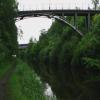
Attercliffe Pedestrian Bridge

 
Radical Working Mens Club, Towpath, Sheffield S4 7ZJ, United Kingdom
 
Information about the place
Attercliffe Pedestrian Bridge is a minor waterways place on the Sheffield and South Yorkshire Navigation (Sheffield Canal) between Rawmarsh Road Bridge No 39 (5 miles and 5¼ furlongs and 15 locks to the northeast) and Sheffield Terminal Warehouse (1 mile and 3¼ furlongs to the west).
 
It is part of Sheffield.
 
The nearest place in the direction of Rawmarsh Road Bridge No 39 is Shirland Road Footbridge No 9 (An old footbridge now closed); ¾ furlongs away.
 
The nearest place in the direction of Sheffield Terminal Warehouse is Tramway Bridge; ½ furlongs away.

There may be access to the towpath here.

Mooring here is unrated.

There is a bridge here which takes pedestrian traffic over the canal.


Amenities

Amenities nearby at Shirland Road Footbridge No 9

 Frankie & Bennys
 Cashpoint

Amenities in Sheffield

 Costco
 Lidl
 M&S Simply Food
 Sainsbury's
 Sainsbury's
 Sainsburys
 Sainsburys
 Somerfield - Pinstone Street - Store# 1234
 Carousel News
 Hawley Street News
 Costa Coffee
 Patisserie-Valerie
 Starbucks
 Ask and Zizzi
 McDonalds
 Pizza Hut
 Strada
 The Milestone
 Bessemer The Fountain Precinct Lower Ground Floor
 Devonshire Cat
 Dog & Partridge
 Fat Cat
 Globe
 Howard
 Kelham Island Tavern
 Museum
 Roebuck Tavern
 SEE ADDRESS
 SEE ADDRESS
 SEE ADDRESS
 SEE ADDRESS
 Sheffield
 Sheffield
 Sheffield Waterworks Company Cambridge House
 Three Tuns
 Unicorn
 Wetherspoons
 Wetherspoons
 Yates's
 Home Bargains
 Poundland
 W H Smith
 W H Smith
 Burger King
 Subway Sandwich Shop
 Boots Chemist
 Boots Chemist
 Barclays
 Barclays
 Cashpoint
 Cashpoint
 Cashpoint
 Cashpoint
 Cashpoint
 Cashpoint
 Cashpoint
 Cashpoint
 Cashpoint
 Cashpoint
 Cashpoint
 Cashpoint
 Cashpoint
 Cashpoint
 Cashpoint
 Cashpoint
 Cashpoint
 Cashpoint
 Cashpoint
 Co-operative Bank
 Coventry
 HSBC
 HSBC
 HSBC
 HSBC
 Lloyds Bank
 Lloyds Bank
 Lloyds Bank
 NatWest
 NatWest
 Nationwide
 RBS
 Santander
 Santander
 Santander
 TSB
 Yorkshire Bank
 Yorkshire Bank
 Yorkshire Bank
 BP
 Challenger Tyre & Exhaust Co. M-F 5.30pm Sa 4pm
 Sheffield Scout Resources Charity
 Sheffield, Bio UK Fuels
 Total
 B&Q
 Decathlon - Sheffield
 Jewson
 Topps Tiles
 Sheffield Station

Amenities at other places in Sheffield

 Bankers Draft at Sheffield Terminal Warehouse
 Dove & Rainbow at Sheffield Terminal Warehouse
 Old Queens Head at Sheffield Terminal Warehouse
 Wetherspoons at Sheffield Terminal Warehouse
 B&M Bargains at Sheffield Terminal Warehouse
 Yorkshire Bank at Sheffield Terminal Warehouse
 Mr Paul Taylor at Staniforth Factory Footbridge
 
Maps
If you are a user and are logged on, or if you are actively planning a route, a map will be displayed here.
Show on external mapping site: Google | OSM | Bing
 
Photos
 
External websites
  S&SY navigation info — associated with Sheffield and South Yorkshire Navigation
Sheffield & South Yorkshire navigation info from IWA
 
Nearest facilities

Mouseover for more information or show routes to facility

Nearest rubbish disposal

In the direction of Rawmarsh Road Bridge No 39

Tinsley CRT facilities1 mile, 2¾ furlongs and 1 lock away
On this waterway in the direction of Rawmarsh Road Bridge No 39
Eastwood Lock No 56 miles, 2 furlongs and 15 locks away
Travel to Rawmarsh Road Bridge No 39, then on the Sheffield and South Yorkshire Navigation (Main Line) to Eastwood Lock No 5

In the direction of Sheffield Terminal Warehouse

Victoria Quays1 mile, 3 furlongs away
On this waterway in the direction of Sheffield Terminal Warehouse

Nearest chemical toilet disposal

In the direction of Rawmarsh Road Bridge No 39

Tinsley CRT facilities1 mile, 2¾ furlongs and 1 lock away
On this waterway in the direction of Rawmarsh Road Bridge No 39
Eastwood Lock No 56 miles, 2 furlongs and 15 locks away
Travel to Rawmarsh Road Bridge No 39, then on the Sheffield and South Yorkshire Navigation (Main Line) to Eastwood Lock No 5
Swinton Lock Activity Centre and CRT Sanitary Station10 miles, 5 furlongs and 19 locks away
Travel to Rawmarsh Road Bridge No 39, then on the Sheffield and South Yorkshire Navigation (Main Line) to Swinton Lock Activity Centre and CRT Sanitary Station

In the direction of Sheffield Terminal Warehouse

Victoria Quays1 mile, 3 furlongs away
On this waterway in the direction of Sheffield Terminal Warehouse

Nearest place to turn

In the direction of Rawmarsh Road Bridge No 39

Shirland Road Bridge Winding Hole1¼ furlongs away
On this waterway in the direction of Rawmarsh Road Bridge No 39 On this waterway in the direction of Rawmarsh Road Bridge No 39
Tinsley Lower Flight Weir Exit2 miles, 4 furlongs and 11 locks away
On this waterway in the direction of Rawmarsh Road Bridge No 39
Rotherham Junction4 miles, 4 furlongs and 14 locks away
On this waterway in the direction of Rawmarsh Road Bridge No 39
Main Street Junction4 miles, 5¾ furlongs and 14 locks away
On this waterway in the direction of Rawmarsh Road Bridge No 39
Central Road Winding Hole4 miles, 6¾ furlongs and 15 locks away
On this waterway in the direction of Rawmarsh Road Bridge No 39
Rawmarsh Road Winding Hole5 miles, 4¾ furlongs and 15 locks away
On this waterway in the direction of Rawmarsh Road Bridge No 39
Sir Frank Price Lock Arm6 miles, 1½ furlongs and 15 locks away
Travel to Rawmarsh Road Bridge No 39, then on the Sheffield and South Yorkshire Navigation (Main Line) to Sir Frank Price Lock Arm
Sir Frank Price Lock Weir Exit6 miles, 2½ furlongs and 16 locks away
Travel to Rawmarsh Road Bridge No 39, then on the Sheffield and South Yorkshire Navigation (Main Line) to Sir Frank Price Lock Weir Exit
Kilnhurst Flood Lock Winding Hole8 miles, 5¾ furlongs and 17 locks away
Travel to Rawmarsh Road Bridge No 39, then on the Sheffield and South Yorkshire Navigation (Main Line) to Kilnhurst Flood Lock Winding Hole
Swinton Junction10 miles, 4¼ furlongs and 18 locks away
Travel to Rawmarsh Road Bridge No 39, then on the Sheffield and South Yorkshire Navigation (Main Line) to Swinton Junction
Swinton Road Corner11 miles, ¼ furlongs and 19 locks away
Travel to Rawmarsh Road Bridge No 39, then on the Sheffield and South Yorkshire Navigation (Main Line) to Swinton Road Corner
Sprotbrough Lock Weir Exit16 miles, 6 furlongs and 22 locks away
Travel to Rawmarsh Road Bridge No 39, then on the Sheffield and South Yorkshire Navigation (Main Line) to Sprotbrough Lock Weir Exit

In the direction of Sheffield Terminal Warehouse

Victoria Quays1 mile, 3 furlongs away
On this waterway in the direction of Sheffield Terminal Warehouse
Sheffield Terminal Warehouse1 mile, 3¼ furlongs away
On this waterway in the direction of Sheffield Terminal Warehouse

No information

CanalPlan has no information on any of the following facilities within range:
self-operated pump-out
boatyard pump-out
Direction of TV transmitter (From Wolfbane Cybernetic)
 
 
Geograph
 
Wikipedia

There is no page on Wikipedia called “Attercliffe Pedestrian Bridge”

Wikipedia pages that might relate to Attercliffe Pedestrian Bridge
[River Don, Yorkshire] Norfolk Bridge. This carries the A6178 Attercliffe Road over the River Don. Washford or Westforth bridge, at the Sheffield end of Attercliffe, was first [Sheffield Supertram] and Malin Bridge via the University of Sheffield and Hillsborough; north-east to Meadowhall Interchange and Rotherham Parkgate via Attercliffe; and south-east [List of tram accidents] tramcar, or involving severe injury or death to those in the tramcar. Pedestrian fatalities are outside the scope of this list. On 12 July 1930, electric [Sheffield Victoria railway station] Lincoln (via Retford), Nottingham (via Chesterfield), Rotherham (via Attercliffe), Huddersfield (via Penistone). William Taylor ca. 1852 Mr. Ward ca. [Sheffield Tramway] first tramway line, horse-drawn, opened in 1873 between Lady's Bridge and Attercliffe, subsequently extended to Brightside and Tinsley. Routes were built [Sheffield station] included the improvement of platform surfaces and the addition of a pedestrian bridge connecting the station concourse with the Sheffield Supertram stop [University of Sheffield] buildings, in the late 2000s, bridges both west (Western Bank) and east (St George’s) campus, and in 2017, a new pedestrian crossing was installed on the [Meadowhall Interchange] shopping centre on the opposite bank of the River Don, with a pedestrian suspension bridge linking the interchange with the shopping centre. The heavy rail [Fitzalan Square] square is one of the busiest areas of the city centre, with traffic and pedestrians continually moving through the area. It has a Sheffield Supertram stop
 
Google

Results of Google Search

Attercliffe
Bernard Road Bridge No.5 seen from the East. Le Pont n°5 de la Bernard Road vu de l'Est. ... Attercliffe Pedestrian Bridge seen from the West. La Passerelle ...
Seventy year old Sheffield canal bridge reopens | SheffNews.
Aug 4, 2020 ... Shirland Lane Canal Bridge in Attercliffe has re-opened after being ... safe passage for canal traffic and pedestrians on the tow path below.
Stevenson Road Bridge Over The River Don, Attercliffe, UK - Arch ...
Sep 9, 2016 ... Stevenson Road Bridge Over The River Don, Attercliffe, UK ... weirs that punctuate a local walking and cycling route, the Five Weirs Walk. link
The Best 2 Star Hotels in Attercliffe from $35 | Expedia
"Really helpful and friendly staff and clean and comfortable rooms. The downsides were the traffic noise and the lack of pedestrian access, (no pedestrian…
Old Attercliffe
Sep 27, 2000 ... Repaired according to the Sessions order, 'pedestrians and traffic from Sheffield used the old 1 highway ' past Royds mill as the bridge approach ...
Top Hotels in Attercliffe from $35 (FREE cancellation on select ...
Browse Expedia's selection of 1570 hotels and places to stay in Attercliffe. Find cheap deals ... The downsides were the traffic noise and the lack of pedestrian access, (no pedestrian…""Really ... Thunder Bridge Lane, Huddersfield, England.
River Don, Yorkshire - Wikipedia
The River Don is a river in South Yorkshire and the East Riding of Yorkshire, England. It rises in the Pennines, west of Dunford Bridge, and flows for 70 miles ( 110 ... Samuel Harrison writes: "The Ball Street foot bridge, adjoining Mr. Mills's tannery, was destroyed. ... This carries the A6178 Attercliffe Road over the River Don.
Sheffield School of Architecture Catalogue 2016 by SSoA - issuu
Jun 16, 2016 ... ... route for pedestrians to cross the canal through the nearest bridge. ... 08 Jingyu Tan - The Pedestrian Route Design This project is part of the urban regeneration of Meadowhall and Attercliffe through pedestrian route ...