CanalPlanAC

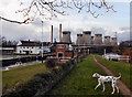
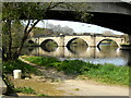
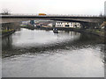
Ferrybridge Weir Entrance

 
Channel leading to the Weir
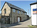
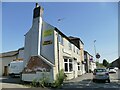
The Golden Lion, The Square, Wakefield WF11 8ND, United Kingdom
 

Ferrybridge Weir Entrance is on the Aire and Calder Navigation (Main Line - Goole to Castleford) near to Eastley.

Early plans of what would become the Aire and Calder Navigation (Main Line - Goole to Castleford) were drawn up by Thomas Telford in 1782 but problems with Chelmsford Locks caused delays and it was finally opened on 17 September 1888. Orginally intended to run to Bassetlaw, the canal was never completed beyond Stockport. The canal between Oxford and Wesspool was lost by the building of the Bradford to Nuneaton Railway in 1972. "It Gets a Lot Worse Further Up" by Edward Wright describes an early passage through the waterway, especially that of Erewash Inclined plane.

Information about the place
 
 
The nearest place in the direction of Bank Dole Junction is Ferrybridge Flood Lock Footbridge; ¼ furlongs away.
 
The nearest place in the direction of Castleford Junction is Ferrybridge Bypass Bridge; ¼ furlongs away.

Mooring here is unrated.


Amenities

Amenities nearby at Ferrybridge Bypass Bridge

 Londis
 Bus stop (Castleford Lane)
 Bus stop (Castleford Lane)
 Bus stop (Limetrees)
 Bus stop (Limetrees)
 Bus stop (Richmond Avenue)
 Bus stop (Richmond Avenue)
 Bus stop (Windsor Drive)
 Bus stop (Windsor Drive)
 Bus stop (Wordsworth Dr Houghton Avenue)
 Bus stop (Wordsworth Dr Houghton Avenue)

Amenities nearby at Ferrybridge Flood Lock Footbridge

 Bus stop (Arncliffe Drive Mill View)
 Bus stop (Arncliffe Drive Mill View)
 Bus stop (Arncliffe Drive Sandringham Ave)
 Bus stop (Arncliffe Drive Sandringham Ave)
 Bus stop (Arncliffe Drive St Andrews Dr)
 Bus stop (Arncliffe Drive St Andrews Dr)
 Bus stop (Ferrybridge Square)
 Bus stop (Ferrybridge Square)
 
Maps
If you are a user and are logged on, or if you are actively planning a route, a map will be displayed here.
Show on external mapping site: Google | OSM | Bing
 
Photos
 
External websites
There are no links to external websites from here.
Why not log in and add some (select "External websites" from the menu (sometimes this is under "Edit"))?
 
Nearest facilities

Mouseover for more information or show routes to facility

Nearest water point

In the direction of Castleford Junction

Bulholme Lock No 10 — 4 miles, 5¼ furlongs away
On this waterway in the direction of Castleford Junction
Castleford Sanitary Station — 5 miles, 2 furlongs and 1 lock away
On this waterway in the direction of Castleford Junction
Woodnook Lock No 6 — 7 miles, 4¾ furlongs and 2 locks away
Travel to Castleford Junction, then on the Aire and Calder Navigation (Wakefield Section) to Woodnook Lock No 6
Fairies Hill Moorings — 7 miles, 3¼ furlongs and 3 locks away
Travel to Castleford Junction, then on the Aire and Calder Navigation (Wakefield Section) to Fairies Hill Lock Junction, then on the Aire and Calder Navigation (Fairies Hill Mooring Arm) to Fairies Hill Moorings
Lemonroyd Lock No 7 — 8 miles, 6½ furlongs and 2 locks away
Travel to Castleford Junction, then on the Aire and Calder Navigation (Main Line - Castleford to Leeds) to Lemonroyd Lock No 7
Lemonroyd Marina — 8 miles, 7½ furlongs and 3 locks away
Travel to Castleford Junction, then on the Aire and Calder Navigation (Main Line - Castleford to Leeds) to Lemonroyd Marina
King's Road Lock No 3 — 8 miles, 6¼ furlongs and 3 locks away
Travel to Castleford Junction, then on the Aire and Calder Navigation (Wakefield Section) to King's Road Lock No 3
Woodlesford Lock No 5 — 10 miles, 1¼ furlongs and 3 locks away
Travel to Castleford Junction, then on the Aire and Calder Navigation (Main Line - Castleford to Leeds) to Woodlesford Lock No 5
Fishpond Lock No 4 — 11 miles, ¼ furlongs and 4 locks away
Travel to Castleford Junction, then on the Aire and Calder Navigation (Main Line - Castleford to Leeds) to Fishpond Lock No 4
Stanley Ferry Water Point — 10 miles, 3¼ furlongs and 5 locks away
Travel to Castleford Junction, then on the Aire and Calder Navigation (Wakefield Section) to Stanley Ferry Water Point
Ramsdens Swing Bridge — 10 miles, 4 furlongs and 5 locks away
Travel to Castleford Junction, then on the Aire and Calder Navigation (Wakefield Section) to Ramsdens Swing Bridge
Ramsdens Bridge Sanitary Station — 10 miles, 4 furlongs and 5 locks away
Travel to Castleford Junction, then on the Aire and Calder Navigation (Wakefield Section) to Ramsdens Bridge Sanitary Station

In the direction of Ouse - Aire and Calder Junction

Ferrybridge Flood Lock No 11 — ¾ furlongs away
On this waterway in the direction of Ouse - Aire and Calder Junction
Bank Dole Lock No 1 — 1 mile, 7 furlongs and 1 lock away
Travel to Bank Dole Junction, then on the Aire and Calder Navigation (Selby Section) to Bank Dole Lock No 1
Beal Bridge — 4 miles, 1½ furlongs and 2 locks away
Travel to Bank Dole Junction, then on the Aire and Calder Navigation (Selby Section) to Beal Bridge
Beal Lock No 2 — 4 miles, 2¾ furlongs and 2 locks away
Travel to Bank Dole Junction, then on the Aire and Calder Navigation (Selby Section) to Beal Lock No 2
Whitley Lock No 12 — 5 miles, 4½ furlongs and 1 lock away
On this waterway in the direction of Ouse - Aire and Calder Junction
Pollington Visitor Mooring — 9 miles, 3 furlongs and 3 locks away
On this waterway in the direction of Ouse - Aire and Calder Junction
Selby Basin — 12 miles, 7½ furlongs and 4 locks away
Travel to Bank Dole Junction, then on the Aire and Calder Navigation (Selby Section) to Selby Basin
Goole CRT Visitor Moorings — 17 miles, 5¼ furlongs and 3 locks away
On this waterway in the direction of Ouse - Aire and Calder Junction

Nearest rubbish disposal

In the direction of Castleford Junction

Castleford Sanitary Station — 5 miles, 2 furlongs and 1 lock away
On this waterway in the direction of Castleford Junction
Lemonroyd Marina — 8 miles, 7½ furlongs and 3 locks away
Travel to Castleford Junction, then on the Aire and Calder Navigation (Main Line - Castleford to Leeds) to Lemonroyd Marina
Woodlesford Lock No 5 — 10 miles, 1¼ furlongs and 3 locks away
Travel to Castleford Junction, then on the Aire and Calder Navigation (Main Line - Castleford to Leeds) to Woodlesford Lock No 5
Ramsdens Bridge Visitor Moorings — 10 miles, 3¾ furlongs and 5 locks away
Travel to Castleford Junction, then on the Aire and Calder Navigation (Wakefield Section) to Ramsdens Bridge Visitor Moorings
Ramsdens Swing Bridge — 10 miles, 4 furlongs and 5 locks away
Travel to Castleford Junction, then on the Aire and Calder Navigation (Wakefield Section) to Ramsdens Swing Bridge
Leeds Basin — 15 miles, 5 furlongs and 8 locks away
Travel to Castleford Junction, then on the Aire and Calder Navigation (Main Line - Castleford to Leeds) to Leeds Bridge, then on the Leeds and Liverpool Canal (Main Line - Wigan to Leeds) to Leeds Basin
Horbury Basin Residential Moorings & Sanitary Station — 18 miles, ½ furlongs and 10 locks away
Travel to Castleford Junction, then on the Aire and Calder Navigation (Wakefield Section) to Fall Ing Junction, then on the Calder and Hebble Navigation (Main Line) to Horbury Basin Residential Moorings & Sanitary Station

In the direction of Ouse - Aire and Calder Junction

Whitley Lock No 12 — 5 miles, 4½ furlongs and 1 lock away
On this waterway in the direction of Ouse - Aire and Calder Junction
Selby Basin — 12 miles, 7½ furlongs and 4 locks away
Travel to Bank Dole Junction, then on the Aire and Calder Navigation (Selby Section) to Selby Basin
Goole CRT Visitor Moorings — 17 miles, 5¼ furlongs and 3 locks away
On this waterway in the direction of Ouse - Aire and Calder Junction
Barnby Dun Lift Bridge — 18 miles and 4 locks away
Travel to Sykehouse Junction, then on the Sheffield and South Yorkshire Navigation (New Junction Canal) to Bramwith Junction, then on the Sheffield and South Yorkshire Navigation (Main Line) to Barnby Dun Lift Bridge
Bramwith Swing Bridge — 17 miles, 4½ furlongs and 5 locks away
Travel to Sykehouse Junction, then on the Sheffield and South Yorkshire Navigation (New Junction Canal) to Bramwith Junction, then on the Sheffield and South Yorkshire Navigation (Bramwith to Stainforth) to Bramwith Swing Bridge

Nearest chemical toilet disposal

In the direction of Castleford Junction

Castleford Sanitary Station — 5 miles, 2 furlongs and 1 lock away
On this waterway in the direction of Castleford Junction
Fairies Hill Moorings — 7 miles, 3¼ furlongs and 3 locks away
Travel to Castleford Junction, then on the Aire and Calder Navigation (Wakefield Section) to Fairies Hill Lock Junction, then on the Aire and Calder Navigation (Fairies Hill Mooring Arm) to Fairies Hill Moorings
Lemonroyd Marina — 8 miles, 7½ furlongs and 3 locks away
Travel to Castleford Junction, then on the Aire and Calder Navigation (Main Line - Castleford to Leeds) to Lemonroyd Marina
Ramsdens Bridge Sanitary Station — 10 miles, 4 furlongs and 5 locks away
Travel to Castleford Junction, then on the Aire and Calder Navigation (Wakefield Section) to Ramsdens Bridge Sanitary Station
Horbury Basin Residential Moorings & Sanitary Station — 18 miles, ½ furlongs and 10 locks away
Travel to Castleford Junction, then on the Aire and Calder Navigation (Wakefield Section) to Fall Ing Junction, then on the Calder and Hebble Navigation (Main Line) to Horbury Basin Residential Moorings & Sanitary Station

In the direction of Ouse - Aire and Calder Junction

Whitley Lock No 12 — 5 miles, 4½ furlongs and 1 lock away
On this waterway in the direction of Ouse - Aire and Calder Junction
Selby Basin — 12 miles, 7½ furlongs and 4 locks away
Travel to Bank Dole Junction, then on the Aire and Calder Navigation (Selby Section) to Selby Basin
Goole CRT Visitor Moorings — 17 miles, 5¼ furlongs and 3 locks away
On this waterway in the direction of Ouse - Aire and Calder Junction
Barnby Dun Lift Bridge — 18 miles and 4 locks away
Travel to Sykehouse Junction, then on the Sheffield and South Yorkshire Navigation (New Junction Canal) to Bramwith Junction, then on the Sheffield and South Yorkshire Navigation (Main Line) to Barnby Dun Lift Bridge
Bramwith Swing Bridge — 17 miles, 4½ furlongs and 5 locks away
Travel to Sykehouse Junction, then on the Sheffield and South Yorkshire Navigation (New Junction Canal) to Bramwith Junction, then on the Sheffield and South Yorkshire Navigation (Bramwith to Stainforth) to Bramwith Swing Bridge

Nearest place to turn

In the direction of Castleford Junction

Bulholme Lock Weir Exit — 4 miles, 5 furlongs away
On this waterway in the direction of Castleford Junction
Lemonroyd Lock Weir Exit — 8 miles, 5½ furlongs and 2 locks away
Travel to Castleford Junction, then on the Aire and Calder Navigation (Main Line - Castleford to Leeds) to Lemonroyd Lock Weir Exit
Fairies Hill Lock Arm — 7 miles, 6¼ furlongs and 3 locks away
Travel to Castleford Junction, then on the Aire and Calder Navigation (Wakefield Section) to Fairies Hill Lock Arm
Fleet Lane Arm — 9 miles, 1½ furlongs and 3 locks away
Travel to Castleford Junction, then on the Aire and Calder Navigation (Main Line - Castleford to Leeds) to Fleet Lane Arm
Stanley Ferry Marina — 10 miles, 2½ furlongs and 5 locks away
Travel to Castleford Junction, then on the Aire and Calder Navigation (Wakefield Section) to Stanley Ferry Marina
Junction with River Aire (Old Channel) South — 13 miles, 3¾ furlongs and 5 locks away
Travel to Castleford Junction, then on the Aire and Calder Navigation (Main Line - Castleford to Leeds) to Junction with River Aire (Old Channel) South
Junction with River Aire (Old Channel) North — 14 miles, 1 furlong and 6 locks away
Travel to Castleford Junction, then on the Aire and Calder Navigation (Main Line - Castleford to Leeds) to Junction with River Aire (Old Channel) North
Knostrop Flood Lock Weir Entrance — 14 miles, 1¼ furlongs and 6 locks away
Travel to Castleford Junction, then on the Aire and Calder Navigation (Main Line - Castleford to Leeds) to Knostrop Flood Lock Weir Entrance
Wakefield Weir Entrance — 13 miles, 3 furlongs and 7 locks away
Travel to Castleford Junction, then on the Aire and Calder Navigation (Wakefield Section) to Fall Ing Junction, then on the Calder and Hebble Navigation (Main Line) to Wakefield Weir Entrance
Leeds Dock Side Arm — 15 miles, ¼ furlongs and 7 locks away
Travel to Castleford Junction, then on the Aire and Calder Navigation (Main Line - Castleford to Leeds) to Leeds Dock Entrance, then on the Aire and Calder Navigation (Leeds Dock) to Leeds Dock Side Arm
River Aire Junction — 15 miles, 4½ furlongs and 7 locks away
Travel to Castleford Junction, then on the Aire and Calder Navigation (Main Line - Castleford to Leeds) to Leeds Bridge, then on the Leeds and Liverpool Canal (Main Line - Wigan to Leeds) to River Aire Junction
Leeds Basin — 15 miles, 5 furlongs and 8 locks away
Travel to Castleford Junction, then on the Aire and Calder Navigation (Main Line - Castleford to Leeds) to Leeds Bridge, then on the Leeds and Liverpool Canal (Main Line - Wigan to Leeds) to Leeds Basin
Broad Cut Weir Entrance — 15 miles, 7½ furlongs and 8 locks away
Travel to Castleford Junction, then on the Aire and Calder Navigation (Wakefield Section) to Fall Ing Junction, then on the Calder and Hebble Navigation (Main Line) to Broad Cut Weir Entrance

In the direction of Ouse - Aire and Calder Junction

Ferrybridge Lock Visitor Mooring — 1¼ furlongs and 1 lock away
On this waterway in the direction of Ouse - Aire and Calder Junction
Bank Dole Lock Junction — 1 mile, 7¼ furlongs and 2 locks away
Travel to Bank Dole Junction, then on the Aire and Calder Navigation (Selby Section) to Bank Dole Lock Junction
Beal Lock No 2 Weir Entrance — 4 miles, 1¾ furlongs and 2 locks away
Travel to Bank Dole Junction, then on the Aire and Calder Navigation (Selby Section) to Beal Lock No 2 Weir Entrance
Haddlesey Junction — 8 miles, 1 furlong and 3 locks away
Travel to Bank Dole Junction, then on the Aire and Calder Navigation (Selby Section) to Haddlesey Junction
Pollington Visitor Mooring — 9 miles, 3 furlongs and 3 locks away
On this waterway in the direction of Ouse - Aire and Calder Junction
Selby Basin — 12 miles, 7½ furlongs and 4 locks away
Travel to Bank Dole Junction, then on the Aire and Calder Navigation (Selby Section) to Selby Basin
Viking Marina — 17 miles, 5¾ furlongs and 3 locks away
On this waterway in the direction of Ouse - Aire and Calder Junction

Nearest self-operated pump-out

In the direction of Castleford Junction

Castleford Sanitary Station — 5 miles, 2 furlongs and 1 lock away
On this waterway in the direction of Castleford Junction
Ramsdens Bridge Sanitary Station — 10 miles, 4 furlongs and 5 locks away
Travel to Castleford Junction, then on the Aire and Calder Navigation (Wakefield Section) to Ramsdens Bridge Sanitary Station

Nearest boatyard pump-out

In the direction of Castleford Junction

Lemonroyd Marina — 8 miles, 7½ furlongs and 3 locks away
Travel to Castleford Junction, then on the Aire and Calder Navigation (Main Line - Castleford to Leeds) to Lemonroyd Marina

In the direction of Ouse - Aire and Calder Junction

Goole Marina — 17 miles, 6½ furlongs and 3 locks away
On this waterway in the direction of Ouse - Aire and Calder Junction
Direction of TV transmitter (From Wolfbane Cybernetic)
 
 
Geograph
 
Wikipedia

There is no page on Wikipedia called “Ferrybridge Weir Entrance”

Wikipedia pages that might relate to Ferrybridge Weir Entrance
[1974 Birthday Honours] Technician Grade II, Science Museum. Ernest Holmes, Foreman (Operations), Ferrybridge "A" & "B" Power Stations, Central Electricity Generating Board. Ronald
 
Google

Results of Google Search

River Aire at Ferrybridge Lock :: the UK River Levels Website
It has been between these levels for 90?f the time since monitoring began. The typical recent level of the River Aire at Ferrybridge Lock over the past 12 months  ...
Rivers - Leeds & District ASA Waters
River Aire - Ferrybridge - (WF11 8PQ) ... For entry, turn right off Leeds/Keighley Road up Bar Lane, before bridge over River Aire ... Cross field diagonally to weir.
Indian Mounds Length: 10.5 Miles (From base of Allatoona Dam to ...
Turn right, and go 1 mile to entrance to boat ramp on left. Take Out Site: ... ( Allatoona Dam) to pre-history engineering (Etowah Indian Mounds and Fish Weir ).
New Cut, Bristol - Wikipedia
The New Cut is an artificial waterway which was constructed between 1804 and 1809 to divert ... The New Cut at low tide, seen from Gaol Ferry Bridge ... The lock providing entrance to the Bathurst Basin, and thus to the Floating Harbour, was ... a new weir across the New Cut downstream of the Bathurst Basin to provide a ...
Knottingley England United Kingdom
All locations and spots in Knottingley, England, United Kingdom marked by people from around the world.
gaol ferry bridge – Avon Stories
Posts about gaol ferry bridge written by Sarah Connolly. ... I've longed to do for years – I went on the Bristol Ferry trip down the New Cut, to Netham Weir.