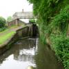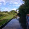
Debdale Bridge No 22
Lea Lane, Wolverley DY10 3RJ, United Kingdom
Address is taken from a point 235 yards away.

Debdale Bridge No 22
is a minor waterways place
on the Staffordshire and Worcestershire Canal (Main Line: Stourport to Stourton) between
Stourton Junction (Junction of the Staffordshire and Worcestershire Canal (Main Line) and the Stourbridge Canal.) (5 miles
and 5 locks
to the northeast) and
Kidderminster (2 miles and 7¼ furlongs
and 2 locks
to the southwest).
The nearest place in the direction of Stourton Junction is Debdale Lock No 9;
a few yards
away.
The nearest place in the direction of Kidderminster is Lea Lane Winding Hole;
5 furlongs
away.
There may be access to the towpath here.
Mooring here is unrated.
There is a bridge here which takes pedestrian traffic over the canal.
Cookley Tunnel (western entrance) | 1¾ furlongs | |
Cookley Forge Towpath Bridge | 1¼ furlongs | |
Cookley Visitor Moorings | ¾ furlongs | |
Debdale Lock Winding Hole | ¼ furlongs | |
Debdale Lock No 9 | a few yards | |
Debdale Bridge No 22 | ||
Lea Lane Winding Hole | 5 furlongs | |
Wolverley Forge Bridge No 21 | 7¼ furlongs | |
Wolverley Lock No 8 | 1 mile, 1½ furlongs | |
The Lock Inn and Old Smithy Tea Rooms at Wolverley | 1 mile, 1½ furlongs | |
Wolverley Bridge No 20 | 1 mile, 1½ furlongs |
There are no links to external websites from here.
Why not log in and add some (select "External websites" from the menu (sometimes this is under "Edit"))?
Mouseover for more information or show routes to facility
Nearest water point
In the direction of Stourton Junction
Kinver Services — 3 miles, 3¼ furlongs and 3 locks away
On this waterway in the direction of Stourton Junction
Stewponey Water Point — 4 miles, 7 furlongs and 5 locks away
On this waterway in the direction of Stourton Junction
Greensforge Wharf Services — 7 miles, 6½ furlongs and 8 locks away
Travel to Stourton Junction, then on the Staffordshire and Worcestershire Canal (Main Line: Stourton to Aldersley) to Greensforge Wharf Services
Stourbridge Visitor Moorings — 8 miles and 9 locks away
Travel to Stourton Junction, then on the Stourbridge Canals (Main Line) to Wordsley Junction, then on the Stourbridge Canals (Stourbridge Branch) to Stourbridge Visitor Moorings
Autherley Stop Lock Water Point — 18 miles, 3¼ furlongs and 24 locks away
Travel to Stourton Junction, then on the Staffordshire and Worcestershire Canal (Main Line: Stourton to Aldersley) to Aldersley Junction, then on the Staffordshire and Worcestershire Canal (Main Line: Aldersley to Autherley) to Autherley Junction, then on the Shropshire Union Canal (Birmingham and Liverpool Junction Canal - Main Line) to Autherley Stop Lock Water Point
Blowers Green Pumphouse — 13 miles, 5¾ furlongs and 34 locks away
Travel to Stourton Junction, then on the Stourbridge Canals (Main Line) to Black Delph, then on the Birmingham Canal Navigations (Dudley Canal No 1 - Through Route) to Parkhead Junction, then on the Birmingham Canal Navigations (Dudley Canal No 2 - Coombeswood ) to Blowers Green Pumphouse
Bumble Hole Visitor Centre — 16 miles, 1¾ furlongs and 34 locks away
Travel to Stourton Junction, then on the Stourbridge Canals (Main Line) to Black Delph, then on the Birmingham Canal Navigations (Dudley Canal No 1 - Through Route) to Parkhead Junction, then on the Birmingham Canal Navigations (Dudley Canal No 2 - Coombeswood ) to Bumble Hole Visitor Centre
Dudley Tunnel (northern entrance) — 15 miles, 5¾ furlongs and 37 locks away
Travel to Stourton Junction, then on the Stourbridge Canals (Main Line) to Black Delph, then on the Birmingham Canal Navigations (Dudley Canal No 1 - Through Route) to Pensnett Junction, then on the Birmingham Canal Navigations (Dudley Canal No 1 - Dudley Tunnel) to Dudley Tunnel (northern entrance)
Dudley Canal & Tunnel Trust Footbridge — 15 miles, 6½ furlongs and 37 locks away
Travel to Stourton Junction, then on the Stourbridge Canals (Main Line) to Black Delph, then on the Birmingham Canal Navigations (Dudley Canal No 1 - Through Route) to Pensnett Junction, then on the Birmingham Canal Navigations (Dudley Canal No 1 - Dudley Tunnel) to Dudley Tunnel (northern entrance), then on the Birmingham Canal Navigations (Dudley Canal No 1 - Birmingham End) to Dudley Canal & Tunnel Trust Footbridge
Black Country Museum — 15 miles, 6¾ furlongs and 37 locks away
Travel to Stourton Junction, then on the Stourbridge Canals (Main Line) to Black Delph, then on the Birmingham Canal Navigations (Dudley Canal No 1 - Through Route) to Pensnett Junction, then on the Birmingham Canal Navigations (Dudley Canal No 1 - Dudley Tunnel) to Dudley Tunnel (northern entrance), then on the Birmingham Canal Navigations (Dudley Canal No 1 - Birmingham End) to Black Country Museum
Todds End Customer Service Facility — 15 miles, 7 furlongs and 37 locks away
Travel to Stourton Junction, then on the Stourbridge Canals (Main Line) to Black Delph, then on the Birmingham Canal Navigations (Dudley Canal No 1 - Through Route) to Pensnett Junction, then on the Birmingham Canal Navigations (Dudley Canal No 1 - Dudley Tunnel) to Dudley Tunnel (northern entrance), then on the Birmingham Canal Navigations (Dudley Canal No 1 - Birmingham End) to Todds End Customer Service Facility
Hawne Basin — 18 miles, 7¾ furlongs and 34 locks away
Travel to Stourton Junction, then on the Stourbridge Canals (Main Line) to Black Delph, then on the Birmingham Canal Navigations (Dudley Canal No 1 - Through Route) to Parkhead Junction, then on the Birmingham Canal Navigations (Dudley Canal No 2 - Coombeswood ) to Hawne Basin
Broad Street Basin — 19 miles, 5¼ furlongs and 44 locks away
Travel to Stourton Junction, then on the Staffordshire and Worcestershire Canal (Main Line: Stourton to Aldersley) to Aldersley Junction, then on the Birmingham Canal Navigations (Main Line) to Broad Street Basin
In the direction of York Street Bridge
Caldwall Mill Bridge No 14 — 3 miles, 4 furlongs and 3 locks away
On this waterway in the direction of York Street Bridge
Upper Basin Waterpoint — 7 miles, 2¼ furlongs and 6 locks away
Travel to York Street Bridge, then on the Staffordshire and Worcestershire Canal (Stourport Basins: Narrow Route) to Upper Basin Waterpoint
Lincomb Lock — 8 miles, 5½ furlongs and 8 locks away
Travel to York Street Bridge, then on the Staffordshire and Worcestershire Canal (Stourport Basins: Narrow Route) to Stourport Upper Basin, then on the Staffordshire and Worcestershire Canal (Stourport Basins: Broad Route) to Severn - Stourport Broad Locks Entrance, then on the River Severn (main river - Stourport to Worcester) to Lincomb Lock
Holt Lock (Holt Fleet) — 12 miles, 7¼ furlongs and 9 locks away
Travel to York Street Bridge, then on the Staffordshire and Worcestershire Canal (Stourport Basins: Narrow Route) to Stourport Upper Basin, then on the Staffordshire and Worcestershire Canal (Stourport Basins: Broad Route) to Severn - Stourport Broad Locks Entrance, then on the River Severn (main river - Stourport to Worcester) to Holt Lock (Holt Fleet)
Worcester Trip Boat Moorings — 19 miles, 4 furlongs and 11 locks away
Travel to York Street Bridge, then on the Staffordshire and Worcestershire Canal (Stourport Basins: Narrow Route) to Stourport Upper Basin, then on the Staffordshire and Worcestershire Canal (Stourport Basins: Broad Route) to Severn - Stourport Broad Locks Entrance, then on the River Severn (main river - Stourport to Worcester) to Worcester Trip Boat MooringsNearest rubbish disposal
In the direction of Stourton Junction
Kinver Services — 3 miles, 3¼ furlongs and 3 locks away
On this waterway in the direction of Stourton Junction
Greensforge Wharf Services — 7 miles, 6½ furlongs and 8 locks away
Travel to Stourton Junction, then on the Staffordshire and Worcestershire Canal (Main Line: Stourton to Aldersley) to Greensforge Wharf Services
Stourbridge Basin — 8 miles, 2 furlongs and 9 locks away
Travel to Stourton Junction, then on the Stourbridge Canals (Main Line) to Wordsley Junction, then on the Stourbridge Canals (Stourbridge Branch) to Stourbridge Basin
Bratch Bottom Lock No 23 — 11 miles, 4 furlongs and 14 locks away
Travel to Stourton Junction, then on the Staffordshire and Worcestershire Canal (Main Line: Stourton to Aldersley) to Bratch Bottom Lock No 23
Delph Bottom Lock No 8 — 11 miles, 5 furlongs and 25 locks away
Travel to Stourton Junction, then on the Stourbridge Canals (Main Line) to Black Delph, then on the Birmingham Canal Navigations (Dudley Canal No 1 - Through Route) to Delph Bottom Lock No 8
Autherley Junction Bridge No 1 — 18 miles, 2½ furlongs and 23 locks away
Travel to Stourton Junction, then on the Staffordshire and Worcestershire Canal (Main Line: Stourton to Aldersley) to Aldersley Junction, then on the Staffordshire and Worcestershire Canal (Main Line: Aldersley to Autherley) to Autherley Junction, then on the Shropshire Union Canal (Birmingham and Liverpool Junction Canal - Main Line) to Autherley Junction Bridge No 1
Waterfront Services (Dudley) — 12 miles, 4¾ furlongs and 33 locks away
Travel to Stourton Junction, then on the Stourbridge Canals (Main Line) to Black Delph, then on the Birmingham Canal Navigations (Dudley Canal No 1 - Through Route) to Waterfront Services (Dudley)
Blowers Green Bridge — 13 miles, 6 furlongs and 34 locks away
Travel to Stourton Junction, then on the Stourbridge Canals (Main Line) to Black Delph, then on the Birmingham Canal Navigations (Dudley Canal No 1 - Through Route) to Parkhead Junction, then on the Birmingham Canal Navigations (Dudley Canal No 2 - Coombeswood ) to Blowers Green Bridge
Black Country Museum — 15 miles, 6¾ furlongs and 37 locks away
Travel to Stourton Junction, then on the Stourbridge Canals (Main Line) to Black Delph, then on the Birmingham Canal Navigations (Dudley Canal No 1 - Through Route) to Pensnett Junction, then on the Birmingham Canal Navigations (Dudley Canal No 1 - Dudley Tunnel) to Dudley Tunnel (northern entrance), then on the Birmingham Canal Navigations (Dudley Canal No 1 - Birmingham End) to Black Country Museum
Hawne Basin — 18 miles, 7¾ furlongs and 34 locks away
Travel to Stourton Junction, then on the Stourbridge Canals (Main Line) to Black Delph, then on the Birmingham Canal Navigations (Dudley Canal No 1 - Through Route) to Parkhead Junction, then on the Birmingham Canal Navigations (Dudley Canal No 2 - Coombeswood ) to Hawne Basin
Wolverhampton Lock No 9 — 19 miles and 35 locks away
Travel to Stourton Junction, then on the Staffordshire and Worcestershire Canal (Main Line: Stourton to Aldersley) to Aldersley Junction, then on the Birmingham Canal Navigations (Main Line) to Wolverhampton Lock No 9
Broad Street Basin — 19 miles, 5¼ furlongs and 44 locks away
Travel to Stourton Junction, then on the Staffordshire and Worcestershire Canal (Main Line: Stourton to Aldersley) to Aldersley Junction, then on the Birmingham Canal Navigations (Main Line) to Broad Street Basin
In the direction of York Street Bridge
Upper Basin Waterpoint — 7 miles, 2¼ furlongs and 6 locks away
Travel to York Street Bridge, then on the Staffordshire and Worcestershire Canal (Stourport Basins: Narrow Route) to Upper Basin Waterpoint
Sabrina Footbridge — 19 miles, 2¼ furlongs and 11 locks away
Travel to York Street Bridge, then on the Staffordshire and Worcestershire Canal (Stourport Basins: Narrow Route) to Stourport Upper Basin, then on the Staffordshire and Worcestershire Canal (Stourport Basins: Broad Route) to Severn - Stourport Broad Locks Entrance, then on the River Severn (main river - Stourport to Worcester) to Sabrina FootbridgeNearest chemical toilet disposal
In the direction of Stourton Junction
Kinver Services — 3 miles, 3¼ furlongs and 3 locks away
On this waterway in the direction of Stourton Junction
Greensforge Wharf Services — 7 miles, 6½ furlongs and 8 locks away
Travel to Stourton Junction, then on the Staffordshire and Worcestershire Canal (Main Line: Stourton to Aldersley) to Greensforge Wharf Services
Stourbridge Basin — 8 miles, 2 furlongs and 9 locks away
Travel to Stourton Junction, then on the Stourbridge Canals (Main Line) to Wordsley Junction, then on the Stourbridge Canals (Stourbridge Branch) to Stourbridge Basin
Waterfront Services (Dudley) — 12 miles, 4¾ furlongs and 33 locks away
Travel to Stourton Junction, then on the Stourbridge Canals (Main Line) to Black Delph, then on the Birmingham Canal Navigations (Dudley Canal No 1 - Through Route) to Waterfront Services (Dudley)
Blowers Green Pumphouse — 13 miles, 5¾ furlongs and 34 locks away
Travel to Stourton Junction, then on the Stourbridge Canals (Main Line) to Black Delph, then on the Birmingham Canal Navigations (Dudley Canal No 1 - Through Route) to Parkhead Junction, then on the Birmingham Canal Navigations (Dudley Canal No 2 - Coombeswood ) to Blowers Green Pumphouse
Dudley Tunnel (northern entrance) — 15 miles, 5¾ furlongs and 37 locks away
Travel to Stourton Junction, then on the Stourbridge Canals (Main Line) to Black Delph, then on the Birmingham Canal Navigations (Dudley Canal No 1 - Through Route) to Pensnett Junction, then on the Birmingham Canal Navigations (Dudley Canal No 1 - Dudley Tunnel) to Dudley Tunnel (northern entrance)
Black Country Museum — 15 miles, 6¾ furlongs and 37 locks away
Travel to Stourton Junction, then on the Stourbridge Canals (Main Line) to Black Delph, then on the Birmingham Canal Navigations (Dudley Canal No 1 - Through Route) to Pensnett Junction, then on the Birmingham Canal Navigations (Dudley Canal No 1 - Dudley Tunnel) to Dudley Tunnel (northern entrance), then on the Birmingham Canal Navigations (Dudley Canal No 1 - Birmingham End) to Black Country Museum
Todds End Customer Service Facility — 15 miles, 7 furlongs and 37 locks away
Travel to Stourton Junction, then on the Stourbridge Canals (Main Line) to Black Delph, then on the Birmingham Canal Navigations (Dudley Canal No 1 - Through Route) to Pensnett Junction, then on the Birmingham Canal Navigations (Dudley Canal No 1 - Dudley Tunnel) to Dudley Tunnel (northern entrance), then on the Birmingham Canal Navigations (Dudley Canal No 1 - Birmingham End) to Todds End Customer Service Facility
Hawne Basin — 18 miles, 7¾ furlongs and 34 locks away
Travel to Stourton Junction, then on the Stourbridge Canals (Main Line) to Black Delph, then on the Birmingham Canal Navigations (Dudley Canal No 1 - Through Route) to Parkhead Junction, then on the Birmingham Canal Navigations (Dudley Canal No 2 - Coombeswood ) to Hawne Basin
Broad Street Basin — 19 miles, 5¼ furlongs and 44 locks away
Travel to Stourton Junction, then on the Staffordshire and Worcestershire Canal (Main Line: Stourton to Aldersley) to Aldersley Junction, then on the Birmingham Canal Navigations (Main Line) to Broad Street Basin
In the direction of York Street Bridge
Caldwall Mill Bridge No 14 — 3 miles, 4 furlongs and 3 locks away
On this waterway in the direction of York Street Bridge
Upper Basin Waterpoint — 7 miles, 2¼ furlongs and 6 locks away
Travel to York Street Bridge, then on the Staffordshire and Worcestershire Canal (Stourport Basins: Narrow Route) to Upper Basin Waterpoint
Stourport Marina — 8 miles, 2¼ furlongs and 8 locks away
Travel to York Street Bridge, then on the Staffordshire and Worcestershire Canal (Stourport Basins: Narrow Route) to Stourport Upper Basin, then on the Staffordshire and Worcestershire Canal (Stourport Basins: Broad Route) to Severn - Stourport Broad Locks Entrance, then on the River Severn (main river - Stourport to Worcester) to Stourport MarinaNearest place to turn
In the direction of Stourton Junction
Debdale Lock Winding Hole — ¼ furlongs and 1 lock away
On this waterway in the direction of Stourton Junction
Cookley Forge Towpath Bridge — 1¼ furlongs and 1 lock away
On this waterway in the direction of Stourton Junction
Whittington Winding Hole — 2 miles, 4½ furlongs and 2 locks away
On this waterway in the direction of Stourton Junction
Hyde Lock Winding Hole — 3 miles, 6½ furlongs and 4 locks away
On this waterway in the direction of Stourton Junction
Stourton Junction — 5 miles and 5 locks away
On this waterway in the direction of Stourton Junction
Gothersley Winding Hole — 6 miles, 4 furlongs and 5 locks away
Travel to Stourton Junction, then on the Staffordshire and Worcestershire Canal (Main Line: Stourton to Aldersley) to Gothersley Winding Hole
Winding Hole above Stourton Top Lock — 5 miles, 2¾ furlongs and 9 locks away
Travel to Stourton Junction, then on the Stourbridge Canals (Main Line) to Winding Hole above Stourton Top Lock
Ashwood Basin — 7 miles, 3¼ furlongs and 7 locks away
Travel to Stourton Junction, then on the Staffordshire and Worcestershire Canal (Main Line: Stourton to Aldersley) to Ashwood Basin
Wordsley Junction — 7 miles and 9 locks away
Travel to Stourton Junction, then on the Stourbridge Canals (Main Line) to Wordsley Junction
In the direction of York Street Bridge
Lea Lane Winding Hole — 5 furlongs away
On this waterway in the direction of York Street Bridge
Broadwaters Aqueduct Winding Hole — 2 miles, 1 furlong and 2 locks away
On this waterway in the direction of York Street Bridge
Kidderminster — 2 miles, 7¼ furlongs and 2 locks away
On this waterway in the direction of York Street Bridge
Academy Winding Hole — 3 miles, 1½ furlongs and 3 locks away
On this waterway in the direction of York Street Bridge
Pratt's Wharf — 5 miles, ½ furlongs and 5 locks away
On this waterway in the direction of York Street Bridge
Former Railway Interchange Basin — 6 miles, 4 furlongs and 5 locks away
On this waterway in the direction of York Street Bridge
Stourport Upper Basin — 7 miles, 2¼ furlongs and 6 locks away
Travel to York Street Bridge, then on the Staffordshire and Worcestershire Canal (Stourport Basins: Narrow Route) to Stourport Upper Basin
Stourport Clock Basin — 7 miles, 2¾ furlongs and 6 locks away
Travel to York Street Bridge, then on the Staffordshire and Worcestershire Canal (Stourport Basins: Narrow Route) to Stourport Clock Basin
Stourport Lower Basin - between Broad Locks — 7 miles, 3 furlongs and 7 locks away
Travel to York Street Bridge, then on the Staffordshire and Worcestershire Canal (Stourport Basins: Narrow Route) to Stourport Upper Basin, then on the Staffordshire and Worcestershire Canal (Stourport Basins: Broad Route) to Stourport Lower Basin - between Broad Locks
Stourport Lower Basin - between Narrow Locks — 7 miles, 3½ furlongs and 7 locks away
Travel to York Street Bridge, then on the Staffordshire and Worcestershire Canal (Stourport Basins: Narrow Route) to Stourport Upper Basin, then on the Staffordshire and Worcestershire Canal (Stourport Basins: Broad Route) to Stourport Lower Basin - between Broad Locks, then on the Staffordshire and Worcestershire Canal (Stourport Basins: Broad Locks to Narrow Locks to Stourport Lower Basin - between Narrow Locks
Severn - Stourport Narrow Locks Entrance — 7 miles, 4 furlongs and 8 locks away
Travel to York Street Bridge, then on the Staffordshire and Worcestershire Canal (Stourport Basins: Narrow Route) to Stourport Upper Basin, then on the Staffordshire and Worcestershire Canal (Stourport Basins: Broad Route) to Severn - Stourport Broad Locks Entrance, then on the River Severn (main river - Stourport to Worcester) to Severn - Stourport Narrow Locks EntranceNearest self-operated pump-out
In the direction of Stourton Junction
Kinver Services — 3 miles, 3¼ furlongs and 3 locks away
On this waterway in the direction of Stourton Junction
Dudley Tunnel (northern entrance) — 15 miles, 5¾ furlongs and 37 locks away
Travel to Stourton Junction, then on the Stourbridge Canals (Main Line) to Black Delph, then on the Birmingham Canal Navigations (Dudley Canal No 1 - Through Route) to Pensnett Junction, then on the Birmingham Canal Navigations (Dudley Canal No 1 - Dudley Tunnel) to Dudley Tunnel (northern entrance)
Black Country Museum — 15 miles, 6¾ furlongs and 37 locks away
Travel to Stourton Junction, then on the Stourbridge Canals (Main Line) to Black Delph, then on the Birmingham Canal Navigations (Dudley Canal No 1 - Through Route) to Pensnett Junction, then on the Birmingham Canal Navigations (Dudley Canal No 1 - Dudley Tunnel) to Dudley Tunnel (northern entrance), then on the Birmingham Canal Navigations (Dudley Canal No 1 - Birmingham End) to Black Country Museum
Todds End Customer Service Facility — 15 miles, 7 furlongs and 37 locks away
Travel to Stourton Junction, then on the Stourbridge Canals (Main Line) to Black Delph, then on the Birmingham Canal Navigations (Dudley Canal No 1 - Through Route) to Pensnett Junction, then on the Birmingham Canal Navigations (Dudley Canal No 1 - Dudley Tunnel) to Dudley Tunnel (northern entrance), then on the Birmingham Canal Navigations (Dudley Canal No 1 - Birmingham End) to Todds End Customer Service FacilityNearest boatyard pump-out
In the direction of Stourton Junction
Oxley Marine — 18 miles, 1½ furlongs and 23 locks away
Travel to Stourton Junction, then on the Staffordshire and Worcestershire Canal (Main Line: Stourton to Aldersley) to Aldersley Junction, then on the Staffordshire and Worcestershire Canal (Main Line: Aldersley to Autherley) to Oxley Marine
Autherley Wharf — 18 miles, 3 furlongs and 24 locks away
Travel to Stourton Junction, then on the Staffordshire and Worcestershire Canal (Main Line: Stourton to Aldersley) to Aldersley Junction, then on the Staffordshire and Worcestershire Canal (Main Line: Aldersley to Autherley) to Autherley Junction, then on the Shropshire Union Canal (Birmingham and Liverpool Junction Canal - Main Line) to Autherley Wharf
Withymoor Island Service Wharf — 15 miles, 6¾ furlongs and 34 locks away
Travel to Stourton Junction, then on the Stourbridge Canals (Main Line) to Black Delph, then on the Birmingham Canal Navigations (Dudley Canal No 1 - Through Route) to Parkhead Junction, then on the Birmingham Canal Navigations (Dudley Canal No 2 - Coombeswood ) to Withymoor Island Service Wharf
Hawne Basin — 18 miles, 7¾ furlongs and 34 locks away
Travel to Stourton Junction, then on the Stourbridge Canals (Main Line) to Black Delph, then on the Birmingham Canal Navigations (Dudley Canal No 1 - Through Route) to Parkhead Junction, then on the Birmingham Canal Navigations (Dudley Canal No 2 - Coombeswood ) to Hawne Basin
In the direction of York Street Bridge
Stourport Upper Basin — 7 miles, 2¼ furlongs and 6 locks away
Travel to York Street Bridge, then on the Staffordshire and Worcestershire Canal (Stourport Basins: Narrow Route) to Stourport Upper Basin
Upper Staircase Lock Landing Pontoon — 7 miles, 3 furlongs and 6 locks away
Travel to York Street Bridge, then on the Staffordshire and Worcestershire Canal (Stourport Basins: Narrow Route) to Upper Staircase Lock Landing Pontoon
Stourport Marina — 8 miles, 2¼ furlongs and 8 locks away
Travel to York Street Bridge, then on the Staffordshire and Worcestershire Canal (Stourport Basins: Narrow Route) to Stourport Upper Basin, then on the Staffordshire and Worcestershire Canal (Stourport Basins: Broad Route) to Severn - Stourport Broad Locks Entrance, then on the River Severn (main river - Stourport to Worcester) to Stourport MarinaDirection of TV transmitter (From Wolfbane Cybernetic)
There is no page on Wikipedia called “Debdale Bridge”
Wikipedia pages that might relate to Debdale Bridge
[Fallowfield Loop]
former railway bridges at Stockport Road and Wellington Road. Towards the east of the route the Loop passes Highfield Country Park, Debdale Park and Gorton
[A616 road]
Newark Castle railway station, by continuing from its present route down Debdale Hill then through Kelham, where it met the A617, and along the present-day
[Fallowfield Loop railway line]
of the Manchester Metrolink tram network when the stretch of track at Debdale Park on the site of the former Hyde Road railway station was used in 1987
[Grand Union Canal]
Grand Union, supported by Government grants. The narrow locks (and several bridges) between Napton and Camp Hill Top Lock in Birmingham were rebuilt to take
[Gorton Heritage Trail]
uk/northeastmanchesteradvertiser/news/s/1023646_take_a_walk_on_the_wild_side "Friends of Debdale Park – A Green Lung in a Densely Urban Area". 4. www.brookfieldchurch.altervista
[Staffordshire and Worcestershire Canal]
bridge The Dunstall Water Bridge carries the Smestow Brook over the canal. The Dunstall water Bridge viewed from the canal side. The "Meccano Bridge"
[Hyde Road railway station]
development of the Manchester Metrolink system when the stretch of track at Debdale Park on the site of the former Hyde Road railway station was used in 1987
[Grand Union Canal (old)]
Northampton Arm. The Leicestershire and Northampton union reached the village of Debdale by 1797, but in doing so had used up all of its money. James Barnes, an
[Kilby - Foxton Canal]
Union Canal and its banks in Leicestershire, between Kilby Bridge, south of Wigston, and Debdale Wharf, north of Foxton. Nine species of pondweed have been
[Manchester Metrolink]
a Docklands Light Railway P86 train on a freight-only line adjacent to Debdale Park. The Project Light Rail proposals were presented to the UK Government
Results of Google Search
Towpath Guide No 1: Staffordshire & Worcestershire Canal by J Ian Langford, ISBN: 0 900404 22 1, 276 ... Junction Roving bridge; Staffordshire & Worcestershire Canal - Stourport Boat, narrow locks and dry dock ... Debdale Bridge No 22. 7.3.
... Debdale Park, Hyde Rd / near Tanyard Brow · Reddish Bridge, Hyde Rd / Debdale Park (Stop B) · Debdale Park, Hyde Rd / near Clumber Rd · Thornley Park, ...