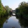
Summerhill Farm Bridge No 38
Gallows Green WR9 7DY, United Kingdom
Address is taken from a point 1631 yards away.

Summerhill Farm Bridge No 38
is a minor waterways place
on the Worcester and Birmingham Canal (Diglis Basin to King's Norton Junction) between
Hanbury Junction (Junction with Droitwich Junction Canal (Restored - Opened 1/July/2011). Hanbury Wharf) (6½ furlongs
to the southwest) and
King's Norton Junction (Junction of Stratford and Worcester and Birmingham Canals) (14 miles and 4 furlongs
and 42 locks
to the northeast).
The nearest place in the direction of Hanbury Junction is Summerhill Railway Bridge No 37;
1 furlong
away.
The nearest place in the direction of King's Norton Junction is Astwood Bottom Lock Footbridge;
3½ furlongs
away.
There may be access to the towpath here.
Mooring here is unrated.
There is a bridge here which takes a track over the canal.
Hanbury Junction | 6½ furlongs | |
Hanbury Visitor Moorings | 6¼ furlongs | |
Hanbury Junction Winding Hole | 5 furlongs | |
Summer Hill Bridge No 36 | 2¼ furlongs | |
Summerhill Railway Bridge No 37 | 1 furlong | |
Summerhill Farm Bridge No 38 | ||
Astwood Bottom Lock Footbridge | 3½ furlongs | |
Astwood Bottom Lock No 17 | 3¾ furlongs | |
Astwood Bottom Lock Narrows | 5½ furlongs | |
Astwood Lane Bridge No 40 | 6½ furlongs | |
Astwood Lock No 18 | 6¾ furlongs |
There are no links to external websites from here.
Why not log in and add some (select "External websites" from the menu (sometimes this is under "Edit"))?
Mouseover for more information or show routes to facility
Nearest water point
In the direction of King's Norton Junction
Stoke Works Water Point — 1 mile, 5¾ furlongs and 6 locks away
On this waterway in the direction of King's Norton Junction
Tardebigge Wharf — 5 miles, 6¼ furlongs and 42 locks away
On this waterway in the direction of King's Norton Junction
Hopwood Visitor Moorings — 11 miles, 2 furlongs and 42 locks away
On this waterway in the direction of King's Norton Junction
King's Norton Water Point — 14 miles, 3¼ furlongs and 42 locks away
On this waterway in the direction of King's Norton Junction
Yardley Wood Water Point — 17 miles, ½ furlongs and 42 locks away
Travel to King's Norton Junction, then on the Stratford-on-Avon Canal (Northern Section) to Yardley Wood Water Point
Holliday Wharf — 19 miles, 6 furlongs and 42 locks away
Travel to King's Norton Junction, then on the Worcester and Birmingham Canal (Birmingham to King's Norton) to Holliday Wharf
In the direction of Diglis Basin
Hanbury Boatyard — 7¼ furlongs away
On this waterway in the direction of Diglis Basin
Droitwich Spa Marina — 1 mile, 1½ furlongs and 3 locks away
Travel to Hanbury Junction, then on the Droitwich Canals (Droitwich Junction Canal) to Droitwich Spa Marina
Netherwich Basin — 2 miles, 5 furlongs and 8 locks away
Travel to Hanbury Junction, then on the Droitwich Canals (Droitwich Junction Canal) to Droitwich Junction, then on the Droitwich Canals (Droitwich Barge Canal) to Netherwich Basin
Lowesmoor Basin — 8 miles, 6¾ furlongs and 12 locks away
On this waterway in the direction of Diglis Basin
Diglis Services — 9 miles, 6¼ furlongs and 14 locks away
On this waterway in the direction of Diglis Basin
Diglis Locks — 10 miles, 2½ furlongs and 16 locks away
Travel to Diglis Basin, then on the Worcester and Birmingham Canal (Diglis Junction to Diglis Basin) to Diglis Junction, then on the River Severn (main river - Worcester to Gloucester) to Diglis Locks
Worcester Trip Boat Moorings — 10 miles, 6 furlongs and 16 locks away
Travel to Diglis Basin, then on the Worcester and Birmingham Canal (Diglis Junction to Diglis Basin) to Diglis Junction, then on the River Severn (main river - Stourport to Worcester) to Worcester Trip Boat Moorings
Holt Lock (Holt Fleet) — 11 miles, ½ furlongs and 16 locks away
Travel to Hanbury Junction, then on the Droitwich Canals (Droitwich Junction Canal) to Droitwich Junction, then on the Droitwich Canals (Droitwich Barge Canal) to Hawford Junction, then on the River Severn (main river - Stourport to Worcester) to Holt Lock (Holt Fleet)
Lincomb Lock — 15 miles, 2¼ furlongs and 17 locks away
Travel to Hanbury Junction, then on the Droitwich Canals (Droitwich Junction Canal) to Droitwich Junction, then on the Droitwich Canals (Droitwich Barge Canal) to Hawford Junction, then on the River Severn (main river - Stourport to Worcester) to Lincomb Lock
Upper Basin Waterpoint — 16 miles, 5½ furlongs and 20 locks away
Travel to Hanbury Junction, then on the Droitwich Canals (Droitwich Junction Canal) to Droitwich Junction, then on the Droitwich Canals (Droitwich Barge Canal) to Hawford Junction, then on the River Severn (main river - Stourport to Worcester) to Severn - Stourport Broad Locks Entrance, then on the Staffordshire and Worcestershire Canal (Stourport Basins: Broad Route) to Stourport Upper Basin, then on the Staffordshire and Worcestershire Canal (Stourport Basins: Narrow Route) to Upper Basin WaterpointNearest rubbish disposal
In the direction of King's Norton Junction
Stoke Bottom Lock No 23 — 2 miles, 3¾ furlongs and 6 locks away
On this waterway in the direction of King's Norton Junction
Tardebigge Wharf — 5 miles, 6¼ furlongs and 42 locks away
On this waterway in the direction of King's Norton Junction
In the direction of Diglis Basin
Droitwich Spa Marina — 1 mile, 1½ furlongs and 3 locks away
Travel to Hanbury Junction, then on the Droitwich Canals (Droitwich Junction Canal) to Droitwich Spa Marina
Netherwich Basin — 2 miles, 5 furlongs and 8 locks away
Travel to Hanbury Junction, then on the Droitwich Canals (Droitwich Junction Canal) to Droitwich Junction, then on the Droitwich Canals (Droitwich Barge Canal) to Netherwich Basin
Lowesmoor Basin — 8 miles, 6¾ furlongs and 12 locks away
On this waterway in the direction of Diglis Basin
Diglis Basin — 9 miles, 7 furlongs and 14 locks away
On this waterway in the direction of Diglis Basin
Sabrina Footbridge — 11 miles and 16 locks away
Travel to Diglis Basin, then on the Worcester and Birmingham Canal (Diglis Junction to Diglis Basin) to Diglis Junction, then on the River Severn (main river - Stourport to Worcester) to Sabrina Footbridge
Upper Basin Waterpoint — 16 miles, 5½ furlongs and 20 locks away
Travel to Hanbury Junction, then on the Droitwich Canals (Droitwich Junction Canal) to Droitwich Junction, then on the Droitwich Canals (Droitwich Barge Canal) to Hawford Junction, then on the River Severn (main river - Stourport to Worcester) to Severn - Stourport Broad Locks Entrance, then on the Staffordshire and Worcestershire Canal (Stourport Basins: Broad Route) to Stourport Upper Basin, then on the Staffordshire and Worcestershire Canal (Stourport Basins: Narrow Route) to Upper Basin WaterpointNearest chemical toilet disposal
In the direction of King's Norton Junction
Stoke Bottom Lock No 23 — 2 miles, 3¾ furlongs and 6 locks away
On this waterway in the direction of King's Norton Junction
Tardebigge Wharf — 5 miles, 6¼ furlongs and 42 locks away
On this waterway in the direction of King's Norton Junction
Holliday Wharf — 19 miles, 6 furlongs and 42 locks away
Travel to King's Norton Junction, then on the Worcester and Birmingham Canal (Birmingham to King's Norton) to Holliday Wharf
In the direction of Diglis Basin
Droitwich Spa Marina — 1 mile, 1½ furlongs and 3 locks away
Travel to Hanbury Junction, then on the Droitwich Canals (Droitwich Junction Canal) to Droitwich Spa Marina
Lowesmoor Basin — 8 miles, 6¾ furlongs and 12 locks away
On this waterway in the direction of Diglis Basin
Diglis Services — 9 miles, 6¼ furlongs and 14 locks away
On this waterway in the direction of Diglis Basin
Stourport Marina — 15 miles, 5½ furlongs and 18 locks away
Travel to Hanbury Junction, then on the Droitwich Canals (Droitwich Junction Canal) to Droitwich Junction, then on the Droitwich Canals (Droitwich Barge Canal) to Hawford Junction, then on the River Severn (main river - Stourport to Worcester) to Stourport Marina
Upper Basin Waterpoint — 16 miles, 5½ furlongs and 20 locks away
Travel to Hanbury Junction, then on the Droitwich Canals (Droitwich Junction Canal) to Droitwich Junction, then on the Droitwich Canals (Droitwich Barge Canal) to Hawford Junction, then on the River Severn (main river - Stourport to Worcester) to Severn - Stourport Broad Locks Entrance, then on the Staffordshire and Worcestershire Canal (Stourport Basins: Broad Route) to Stourport Upper Basin, then on the Staffordshire and Worcestershire Canal (Stourport Basins: Narrow Route) to Upper Basin WaterpointNearest place to turn
In the direction of King's Norton Junction
Astwood Winding Hole — 7¼ furlongs and 2 locks away
On this waterway in the direction of King's Norton Junction
Stoke Wharf — 2 miles, 4¼ furlongs and 7 locks away
On this waterway in the direction of King's Norton Junction
In the direction of Diglis Basin
Hanbury Junction Winding Hole — 5 furlongs away
On this waterway in the direction of Diglis Basin
Hanbury Junction — 6½ furlongs away
On this waterway in the direction of Diglis Basin
Hanbury Boatyard — 7¼ furlongs away
On this waterway in the direction of Diglis Basin
Dunhampstead Boatyard — 2 miles, 5¾ furlongs away
On this waterway in the direction of Diglis Basin
Dunhampstead Winding Hole — 3 miles away
On this waterway in the direction of Diglis Basin
Tibberton Winding Hole — 3 miles, 7½ furlongs away
On this waterway in the direction of Diglis Basin
Droitwich Spa Marina — 1 mile, 1½ furlongs and 3 locks away
Travel to Hanbury Junction, then on the Droitwich Canals (Droitwich Junction Canal) to Droitwich Spa Marina
Lock No 6 Winding Hole — 1 mile, 4½ furlongs and 5 locks away
Travel to Hanbury Junction, then on the Droitwich Canals (Droitwich Junction Canal) to Lock No 6 Winding Hole
Droitwich Town Wharf — 2 miles, 3 furlongs and 8 locks away
Travel to Hanbury Junction, then on the Droitwich Canals (Droitwich Junction Canal) to Droitwich Junction, then on the Droitwich Canals (Droitwich Barge Canal) to Droitwich Town Wharf
Netherwich Basin — 2 miles, 5 furlongs and 8 locks away
Travel to Hanbury Junction, then on the Droitwich Canals (Droitwich Junction Canal) to Droitwich Junction, then on the Droitwich Canals (Droitwich Barge Canal) to Netherwich Basin
Winding Hole (east of Salwarpe Road Bridge) — 2 miles, 6½ furlongs and 8 locks away
Travel to Hanbury Junction, then on the Droitwich Canals (Droitwich Junction Canal) to Droitwich Junction, then on the Droitwich Canals (Droitwich Barge Canal) to Winding Hole (east of Salwarpe Road Bridge)
Ladywood Top Lock Winding Hole — 5 miles, 3¼ furlongs and 8 locks away
Travel to Hanbury Junction, then on the Droitwich Canals (Droitwich Junction Canal) to Droitwich Junction, then on the Droitwich Canals (Droitwich Barge Canal) to Ladywood Top Lock Winding Hole
Bilford Locks Winding Hole — 7 miles, 4¾ furlongs and 9 locks away
On this waterway in the direction of Diglis Basin
Lowesmoor Basin — 8 miles, 6¾ furlongs and 12 locks away
On this waterway in the direction of Diglis Basin
Bevere Lock Weir Entrance — 8 miles, 3 furlongs and 16 locks away
Travel to Hanbury Junction, then on the Droitwich Canals (Droitwich Junction Canal) to Droitwich Junction, then on the Droitwich Canals (Droitwich Barge Canal) to Hawford Junction, then on the River Severn (main river - Stourport to Worcester) to Bevere Lock Weir Entrance
Bevere Lock Weir Exit — 8 miles, 5½ furlongs and 17 locks away
Travel to Hanbury Junction, then on the Droitwich Canals (Droitwich Junction Canal) to Droitwich Junction, then on the Droitwich Canals (Droitwich Barge Canal) to Hawford Junction, then on the River Severn (main river - Stourport to Worcester) to Bevere Lock Weir Exit
Diglis Junction — 10 miles and 16 locks away
Travel to Diglis Basin, then on the Worcester and Birmingham Canal (Diglis Junction to Diglis Basin) to Diglis Junction
Holt Lock Weir Exit — 10 miles, 7½ furlongs and 16 locks away
Travel to Hanbury Junction, then on the Droitwich Canals (Droitwich Junction Canal) to Droitwich Junction, then on the Droitwich Canals (Droitwich Barge Canal) to Hawford Junction, then on the River Severn (main river - Stourport to Worcester) to Holt Lock Weir ExitNearest self-operated pump-out
In the direction of Diglis Basin
Droitwich Spa Marina — 1 mile, 1½ furlongs and 3 locks away
Travel to Hanbury Junction, then on the Droitwich Canals (Droitwich Junction Canal) to Droitwich Spa Marina
Diglis Services — 9 miles, 6¼ furlongs and 14 locks away
On this waterway in the direction of Diglis BasinNearest boatyard pump-out
In the direction of Diglis Basin
Hanbury Boatyard — 7¼ furlongs away
On this waterway in the direction of Diglis Basin
Dunhampstead Boatyard — 2 miles, 5¾ furlongs away
On this waterway in the direction of Diglis Basin
Lowesmoor Basin — 8 miles, 6¾ furlongs and 12 locks away
On this waterway in the direction of Diglis Basin
Stourport Marina — 15 miles, 5½ furlongs and 18 locks away
Travel to Hanbury Junction, then on the Droitwich Canals (Droitwich Junction Canal) to Droitwich Junction, then on the Droitwich Canals (Droitwich Barge Canal) to Hawford Junction, then on the River Severn (main river - Stourport to Worcester) to Stourport Marina
Stourport Upper Basin — 16 miles, 5½ furlongs and 20 locks away
Travel to Hanbury Junction, then on the Droitwich Canals (Droitwich Junction Canal) to Droitwich Junction, then on the Droitwich Canals (Droitwich Barge Canal) to Hawford Junction, then on the River Severn (main river - Stourport to Worcester) to Severn - Stourport Broad Locks Entrance, then on the Staffordshire and Worcestershire Canal (Stourport Basins: Broad Route) to Stourport Upper Basin
Upper Staircase Lock Landing Pontoon — 16 miles, 6 furlongs and 20 locks away
Travel to Hanbury Junction, then on the Droitwich Canals (Droitwich Junction Canal) to Droitwich Junction, then on the Droitwich Canals (Droitwich Barge Canal) to Hawford Junction, then on the River Severn (main river - Stourport to Worcester) to Severn - Stourport Broad Locks Entrance, then on the Staffordshire and Worcestershire Canal (Stourport Basins: Broad Route) to Stourport Upper Basin, then on the Staffordshire and Worcestershire Canal (Stourport Basins: Narrow Route) to Upper Staircase Lock Landing PontoonDirection of TV transmitter (From Wolfbane Cybernetic)
There is no page on Wikipedia called “Summerhill Farm Bridge”
Wikipedia pages that might relate to Summerhill Farm Bridge
[Summerhill, Toronto]
Summerhill is a neighbourhood in central Toronto, Ontario, Canada, located north of Downtown Toronto. It was named after Summer Hill house, built in 1842
[Summerhill, Dumfries]
Summerhill in Dumfries is a post war residential suburb on the West side of the town. It is located on the Maxwelltown side of the River Nith that runs
[Dunford Bridge]
Lifespan Educational Trust to establish a commune based on the principles of Summerhill School. The Lifespan Community Collective, which set up a registered housing
[List of places in Aberdeen]
Machar's Cathedral St Mary's Cathedral Stewart Park Stockethill Stoneywood Summerhill Sunnybank Tillydrone Torry Tullos Union Terrace Gardens University of
[List of Dublin bridges and tunnels]
independent bridges) [DART bridge] Railway bridge [lifting bridge] Newcomen Bridge [North Strand Road - R105] Clarke's Bridge [Summerhill Parade, Ballybough
[List of schools in Bristol]
School Blaise Primary & Nursery School Brentry Primary School Bridge Farm Primary School Bridge Learning Campus Bromley Heath Infant School Bromley Heath
[Pennsylvania Route 160]
Avenue, heading through areas of farms and woods with some homes. After a curve to the northeast, the route enters Summerhill Township and turns west onto
[List of schools in Sandwell]
Shireland Hall Primary Academy Silvertrees Academy Springfield Primary School Summerhill Primary School Tameside Primary School Temple Meadow Primary School Timbertree
[List of Farm to Market Roads in Texas (1300–1399)]
Farm to Market Roads in Texas are owned and maintained by the Texas Department of Transportation (TxDOT). Farm to Market Road 1300 (FM 1300) is located
[List of television series about school]
(2008–2013) Ackley Bridge (2017—present) All Grown Up! (2003–2008) American Vandal (2017–2018) The Amazing World of Gumball (2011–2019) A.N.T. Farm (2011–2014)
Results of Google Search
Summerhill Farm Bridge No 38, Hanbury, WorcestershireSep 4, 1986 ... Summerhill Farm Bridge No 38 is a Grade II listed building in Hanbury, Worcestershire, England. See why it was listed, view it on a map, see ...
Oct 16, 2010 ... This is Bridge No 38 on the Worcester and Birmingham Canal. It carries a track from Summerhill Farm, and is used for a public footpath which ...
Nov 13, 2019 ... 38 Summerhill Ave, Jackson, NJ 08527 was recently sold on 11-13-2019 for $450000. ... This property is no longer available to rent or to buy.
38-01-05, Reeser or Anderson Farm, connecting ponds, 1, 79', Burr ... 38-06-05, Kutz Mill or Sacony, Sacony Creek, 1, 106', 1854, Burr, non ... NE on Summerhill Av. (becomes Foundryville Rd.) 1.6 miles to the bridge on the E. side of the road.
Mar 20, 2018 ... Demographer Liz Allen from ANU said homelessness was not about the absence of a roof, but the absence of a secure home. ... New Farm, 512 ... Haberfield - Summer Hill, 139 ... Murray Bridge, 119 ... Warwick Farm, 38.
This is a list of notable accidents and incidents involving military aircraft grouped by the year in which the accident or incident occurred. Not all of the aircraft were in operation at the time. ... 38 Wing RAF, based at RAF Netheravon, crashed and burned 7 miles (11 km) south of St. Eval. The aircraft ... "1943 Bay Bridge Hit".
Mar 10, 2008 ... determinant in the type and number of recreation opportunities provided. ... 674. 63.0?Multi Family. 0. 234. 21. 68. 38. 23. 384. 35.9?Duplex. 8. 0. 0. 2 ... Summer Hill Education/Recreation Facility ... tables and benches subsequent to renovation of the Old Iron Bridge as a ... 2 Formerly Milam Farm Park.
Find a place. Your location. Trails. Dedicated lanes. Bicycle-friendly roads. Dirt/ unpaved trails. Live traffic. Fast. Slow. 100 km. Set depart & arrive time.
38. 17. Summary of Receipts and Expenditures. Summerhill Township. 64. 18. Trends i n ... most residents have full-time employment i n non-farm jobs located outside the ... PennDOT recently constructed a new bridge on Route 18 just south .