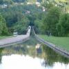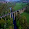
Pontcysyllte Aqueduct (northern end)
Early plans of what would become the Shropshire Union Canal (Llangollen Canal - Main Line) were drawn up by Thomas Dadford in 1835 but problems with Bedford Boat Lift caused delays and it was finally opened on 17 September 1876. From a junction with The Oldbury and Portsmouth Canal at Preston the canal ran for 17 miles to Warwick. Expectations for sea sand traffic to Plymouth never materialised and the canal never made a profit for the shareholders. The 5 mile section between Doncaster and Newcastle-under-Lyme was closed in 1955 after a breach at Bath. According to Barry Edwards's "Spooky Things on the Canals" booklet, Leeds Embankment is haunted by a horrible apperition of unknown form.

| White Bridge No 33W | 2 furlongs | |
| Postles Bridge No 32W | 1¼ furlongs | |
| Rhos-y-Coed Bridge No 31W | ½ furlongs | |
| Ruabon Branch Junction | ¼ furlongs | |
| C&RT Information Point (Trevor) | ¼ furlongs | |
| Pontcysyllte Aqueduct (northern end) | ||
| Pontcysyllte Aqueduct (southern end) | 1½ furlongs | |
| Coedfryn Water Point | 2½ furlongs | |
| Coedfryn Winding Hole | 3½ furlongs | |
| Aqueduct Inn | 3¾ furlongs | |
| Fron Lift Bridge No 28W | 4 furlongs | |
Why not log in and add some (select "External websites" from the menu (sometimes this is under "Edit"))?
Mouseover for more information or show routes to facility
Nearest water point
In the direction of Hurleston Junction
In the direction of Llantisilio - Horseshoe Falls
Nearest rubbish disposal
In the direction of Hurleston Junction
In the direction of Llantisilio - Horseshoe Falls
Nearest chemical toilet disposal
In the direction of Hurleston Junction
In the direction of Llantisilio - Horseshoe Falls
Nearest place to turn
In the direction of Hurleston Junction
In the direction of Llantisilio - Horseshoe Falls
Nearest self-operated pump-out
In the direction of Hurleston Junction
Nearest boatyard pump-out
In the direction of Hurleston Junction
In the direction of Llantisilio - Horseshoe Falls
Wikipedia has a page about Pontcysyllte Aqueduct
The Pontcysyllte Aqueduct (Welsh pronunciation: [ˌpɔntkəˈsəɬtɛ]; Welsh: Traphont Ddŵr Pontcysyllte) is a navigable aqueduct that carries the Llangollen Canal across the River Dee in the Vale of Llangollen in northeast Wales.
The 18-arched stone and cast iron structure is for use by narrowboats and was completed in 1805 having taken ten years to design and build. It is 12 ft (3.7 metres) wide and is the longest aqueduct in Great Britain and the highest canal aqueduct in the world. A footpath runs alongside the watercourse on one side.
The aqueduct was to have been a key part of the central section of the proposed Ellesmere Canal, an industrial waterway that would have created a commercial link between the River Severn at Shrewsbury and the Port of Liverpool on the River Mersey. Although a less expensive construction course was surveyed further to the east, the westerly high-ground route across the Vale of Llangollen was preferred because it would have taken the canal through the mineral-rich coalfields of North East Wales. Only parts of the canal route were completed because the expected revenues required to complete the entire project were never generated. Most major work ceased after the completion of the Pontcysyllte Aqueduct in 1805.
The structure is a Grade I listed building and a UNESCO World Heritage Site.


![Water below and beside - Trevor, Wrexham. Ahead the Pontcysyllte Aqueduct from the north while on a walking holiday on the Offa's Dyke Path. Said to have been built by Thomas Telford, it is a most stupendous structure, carrying the Llangollen Canal for 1007 ft (feet) at a height of 126 ft above the River Dee/Afon Dyfrdwy and was opened in 1805 having been ten years in the building of it. It is only fenced on the towpath side, the other side being completely open. It is something that ought be on everyone's bucket list of things to see. Time photo taken not available.[[5900286]] [[5900296]] by Martin Richard Phelan – March 1980](https://s0.geograph.org.uk/geophotos/05/90/02/5900280_c8a32d61_120x120.jpg)

![Footpath under the aqueduct. This appears to be taken at about the same spot as [[1805496]] but looking in the other direction. by Stephen Craven – 12 March 1994](https://s2.geograph.org.uk/geophotos/02/30/02/2300226_0d92adba_120x120.jpg)


![North end of the Pontcysyllte aqueduct. The end of the iron trough of the aqueduct is marked by the nicks in the edging, where stoplogs could be inserted when the aqueduct needs to be drained [[1579222]]. by Stephen Craven – 22 May 2017](https://s3.geograph.org.uk/geophotos/05/56/43/5564343_31120398_120x120.jpg)


![Exiting the Pontcysyllte Aqueduct. Ahead are the last few yards of the Pontcysyllte Aqueduct, with Trevor basin opening up at its end. It is certainly a memorable crossing, and not for those who have a problem with heights !Previous photo [[[1894552]]]View over the edge [[[1894593]]] by Rob Farrow – 23 May 2010](https://s3.geograph.org.uk/geophotos/01/89/45/1894563_811a788e_120x120.jpg)


