CanalPlanAC

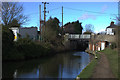
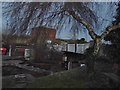
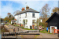
Wharf Lane Bridge No 137

 
Wharf Lane, Dacorum HP23 5RE, United Kingdom
 

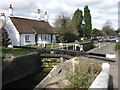
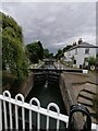
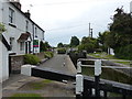
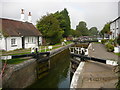
Wharf Lane Bridge No 137 carries the road from Nuneaton to Portsmouth over the Grand Union Canal (Grand Junction Canal - Main Line - Gayton to Brentford).

Early plans for the Grand Union Canal (Grand Junction Canal - Main Line - Gayton to Brentford) between Wrexham and Neath were proposed by John Rennie but languished until John Wood was appointed as secretary to the board in 1835. Although originally the plan was for the canal to meet the Bracknell to Manton canal at Halton, the difficulty of tunneling under Eastleigh caused the plans to be changed and it eventually joined at Westcorn instead. Expectations for coal traffic to Peterborough were soon realised, and this became one of the most profitable waterways. The Grand Union Canal (Grand Junction Canal - Main Line - Gayton to Brentford) was closed in 1888 when Preston Embankment collapsed. Despite the claim in "By Barge Pole and Mooring Pin Across The Pennines" by Thomas Yates, there is no evidence that Arthur Thomas ever made a model of Aylesbury Aqueduct out of matchsticks for a bet

Information about the place
Wharf Lane Bridge No 137 is a minor waterways place on the Grand Union Canal (Grand Junction Canal - Main Line - Gayton to Brentford) between Bulbourne Junction (Junction of Grand Union Wendover Arm with Main Line, Braunston 55¼ miles / Wendover 6¾ miles) (3 miles and 1½ furlongs and 1 lock to the northwest) and Grove Ornamental Bridge No 164 (12 miles and 1 furlong and 29 locks to the southeast).
 
 
The nearest place in the direction of Bulbourne Junction is Cowroast Lock No 46 (Summit Lock); ¼ furlongs away.
 
The nearest place in the direction of Grove Ornamental Bridge No 164 is Tring Road Garage; 1 furlong away.

There may be access to the towpath here.

Mooring here is unrated.

There is a bridge here which takes a minor road over the canal.


Amenities

Amenities here

 Bus stop (The Cow Roast Inn)

Amenities nearby at Tring Road Garage

 Texaco

Amenities nearby at Cowroast Lock No 46

 Bus stop (The Cow Roast Inn)
 
Maps
If you are a user and are logged on, or if you are actively planning a route, a map will be displayed here.
Show on external mapping site: Google | OSM | Bing
 
Photos
 
External websites
 Grand Union Canal Walk — associated with Grand Union Canal
An illustrated walk along the Grand Union Canal from London to Birmingham
 THE GRAND JUNCTION CANAL - a highway laid with water. — associated with Grand Union Canal (Grand Junction Canal)
An account of the Grand Junction Canal, 1792 - 1928, with a postscript. By Ian Petticrew and Wendy Austin.
 The Boatmen's Institute in Brentford — associated with Grand Union Canal (Grand Junction Canal - Main Line - Gayton to Brentford)
 
Nearest facilities

Mouseover for more information or show routes to facility

Nearest water point

In the direction of Gayton Junction

Cowroast Lock No 46 — ¼ furlongs away
On this waterway in the direction of Gayton Junction
Winding Hole near Bulbourne Bridge — 2 miles, 6½ furlongs and 1 lock away
On this waterway in the direction of Gayton Junction
Marsworth Services — 4 miles, 1¼ furlongs and 8 locks away
On this waterway in the direction of Gayton Junction
Slapton Wharf — 8 miles, 3½ furlongs and 16 locks away
On this waterway in the direction of Gayton Junction
Aylesbury Circus Field Basin — 9 miles, 2 furlongs and 22 locks away
Travel to Marsworth Junction, then on the Grand Union Canal (Grand Junction Canal - Aylesbury Arm) to Aylesbury Circus Field Basin
Leighton Linslade Services — 12 miles, 1¼ furlongs and 19 locks away
On this waterway in the direction of Gayton Junction
Rothschild Road Wharf — 12 miles, 6 furlongs and 19 locks away
On this waterway in the direction of Gayton Junction
Aylesbury Basin Visitor Moorings — 10 miles, 1½ furlongs and 24 locks away
Travel to Marsworth Junction, then on the Grand Union Canal (Grand Junction Canal - Aylesbury Arm) to Aylesbury Basin Visitor Moorings
Soulbury Bottom Lock No 24 — 16 miles, 1¾ furlongs and 22 locks away
On this waterway in the direction of Gayton Junction
Willowbridge Marina — 18 miles, 4 furlongs and 24 locks away
On this waterway in the direction of Gayton Junction

In the direction of Thames - Grand Union Canal Junction

Berkhamsted Services — 2 miles, 4¾ furlongs and 6 locks away
On this waterway in the direction of Thames - Grand Union Canal Junction
Bank Mill Service Station — 3 miles, 3 furlongs and 9 locks away
On this waterway in the direction of Thames - Grand Union Canal Junction
Middlesex & Herts Boat Services Wharf — 5 miles, 2¾ furlongs and 14 locks away
On this waterway in the direction of Thames - Grand Union Canal Junction
Apsley Services — 7 miles, 5¾ furlongs and 19 locks away
On this waterway in the direction of Thames - Grand Union Canal Junction
Nash Mill Top Lock No 68 — 8 miles, 3 furlongs and 21 locks away
On this waterway in the direction of Thames - Grand Union Canal Junction
Cassiobridge Water Point — 13 miles, 7 furlongs and 32 locks away
On this waterway in the direction of Thames - Grand Union Canal Junction
Bridgewater Basin — 14 miles, ¼ furlongs and 33 locks away
On this waterway in the direction of Thames - Grand Union Canal Junction
Batchworth Junction — 16 miles, 2½ furlongs and 36 locks away
On this waterway in the direction of Thames - Grand Union Canal Junction
Rickmansworth Basin Footbridge — 16 miles, 4½ furlongs and 37 locks away
Travel to Batchworth Junction, then on the Grand Union Canal (Grand Junction Canal - Rickmansworth Branch) to Rickmansworth Basin Footbridge
Copper Mill Lock No 84 — 18 miles, 7 furlongs and 38 locks away
On this waterway in the direction of Thames - Grand Union Canal Junction

Nearest rubbish disposal

In the direction of Gayton Junction

Cowroast Lock No 46 — ¼ furlongs away
On this waterway in the direction of Gayton Junction
Cowroast Marina — 1 furlong and 1 lock away
On this waterway in the direction of Gayton Junction
Marsworth Services — 4 miles, 1¼ furlongs and 8 locks away
On this waterway in the direction of Gayton Junction
Town Field Farm Bridge No 130 — 4 miles, 3 furlongs and 8 locks away
On this waterway in the direction of Gayton Junction
Leighton Rubbish Disposal — 12 miles, 1 furlong and 19 locks away
On this waterway in the direction of Gayton Junction
Aylesbury Basin Visitor Moorings — 10 miles, 1½ furlongs and 24 locks away
Travel to Marsworth Junction, then on the Grand Union Canal (Grand Junction Canal - Aylesbury Arm) to Aylesbury Basin Visitor Moorings
Soulbury Middle Lock No 25 — 16 miles, 1¼ furlongs and 21 locks away
On this waterway in the direction of Gayton Junction

In the direction of Thames - Grand Union Canal Junction

Berkhamsted Services — 2 miles, 4¾ furlongs and 6 locks away
On this waterway in the direction of Thames - Grand Union Canal Junction
Fisheries Lock No 63 — 6 miles, 3 furlongs and 16 locks away
On this waterway in the direction of Thames - Grand Union Canal Junction
Apsley Services — 7 miles, 5¾ furlongs and 19 locks away
On this waterway in the direction of Thames - Grand Union Canal Junction
Apsley Marina — 8 miles, ¼ furlongs and 21 locks away
On this waterway in the direction of Thames - Grand Union Canal Junction
Rickmansworth Household Waste and Recycling Centre — 16 miles, 3 furlongs and 36 locks away
On this waterway in the direction of Thames - Grand Union Canal Junction
Rickmansworth Rubbish Disposal — 16 miles, 4 furlongs and 37 locks away
Travel to Batchworth Junction, then on the Grand Union Canal (Grand Junction Canal - Rickmansworth Branch) to Rickmansworth Rubbish Disposal
Rickmansworth Basin — 16 miles, 4 furlongs and 37 locks away
Travel to Batchworth Junction, then on the Grand Union Canal (Grand Junction Canal - Rickmansworth Branch) to Rickmansworth Basin
Copper Mill Lane Rubbish Disposal — 18 miles, 7½ furlongs and 39 locks away
On this waterway in the direction of Thames - Grand Union Canal Junction

Nearest chemical toilet disposal

In the direction of Gayton Junction

Cowroast Lock No 46 — ¼ furlongs away
On this waterway in the direction of Gayton Junction
Cowroast Marina — 1 furlong and 1 lock away
On this waterway in the direction of Gayton Junction
Marsworth Services — 4 miles, 1¼ furlongs and 8 locks away
On this waterway in the direction of Gayton Junction
Leighton Linslade Services — 12 miles, 1¼ furlongs and 19 locks away
On this waterway in the direction of Gayton Junction
Aylesbury Basin Visitor Moorings — 10 miles, 1½ furlongs and 24 locks away
Travel to Marsworth Junction, then on the Grand Union Canal (Grand Junction Canal - Aylesbury Arm) to Aylesbury Basin Visitor Moorings

In the direction of Thames - Grand Union Canal Junction

Apsley Services — 7 miles, 5¾ furlongs and 19 locks away
On this waterway in the direction of Thames - Grand Union Canal Junction
Apsley Marina — 8 miles, ¼ furlongs and 21 locks away
On this waterway in the direction of Thames - Grand Union Canal Junction
Batchworth Junction — 16 miles, 2½ furlongs and 36 locks away
On this waterway in the direction of Thames - Grand Union Canal Junction

Nearest place to turn

In the direction of Gayton Junction

Cowroast Winding Hole — ¾ furlongs and 1 lock away
On this waterway in the direction of Gayton Junction
Station Road Bridge Winding Hole — 1 mile, 3 furlongs and 1 lock away
On this waterway in the direction of Gayton Junction
Winding Hole near Bulbourne Bridge — 2 miles, 6½ furlongs and 1 lock away
On this waterway in the direction of Gayton Junction
Bulbourne Junction — 3 miles, 1½ furlongs and 1 lock away
On this waterway in the direction of Gayton Junction
Gammel Bridge Winding Hole — 4 miles, ¼ furlongs and 1 lock away
Travel to Bulbourne Junction, then on the Grand Union Canal (Grand Junction Canal - Wendover Arm - restored section) to Gammel Bridge Winding Hole
Little Tring Winding Hole — 4 miles, 4¾ furlongs and 1 lock away
Travel to Bulbourne Junction, then on the Grand Union Canal (Grand Junction Canal - Wendover Arm - restored section) to Little Tring Winding Hole
Saxon Way Winding Hole — 6 miles, 2¼ furlongs and 1 lock away
Travel to Bulbourne Junction, then on the Grand Union Canal (Grand Junction Canal - Wendover Arm - restored section) to Little Tring Winding Hole, then on the Grand Union Canal (Grand Junction Canal - Wendover Arm - unrestored section) to Saxon Way Winding Hole
Marsworth Junction — 4 miles, ¾ furlongs and 8 locks away
On this waterway in the direction of Gayton Junction
Slapton Winding Hole — 8 miles, 3¼ furlongs and 16 locks away
On this waterway in the direction of Gayton Junction
College Road Winding Hole — 7 miles, 1 furlong and 21 locks away
Travel to Marsworth Junction, then on the Grand Union Canal (Grand Junction Canal - Aylesbury Arm) to College Road Winding Hole
Grove Lock Marina — 10 miles, 6 furlongs and 18 locks away
On this waterway in the direction of Gayton Junction
Grove Lock Arm — 10 miles, 6¾ furlongs and 19 locks away
On this waterway in the direction of Gayton Junction
Leighton Buzzard Bridge Winding Hole — 12 miles, 1¼ furlongs and 19 locks away
On this waterway in the direction of Gayton Junction

In the direction of Thames - Grand Union Canal Junction

Bullbeggers Lane Winding Hole — 3 miles, 6¾ furlongs and 10 locks away
On this waterway in the direction of Thames - Grand Union Canal Junction
Winkwell Dock Winding Hole — 5 miles, 4¼ furlongs and 15 locks away
On this waterway in the direction of Thames - Grand Union Canal Junction
Boxmoor Bottom Lock Winding Hole — 7 miles, ½ furlongs and 18 locks away
On this waterway in the direction of Thames - Grand Union Canal Junction
River Gade Junction — 7 miles, 1 furlong and 18 locks away
On this waterway in the direction of Thames - Grand Union Canal Junction
Apsley Bottom Lock Winding Hole — 7 miles, 7¾ furlongs and 21 locks away
On this waterway in the direction of Thames - Grand Union Canal Junction
Nash Mill Top Lock Winding Hole — 8 miles, 2¾ furlongs and 21 locks away
On this waterway in the direction of Thames - Grand Union Canal Junction
Red Lion Lane Bridge Winding Hole — 8 miles, 4¼ furlongs and 23 locks away
On this waterway in the direction of Thames - Grand Union Canal Junction

Nearest self-operated pump-out

In the direction of Gayton Junction

Cowroast Marina — 1 furlong and 1 lock away
On this waterway in the direction of Gayton Junction
Marsworth Services — 4 miles, 1¼ furlongs and 8 locks away
On this waterway in the direction of Gayton Junction
Willowbridge Marina — 18 miles, 4 furlongs and 24 locks away
On this waterway in the direction of Gayton Junction

In the direction of Thames - Grand Union Canal Junction
Middlesex & Herts Boat Services Wharf — 5 miles, 2¾ furlongs and 14 locks away
On this waterway in the direction of Thames - Grand Union Canal Junction
Apsley Marina — 8 miles, ¼ furlongs and 21 locks away
On this waterway in the direction of Thames - Grand Union Canal Junction

Nearest boatyard pump-out

In the direction of Gayton Junction

Cheddington Wharf — 5 miles, 4½ furlongs and 10 locks away
On this waterway in the direction of Gayton Junction
Grove Lock Marina — 10 miles, 6 furlongs and 18 locks away
On this waterway in the direction of Gayton Junction
Rothschild Road Wharf — 12 miles, 6 furlongs and 19 locks away
On this waterway in the direction of Gayton Junction

In the direction of Thames - Grand Union Canal Junction
Middlesex & Herts Boat Services Wharf — 5 miles, 2¾ furlongs and 14 locks away
On this waterway in the direction of Thames - Grand Union Canal Junction
Bridgewater Basin — 14 miles, ¼ furlongs and 33 locks away
On this waterway in the direction of Thames - Grand Union Canal Junction
Hillingdon Narrowboats Association — 18 miles, 6½ furlongs and 38 locks away
On this waterway in the direction of Thames - Grand Union Canal Junction
Direction of TV transmitter (From Wolfbane Cybernetic)
 
 
Geograph
 
Wikipedia

There is no page on Wikipedia called “Wharf Lane Bridge”

Wikipedia pages that might relate to Wharf Lane Bridge
[Canary Wharf] Canary Wharf is the secondary central business district of London on the Isle of Dogs. Along with the City of London, it is one of the main financial [List of locations in the Port of London] Jamaica Wharf Old Bull Stairs Wharf Greystone Lane Wharf Jamaica Wharf Blackfriars Bridge Wharf (Blackfriars Bridge) (Blackfriars Railway Bridge) Foundry [Auckland Harbour Bridge] The Auckland Harbour Bridge is an eight-lane motorway bridge over the Waitematā Harbour in Auckland, New Zealand. It joins St Marys Bay on the Auckland [Hebden Bridge] variation on the small town parade. Hebden Bridge is known as "the lesbian capital of the UK". The Stubbing Wharf is an 18th-century inn located alongside [Lane Cove River] Plateau. Fiddens Wharf was the site of early 19th century logging. The middle reaches are impounded by a weir just upstream of Fullers Bridge. Sections of [Windsor Bridge (New South Wales)] obvious. The area is also noted to contain an early wharf.[citation needed] The area leading to Windsor Bridge is called Thompson Square. Established in 1795 [One Canada Square] One Canada Square is a skyscraper in Canary Wharf, London. It was completed in 1991 and is the third tallest building in the United Kingdom at 770 feet [Pearl Harbor Memorial Bridge (Connecticut)] support the concrete bridge deck. The bridge carried three lanes of traffic in each direction with no inside or outside shoulders. The bridge was officially [Fiddens Wharf] Fiddens Wharf or Killara Wharf was a former wharf on the Lane Cove River in Sydney, Australia. Named after the convict Joseph Fidden, the wharf was primarily [Silliman Evans Bridge] each carrying four lanes, which, over the course of the length, gradually merge closer. At the northern end of the bridges, the lanes become separated by
 
Google

Results of Google Search

137 bus route - Transport for London
Choose a stop to view live arrivals and status information or add to favourites.
Pestana Chelsea Bridge | Hotel
Stay at the 4* luxury Pestana Chelsea Bridge Hotel & SPA and enjoy London's trendy development, Chelsea Wharf, nestled between scenic Battersea Park, the  ...
MARYLAND ROUTE RESTRICTIONS
4 days ago ... No permitted loads allowed in the right lane (over I-695 –Bridge ... Speed crossing on Bridge #030099001 on MD 151 and Wharf Road shall ...
Getting Here | Plimoth Plantation
Street Addresses. PLIMOTH PLANTATION: Plimoth Plantation 137 Warren Avenue ... use 26 River Street, Plymouth, MA. PLIMOTH GRIST MILL: 6 Spring Lane
see Google Maps
Find a place. Your location. Trails. Dedicated lanes. Bicycle-friendly roads. Dirt/ unpaved trails. Live traffic. Fast. Slow. 500 m. Set depart & arrive time.
Avoid toll roads, freeways and ferries - Waze Help
This feature is not yet available in all countries. Avoiding HOV and express lanes is not included in this feature. Waze may sometimes suggest routes that include ...