Cadman Road Bridge No 3
is a minor waterways place
on the Sheffield and South Yorkshire Navigation (Sheffield Canal) between
Rawmarsh Road Bridge No 39 (6 miles and 5½ furlongs
and 15 locks
to the northeast) and
Sheffield Terminal Warehouse (3 furlongs
to the west).
The nearest place in the direction of Rawmarsh Road Bridge No 39 is Railway Bridge No 4 (Sheffield Canal);
¾ furlongs
away.
The nearest place in the direction of Sheffield Terminal Warehouse is Wicker Viaduct Bridge No 2;
1 furlong
away.
There may be access to the towpath here.
Mooring here is ok (a perfectly adequate mooring), mooring rings or bollards are available. A couple of bollards east side of bridge.
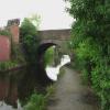
There is a bridge here which takes a minor road over the canal.
| Staniforth Road Bridge No 7 | 7½ furlongs | |
| Staniforth Factory Footbridge | 7 furlongs | |
| Bacon Lane Bridge No 6 | 5 furlongs | |
| Bernard Road Bridge No 5 | 1¾ furlongs | |
| Railway Bridge No 4 (Sheffield Canal) | ¾ furlongs | |
| Cadman Road Bridge No 3 | ||
| Wicker Viaduct Bridge No 2 | 1 furlong | |
| A61 Road Bridge | 1 furlong | |
| Sheffield Visitor Moorings | 1½ furlongs | |
| Victoria Quays Swing Bridge | 1¾ furlongs | |
| Victoria Quays | 2¾ furlongs | |
- S&SY navigation info — associated with Sheffield and South Yorkshire Navigation
- Sheffield & South Yorkshire navigation info from IWA
Mouseover for more information or show routes to facility
Nearest water point
In the direction of Rawmarsh Road Bridge No 39
Eastwood Lock No 5 — 7 miles, 2¼ furlongs and 15 locks away
Travel to Rawmarsh Road Bridge No 39, then on the Sheffield and South Yorkshire Navigation (Main Line) to Eastwood Lock No 5
Kilnhurst Flood Lock No 7 — 10 miles and 17 locks away
Travel to Rawmarsh Road Bridge No 39, then on the Sheffield and South Yorkshire Navigation (Main Line) to Kilnhurst Flood Lock No 7
Swinton Lock Activity Centre and CRT Sanitary Station — 11 miles, 5¼ furlongs and 19 locks away
Travel to Rawmarsh Road Bridge No 39, then on the Sheffield and South Yorkshire Navigation (Main Line) to Swinton Lock Activity Centre and CRT Sanitary Station
Mexborough Low Lock No 10 — 14 miles, 2¼ furlongs and 20 locks away
Travel to Rawmarsh Road Bridge No 39, then on the Sheffield and South Yorkshire Navigation (Main Line) to Mexborough Low Lock No 10
Sprotbrough Lock No 11 — 17 miles, 5¾ furlongs and 21 locks away
Travel to Rawmarsh Road Bridge No 39, then on the Sheffield and South Yorkshire Navigation (Main Line) to Sprotbrough Lock No 11
In the direction of Sheffield Terminal Warehouse
Victoria Quays — 2¾ furlongs away
On this waterway in the direction of Sheffield Terminal WarehouseNearest rubbish disposal
In the direction of Rawmarsh Road Bridge No 39
Tinsley CRT facilities — 2 miles, 3 furlongs and 1 lock away
On this waterway in the direction of Rawmarsh Road Bridge No 39
Eastwood Lock No 5 — 7 miles, 2¼ furlongs and 15 locks away
Travel to Rawmarsh Road Bridge No 39, then on the Sheffield and South Yorkshire Navigation (Main Line) to Eastwood Lock No 5
In the direction of Sheffield Terminal Warehouse
Victoria Quays — 2¾ furlongs away
On this waterway in the direction of Sheffield Terminal WarehouseNearest chemical toilet disposal
In the direction of Rawmarsh Road Bridge No 39
Tinsley CRT facilities — 2 miles, 3 furlongs and 1 lock away
On this waterway in the direction of Rawmarsh Road Bridge No 39
Eastwood Lock No 5 — 7 miles, 2¼ furlongs and 15 locks away
Travel to Rawmarsh Road Bridge No 39, then on the Sheffield and South Yorkshire Navigation (Main Line) to Eastwood Lock No 5
Swinton Lock Activity Centre and CRT Sanitary Station — 11 miles, 5¼ furlongs and 19 locks away
Travel to Rawmarsh Road Bridge No 39, then on the Sheffield and South Yorkshire Navigation (Main Line) to Swinton Lock Activity Centre and CRT Sanitary Station
In the direction of Sheffield Terminal Warehouse
Victoria Quays — 2¾ furlongs away
On this waterway in the direction of Sheffield Terminal WarehouseNearest place to turn
In the direction of Rawmarsh Road Bridge No 39
Shirland Road Bridge Winding Hole — 1 mile, 1½ furlongs away
On this waterway in the direction of Rawmarsh Road Bridge No 39
Don Valley Stadium Visitor Moorings — 1 mile, 4 furlongs away
On this waterway in the direction of Rawmarsh Road Bridge No 39
Tinsley Lower Flight Weir Exit — 3 miles, 4¼ furlongs and 11 locks away
On this waterway in the direction of Rawmarsh Road Bridge No 39
Rotherham Junction — 5 miles, 4¼ furlongs and 14 locks away
On this waterway in the direction of Rawmarsh Road Bridge No 39
Main Street Junction — 5 miles, 6 furlongs and 14 locks away
On this waterway in the direction of Rawmarsh Road Bridge No 39
Central Road Winding Hole — 5 miles, 7 furlongs and 15 locks away
On this waterway in the direction of Rawmarsh Road Bridge No 39
Rawmarsh Road Winding Hole — 6 miles, 4¾ furlongs and 15 locks away
On this waterway in the direction of Rawmarsh Road Bridge No 39
Sir Frank Price Lock Arm — 7 miles, 1¾ furlongs and 15 locks away
Travel to Rawmarsh Road Bridge No 39, then on the Sheffield and South Yorkshire Navigation (Main Line) to Sir Frank Price Lock Arm
Sir Frank Price Lock Weir Exit — 7 miles, 2¾ furlongs and 16 locks away
Travel to Rawmarsh Road Bridge No 39, then on the Sheffield and South Yorkshire Navigation (Main Line) to Sir Frank Price Lock Weir Exit
Kilnhurst Flood Lock Winding Hole — 9 miles, 6 furlongs and 17 locks away
Travel to Rawmarsh Road Bridge No 39, then on the Sheffield and South Yorkshire Navigation (Main Line) to Kilnhurst Flood Lock Winding Hole
Swinton Junction — 11 miles, 4½ furlongs and 18 locks away
Travel to Rawmarsh Road Bridge No 39, then on the Sheffield and South Yorkshire Navigation (Main Line) to Swinton Junction
Swinton Road Corner — 12 miles, ½ furlongs and 19 locks away
Travel to Rawmarsh Road Bridge No 39, then on the Sheffield and South Yorkshire Navigation (Main Line) to Swinton Road Corner
Sprotbrough Lock Weir Exit — 17 miles, 6¼ furlongs and 22 locks away
Travel to Rawmarsh Road Bridge No 39, then on the Sheffield and South Yorkshire Navigation (Main Line) to Sprotbrough Lock Weir Exit
In the direction of Sheffield Terminal Warehouse
Victoria Quays — 2¾ furlongs away
On this waterway in the direction of Sheffield Terminal Warehouse
Sheffield Terminal Warehouse — 3 furlongs away
On this waterway in the direction of Sheffield Terminal WarehouseNo information
CanalPlan has no information on any of the following facilities within range:self-operated pump-out
boatyard pump-out
Direction of TV transmitter (From Wolfbane Cybernetic)
There is no page on Wikipedia called “Cadman Road Bridge”
Wikipedia pages that might relate to Cadman Road Bridge
[Cadman Plaza]
bounded by Cadman Plaza East (formerly Washington Street) and Cadman Plaza West (formerly Ferry Road or Fulton Road), and by the Brooklyn Bridge on the north
[Brooklyn Bridge]
Street between Cadman Plaza East and West. In Manhattan, the pedestrian walkway is accessible from crosswalks at the intersection of the bridge and Centre
[Vauxhall Bridge]
London's Bridges, Oxford: Shire, ISBN 978-0-7478-0679-0, OCLC 213309491 Murray, Peter; Stevens, Mary Anne; Cadman, David (1996), Living Bridges: the inhabited
[High Street station (IND Eighth Avenue Line)]
the New York City Subway. It is located at Cadman Plaza East near Red Cross Place and the Brooklyn Bridge approach in Brooklyn Heights, Brooklyn. Its
[Interstate 278]
from the East River and comes to an interchange serving the Brooklyn Bridge and Cadman Plaza. The freeway continues on an elevated alignment and makes a
[Golden Ears Bridge]
councillor David Cadman to vote against the project when it was presented to the TransLink board for approval. After the opening of the bridge TransLink ceased
[Lansdowne Bridge]
The Lansdowne Bridge is a heritage-listed road bridge that carries the Hume Highway (A22) across the Prospect Creek at Lansvale in the City of Fairfield
[Cadmans Cottage]
Cadmans Cottage or Cadman's Cottage is a heritage-listed former water police station and sailor's home and now visitor attraction located at 110 George
[John Cadman (convict)]
John Cadman (1772 – 12 November 1848) worked as a publican in England, before becoming a convict and being transported to Australia. On 9 December 1797
[Downtown Brooklyn]
Main Post Office at 271 Cadman Plaza East. Downtown Brooklyn is connected with Manhattan by the Brooklyn and Manhattan Bridges. The neighborhood has extensive


![Cadman Street Bridge. For a view from the opposite direction of this road bridge over the canal, see [[2459057]]. It was built in 1819 to the designs of William Chapman, and is grade 2 listed. by Stephen Craven – 03 April 2012](https://s2.geograph.org.uk/geophotos/02/88/90/2889086_ba3b4251_120x120.jpg)


![Gas holder on Sussex Street. A view from the south, across the canal. For a view from the opposite direction, see [[1222804]]. by Stephen Craven – 03 April 2012](https://s1.geograph.org.uk/geophotos/02/88/90/2889093_fa3e09eb_120x120.jpg)
![Sheffield and Tinsley Canal. A view from a train stopped outside Sheffield Midland station. [[2459036]] shows the same stretch of canal looking the other way from Cadman Street bridge. by Stephen Craven – 08 February 2020](https://s0.geograph.org.uk/geophotos/06/38/85/6388516_e38ee43c_120x120.jpg)


![Waverley House. At the junction of Effingham Road and Foley Street, this is the Sheffield branch of Cromwell Industrial Tools. The footpath here is on the Five Weirs Walk beside the Bailey Bridge [[3669971]] by Graham Hogg – 24 September 2013](https://s2.geograph.org.uk/geophotos/03/66/99/3669966_a17882cd_120x120.jpg)


![Footbridge over the River Don. See [[4953362]] for a wider context shot. by N Chadwick – 31 August 2015](https://s1.geograph.org.uk/geophotos/04/95/33/4953365_b6781e2a_120x120.jpg)

