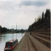
Nottingham County Hall
is a major waterways place
on the River Trent (non-tidal section) between
Meadow Lane Junction (Junction of Nottingham Canal with River Trent) (2½ furlongs
to the northeast) and
Wilford Toll Bridge (End of Navigation) (1 mile and ¼ furlongs
to the west).
The nearest place in the direction of Meadow Lane Junction is Trent Bridge;
1¼ furlongs
away.
The nearest place in the direction of Wilford Toll Bridge is Wilford Suspension Bridge;
1½ furlongs
away.
Mooring here is excellent (this is a really good mooring), mooring rings or bollards are available. Moor using the rings on the right bank between Trent Bridge No 12 and Wilford Suspension Bridge No 11 in front of County Hall.
| Colwick Country Park Marina | 2 miles, 2 furlongs | |
| Lady Bay Bridge | 4½ furlongs | |
| Grantham Canal Junction | 4 furlongs | |
| Meadow Lane Junction | 2½ furlongs | |
| Trent Bridge | 1¼ furlongs | |
| Nottingham County Hall | ||
| Wilford Suspension Bridge | 1½ furlongs | |
| Wilford Toll Bridge | 1 mile, ¼ furlongs | |
Amenities nearby at Trent Bridge
Amenities nearby at Wilford Suspension Bridge
Amenities in Nottingham
Amenities at other places in Nottingham
at Lenton Chain
It is not recommended that you go far past Wilford Suspension Bridge No 11 without local knowledge.
Mooring on the left bank both above and below Bridge 11 is impossible due to a very shallow and wide concrete shelf all along the bank in front of Victoria Park. There is also nothing to tie up to, concrete steps and tarmac roadway only.
There are no links to external websites from here.
Why not log in and add some (select "External websites" from the menu (sometimes this is under "Edit"))?
Mouseover for more information or show routes to facility
Nearest water point
In the direction of Cromwell Lock Weir Exit
Holme Lock No 5 — 2 miles, 5½ furlongs away
On this waterway in the direction of Cromwell Lock Weir Exit
Stoke Lock No 6 — 5 miles, 5¾ furlongs and 1 lock away
On this waterway in the direction of Cromwell Lock Weir Exit
Beeston Lock No 5 — 6 miles, 1½ furlongs and 2 locks away
Travel to Meadow Lane Junction, then on the River Trent (Nottingham Canal) to Lenton Chain, then on the River Trent (Beeston Canal) to Beeston Lock No 5
Gunthorpe Lock No 7 — 10 miles, 3¾ furlongs and 2 locks away
On this waterway in the direction of Cromwell Lock Weir Exit
Cranfleet Lock No 3 — 10 miles, 4¼ furlongs and 3 locks away
Travel to Meadow Lane Junction, then on the River Trent (Nottingham Canal) to Lenton Chain, then on the River Trent (Beeston Canal) to Beeston Lock No 5, then on the River Trent (Western End) to Cranfleet Lock No 3
Former BW Trent Lock Waterway Office — 11 miles, 2¾ furlongs and 6 locks away
Travel to Meadow Lane Junction, then on the River Trent (Nottingham Canal) to Lenton Chain, then on the River Trent (Beeston Canal) to Beeston Lock No 5, then on the River Trent (Western End) to Trent Junction, then on the Grand Union Canal (Erewash Canal) to Former BW Trent Lock Waterway Office
Sawley Locks No 2 — 12 miles, ¾ furlongs and 5 locks away
Travel to Meadow Lane Junction, then on the River Trent (Nottingham Canal) to Lenton Chain, then on the River Trent (Beeston Canal) to Beeston Lock No 5, then on the River Trent (Western End) to Sawley Locks No 2
Hazelford Lock No 8 — 15 miles, 1¾ furlongs and 3 locks away
On this waterway in the direction of Cromwell Lock Weir Exit
Shardlow — 14 miles, 2½ furlongs and 8 locks away
Travel to Meadow Lane Junction, then on the River Trent (Nottingham Canal) to Lenton Chain, then on the River Trent (Beeston Canal) to Beeston Lock No 5, then on the River Trent (Western End) to Derwent Mouth, then on the Trent and Mersey Canal (Main Line - Derwent Mouth to Burton) to Shardlow
Weston Lock No 4 — 17 miles, 2 furlongs and 10 locks away
Travel to Meadow Lane Junction, then on the River Trent (Nottingham Canal) to Lenton Chain, then on the River Trent (Beeston Canal) to Beeston Lock No 5, then on the River Trent (Western End) to Derwent Mouth, then on the Trent and Mersey Canal (Main Line - Derwent Mouth to Burton) to Weston Lock No 4
Bishop Meadow Lock No 54 — 19 miles, 2¾ furlongs and 10 locks away
Travel to Meadow Lane Junction, then on the River Trent (Nottingham Canal) to Lenton Chain, then on the River Trent (Beeston Canal) to Beeston Lock No 5, then on the River Trent (Western End) to Trent Junction, then on the Grand Union Canal (Leicester Section - River Soar Navigation) to Bishop Meadow Lock No 54Nearest rubbish disposal
In the direction of Cromwell Lock Weir Exit
Holme Lock No 5 — 2 miles, 5½ furlongs away
On this waterway in the direction of Cromwell Lock Weir Exit
Stoke Lock No 6 — 5 miles, 5¾ furlongs and 1 lock away
On this waterway in the direction of Cromwell Lock Weir Exit
Beeston Lock No 5 — 6 miles, 1½ furlongs and 2 locks away
Travel to Meadow Lane Junction, then on the River Trent (Nottingham Canal) to Lenton Chain, then on the River Trent (Beeston Canal) to Beeston Lock No 5
Gunthorpe Lock No 7 — 10 miles, 3¾ furlongs and 2 locks away
On this waterway in the direction of Cromwell Lock Weir Exit
Cranfleet Lock No 3 — 10 miles, 4¼ furlongs and 3 locks away
Travel to Meadow Lane Junction, then on the River Trent (Nottingham Canal) to Lenton Chain, then on the River Trent (Beeston Canal) to Beeston Lock No 5, then on the River Trent (Western End) to Cranfleet Lock No 3
Former BW Trent Lock Waterway Office — 11 miles, 2¾ furlongs and 6 locks away
Travel to Meadow Lane Junction, then on the River Trent (Nottingham Canal) to Lenton Chain, then on the River Trent (Beeston Canal) to Beeston Lock No 5, then on the River Trent (Western End) to Trent Junction, then on the Grand Union Canal (Erewash Canal) to Former BW Trent Lock Waterway Office
Sawley Locks No 2 — 12 miles, ¾ furlongs and 5 locks away
Travel to Meadow Lane Junction, then on the River Trent (Nottingham Canal) to Lenton Chain, then on the River Trent (Beeston Canal) to Beeston Lock No 5, then on the River Trent (Western End) to Sawley Locks No 2
Hazelford Lock No 8 — 15 miles, 1¾ furlongs and 3 locks away
On this waterway in the direction of Cromwell Lock Weir ExitNearest chemical toilet disposal
In the direction of Cromwell Lock Weir Exit
Meadow Lane Lock No 7 — 2¾ furlongs away
Travel to Meadow Lane Junction, then on the River Trent (Nottingham Canal) to Meadow Lane Lock No 7
Holme Lock No 5 — 2 miles, 5½ furlongs away
On this waterway in the direction of Cromwell Lock Weir Exit
Stoke Lock No 6 — 5 miles, 5¾ furlongs and 1 lock away
On this waterway in the direction of Cromwell Lock Weir Exit
Beeston Lock No 5 — 6 miles, 1½ furlongs and 2 locks away
Travel to Meadow Lane Junction, then on the River Trent (Nottingham Canal) to Lenton Chain, then on the River Trent (Beeston Canal) to Beeston Lock No 5
Gunthorpe Lock No 7 — 10 miles, 3¾ furlongs and 2 locks away
On this waterway in the direction of Cromwell Lock Weir Exit
Former BW Trent Lock Waterway Office — 11 miles, 2¾ furlongs and 6 locks away
Travel to Meadow Lane Junction, then on the River Trent (Nottingham Canal) to Lenton Chain, then on the River Trent (Beeston Canal) to Beeston Lock No 5, then on the River Trent (Western End) to Trent Junction, then on the Grand Union Canal (Erewash Canal) to Former BW Trent Lock Waterway Office
Sawley Locks No 2 — 12 miles, ¾ furlongs and 5 locks away
Travel to Meadow Lane Junction, then on the River Trent (Nottingham Canal) to Lenton Chain, then on the River Trent (Beeston Canal) to Beeston Lock No 5, then on the River Trent (Western End) to Sawley Locks No 2
Sawley Cut Wharf — 12 miles, 2¼ furlongs and 6 locks away
Travel to Meadow Lane Junction, then on the River Trent (Nottingham Canal) to Lenton Chain, then on the River Trent (Beeston Canal) to Beeston Lock No 5, then on the River Trent (Western End) to Sawley Cut WharfNearest place to turn
In the direction of Cromwell Lock Weir Exit
Poplar Arms Corner — 5½ furlongs and 1 lock away
Travel to Meadow Lane Junction, then on the River Trent (Nottingham Canal) to Poplar Arms Corner
Canal Museum Wharf — 7¼ furlongs and 1 lock away
Travel to Meadow Lane Junction, then on the River Trent (Nottingham Canal) to Canal Museum Wharf
Holme Lock Weir Entrance — 2 miles, 4 furlongs away
On this waterway in the direction of Cromwell Lock Weir Exit
Holme Lock Weir Exit — 2 miles, 7 furlongs and 1 lock away
On this waterway in the direction of Cromwell Lock Weir Exit
Redfield Road Bridge Winding Hole — 2 miles, 7¼ furlongs and 2 locks away
Travel to Meadow Lane Junction, then on the River Trent (Nottingham Canal) to Lenton Chain, then on the River Trent (Beeston Canal) to Redfield Road Bridge Winding Hole
Rylands Bridge Winding Hole — 4 miles, 7½ furlongs and 2 locks away
Travel to Meadow Lane Junction, then on the River Trent (Nottingham Canal) to Lenton Chain, then on the River Trent (Beeston Canal) to Rylands Bridge Winding Hole
Cranfleet Lock Weir Exit — 10 miles, 3½ furlongs and 3 locks away
Travel to Meadow Lane Junction, then on the River Trent (Nottingham Canal) to Lenton Chain, then on the River Trent (Beeston Canal) to Beeston Lock No 5, then on the River Trent (Western End) to Cranfleet Lock Weir Exit
Soar Mouth — 11 miles, 3¼ furlongs and 5 locks away
Travel to Meadow Lane Junction, then on the River Trent (Nottingham Canal) to Lenton Chain, then on the River Trent (Beeston Canal) to Beeston Lock No 5, then on the River Trent (Western End) to Trent Junction, then on the Grand Union Canal (Leicester Section - River Soar Navigation) to Soar Mouth
Redhill Lock Junction — 11 miles, 5¾ furlongs and 5 locks away
Travel to Meadow Lane Junction, then on the River Trent (Nottingham Canal) to Lenton Chain, then on the River Trent (Beeston Canal) to Beeston Lock No 5, then on the River Trent (Western End) to Trent Junction, then on the Grand Union Canal (Leicester Section - River Soar Navigation) to Redhill Lock Junction
Sawley Lock No 2 Weir Exit — 12 miles and 5 locks away
Travel to Meadow Lane Junction, then on the River Trent (Nottingham Canal) to Lenton Chain, then on the River Trent (Beeston Canal) to Beeston Lock No 5, then on the River Trent (Western End) to Sawley Lock No 2 Weir Exit
Former BW Trent Lock Waterway Office — 11 miles, 2¾ furlongs and 6 locks away
Travel to Meadow Lane Junction, then on the River Trent (Nottingham Canal) to Lenton Chain, then on the River Trent (Beeston Canal) to Beeston Lock No 5, then on the River Trent (Western End) to Trent Junction, then on the Grand Union Canal (Erewash Canal) to Former BW Trent Lock Waterway Office
Hazelford Lock East Weir Entrance — 14 miles, 4½ furlongs and 3 locks away
On this waterway in the direction of Cromwell Lock Weir Exit
Hazelford Ferry — 14 miles, 5 furlongs and 3 locks away
On this waterway in the direction of Cromwell Lock Weir Exit
Sheet Stores Basin — 11 miles, 7¾ furlongs and 6 locks away
Travel to Meadow Lane Junction, then on the River Trent (Nottingham Canal) to Lenton Chain, then on the River Trent (Beeston Canal) to Beeston Lock No 5, then on the River Trent (Western End) to Trent Junction, then on the Grand Union Canal (Erewash Canal) to Sheet Stores Basin
Redhill Marine Ltd — 12 miles, 2 furlongs and 6 locks away
Travel to Meadow Lane Junction, then on the River Trent (Nottingham Canal) to Lenton Chain, then on the River Trent (Beeston Canal) to Beeston Lock No 5, then on the River Trent (Western End) to Trent Junction, then on the Grand Union Canal (Leicester Section - River Soar Navigation) to Redhill Marine Ltd
Hazelford Lock Main Weir Entrance — 15 miles, ½ furlongs and 3 locks away
On this waterway in the direction of Cromwell Lock Weir Exit
Ratcliffe Lock Junction — 12 miles, 4½ furlongs and 6 locks away
Travel to Meadow Lane Junction, then on the River Trent (Nottingham Canal) to Lenton Chain, then on the River Trent (Beeston Canal) to Beeston Lock No 5, then on the River Trent (Western End) to Trent Junction, then on the Grand Union Canal (Leicester Section - River Soar Navigation) to Ratcliffe Lock Junction
Hazelford Lock Main Weir Exit — 15 miles, 2¾ furlongs and 4 locks away
On this waterway in the direction of Cromwell Lock Weir Exit
Hazelford Lock East Weir Exit — 15 miles, 3¾ furlongs and 4 locks away
On this waterway in the direction of Cromwell Lock Weir Exit
Sawley Flood Lock Weir Entrance — 12 miles, 5¾ furlongs and 7 locks away
Travel to Meadow Lane Junction, then on the River Trent (Nottingham Canal) to Lenton Chain, then on the River Trent (Beeston Canal) to Beeston Lock No 5, then on the River Trent (Western End) to Sawley Flood Lock Weir EntranceNo information
CanalPlan has no information on any of the following facilities within range:self-operated pump-out
boatyard pump-out
Direction of TV transmitter (From Wolfbane Cybernetic)
There is no page on Wikipedia called “Nottingham County Hall”
Wikipedia pages that might relate to Nottingham County Hall
[Nottingham]
Nottingham (/ˈnɒtɪŋəm/ (listen) NOT-ing-əm) is a city and unitary authority area in Nottinghamshire, England. Part of the East Midlands region, it is 128
[Nottinghamshire]
Derbyshire to the west. The traditional county town is Nottingham, though the county council is based at County Hall in West Bridgford in the borough of Rushcliffe
[University of Nottingham Halls of Residence]
a list of halls of residence on the various campuses of the University of Nottingham in Nottingham, England. The University of Nottingham has a particularly
[County Hall, Nottinghamshire]
Nottingham City Council. During much of the 20th century the county council was based at the old Shire Hall in the Lace Market in Central Nottingham.
[Oranges and Sunshine]
Australia, Nottingham, at Wirksworth in Derbyshire. Some interior scenes were filmed at the University of Leicester, Leicestershire, Nottingham County Hall and
[University of Nottingham]
University of Nottingham is a public research university in Nottingham, United Kingdom. It was founded as University College Nottingham in 1881, and was
[Nottinghamshire County Council]
held in 2017. The county council is based at County Hall in West Bridgford. The council does not have jurisdiction over Nottingham, which is a unitary
[National Justice Museum]
historically, the Shire Hall and County Gaol) is an independent museum on High Pavement in the Lace Market area of Nottingham, England. The museum is
[Nottingham Council House]
Nottingham Council House is the city hall of Nottingham, England. The 200 feet (61 m) high dome that rises above the city is the centrepiece of the skyline
[County town]
there in 1824. Nottingham was constituted a county corporate separate from Nottinghamshire in 1449. The area containing the Shire Hall however remained
Results of Google Search
County Hall | Nottinghamshire County CouncilBy car. County Hall is on the A60 Loughborough Road, south of Nottingham city centre. There is a limited amount of free visitor and disabled car parking ...
Nottinghamshire County Hall is a large municipal building located at Loughborough Road on the south bank of the River Trent at West Bridgford in Rushcliffe, ...
Need to contact us? The Nottinghamshire Pension Fund team are here to help answer your questions. ... County Hall. West Bridgford. Nottingham. NG2 7QP ...
Feb 6, 2020 ... Under the plans, a new building will go up next to County Hall with office space, and room will be made for the Nottinghamshire Archive, which ...
Nottinghamshire County Council has an extensive collection of artefacts, put together over many years and still growing. Many are gifts from visiting delegations ...
Sep 14, 2009 ... Part of Nottinghamshire County Hall is grand with neo-Georgian features, the other was made using concrete and springs.
Location: Sherwood Energy Village, Ollerton, Notts, NG22 9FF. Closing Date: 9 ... Location: County Hall, West Bridgford, Nottingham, NG2 7QP. Closing Date: 5 ...
Oct 14, 2010 ... Vandals have painted slogans on Nottinghamshire County Council's County Hall in protest at proposed cuts. "Fight the cuts" and obscene ...
Design for Nottinghamshire County Hall, Nottingham: 4 drawings - elevation to River Trent and to Playing Field; elevation towards Trent Bridge; ground plan; ...
Nottinghamshire County Council Social Services, Nottingham, Nottinghamshire as featured on carehome.co.uk the leading guide to the care sector.


![River not-so-blue. Taken just minutes after [[985327]] as the patch of open sky shifted. The river now reflects the grey of the next patch of cloud. by Alan Murray-Rust – 23 September 2008](https://s0.geograph.org.uk/photos/98/53/985332_cce58099_120x120.jpg)


![A grey morning by the Trent. A view along the Embankment steps on a chilly April morning. Trent Bridge, in the distance, is in the next gridsquare to the north, [[SK5838]]. by John Sutton – 12 April 2013](https://s2.geograph.org.uk/geophotos/03/41/13/3411310_9138a123_120x120.jpg)
![The River Trent. Looking across the river where one of the county hall buildings and houses on Sandringham Avenue can both be seen on the far side - these features being located in [[SK5837]]. by Jonathan Clitheroe – 10 February 2024](https://s0.geograph.org.uk/geophotos/07/70/58/7705820_3f93884f_120x120.jpg)


![Victoria Embankment in July. This view of the Trent is taken due south, almost along the gridline. The steps and birds in the foreground are in this gridsquare, the far (Bridgford) side of the river in [[SK5837]] and Wilford Suspension Bridge in [[SK5737]]. by John Sutton – 29 July 2012](https://s0.geograph.org.uk/geophotos/03/28/71/3287176_fed9a5cf_120x120.jpg)


![The Embankment Steps. This is a good place to sit in the sunshine and read the paper between breakfast and the start of play at Trent Bridge Cricket Ground. The steps, the narrowboat and a lot of the water are in this gridsquare. Victoria Embankment on the other side of the Trent and Wilford Suspension Bridge are in [[SK5737]]. by John Sutton – 28 July 2012](https://s0.geograph.org.uk/geophotos/03/06/34/3063416_ca43f23e_120x120.jpg)


![A changed view from Trent Bridge. Beyond the Suspension Bridge, in [[SK5737]], are the new riverside flats built on the Becket School site on Wilford Lane. There's now a case for painting the ironwork of the bridge something other than white. The picture was taken early on a Saturday morning, before the sun had broken through.By way of comparison, see [[[2604682]]] (September 2011). by John Sutton – 22 April 2017](https://s1.geograph.org.uk/geophotos/05/36/27/5362737_01515ad9_120x120.jpg)