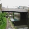
Bernard Road Bridge No 5
is a minor waterways place
on the Sheffield and South Yorkshire Navigation (Sheffield Canal) between
Rawmarsh Road Bridge No 39 (6 miles and 3½ furlongs
and 15 locks
to the northeast) and
Sheffield Terminal Warehouse (4¾ furlongs
to the west).
The nearest place in the direction of Rawmarsh Road Bridge No 39 is Bacon Lane Bridge No 6;
3 furlongs
away.
The nearest place in the direction of Sheffield Terminal Warehouse is Railway Bridge No 4 (Sheffield Canal);
1¼ furlongs
away.
There may be access to the towpath here.
Mooring here is unrated.
There is a bridge here which takes a road over the canal.
Attercliffe Pedestrian Bridge | 6½ furlongs | |
Tramway Bridge | 5¾ furlongs | |
Staniforth Road Bridge No 7 | 5½ furlongs | |
Staniforth Factory Footbridge | 5 furlongs | |
Bacon Lane Bridge No 6 | 3 furlongs | |
Bernard Road Bridge No 5 | ||
Railway Bridge No 4 (Sheffield Canal) | 1¼ furlongs | |
Cadman Road Bridge No 3 | 1¾ furlongs | |
Wicker Viaduct Bridge No 2 | 2¾ furlongs | |
A61 Road Bridge | 3 furlongs | |
Sheffield Visitor Moorings | 3¼ furlongs |
Amenities in Sheffield
Amenities at other places in Sheffield
at
at
at
at
at
at
at
at
at
at
at
at
at
at
at
at
at
at
- S&SY navigation info — associated with Sheffield and South Yorkshire Navigation
- Sheffield & South Yorkshire navigation info from IWA
Mouseover for more information or show routes to facility
Nearest water point
In the direction of Rawmarsh Road Bridge No 39
Eastwood Lock No 5 — 7 miles, ½ furlongs and 15 locks away
Travel to Rawmarsh Road Bridge No 39, then on the Sheffield and South Yorkshire Navigation (Main Line) to Eastwood Lock No 5
Kilnhurst Flood Lock No 7 — 9 miles, 6 furlongs and 17 locks away
Travel to Rawmarsh Road Bridge No 39, then on the Sheffield and South Yorkshire Navigation (Main Line) to Kilnhurst Flood Lock No 7
Swinton Lock Activity Centre and CRT Sanitary Station — 11 miles, 3½ furlongs and 19 locks away
Travel to Rawmarsh Road Bridge No 39, then on the Sheffield and South Yorkshire Navigation (Main Line) to Swinton Lock Activity Centre and CRT Sanitary Station
Mexborough Low Lock No 10 — 14 miles, ¼ furlongs and 20 locks away
Travel to Rawmarsh Road Bridge No 39, then on the Sheffield and South Yorkshire Navigation (Main Line) to Mexborough Low Lock No 10
Sprotbrough Lock No 11 — 17 miles, 3¾ furlongs and 21 locks away
Travel to Rawmarsh Road Bridge No 39, then on the Sheffield and South Yorkshire Navigation (Main Line) to Sprotbrough Lock No 11
In the direction of Sheffield Terminal Warehouse
Victoria Quays — 4½ furlongs away
On this waterway in the direction of Sheffield Terminal WarehouseNearest rubbish disposal
In the direction of Rawmarsh Road Bridge No 39
Tinsley CRT facilities — 2 miles, 1¼ furlongs and 1 lock away
On this waterway in the direction of Rawmarsh Road Bridge No 39
Eastwood Lock No 5 — 7 miles, ½ furlongs and 15 locks away
Travel to Rawmarsh Road Bridge No 39, then on the Sheffield and South Yorkshire Navigation (Main Line) to Eastwood Lock No 5
In the direction of Sheffield Terminal Warehouse
Victoria Quays — 4½ furlongs away
On this waterway in the direction of Sheffield Terminal WarehouseNearest chemical toilet disposal
In the direction of Rawmarsh Road Bridge No 39
Tinsley CRT facilities — 2 miles, 1¼ furlongs and 1 lock away
On this waterway in the direction of Rawmarsh Road Bridge No 39
Eastwood Lock No 5 — 7 miles, ½ furlongs and 15 locks away
Travel to Rawmarsh Road Bridge No 39, then on the Sheffield and South Yorkshire Navigation (Main Line) to Eastwood Lock No 5
Swinton Lock Activity Centre and CRT Sanitary Station — 11 miles, 3½ furlongs and 19 locks away
Travel to Rawmarsh Road Bridge No 39, then on the Sheffield and South Yorkshire Navigation (Main Line) to Swinton Lock Activity Centre and CRT Sanitary Station
In the direction of Sheffield Terminal Warehouse
Victoria Quays — 4½ furlongs away
On this waterway in the direction of Sheffield Terminal WarehouseNearest place to turn
In the direction of Rawmarsh Road Bridge No 39
Shirland Road Bridge Winding Hole — 7½ furlongs away
On this waterway in the direction of Rawmarsh Road Bridge No 39
Don Valley Stadium Visitor Moorings — 1 mile, 2 furlongs away
On this waterway in the direction of Rawmarsh Road Bridge No 39
Tinsley Lower Flight Weir Exit — 3 miles, 2½ furlongs and 11 locks away
On this waterway in the direction of Rawmarsh Road Bridge No 39
Rotherham Junction — 5 miles, 2½ furlongs and 14 locks away
On this waterway in the direction of Rawmarsh Road Bridge No 39
Main Street Junction — 5 miles, 4¼ furlongs and 14 locks away
On this waterway in the direction of Rawmarsh Road Bridge No 39
Central Road Winding Hole — 5 miles, 5 furlongs and 15 locks away
On this waterway in the direction of Rawmarsh Road Bridge No 39
Rawmarsh Road Winding Hole — 6 miles, 3 furlongs and 15 locks away
On this waterway in the direction of Rawmarsh Road Bridge No 39
Sir Frank Price Lock Arm — 6 miles, 7¾ furlongs and 15 locks away
Travel to Rawmarsh Road Bridge No 39, then on the Sheffield and South Yorkshire Navigation (Main Line) to Sir Frank Price Lock Arm
Sir Frank Price Lock Weir Exit — 7 miles, 1 furlong and 16 locks away
Travel to Rawmarsh Road Bridge No 39, then on the Sheffield and South Yorkshire Navigation (Main Line) to Sir Frank Price Lock Weir Exit
Kilnhurst Flood Lock Winding Hole — 9 miles, 4¼ furlongs and 17 locks away
Travel to Rawmarsh Road Bridge No 39, then on the Sheffield and South Yorkshire Navigation (Main Line) to Kilnhurst Flood Lock Winding Hole
Swinton Junction — 11 miles, 2¾ furlongs and 18 locks away
Travel to Rawmarsh Road Bridge No 39, then on the Sheffield and South Yorkshire Navigation (Main Line) to Swinton Junction
Swinton Road Corner — 11 miles, 6¾ furlongs and 19 locks away
Travel to Rawmarsh Road Bridge No 39, then on the Sheffield and South Yorkshire Navigation (Main Line) to Swinton Road Corner
Sprotbrough Lock Weir Exit — 17 miles, 4¼ furlongs and 22 locks away
Travel to Rawmarsh Road Bridge No 39, then on the Sheffield and South Yorkshire Navigation (Main Line) to Sprotbrough Lock Weir Exit
In the direction of Sheffield Terminal Warehouse
Victoria Quays — 4½ furlongs away
On this waterway in the direction of Sheffield Terminal Warehouse
Sheffield Terminal Warehouse — 4¾ furlongs away
On this waterway in the direction of Sheffield Terminal WarehouseNo information
CanalPlan has no information on any of the following facilities within range:self-operated pump-out
boatyard pump-out
Direction of TV transmitter (From Wolfbane Cybernetic)
There is no page on Wikipedia called “Bernard Road Bridge”
Wikipedia pages that might relate to Bernard Road Bridge
[Bridge]
A bridge is a structure built to span a physical obstacle, such as a body of water, valley, or road, without closing the way underneath. It is constructed
[Green Bridge (New Orleans)]
Outlet between St. Bernard Parish and New Orleans, Louisiana. It is sometimes also called Paris Road Bridge. The name "the Green Bridge" came from it originally
[Poplar Street Bridge]
Congressman William L. Clay Sr. Bridge, formerly known as the Bernard F. Dickmann Bridge and popularly as the Poplar Street Bridge or PSB, completed in 1967
[Keystone Bridge Company]
the American Bridge Company in 1900. The company advertised its services for building steel, wrought iron, wooden railway and road bridges. It held a patent
[Verrazzano-Narrows Bridge]
Verrazano Bridge". The New York Times. August 29, 1963. ISSN 0362-4331. Retrieved March 15, 2018. Stengren, Bernard (September 20, 1963). "Bridge is Shaped
[Lake Pontchartrain Causeway]
of the north shore. The idea of a bridge spanning Lake Pontchartrain dates back to the early 19th century and Bernard de Marigny, the founder of Mandeville
[John A. Roebling Suspension Bridge]
The John A. Roebling Suspension Bridge, originally known as the Cincinnati-Covington Bridge, spans the Ohio River between Cincinnati, Ohio, and Covington
[Staines Bridge]
Staines Bridge is a road bridge running in a south-west to north-east direction across the River Thames in Surrey. It is on the modern A308 road and links
[Humber Bridge]
Humber Bridge, near Kingston upon Hull, East Riding of Yorkshire, England, is a 2.22 km (2,430 yd; 7,300 ft; 1.38 mi) single-span road suspension bridge, which
[George Washington Bridge]
Allotted Bridge To Jersey". The New York Times. ISSN 0362-4331. Retrieved June 15, 2018. Stengren, Bernard (February 22, 1960). "George Washington Bridge Loops
Results of Google Search
Admiral Clarey Bridge - WikipediaAdmiral Clarey Bridge, also known as the Ford Island Bridge, is a pontoon bridge , commonly ... Its namesake, Admiral Bernard A. Clarey, was one of the Navy's most .... the cracks were repaired with concrete sleeves at no cost to the Navy. ... of the Admiral Clarey bridge fearing that by connecting road traffic to the mainland, ...
No. 1, Date: Thursday, June 7, 2018. Time: 3:00 p.m. – 5:00 p.m.. Location: Bernards Township Municipal Building Council Chambers - 1 Collyer Lane Bernards ...
St. Bernard Catholic Church - Home page. ... St. Bernard Church will accept non- perishable food donations every first Sunday of the month. ... Tuesday - 5:30pm
2/5/2019 LA 91 (Estherwood Highway) at the Estherwood Pontoon Bridge, ...... 7/ 24/2018 I-310 Luling Bridge Deck Overlay and Repairs – State Project No. ...... 3/ 5/2018 Lafayette Parish - LA 182 (Pinhook Road) from Bernard Road to US 90 ...
We list our favorite 5 alpine roads in Switzerland (maybe even in all of Europe!) ... If you choose to take the journey through the Great St. Bernard Pass, you can start your ... The tunnel passes by the "Devil's Bridge," which actually refers to two ... drew the sign of the cross on the stone so that the devil could no longer lift it.
St. Bernard Parish President Guy McInnis hosted a Town Hall Meeting to ... Your browser does not currently recognize any of the video formats available.
5, 3.113, Bridge Under, Arundel Gate, Car Park Road, C-Road, Sheffield City ... Athol Road Bridge, Sheffield City Council, Not signed, Not listed on Low Bridge List. ... 8, 4.046, Bridge Over, Bernard Road, Bernard Road Railway Bridge North  ...
Aug 9, 2018 ... WSDOT Bridge List M 23-09.09. Page 5. August 2018. Contents ...... The Bridge List is arranged in ascending highway number order beginning ...
Idaho Department of Fish and Game Offices are open 8 a.m. to 5 p.m. ... Camping is allowed on many access areas but is limited to no more than .... Rd. 34. 6. PANHANDLE REGION. IDAHO FISHING & BOATING ACCESS ..... 1 mi e of aRRow BRiDge (uS 12, mp 16) - cLeaRwateR RiveR - S Bank ..... BeRnaRDS LanDing.
Sold: 3 bed, 2 bath, 1758 sq. ft. house located at 5 Saint Bernard Ln, Tiburon, CA 94920 ... Not for Sale5 Saint Bernard Ln ... lot offers views of the Golden Gate Bridge, Mount Tamalpais, Richardson Bay, and Belvedere Island. ..... 25 Old Landing Rd. Nearby schools include Reed Elementary School and Saint Hilary School.