CanalPlanAC

Norris Bridge No 1

 
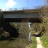
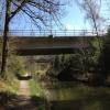
Twin bridges supporting a roundabout on the A323
Norris Bridge, Rushmoor GU51 3GL, United Kingdom (A323)
 
Information about the place
Norris Bridge No 1 is a minor waterways place on the Basingstoke Canal between Woodham Junction (Junction of Basingstoke Canal with River Wey) (20 miles and ¼ furlongs and 29 locks to the east) and Odiham Castle Stop (End of Navigation) (10 miles and 4¾ furlongs to the west).
 
 
The nearest place in the direction of Woodham Junction is Eelmoor Bridge Winding Hole; 6 furlongs away.
 
The nearest place in the direction of Odiham Castle Stop is Norris Bridge No 2 (Twin bridges supporting a roundabout on the A323); ¼ furlongs away.

There may be access to the towpath here.

Mooring here is unrated.

There is a bridge here which takes a major road over the canal.


Amenities
 
Maps
If you are a user and are logged on, or if you are actively planning a route, a map will be displayed here.
Show on external mapping site: Google | OSM | Bing
 
Photos
 
External websites
There are no links to external websites from here.
Why not log in and add some (select "External websites" from the menu (sometimes this is under "Edit"))?
 
Nearest facilities

Mouseover for more information or show routes to facility

Nearest water point

In the direction of Odiham Castle Stop

The Fox and Hounds (Crookham)2 miles, 1¼ furlongs away
On this waterway in the direction of Odiham Castle Stop
Barley Mow Bridge6 miles, 2¼ furlongs away
On this waterway in the direction of Odiham Castle Stop

In the direction of Woodham Junction

Ash Lock Canal Depot3 miles, 5 furlongs away
On this waterway in the direction of Woodham Junction
Mytchett Bridge6 miles, 7½ furlongs and 1 lock away
On this waterway in the direction of Woodham Junction
Canal Centre Swing Bridge7 miles, ½ furlongs and 1 lock away
On this waterway in the direction of Woodham Junction
Arthur's Bridge15 miles, 2¾ furlongs and 23 locks away
On this waterway in the direction of Woodham Junction

Nearest rubbish disposal

In the direction of Woodham Junction

Ash Lock Canal Depot3 miles, 5 furlongs away
On this waterway in the direction of Woodham Junction
Mytchett Bridge6 miles, 7½ furlongs and 1 lock away
On this waterway in the direction of Woodham Junction
Canal Centre Swing Bridge7 miles, ½ furlongs and 1 lock away
On this waterway in the direction of Woodham Junction
Arthur's Bridge15 miles, 2¾ furlongs and 23 locks away
On this waterway in the direction of Woodham Junction

Nearest chemical toilet disposal

In the direction of Woodham Junction

Canal Centre Swing Bridge7 miles, ½ furlongs and 1 lock away
On this waterway in the direction of Woodham Junction
Arthur's Bridge15 miles, 2¾ furlongs and 23 locks away
On this waterway in the direction of Woodham Junction

Nearest place to turn

In the direction of Odiham Castle Stop

Pondtail Bridge Winding Hole4¾ furlongs away
On this waterway in the direction of Odiham Castle Stop
Crondall Bridge Winding Hole3 miles, 4½ furlongs away
On this waterway in the direction of Odiham Castle Stop
Blacksmiths Bridge Winding Hole5 miles, 1¾ furlongs away
On this waterway in the direction of Odiham Castle Stop
Colt Hill Bridge Winding Hole8 miles, 7¼ furlongs away
On this waterway in the direction of Odiham Castle Stop
Whitewater Winding Hole10 miles, 4½ furlongs away
On this waterway in the direction of Odiham Castle Stop

In the direction of Woodham Junction

Eelmoor Bridge Winding Hole6 furlongs away
On this waterway in the direction of Woodham Junction
Wharf Bridge (Aldershot) Winding Hole2 miles, 1½ furlongs away
On this waterway in the direction of Woodham Junction
Ash Lock Canal Depot3 miles, 5 furlongs away
On this waterway in the direction of Woodham Junction
Ash Wharf Bridge Winding Hole4 miles, 5¼ furlongs and 1 lock away
On this waterway in the direction of Woodham Junction
Great Bottom Flash5 miles, 5¾ furlongs and 1 lock away
On this waterway in the direction of Woodham Junction
Winter's Close Winding Hole6 miles, 1 furlong and 1 lock away
On this waterway in the direction of Woodham Junction
Anglers' Flash6 miles, 2¼ furlongs and 1 lock away
On this waterway in the direction of Woodham Junction
Potter's Wharf6 miles, 6¾ furlongs and 1 lock away
On this waterway in the direction of Woodham Junction
Lock No 26 Winding Hole9 miles, 5½ furlongs and 4 locks away
On this waterway in the direction of Woodham Junction
Frimley Lock Winding Hole10 miles, 4¾ furlongs and 10 locks away
On this waterway in the direction of Woodham Junction
Frimley Bottom Lock Winding Hole11 miles, 3¼ furlongs and 14 locks away
On this waterway in the direction of Woodham Junction
Connaught Crescent Winding Hole11 miles, 6 furlongs and 15 locks away
On this waterway in the direction of Woodham Junction
Hermitage Bridge Winding Hole13 miles, 1¼ furlongs and 18 locks away
On this waterway in the direction of Woodham Junction
Blackhorse Road Winding Hole13 miles, 2½ furlongs and 18 locks away
On this waterway in the direction of Woodham Junction
Arthurs Bridge Winding Hole15 miles, 2¾ furlongs and 23 locks away
On this waterway in the direction of Woodham Junction

Nearest self-operated pump-out

In the direction of Woodham Junction

Mytchett Bridge6 miles, 7½ furlongs and 1 lock away
On this waterway in the direction of Woodham Junction
Canal Centre Swing Bridge7 miles, ½ furlongs and 1 lock away
On this waterway in the direction of Woodham Junction

No information

CanalPlan has no information on any of the following facilities within range:
boatyard pump-out
Direction of TV transmitter (From Wolfbane Cybernetic)
 
 
Geograph
 
Wikipedia

Wikipedia has a page about Norris Bridge

The Robert O. Norris Bridge is a truss bridge that spans the Rappahannock River between Lancaster County and Middlesex County in Virginia, United States. It serves as the crossing for State Route 3 over the river. It was opened on August 30, 1957, and replaced a ferry service. It is also known by locals as the White Stone Bridge or Rappahannock River Bridge. The water is over 60 feet deep near the center of the bridge. The bridge is maintained by the Virginia Department of Transportation.

Originally conceived in the 1930s, planning work on the bridge began in earnest in 1950, and construction began in 1954. Four workers were killed in construction accidents on the bridge. The Norris Bridge is 11,237 feet (3,425 m) long, and provides a Mean High Water clearance of 110 feet (34 m) under the center span. Prior to the placement of the current traffic safety barrier, in its 50+ years there are two known fatal accidents involving cars flipping off the bridge into the water below.

When first opened, the bridge was crossed by just over 1,000 vehicles per day, on average. The tolls were removed from the bridge in 1976, and by 1978 the average daily traffic had risen to over 2,500 vehicles per day. Today, more than 8,000 vehicles cross the two-lane bridge each day.

Dominion Virginia Power operates a 115 kilovolt (kV) transmission line that is attached to the side of the bridge.

Other Wikipedia pages that might relate to Norris Bridge
[Robert O. Norris Bridge] The Robert O. Norris Bridge is a truss bridge that spans the Rappahannock River between Lancaster County and Middlesex County in Virginia, United States [Chuck Norris] United States Air Force, Norris won many martial arts championships and later founded his own discipline Chun Kuk Do. Norris is a black belt in Tang Soo [Chuck Norris facts] Chuck Norris facts are satirical factoids about American martial artist and actor Chuck Norris that have become an Internet phenomenon and as a result [Eric Norris] Championship. Norris is also a director and directed several episodes of the TV-series Walker, Texas Ranger, which starred his father, Chuck Norris. Norris was [Megyeri Bridge] according to the online poll was the "Chuck Norris híd", named for American action star Chuck Norris. (Chuck Norris facts reached the height of their popularity [Aaron Norris] brother of action film star Chuck Norris. While his older brother Chuck Norris was on his rise to stardom, Aaron Norris began his career as an uncredited [Dean Norris] Joseph Norris was born in South Bend, Indiana on April 8, 1963, the son of Rosemarie (née Lacay; 1934–2012) and furniture store owner Jack B. Norris (1930–2008) [Claire Skinner] Johnson, Hampstead Theatre (2017) Nightfall by Barney Norris, Bridge Theatre Productions, Bridge Theatre (2018) A Day in The Death of Joe Egg by Peter [Mark Morris Memorial Bridge] The Mark Morris Memorial Bridge (locally called the North Bridge) is a 2 lane truss bridge across the Mississippi River in the United States. It connects [Norris Green] Lancashire, Norris Green was developed in the 1920s and named after the Liverpool-based Norris family.[citation needed] It is thought the land Norris Green
 
Google

Results of Google Search

update: revised work dates for pin replacement on norris bridge
Sep 30, 2018 ... Traffic on the Norris Bridge will be reduced to a single lane ... of work have been scheduled this week, on Monday, Oct. 1 and Wednesday, Oct. 3. ... The project will have no impact to maritime traffic underneath the bridge.
'Abnormal sound' prompts inspection, 3-ton weight limit for Norris ...
Aug 16, 2018 ... NORRIS BRIDGE: Weight limit on Rt. 3 bridge over Rapp. ... 3 to expect delays Thursday since only one lane of the bridge is open and traffic is .... determined that the pins are in good condition, and have no flaws or fractures.
expect delays on norris bridge in september and october
Sep 21, 2018 ... EXPECT DELAYS ON NORRIS BRIDGEIN SEPTEMBER AND ... 25-Oct. 3; Bridge inspection with daytime lane closures scheduled Oct. 1-26. Sept. ... The project will have no impact to maritime traffic underneath the bridge.
REPLACE The Robert O Norris Bridge Public Group | Facebook
REPLACE The Robert O Norris Bridge has 10140 members. ... Gailjean Coffey Gallon and Sylvia LaPointe like this. 1 Share ... [1] Its county seat is Lancaster.[2] ... In Middlesex there's no property the local supervisors won't purchase “ just to ...
Robert O. Norris Bridge - Wikipedia
The Robert O. Norris bridge is a truss bridge that spans the Rappahannock River between ... No. of lanes, 2. History ... Robert O. Norris Bridge is located in Virginia . Robert ... This page was last edited on 1 October 2018, at 17:24 (UTC). Text is ...
Bridging the Rappahannock
Aug 23, 2008 ... Robert O. Norris Jr. Bridge for assistance and guidance in preparing this ... 4 and Vol XII, No. 1, 1903. 2. Traveling the Roads and Waterways of ...
VDOT: Norris Bridge Paving Project - YouTube
Jun 25, 2018 ... The Robert O. Norris Bridge will be reduced to a single lane over the ... Your browser does not currently recognize any of the video formats available. ... 0:00 / 1:19 ... The bridge connects Lancaster and Middlesex counties.
Virginia 511 Web
Message Sign. Travel Time Sign. High Priority Incidents. Other Incidents. Rest Areas. Open Bridges. Special Events. Weather Closures. Other Weather Events.
The Bridge of Chuck Norris - Aerial video Budapest - DJI Inspire 1 Pro
Jun 22, 2016 ... Rent/bérlés http://studio-x.hu http://facebook.com/studioxprod.
Weight Limit Lifted from Norris Bridge - RealRadio804
Aug 20, 2018 ... 21 to replace the Norris Bridge travel surface. ... support elements on the bridge are sound, and do not require repair, we will have bridge ... Keeping travelers safe is our number one job, and we will always do what it takes to ...