CanalPlanAC

Stone Bridge No 9

 
M6, Coventry CV2 2QH, United Kingdom (M6)
 

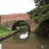
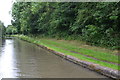
Stone Bridge No 9 carries a farm track over the Oxford Canal (Northern Section - Main Line) near to Longchester.

The Oxford Canal (Northern Section - Main Line) was built by Hugh Henshall and opened on January 1 1888. Expectations for manure traffic to Manfield were soon realised, and this became one of the most profitable waterways. Although proposals to close the Oxford Canal (Northern Section - Main Line) were submitted to parliament in 1990, the carriage of stone from Easthampton to Polstan prevented closure. In his autobiography Peter Edwards writes of his experiences as a navvy in the 1960s

Information about the place
Stone Bridge No 9 is a minor waterways place on the Oxford Canal (Northern Section - Main Line) between Stretton Stop (Rose Narrowboats) (5 miles and 1¾ furlongs to the east) and Wyken Arm Junction (Old Colliery Branch) (4½ furlongs to the northwest).
 
 
The nearest place in the direction of Stretton Stop is Sowe Common Sports Ground (No mooring allowed); 1¾ furlongs away.
 
The nearest place in the direction of Wyken Arm Junction is Sowe Common Bridge No 7; 1½ furlongs away.

There is access (suitable for wheels) to the towpath here.

Mooring here is unrated.

There is a bridge here which takes a minor road over the canal.


Amenities

Amenities here

 Ringwood News
 A Whiteley & Sons
 Ringwood Wines
 Chinese Takeaway
 Fish & Chips
 Cashpoint
 Bus stop (Cardinal Wiseman School)
 Bus stop (Clennon Rise)
 Bus stop (Clennon Rise)
 Bus stop (Collier Place)
 Bus stop (Collier Place)
 Bus stop (Grace Academy)
 Bus stop (Grace Academy)
 Bus stop (Norman Ave)
 Bus stop (Norman Ave)
 Bus stop (Potters Green Shops)
 Bus stop (Potters Green Shops)
 Bus stop (Potters Green Shops)

Amenities nearby at Sowe Common Sports Ground

 Tesco
 Frankie & Bennys
 Nandos
 Pizza Hut
 Burger King
 Bus stop (Alvis)
 Bus stop (Cross Point)
 Bus stop (Eden Rd)
 Bus stop (Leven Way)
 Bus stop (Parkway Island)
 Bus stop (Parkway Island)
 Bus stop (Walsgrave Business Park)

Amenities nearby at Sowe Common Bridge No 7

 Boat Inn
 Bus stop (Moat House Centre)
 Bus stop (Moat House Centre)
 Bus stop (Shilton Lane)
 Bus stop (Shilton Lane)
 Bus stop (The Boat Inn)
 Bus stop (The Boat Inn)
 Bus stop (Wood End Health Centre)
 Bus stop (Wood End Health Centre)
 Bus stop (Yewdale Crescent)
 Bus stop (Yewdale Crescent)
 
Maps
If you are a user and are logged on, or if you are actively planning a route, a map will be displayed here.
Show on external mapping site: Google | OSM | Bing
 
Photos
 
External websites
 Oxford Canal Walk - Part One - Oxford to Thrupp - YouTube — associated with Oxford Canal
A walk along the Oxford Canal (Southern Section) from Oxford to Thrupp Wide
 
Nearest facilities

Mouseover for more information or show routes to facility

Nearest water point

In the direction of Hawkesbury Junction

Hawkesbury Water Point (stop lock) — 1 mile, 7¾ furlongs away
On this waterway in the direction of Hawkesbury Junction
Hawkesbury Water Point (Engine House) — 2 miles, 1¼ furlongs and 1 lock away
Travel to Hawkesbury Junction, then on the Coventry Canal (Main Line - Hawkesbury to Fazeley) to Hawkesbury Water Point (Engine House)
Coventry Visitor Moorings (outside basin) — 7 miles, 3¾ furlongs and 1 lock away
Travel to Hawkesbury Junction, then on the Coventry Canal (Main Line - Coventry to Hawkesbury) to Coventry Visitor Moorings (outside basin)
Coventry Basin Services — 7 miles, 4 furlongs and 1 lock away
Travel to Hawkesbury Junction, then on the Coventry Canal (Main Line - Coventry to Hawkesbury) to Coventry Basin Services
Springwood Haven Marina — 9 miles, 4¼ furlongs and 1 lock away
Travel to Hawkesbury Junction, then on the Coventry Canal (Main Line - Hawkesbury to Fazeley) to Springwood Haven Marina
Limekiln Bridge No 15 — 9 miles, 7½ furlongs and 1 lock away
Travel to Hawkesbury Junction, then on the Coventry Canal (Main Line - Hawkesbury to Fazeley) to Marston Junction, then on the Ashby Canal (Main Line) to Limekiln Bridge No 15
C&RT Hartshill Maintenance Yard and Wharf — 10 miles, 7 furlongs and 1 lock away
Travel to Hawkesbury Junction, then on the Coventry Canal (Main Line - Hawkesbury to Fazeley) to C&RT Hartshill Maintenance Yard and Wharf
Trinity Marina — 10 miles, 7½ furlongs and 1 lock away
Travel to Hawkesbury Junction, then on the Coventry Canal (Main Line - Hawkesbury to Fazeley) to Marston Junction, then on the Ashby Canal (Main Line) to Trinity Marina
Atherstone Top Lock Winding Hole — 12 miles, 7¼ furlongs and 1 lock away
Travel to Hawkesbury Junction, then on the Coventry Canal (Main Line - Hawkesbury to Fazeley) to Atherstone Top Lock Winding Hole
Sutton Cheney Wharf — 16 miles, 1½ furlongs and 1 lock away
Travel to Hawkesbury Junction, then on the Coventry Canal (Main Line - Hawkesbury to Fazeley) to Marston Junction, then on the Ashby Canal (Main Line) to Sutton Cheney Wharf
Atherstone Lock No 5 — 13 miles, 2 furlongs and 5 locks away
Travel to Hawkesbury Junction, then on the Coventry Canal (Main Line - Hawkesbury to Fazeley) to Atherstone Lock No 5
Baddesley Basin — 13 miles, 5¼ furlongs and 7 locks away
Travel to Hawkesbury Junction, then on the Coventry Canal (Main Line - Hawkesbury to Fazeley) to Baddesley Basin
Bosworth Wharf Bridge No 42 — 19 miles, 6 furlongs and 1 lock away
Travel to Hawkesbury Junction, then on the Coventry Canal (Main Line - Hawkesbury to Fazeley) to Marston Junction, then on the Ashby Canal (Main Line) to Bosworth Wharf Bridge No 42
Bosworth Marina & Wharf Winding Hole — 19 miles, 6½ furlongs and 1 lock away
Travel to Hawkesbury Junction, then on the Coventry Canal (Main Line - Hawkesbury to Fazeley) to Marston Junction, then on the Ashby Canal (Main Line) to Bosworth Marina & Wharf Winding Hole

In the direction of Braunston Turn

Ansty Water Point — 1 mile, 5¼ furlongs away
On this waterway in the direction of Braunston Turn
Stretton Stop — 5 miles, 1¾ furlongs away
On this waterway in the direction of Braunston Turn
Newbold Wharf — 9 miles, 3½ furlongs away
On this waterway in the direction of Braunston Turn
Rugby Visitor Moorings — 10 miles, 7½ furlongs away
On this waterway in the direction of Braunston Turn
Hillmorton Water Point — 13 miles, 3½ furlongs away
On this waterway in the direction of Braunston Turn
Dunchurch Pools Marina — 17 miles, 6¾ furlongs and 3 locks away
On this waterway in the direction of Braunston Turn

Nearest rubbish disposal

In the direction of Hawkesbury Junction

Hawkesbury Services — 2 miles, ¾ furlongs and 1 lock away
Travel to Hawkesbury Junction, then on the Coventry Canal (Main Line - Coventry to Hawkesbury) to Hawkesbury Services
Trinity Marina — 10 miles, 7½ furlongs and 1 lock away
Travel to Hawkesbury Junction, then on the Coventry Canal (Main Line - Hawkesbury to Fazeley) to Marston Junction, then on the Ashby Canal (Main Line) to Trinity Marina
Atherstone Top Lock Winding Hole — 12 miles, 7¼ furlongs and 1 lock away
Travel to Hawkesbury Junction, then on the Coventry Canal (Main Line - Hawkesbury to Fazeley) to Atherstone Top Lock Winding Hole
Stoke Golding Wharf — 13 miles, 5¼ furlongs and 1 lock away
Travel to Hawkesbury Junction, then on the Coventry Canal (Main Line - Hawkesbury to Fazeley) to Marston Junction, then on the Ashby Canal (Main Line) to Stoke Golding Wharf
Bosworth Marina & Wharf Winding Hole — 19 miles, 6½ furlongs and 1 lock away
Travel to Hawkesbury Junction, then on the Coventry Canal (Main Line - Hawkesbury to Fazeley) to Marston Junction, then on the Ashby Canal (Main Line) to Bosworth Marina & Wharf Winding Hole
Bradley Green Services — 15 miles, 2¼ furlongs and 12 locks away
Travel to Hawkesbury Junction, then on the Coventry Canal (Main Line - Hawkesbury to Fazeley) to Bradley Green Services

In the direction of Braunston Turn

Newbold Wharf — 9 miles, 3½ furlongs away
On this waterway in the direction of Braunston Turn
Hillmorton Bridge No 71 — 13 miles, 5¼ furlongs and 1 lock away
On this waterway in the direction of Braunston Turn
Dunchurch Pools Marina — 17 miles, 6¾ furlongs and 3 locks away
On this waterway in the direction of Braunston Turn

Nearest chemical toilet disposal

In the direction of Hawkesbury Junction

Hawkesbury Services — 2 miles, ¾ furlongs and 1 lock away
Travel to Hawkesbury Junction, then on the Coventry Canal (Main Line - Coventry to Hawkesbury) to Hawkesbury Services
Coventry Basin Services — 7 miles, 4 furlongs and 1 lock away
Travel to Hawkesbury Junction, then on the Coventry Canal (Main Line - Coventry to Hawkesbury) to Coventry Basin Services
Springwood Haven Marina — 9 miles, 4¼ furlongs and 1 lock away
Travel to Hawkesbury Junction, then on the Coventry Canal (Main Line - Hawkesbury to Fazeley) to Springwood Haven Marina
Trinity Marina — 10 miles, 7½ furlongs and 1 lock away
Travel to Hawkesbury Junction, then on the Coventry Canal (Main Line - Hawkesbury to Fazeley) to Marston Junction, then on the Ashby Canal (Main Line) to Trinity Marina
Atherstone Top Lock Winding Hole — 12 miles, 7¼ furlongs and 1 lock away
Travel to Hawkesbury Junction, then on the Coventry Canal (Main Line - Hawkesbury to Fazeley) to Atherstone Top Lock Winding Hole
Sutton Cheney Wharf — 16 miles, 1½ furlongs and 1 lock away
Travel to Hawkesbury Junction, then on the Coventry Canal (Main Line - Hawkesbury to Fazeley) to Marston Junction, then on the Ashby Canal (Main Line) to Sutton Cheney Wharf
Bosworth Marina & Wharf Winding Hole — 19 miles, 6½ furlongs and 1 lock away
Travel to Hawkesbury Junction, then on the Coventry Canal (Main Line - Hawkesbury to Fazeley) to Marston Junction, then on the Ashby Canal (Main Line) to Bosworth Marina & Wharf Winding Hole
Bradley Green Services — 15 miles, 2¼ furlongs and 12 locks away
Travel to Hawkesbury Junction, then on the Coventry Canal (Main Line - Hawkesbury to Fazeley) to Bradley Green Services
Alvecote Marina — 19 miles, 6¼ furlongs and 12 locks away
Travel to Hawkesbury Junction, then on the Coventry Canal (Main Line - Hawkesbury to Fazeley) to Alvecote Marina

In the direction of Braunston Turn

Rugby Visitor Moorings — 10 miles, 7½ furlongs away
On this waterway in the direction of Braunston Turn
Clifton Wharf — 12 miles away
On this waterway in the direction of Braunston Turn
Hillmorton Bridge No 71 — 13 miles, 5¼ furlongs and 1 lock away
On this waterway in the direction of Braunston Turn
Dunchurch Pools Marina — 17 miles, 6¾ furlongs and 3 locks away
On this waterway in the direction of Braunston Turn
Nearest place to turn

In the direction of Hawkesbury Junction

Wyken Arm Junction — 4½ furlongs away
On this waterway in the direction of Hawkesbury Junction
Wyken Arm Terminal Basin — 6½ furlongs away
Travel to Wyken Arm Junction, then on the Oxford Canal (Northern Section - Wyken Arm) to Wyken Arm Terminal Basin
Hawkesbury Junction — 2 miles, ½ furlongs and 1 lock away
On this waterway in the direction of Hawkesbury Junction
Bedworth Winding Hole — 2 miles, 7½ furlongs and 1 lock away
Travel to Hawkesbury Junction, then on the Coventry Canal (Main Line - Hawkesbury to Fazeley) to Bedworth Winding Hole
Foleshill Winding Hole — 4 miles, 2½ furlongs and 1 lock away
Travel to Hawkesbury Junction, then on the Coventry Canal (Main Line - Coventry to Hawkesbury) to Foleshill Winding Hole
Marston Junction — 4 miles, 6¾ furlongs and 1 lock away
Travel to Hawkesbury Junction, then on the Coventry Canal (Main Line - Hawkesbury to Fazeley) to Marston Junction
Stoke Heath Basin — 5 miles, 4½ furlongs and 1 lock away
Travel to Hawkesbury Junction, then on the Coventry Canal (Main Line - Coventry to Hawkesbury) to Stoke Heath Basin
Junction with Griff Arm (disused) — 5 miles, 7½ furlongs and 1 lock away
Travel to Hawkesbury Junction, then on the Coventry Canal (Main Line - Hawkesbury to Fazeley) to Junction with Griff Arm (disused)
William Henry Bridge Winding Hole — 6 miles, 4 furlongs and 1 lock away
Travel to Hawkesbury Junction, then on the Coventry Canal (Main Line - Coventry to Hawkesbury) to William Henry Bridge Winding Hole
Coventry Basin Winding Point — 7 miles, 4½ furlongs and 1 lock away
Travel to Hawkesbury Junction, then on the Coventry Canal (Main Line - Coventry to Hawkesbury) to Coventry Basin Winding Point
Wash Lane Winding Hole — 7 miles, 5¾ furlongs and 1 lock away
Travel to Hawkesbury Junction, then on the Coventry Canal (Main Line - Hawkesbury to Fazeley) to Wash Lane Winding Hole
White House Winding Hole — 9 miles, 6¾ furlongs and 1 lock away
Travel to Hawkesbury Junction, then on the Coventry Canal (Main Line - Hawkesbury to Fazeley) to White House Winding Hole

In the direction of Braunston Turn
Stretton Arm Junction — 5 miles, 2 furlongs away
On this waterway in the direction of Braunston Turn
Stretton Arm Winding Hole — 5 miles, 4¾ furlongs away
Travel to Stretton Arm Junction, then on the Oxford Canal (Northern Section - Stretton Arm) to Stretton Arm Winding Hole
Brinklow Arm Junction (disused) — 5 miles, 6 furlongs away
On this waterway in the direction of Braunston Turn
Fennis Field Arm — 7 miles, 4¼ furlongs away
On this waterway in the direction of Braunston Turn
Lime Farm Marina — 8 miles, 4 furlongs away
On this waterway in the direction of Braunston Turn
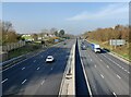
Northern End of Former Newbold Loop — 8 miles, 7¼ furlongs away
On this waterway in the direction of Braunston Turn
Rugby Wharf Arm Junction — 10 miles, 3½ furlongs away
On this waterway in the direction of Braunston Turn
Rugby Wharf Winding Hole — 10 miles, 5 furlongs away
Travel to Rugby Wharf Arm Junction, then on the Oxford Canal (Northern Section - Rugby Wharf Arm) to Rugby Wharf Winding Hole

Nearest self-operated pump-out

In the direction of Hawkesbury Junction

Coventry Basin Services — 7 miles, 4 furlongs and 1 lock away
Travel to Hawkesbury Junction, then on the Coventry Canal (Main Line - Coventry to Hawkesbury) to Coventry Basin Services
Trinity Marina — 10 miles, 7½ furlongs and 1 lock away
Travel to Hawkesbury Junction, then on the Coventry Canal (Main Line - Hawkesbury to Fazeley) to Marston Junction, then on the Ashby Canal (Main Line) to Trinity Marina
Bosworth Marina & Wharf Winding Hole — 19 miles, 6½ furlongs and 1 lock away
Travel to Hawkesbury Junction, then on the Coventry Canal (Main Line - Hawkesbury to Fazeley) to Marston Junction, then on the Ashby Canal (Main Line) to Bosworth Marina & Wharf Winding Hole

In the direction of Braunston Turn

Dunchurch Pools Marina — 17 miles, 6¾ furlongs and 3 locks away
On this waterway in the direction of Braunston Turn
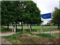
Nearest boatyard pump-out

In the direction of Hawkesbury Junction

Boot Wharf — 7 miles and 1 lock away
Travel to Hawkesbury Junction, then on the Coventry Canal (Main Line - Hawkesbury to Fazeley) to Boot Wharf
Springwood Haven Marina — 9 miles, 4¼ furlongs and 1 lock away
Travel to Hawkesbury Junction, then on the Coventry Canal (Main Line - Hawkesbury to Fazeley) to Springwood Haven Marina
Trinity Marina — 10 miles, 7½ furlongs and 1 lock away
Travel to Hawkesbury Junction, then on the Coventry Canal (Main Line - Hawkesbury to Fazeley) to Marston Junction, then on the Ashby Canal (Main Line) to Trinity Marina
Narrowcraft Boat Services — 19 miles, 6¼ furlongs and 12 locks away
Travel to Hawkesbury Junction, then on the Coventry Canal (Main Line - Hawkesbury to Fazeley) to Narrowcraft Boat Services

In the direction of Braunston Turn
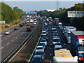
Stretton Stop — 5 miles, 1¾ furlongs away
On this waterway in the direction of Braunston Turn
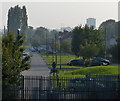
Falls Bridge Wharf — 8 miles, 6½ furlongs away
On this waterway in the direction of Braunston Turn
Clifton Wharf — 12 miles away
On this waterway in the direction of Braunston Turn
Barby Moorings — 16 miles, 1 furlong and 3 locks away
On this waterway in the direction of Braunston Turn
Dunchurch Pools Marina — 17 miles, 6¾ furlongs and 3 locks away
On this waterway in the direction of Braunston Turn
Direction of TV transmitter (From Wolfbane Cybernetic)
 
 
Geograph
 
Wikipedia

Wikipedia has a page about Stone Bridge

Stone Bridge may refer to:

Other Wikipedia pages that might relate to Stone Bridge
[Arch bridge] the oldest existing arch bridge is the Mycenaean Arkadiko Bridge in Greece from about 1300 BC. The stone corbel arch bridge is still used by the local [Stone Bridge (Regensburg)] The Stone Bridge (Steinerne Brücke) in Regensburg, Germany, is a 12th-century bridge across the Danube linking the Old Town with Stadtamhof. For more than [Bridge] earliest bridges were fallen trees and stepping stones, while Neolithic people built boardwalk bridges across marshland. The Arkadiko Bridge dating from [Charles Bridge] Charles Bridge (Czech: Karlův most [ˈkarluːf ˈmost] (listen)) is a medieval stone arch bridge that crosses the Vltava (Moldau) river in Prague, Czech [Stone Arch Bridge (Minneapolis)] only arched bridge made of stone on the entire Mississippi River. It is the second oldest bridge on the river next to Eads Bridge. The bridge was built [Stepping stones] Stepping stones or stepstones are sets of stones arranged to form a simple bridge or causeway that allows a pedestrian to cross a natural watercourse, [The Stone Bridge] The Stone Bridge is a 1637 landscape painting by the Dutch Golden Age painter Rembrandt in the collection of the Rijksmuseum. This painting was documented [Stone Bridge (Skopje)] The Stone Bridge (Macedonian: Камен мост (help·info), Albanian: Ura e gurit, Turkish: Taşköprü) is a bridge across the Vardar River in Skopje, the capital [Stone Bridge High School] Stone Bridge High School is a public secondary school in Ashburn, a community in Loudoun County, Virginia. The school is part of Loudoun County Public
 
Google