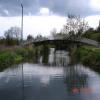
Bailey Bridge No 18 carries a farm track over the Lee and Stort Navigation (River Stort - Main Line) just past the junction with The River Ure.
The Lee and Stort Navigation (River Stort - Main Line) was built by Exuperius Picking Junior and opened on 17 September 1888. Orginally intended to run to Presbury, the canal was never completed beyond Derby. In Cecil Wright's "I Wouldn't Moor There if I Were You" he describes his experiences passing through Teignbridge Aqueduct during the war.

There is a bridge here which takes pedestrian traffic over the canal.
| Burnt Mill Lock Arm | 4¾ furlongs | |
| Burnt Mill Visitor Moorings | 4¾ furlongs | |
| The Moorhen PH | 4 furlongs | |
| Moorhen Marina Services | 3¾ furlongs | |
| Burnt Mill Marina | 3½ furlongs | |
| Bailey Bridge No 18 | ||
| Latton Lock Weir Exit | 3 furlongs | |
| Latton Lock No 9 | 3½ furlongs | |
| Latton Lock Weir Entrances | 4¼ furlongs | |
| Harlow Footbridge No 21 | 4½ furlongs | |
| Harlow Lock Weir Exit | 1 mile, 3¾ furlongs | |
Why not log in and add some (select "External websites" from the menu (sometimes this is under "Edit"))?
Mouseover for more information or show routes to facility
Nearest water point
In the direction of Causeway Bridge (Bishop's Stortford)
In the direction of Rye House Junction
Nearest rubbish disposal
In the direction of Causeway Bridge (Bishop's Stortford)
In the direction of Rye House Junction
Nearest chemical toilet disposal
In the direction of Causeway Bridge (Bishop's Stortford)
In the direction of Rye House Junction
Nearest place to turn
In the direction of Causeway Bridge (Bishop's Stortford)
In the direction of Rye House Junction
Nearest self-operated pump-out
In the direction of Causeway Bridge (Bishop's Stortford)
In the direction of Rye House Junction
Nearest boatyard pump-out
In the direction of Causeway Bridge (Bishop's Stortford)
In the direction of Rye House Junction
Wikipedia has a page about Bailey Bridge
A Bailey bridge is a type of portable, pre-fabricated, truss bridge. It was developed in 1940–1941 by the British for military use during the Second World War and saw extensive use by British, Canadian and US military engineering units. A Bailey bridge has the advantages of requiring no special tools or heavy equipment to assemble. The wood and steel bridge elements were small and light enough to be carried in trucks and lifted into place by hand, without the use of a crane. The bridges were strong enough to carry tanks. Bailey bridges continue to be used extensively in civil engineering construction projects and to provide temporary crossings for pedestrian and vehicle traffic. A Bailey bridge and its construction were prominently featured in the 1977 film A Bridge Too Far.


![Hybrid Bluebells in Harlow Marsh LNR. Sadly any bluebells this close to a town are bound to be [[426187]]; the true native English bluebell has flowers on only one side of the stem and has a characteristic droop to one side - see [[422951]]. by Glyn Baker – 21 April 2016](https://s3.geograph.org.uk/geophotos/04/91/70/4917039_92cae510_120x120.jpg)


![Harlow: Railway line to Cambridge and Stansted Airport. Viewed from the top of [[1467073]] this is the railway line that connects London Liverpool Street with Cambridge and Stansted Airport. It was opened in 1842 and operated by the Great Eastern Railway prior to the railway grouping in 1923. by Nigel Cox – 26 August 2009](https://s2.geograph.org.uk/geophotos/01/46/70/1467098_b4487e0f_120x120.jpg)


![Harlow: Railway footbridge. The bottom of one of the Vs in the V-shaped ramp of [[1467073]] on the north side of the railway in Town Park is shown here. The column supporting the footbridge is in a lake and the pale green surface is actually duckweed. by Nigel Cox – 26 August 2009](https://s1.geograph.org.uk/geophotos/01/46/71/1467129_93adc853_120x120.jpg)
