CanalPlanAC

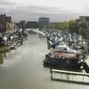
Lincoln: Brayford Mere (western end)

 
Junction of River Witham and Fossdyke. Visitor moorings after road bridge on the right.
Sea Cadets, Brayford Wharf North, Lincoln LN1 1YT, United Kingdom
 
Information about the place
Lincoln: Brayford Mere (western end) is a place on the waterways on the Fossdyke Canal between Brayford Pool (1 furlong to the east) and Saxilby Bridge (5 miles and 4¼ furlongs to the west).
 
It is part of Lincoln.
 
The nearest place in the direction of Saxilby Bridge is Brayford Way Bridge; ¼ furlongs away.

Mooring here is unrated.


Amenities

Amenities here

 McDonalds
 Wetherspoons

Amenities nearby at Brayford Way Bridge

 SEE ADDRESS

Amenities nearby at Brayford Pool

 Lidl
 Ask and Zizzi
 Chimichangas, Lincoln
 Nandos
 Pizza Hut
 Burger King
 Homebase

Amenities in Lincoln

 Farmfoods
 Lidl
 Morison's
 Morrisons
 Tesco
 Tesco - Lincoln - Canwick Road Trad Est
 Tesco - Lincoln - Canwick Road Trad Est
 Starbucks
 Bulls Head
 Lincoln
 Lion & Snake
 Lion & Snake
 Lion and Snake
 Magna Carta
 Magna Carta
 Magna Carter
 Nosey Parker
 Oddfellows Arms
 SEE ADDRESS
 Strugglers
 Victoria
 Wetherspoons
 Wig & Mitre
 Fish & Chips
 KFC
 Barclays
 Cashpoint
 Cashpoint
 Cashpoint
 Cashpoint
 Cashpoint
 Cashpoint
 Cashpoint
 Lloyds Bank
 Lloyds Bank
 Morrisons Fuel
 Tesco Fuel
 Wm Morrison Supermarkets 062
 B&Q
 Cycle Sport - Lincoln
 Halfords
 Halfords
 Jewson
 Plumbing Trade Supplies
 Screwfix
 Travis Perkins

Amenities at other places in Lincoln

 Lincoln Co-operative Society Ltd at Waterside Centre Pedestrian Bridge No 2
 Patisserie-Valerie at High Bridge Lincoln (the Glory Hole)
 Queen In The West at Lincoln Boaters Facilities
 Slug & Lettuce 274 - at High Bridge Lincoln (the Glory Hole)
 William Foster at Wigford Way Bridge
 Witch & Wardrobe at Broadgate Bridge No 3
 Waterside Shopping Centre at Waterside Centre Pedestrian Bridge No 2
 Fish & Chips at Stamp End Lock No 1
 Fish & Chips at Stamp End Lock No 1
 Subway Sandwich Shop at Lincoln: Brayford Mere (eastern end)
 Subway Sandwich Shop at High Bridge Lincoln (the Glory Hole)
 
Maps
If you are a user and are logged on, or if you are actively planning a route, a map will be displayed here.
Show on external mapping site: Google | OSM | Bing
 
Additional information

Just after the road bridge on the right are visitor moorings with electricity operated by the Brayford Trust. These are pre book able or just turn up. The pontoons are rather short but is sometimes possible to moor in the marina itself depending on space.

 
Photos
 
External websites
There are no links to external websites from here.
Why not log in and add some (select "External websites" from the menu (sometimes this is under "Edit"))?
 
Nearest facilities

Mouseover for more information or show routes to facility

Nearest water point

In the direction of Torksey Junction

Lincoln Boaters Facilities3¼ furlongs away
On this waterway in the direction of Torksey Junction
Saxilby Village Water Point5 miles, 4¾ furlongs away
On this waterway in the direction of Torksey Junction
Torksey Lock10 miles, 5½ furlongs away
On this waterway in the direction of Torksey Junction

In the direction of High Bridge Lincoln (the Glory Hole)

Stamp End Lock No 16 furlongs away
Travel to High Bridge Lincoln (the Glory Hole), then on the River Witham (Lincoln to Boston) to Stamp End Lock No 1
Bardney Lock No 28 miles, 3¼ furlongs and 1 lock away
Travel to High Bridge Lincoln (the Glory Hole), then on the River Witham (Lincoln to Boston) to Bardney Lock No 2

Nearest rubbish disposal

In the direction of Torksey Junction

Lincoln Boaters Facilities3¼ furlongs away
On this waterway in the direction of Torksey Junction
Torksey Lock10 miles, 5½ furlongs away
On this waterway in the direction of Torksey Junction

In the direction of High Bridge Lincoln (the Glory Hole)

Bardney Lock No 28 miles, 3¼ furlongs and 1 lock away
Travel to High Bridge Lincoln (the Glory Hole), then on the River Witham (Lincoln to Boston) to Bardney Lock No 2

Nearest chemical toilet disposal

In the direction of Torksey Junction

Lincoln Boaters Facilities3¼ furlongs away
On this waterway in the direction of Torksey Junction
Saxilby Council Public Facilities5 miles, 5¼ furlongs away
On this waterway in the direction of Torksey Junction
Torksey Lock10 miles, 5½ furlongs away
On this waterway in the direction of Torksey Junction

In the direction of High Bridge Lincoln (the Glory Hole)

Bardney Lock No 28 miles, 3¼ furlongs and 1 lock away
Travel to High Bridge Lincoln (the Glory Hole), then on the River Witham (Lincoln to Boston) to Bardney Lock No 2

Nearest place to turn

In the direction of Torksey Junction

Lincoln Boaters Facilities3¼ furlongs away
On this waterway in the direction of Torksey Junction

In the direction of High Bridge Lincoln (the Glory Hole)

Bardney Village Visitor Moorings9 miles, ½ furlongs and 2 locks away
Travel to High Bridge Lincoln (the Glory Hole), then on the River Witham (Lincoln to Boston) to Bardney Village Visitor Moorings
River Witham - Nocton Delph Junction11 miles, 3½ furlongs and 2 locks away
Travel to High Bridge Lincoln (the Glory Hole), then on the River Witham (Lincoln to Boston) to River Witham - Nocton Delph Junction
Dunstan Fen Visitor Moorings12 miles, 1¼ furlongs and 2 locks away
Travel to High Bridge Lincoln (the Glory Hole), then on the River Witham (Lincoln to Boston) to Dunstan Fen Visitor Moorings
Southrey Visitor Moorings12 miles, 1¾ furlongs and 2 locks away
Travel to High Bridge Lincoln (the Glory Hole), then on the River Witham (Lincoln to Boston) to Southrey Visitor Moorings
Stixwould13 miles, 6½ furlongs and 2 locks away
Travel to High Bridge Lincoln (the Glory Hole), then on the River Witham (Lincoln to Boston) to Stixwould
Kirkstead Bridge Visitor Moorings15 miles, 7½ furlongs and 2 locks away
Travel to High Bridge Lincoln (the Glory Hole), then on the River Witham (Lincoln to Boston) to Kirkstead Bridge Visitor Moorings
Horncastle Canal Junction19 miles, 6 furlongs and 2 locks away
Travel to High Bridge Lincoln (the Glory Hole), then on the River Witham (Lincoln to Boston) to Horncastle Canal Junction

Nearest self-operated pump-out

In the direction of Torksey Junction

Lincoln Boaters Facilities3¼ furlongs away
On this waterway in the direction of Torksey Junction
Torksey Lock10 miles, 5½ furlongs away
On this waterway in the direction of Torksey Junction

No information

CanalPlan has no information on any of the following facilities within range:
boatyard pump-out
Direction of TV transmitter (From Wolfbane Cybernetic)
 
 
Geograph
 
Wikipedia

There is no page on Wikipedia called “Lincoln: Brayford Mere”

Wikipedia pages that might relate to Lincoln: Brayford Mere
[Lincoln, England] (the modern Brayford Pool) in the River Witham at the foot of a large hill (on which the Normans later built Lincoln Cathedral and Lincoln Castle). The [Foss Dyke] continued, and the last commercial operation was in 1972. The Brayford Mere Trust have turned Brayford Pool into a Marina, and the Lincolnshire Waterways Partnership [Boultham] Boultham covers most of Lincoln west of the River Witham near Lincoln High Street. The northern boundary is defined by Brayford Pool and the Fossdyke as [River Witham] into Brayford Mere, to the west of Lincoln, and draining along the course of the Fossdyke, while the Langworth River emptied into another mere to the [Upper Witham IDB] normal course of the Witham in dryer weather was into Brayford Mere, a large lake to the west of Lincoln, and then westwards, roughly following the course [Lincolnshire lines of the Great Northern Railway] permission to open until signals were provided at the swing bridge at Brayford Mere (Lincoln). They were duly provided, and the line was opened on 9 April 1849 [Great Northern Railway (Great Britain)] from Lincoln to Gainsborough on 29 March 1849, but refused permission to open until signals were provided at the swing bridge at Brayford Mere (Lincoln);
 
Google