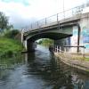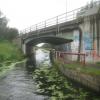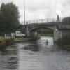
Bawtry Road Bridge
is a minor waterways place
on the Aire and Calder Navigation (Selby Section) between
Paper House Bridge (3 miles and 5 furlongs
to the southwest) and
Selby Junction (River Ouse) (Junction of Selby Canal and River Ouse (Yorkshire)) (7 furlongs
and 1 lock
to the northeast).
The nearest place in the direction of Paper House Bridge is Brayton Railway Bridge;
4¼ furlongs
away.
The nearest place in the direction of Selby Junction (River Ouse) is Selby Narrows;
2 furlongs
away.
There is no access to the towpath here.
Mooring here is unrated.
There is a bridge here which takes a major road over the canal.
| Burn Bridge | 1 mile, 5½ furlongs | |
| Henwick Hall Lane Narrows | 1 mile, 1¾ furlongs | |
| Henwick Hall Lane Bridge | 7¾ furlongs | |
| Brayton Bridge | 6¾ furlongs | |
| Brayton Railway Bridge | 4¼ furlongs | |
| Bawtry Road Bridge | ||
| Selby Narrows | 2 furlongs | |
| Selby Swing Bridge | 2½ furlongs | |
| Selby Basin | 3 furlongs | |
| Selby Junction Lock | 5 furlongs | |
| Selby Junction (River Ouse) | 7 furlongs | |
Selby Boat Centre just before the Bridge heading towards Selby.
There are no links to external websites from here.
Why not log in and add some (select "External websites" from the menu (sometimes this is under "Edit"))?
Why not log in and add some (select "External websites" from the menu (sometimes this is under "Edit"))?
Mouseover for more information or show routes to facility
Nearest water point
In the direction of Selby Junction (River Ouse)
Selby Basin — 3 furlongs away
On this waterway in the direction of Selby Junction (River Ouse)
Naburn Lock — 14 miles, 3 furlongs and 1 lock away
Travel to Selby Junction (River Ouse), then on the River Ouse : Yorkshire (tidal section - Naburn to Goole) to Naburn Lock
Goole Marina — 17 miles, 4¼ furlongs and 2 locks away
Travel to Selby Junction (River Ouse), then on the River Ouse : Yorkshire (tidal section - Naburn to Goole) to Ouse - Aire and Calder Junction, then on the Aire and Calder Navigation (Main Line - Goole to Castleford) to Goole Marina
Dutch Riverside — 17 miles, 5¾ furlongs and 2 locks away
Travel to Selby Junction (River Ouse), then on the River Ouse : Yorkshire (tidal section - Naburn to Goole) to Ouse - Aire and Calder Junction, then on the Aire and Calder Navigation (Main Line - Goole to Castleford) to Dutch Riverside
Skeldergate Bridge — 19 miles, 7¼ furlongs and 2 locks away
Travel to Selby Junction (River Ouse), then on the River Ouse : Yorkshire (tidal section - Naburn to Goole) to Naburn Lock, then on the River Ouse : Yorkshire (non-tidal section) to Skeldergate Bridge
In the direction of Bank Dole Junction
Beal Lock No 2 — 8 miles, 1¾ furlongs and 1 lock away
On this waterway in the direction of Bank Dole Junction
Beal Bridge — 8 miles, 3 furlongs and 2 locks away
On this waterway in the direction of Bank Dole Junction
Bank Dole Lock No 1 — 10 miles, 5½ furlongs and 2 locks away
On this waterway in the direction of Bank Dole Junction
Ferrybridge Flood Lock No 11 — 12 miles, 3¾ furlongs and 3 locks away
Travel to Bank Dole Junction, then on the Aire and Calder Navigation (Main Line - Goole to Castleford) to Ferrybridge Flood Lock No 11
Ferrybridge Flood Lock Footbridge — 12 miles, 4 furlongs and 4 locks away
Travel to Bank Dole Junction, then on the Aire and Calder Navigation (Main Line - Goole to Castleford) to Ferrybridge Flood Lock Footbridge
Whitley Lock No 12 — 14 miles, 6¾ furlongs and 3 locks away
Travel to Bank Dole Junction, then on the Aire and Calder Navigation (Main Line - Goole to Castleford) to Whitley Lock No 12
Bulholme Lock No 10 — 17 miles, 1¾ furlongs and 4 locks away
Travel to Bank Dole Junction, then on the Aire and Calder Navigation (Main Line - Goole to Castleford) to Bulholme Lock No 10
Castleford Sanitary Station — 17 miles, 6½ furlongs and 5 locks away
Travel to Bank Dole Junction, then on the Aire and Calder Navigation (Main Line - Goole to Castleford) to Castleford Sanitary Station
Pollington Manor Swing Bridge — 18 miles, 5 furlongs and 5 locks away
Travel to Bank Dole Junction, then on the Aire and Calder Navigation (Main Line - Goole to Castleford) to Pollington Manor Swing Bridge
Pollington Visitor Mooring — 18 miles, 5¼ furlongs and 5 locks away
Travel to Bank Dole Junction, then on the Aire and Calder Navigation (Main Line - Goole to Castleford) to Pollington Visitor Mooring
Fairies Hill Moorings — 19 miles, 7¾ furlongs and 7 locks away
Travel to Bank Dole Junction, then on the Aire and Calder Navigation (Main Line - Goole to Castleford) to Castleford Junction, then on the Aire and Calder Navigation (Wakefield Section) to Fairies Hill Lock Junction, then on the Aire and Calder Navigation (Wakefield Section - Fairies Hill Mooring Arm) to Fairies Hill MooringsNearest rubbish disposal
In the direction of Selby Junction (River Ouse)
Selby Basin — 3 furlongs away
On this waterway in the direction of Selby Junction (River Ouse)
Naburn Lock — 14 miles, 3 furlongs and 1 lock away
Travel to Selby Junction (River Ouse), then on the River Ouse : Yorkshire (tidal section - Naburn to Goole) to Naburn Lock
Goole Marina — 17 miles, 4¼ furlongs and 2 locks away
Travel to Selby Junction (River Ouse), then on the River Ouse : Yorkshire (tidal section - Naburn to Goole) to Ouse - Aire and Calder Junction, then on the Aire and Calder Navigation (Main Line - Goole to Castleford) to Goole Marina
Dutch Riverside — 17 miles, 5¾ furlongs and 2 locks away
Travel to Selby Junction (River Ouse), then on the River Ouse : Yorkshire (tidal section - Naburn to Goole) to Ouse - Aire and Calder Junction, then on the Aire and Calder Navigation (Main Line - Goole to Castleford) to Dutch Riverside
In the direction of Bank Dole Junction
Whitley Lock No 12 — 14 miles, 6¾ furlongs and 3 locks away
Travel to Bank Dole Junction, then on the Aire and Calder Navigation (Main Line - Goole to Castleford) to Whitley Lock No 12
Castleford Sanitary Station — 17 miles, 6½ furlongs and 5 locks away
Travel to Bank Dole Junction, then on the Aire and Calder Navigation (Main Line - Goole to Castleford) to Castleford Sanitary StationNearest chemical toilet disposal
In the direction of Selby Junction (River Ouse)
Selby Basin — 3 furlongs away
On this waterway in the direction of Selby Junction (River Ouse)
Naburn Lock — 14 miles, 3 furlongs and 1 lock away
Travel to Selby Junction (River Ouse), then on the River Ouse : Yorkshire (tidal section - Naburn to Goole) to Naburn Lock
Goole Marina — 17 miles, 4¼ furlongs and 2 locks away
Travel to Selby Junction (River Ouse), then on the River Ouse : Yorkshire (tidal section - Naburn to Goole) to Ouse - Aire and Calder Junction, then on the Aire and Calder Navigation (Main Line - Goole to Castleford) to Goole Marina
Dutch Riverside — 17 miles, 5¾ furlongs and 2 locks away
Travel to Selby Junction (River Ouse), then on the River Ouse : Yorkshire (tidal section - Naburn to Goole) to Ouse - Aire and Calder Junction, then on the Aire and Calder Navigation (Main Line - Goole to Castleford) to Dutch Riverside
In the direction of Bank Dole Junction
Whitley Lock No 12 — 14 miles, 6¾ furlongs and 3 locks away
Travel to Bank Dole Junction, then on the Aire and Calder Navigation (Main Line - Goole to Castleford) to Whitley Lock No 12
Castleford Sanitary Station — 17 miles, 6½ furlongs and 5 locks away
Travel to Bank Dole Junction, then on the Aire and Calder Navigation (Main Line - Goole to Castleford) to Castleford Sanitary Station
Fairies Hill Moorings — 19 miles, 7¾ furlongs and 7 locks away
Travel to Bank Dole Junction, then on the Aire and Calder Navigation (Main Line - Goole to Castleford) to Castleford Junction, then on the Aire and Calder Navigation (Wakefield Section) to Fairies Hill Lock Junction, then on the Aire and Calder Navigation (Wakefield Section - Fairies Hill Mooring Arm) to Fairies Hill MooringsNearest place to turn
In the direction of Selby Junction (River Ouse)
Selby Basin — 3 furlongs away
On this waterway in the direction of Selby Junction (River Ouse)
Naburn Lock Winding Hole — 14 miles, 3¾ furlongs and 2 locks away
Travel to Selby Junction (River Ouse), then on the River Ouse : Yorkshire (tidal section - Naburn to Goole) to Naburn Lock, then on the River Ouse : Yorkshire (non-tidal section) to Naburn Lock Winding Hole
Naburn Lock Weir Entrance — 14 miles, 5¼ furlongs and 2 locks away
Travel to Selby Junction (River Ouse), then on the River Ouse : Yorkshire (tidal section - Naburn to Goole) to Naburn Lock, then on the River Ouse : Yorkshire (non-tidal section) to Naburn Lock Weir Entrance
Viking Marina — 17 miles, 5 furlongs and 2 locks away
Travel to Selby Junction (River Ouse), then on the River Ouse : Yorkshire (tidal section - Naburn to Goole) to Ouse - Aire and Calder Junction, then on the Aire and Calder Navigation (Main Line - Goole to Castleford) to Viking Marina
Cottingwith Junction — 18 miles, 7 furlongs and 2 locks away
Travel to Selby Junction (River Ouse), then on the River Ouse : Yorkshire (tidal section - Naburn to Goole) to Ouse - Derwent Junction, then on the River Derwent to Cottingwith Junction
In the direction of Bank Dole Junction
Haddlesey Junction — 4 miles, 3¼ furlongs and 1 lock away
On this waterway in the direction of Bank Dole Junction
Beal Lock No 2 Weir Entrance — 8 miles, 2¾ furlongs and 2 locks away
On this waterway in the direction of Bank Dole Junction
Bank Dole Lock Junction — 10 miles, 5¼ furlongs and 2 locks away
On this waterway in the direction of Bank Dole Junction
Bulholme Lock Weir Exit — 17 miles, 1¼ furlongs and 4 locks away
Travel to Bank Dole Junction, then on the Aire and Calder Navigation (Main Line - Goole to Castleford) to Bulholme Lock Weir ExitNearest self-operated pump-out
In the direction of Selby Junction (River Ouse)
Naburn Lock — 14 miles, 3 furlongs and 1 lock away
Travel to Selby Junction (River Ouse), then on the River Ouse : Yorkshire (tidal section - Naburn to Goole) to Naburn Lock
In the direction of Bank Dole Junction
Castleford Sanitary Station — 17 miles, 6½ furlongs and 5 locks away
Travel to Bank Dole Junction, then on the Aire and Calder Navigation (Main Line - Goole to Castleford) to Castleford Sanitary StationNearest boatyard pump-out
In the direction of Selby Junction (River Ouse)
Goole Marina — 17 miles, 4¼ furlongs and 2 locks away
Travel to Selby Junction (River Ouse), then on the River Ouse : Yorkshire (tidal section - Naburn to Goole) to Ouse - Aire and Calder Junction, then on the Aire and Calder Navigation (Main Line - Goole to Castleford) to Goole MarinaDirection of TV transmitter (From Wolfbane Cybernetic)
There is no page on Wikipedia called “Bawtry Road Bridge”
Wikipedia pages that might relate to Bawtry Road Bridge
[Selby Canal]
railway line crosses at Brayton Railway Bridge, and the A1041 road at Bawtry Road Bridge. The only swing bridge is situated just before the final lock
[A638 road]
through Retford, Bawtry, Doncaster, Ackworth, Crofton, Nostell, Wakefield, Dewsbury, Heckmondwike and Cleckheaton. The section of road between Markham
[A roads in Zone 1 of the Great Britain numbering scheme]
List of A roads in zone 1 in Great Britain beginning north of the River Thames, east of the A1 (roads beginning with 1). "Old Stoke Bridge, Ipswich". www
[Humber Bridge]
swing bridge bottleneck and on through Finningley and Bawtry, meeting the east–west A631). The journey was along straight single-carriageway roads across
[A1500 road]
intermittently discovered nearly to Bawtry. (None of this is part of the A1500.) The A1500 follows the Roman Road through Sturton by Stow at SK890803
[River Idle]
Meden, near Markham Moor. From there, it flows north through Retford and Bawtry before entering the River Trent at Stockwith near Misterton. The county
[Scaftworth]
occupation. Bawtry Road Bridge was built in 1810 and widened in 1940. This is the present boundary of the parish and Nottinghamshire, with Bawtry and South
[A631 road]
a trunk road. After the M1 the road is a single carriageway non-trunk road and heads east to Rotherham as Bawtry Road through Tinsley. It passes Tinsley
[A614 road]
road runs north to the settlement of Bawtry, passing to the south of a nearby colliery at Harworth. At Bawtry the road meets the A638, a Roman road which
[Great North Road (Great Britain)]
Road diverges west of the Roman road and continues through Grantham, Newark, Retford and Bawtry to Doncaster. North of Doncaster the Great North Road
Results of Google Search
Wharves and dry dock. Selby Swing Bridge. A1041 Bawtry Road bridge. Doncaster to Selby Railway. Brayton Lane Bridge. A63 road bridge. A19 Burn Bridge.
This closure will allow vital piles to be bored for the south abutment of the new bridge. Once the closure is in place it will remain there until the these foundations ...
Dec 19, 2017 ... Bawtry Road Bridge carries the A1041 road across the Selby Canal.
Bawtry Road Railway Bridge, Selby. Also called the Thelson Oils Bridge, the bridge was located on the old Selby-Goole line. The railway opened in 1907 and ...
Nov 1, 2015 ... Bawtry Road bridge, Selby. taken 4 years ago, near to Selby, North Yorkshire, Great Britain. This is 1 of 3 images, with title starting with Bawtry ...
Click here to find out opening hours of Costa Express Shell Canklow Bridge, Bawtry Road, Canklow Roundabout, Rotherham today. All information about the ...
River Idle at Bawtry including the A631 Bawtry Bridge and properties near the river on ... Serlby and the riverside cottages and farms, and the Great North Road.
How much are people paying for property in Bawtry Road? For this and lots ... Bridge Cottage, Bawtry Road, Worksop, Nottinghamshire, S81 8HG Occupier info ...
... Bawtry Road ( 32791692 ) as forward; Way Sheep Bridge Lane ( 31246849 ); Way Sheep Bridge Lane ( 405788046 ); Way Sheep Bridge Lane ( 405788047 ) ...


![Bawtry Road (A1041), Selby. Old milepost [[[6385024]]] - 1 mile to Selby. by JThomas – 01 February 2020](https://s3.geograph.org.uk/geophotos/06/38/50/6385043_9937faf1_120x120.jpg)


![Bawtry Road (A1041), Selby. Showing position of Postbox No. YO8 34.See [[[6382608]]] for postbox. by JThomas – 01 February 2020](https://s0.geograph.org.uk/geophotos/06/38/26/6382612_9dc7fa98_120x120.jpg)
![Bawtry Road (A1041), Selby. Old milepost [[[6385024]]] - 14 miles to Thorne. by JThomas – 01 February 2020](https://s2.geograph.org.uk/geophotos/06/38/50/6385042_b905f331_120x120.jpg)


![Elizabeth II postbox on Bawtry Road, Selby. Postbox No. YO8 34.See [[[6382611]]] and [[[6382612]]] for context. by JThomas – 01 February 2020](https://s0.geograph.org.uk/geophotos/06/38/26/6382608_726a1f52_120x120.jpg)
