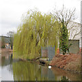
Holloway Road Bridge
Maldon CM9 4TD, United Kingdom

Holloway Road Bridge
is a minor waterways place
on the Chelmer and Blackwater Navigation between
End of Navigation (Chelmsford) (Limit of navigation) (12 miles and 3 furlongs
and 12 locks
to the west) and
Heybridge Sea Lock No 13 (End of Navigation and exit to Blackwater estuary) (1 mile and 4½ furlongs
to the southeast).
The nearest place in the direction of End of Navigation (Chelmsford) is A414 East Bridge;
2¾ furlongs
away.
The nearest place in the direction of Heybridge Sea Lock No 13 is Colchester Road Pipe Bridge;
2¼ furlongs
away.
There may be access to the towpath here.
Mooring here is unrated.
There is a bridge here which takes a minor road over the canal.
| Golf Course Footbridge | 6½ furlongs | |
| Narrows Footbridge | 5¼ furlongs | |
| A414 West Bridge | 5 furlongs | |
| Playground Footbridge | 4 furlongs | |
| A414 East Bridge | 2¾ furlongs | |
| Holloway Road Bridge | ||
| Colchester Road Pipe Bridge | 2¼ furlongs | |
| Colchester Road Bridge | 2½ furlongs | |
| Rennie Walk Footbridge | 5 furlongs | |
| Heybridge Sea Lock No 13 | 1 mile, 4½ furlongs | |
There are no links to external websites from here.
Why not log in and add some (select "External websites" from the menu (sometimes this is under "Edit"))?
Why not log in and add some (select "External websites" from the menu (sometimes this is under "Edit"))?
Mouseover for more information or show routes to facility
Nearest place to turn
In the direction of End of Navigation (Chelmsford)
River Blackwater Junction — 1 mile, 2¼ furlongs and 1 lock away
On this waterway in the direction of End of Navigation (Chelmsford)
Rickett's Lock Weir Exit — 2 miles, 1¼ furlongs and 2 locks away
On this waterway in the direction of End of Navigation (Chelmsford)
The Causeway Bridge Winding Hole — 3 miles, 4½ furlongs and 3 locks away
On this waterway in the direction of End of Navigation (Chelmsford)
Rushes Lock Weir Exit — 4 miles, 6 furlongs and 4 locks away
On this waterway in the direction of End of Navigation (Chelmsford)
Rushes Lock Weir Entrance — 4 miles, 6½ furlongs and 5 locks away
On this waterway in the direction of End of Navigation (Chelmsford)
Paper Mill Lock Weir Exit — 6 miles, 1¾ furlongs and 5 locks away
On this waterway in the direction of End of Navigation (Chelmsford)
Paper Mill Lock Weir Entrance — 6 miles, 2½ furlongs and 6 locks away
On this waterway in the direction of End of Navigation (Chelmsford)
Little Baddow Lock Weir Exit — 7 miles, 4½ furlongs and 6 locks away
On this waterway in the direction of End of Navigation (Chelmsford)
Little Baddow Lock Weir Entrance — 7 miles, 6 furlongs and 7 locks away
On this waterway in the direction of End of Navigation (Chelmsford)
Stoneham's Lock Weir Exit — 8 miles, 1½ furlongs and 7 locks away
On this waterway in the direction of End of Navigation (Chelmsford)
Cuton Lock Weir Exit — 9 miles, ¼ furlongs and 8 locks away
On this waterway in the direction of End of Navigation (Chelmsford)
Cuton Lock Weir Entrance — 9 miles, 1 furlong and 9 locks away
On this waterway in the direction of End of Navigation (Chelmsford)
Sandford Lock Weir Exit — 10 miles, ¼ furlongs and 9 locks away
On this waterway in the direction of End of Navigation (Chelmsford)
Sandford Lock Weir Entrance — 10 miles, 3 furlongs and 10 locks away
On this waterway in the direction of End of Navigation (Chelmsford)
Springfield Lock Weir Exit — 11 miles, 7½ furlongs and 11 locks away
On this waterway in the direction of End of Navigation (Chelmsford)No information
CanalPlan has no information on any of the following facilities within range:water point
rubbish disposal
chemical toilet disposal
self-operated pump-out
boatyard pump-out
Direction of TV transmitter (From Wolfbane Cybernetic)
There is no page on Wikipedia called “Holloway Road Bridge”
Wikipedia pages that might relate to Holloway Road Bridge
[Holloway and Caledonian Road railway station]
Holloway & Caledonian Road (originally Holloway) was a railway station opened in 1852 by the Great Northern Railway (GNR). It was located on Holloway
[Caledonian Road, London]
Battle Bridge and Holloway Road Company. The company built the Caledonian Road in 1826 as a toll road to link the New Road with Holloway Road (which is
[Dethick, Lea and Holloway]
contains the three main settlements – Dethick, Lea and Holloway, as well as the younger village of Lea Bridge. The area's most notable family is the Nightingales
[Darebin Creek Bridge]
the Heidelberg Road Trust. The toll keeper was Henry Holloway, and the charges included one farthing for every pig that crossed the bridge and up to eighteen
[Sterling Holloway]
Sterling Price Holloway Jr. (January 4, 1905 – November 22, 1992) was an American actor, who appeared in over 100 films and 40 television shows. He did
[Camden Road]
Camden Road is a main road in London running from the junction of Camden High Street and Camden Town Underground station up to Holloway Road. It is part
[Pulaski Bridge]
Pulaski Bridge is a bascule bridge, a type of drawbridge. It carries six lanes of traffic and a pedestrian sidewalk over the water, Long Island Rail Road tracks
[Holloway Brothers (London)]
a partnership in 1882 by two brothers, Henry Thomas Holloway and Henry Holloway, at Queen's Road in Battersea; this was a consequence of their elder brother
[A1 in London]
The road travels through the City and three London boroughs: Islington, Haringey and Barnet, which include the districts of Islington, Holloway, Highgate
[Upper Holloway railway station]
a station. Holloway Road passes over the line and steps and ramps for wheelchair users, buggies, bikes etc. on either side of the bridge lead directly


![George VI postbox on Holloway Road, Heybridge. Postbox No. CM9 223.See [[[5382144]]] for context. by JThomas – 27 April 2017](https://s0.geograph.org.uk/geophotos/05/38/21/5382140_aadaacfa_120x120.jpg)
![House on Holloway Road, Heybridge. Showing position of Postbox No. CM9 223.See [[[5382140]]] for postbox. by JThomas – 27 April 2017](https://s0.geograph.org.uk/geophotos/05/38/21/5382144_bbec6862_120x120.jpg)


