CanalPlanAC

Whitworth Street West Footbridge No 1

 
Deansgate-Castlefield, Deansgate Locks, Manchester M1 5LH, United Kingdom
 
Information about the place
Whitworth Street West Footbridge No 1 is a minor waterways place on the Rochdale Canal between Castlefield Junction (Junction of Bridgewater and Rochdale Canals) (2 furlongs and 2 locks to the west) and Ducie Street Junction (Junction of Rochdale and Ashton Canals) (7½ furlongs and 7 locks to the east).
 
 
The nearest place in the direction of Castlefield Junction is Tunnel Lock No 91; ¼ furlongs away.
 
The nearest place in the direction of Ducie Street Junction is Whitworth Street West Footbridge No 2; ¼ furlongs away.

There may be access to the towpath here.

Mooring here is unrated.

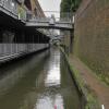
There is a bridge here which takes pedestrian traffic over the canal.


Amenities

Amenities here

 Sainsbury's
 Sainsburys
 Cashpoint
 Deansgate Station

Amenities nearby at Whitworth Street West Footbridge No 2

 
Maps
If you are a user and are logged on, or if you are actively planning a route, a map will be displayed here.
Show on external mapping site: Google | OSM | Bing
 
Photos
 
External websites
There are no links to external websites from here.
Why not log in and add some (select "External websites" from the menu (sometimes this is under "Edit"))?
 
Nearest facilities

Mouseover for more information or show routes to facility

Nearest water point

In the direction of Castlefield Junction

Staffordshire, Kenworthy and other Arms2¼ furlongs and 2 locks away
Travel to Castlefield Junction, then on the Bridgewater Canal (Main Line) to Staffordshire, Kenworthy and other Arms
Potato Wharf Arm & The New Basin3 furlongs and 2 locks away
Travel to Castlefield Junction, then on the Bridgewater Canal (Main Line) to Potato Wharf Arm & The New Basin
Stretford Marina3 miles, 2½ furlongs and 2 locks away
Travel to Castlefield Junction, then on the Bridgewater Canal (Main Line) to Stretford Marina
Watch House Cruising Club4 miles, 2¾ furlongs and 2 locks away
Travel to Castlefield Junction, then on the Bridgewater Canal (Main Line) to Watch House Cruising Club
Worsley Visitor Moorings7 miles, 4½ furlongs and 2 locks away
Travel to Castlefield Junction, then on the Bridgewater Canal (Main Line) to Stretford - Waters Meeting, then on the Bridgewater Canal (Stretford and Leigh Branch) to Worsley Visitor Moorings
Bridgewater Marina9 miles, ¼ furlongs and 2 locks away
Travel to Castlefield Junction, then on the Bridgewater Canal (Main Line) to Stretford - Waters Meeting, then on the Bridgewater Canal (Stretford and Leigh Branch) to Bridgewater Marina
Ye Olde Number 3 Transit Moorings11 miles, 1¾ furlongs and 2 locks away
Travel to Castlefield Junction, then on the Bridgewater Canal (Main Line) to Ye Olde Number 3 Transit Moorings
Plank Lane Visitor Moorings15 miles, 5 furlongs and 2 locks away
Travel to Castlefield Junction, then on the Bridgewater Canal (Main Line) to Stretford - Waters Meeting, then on the Bridgewater Canal (Stretford and Leigh Branch) to Leigh Bridge No 11, then on the Leeds and Liverpool Canal (Leigh Branch) to Plank Lane Visitor Moorings

In the direction of Sowerby Bridge Junction

New Islington Marina1 mile, 3½ furlongs and 9 locks away
Travel to New Islington Marina Entrance, then on the Rochdale Canal (Main Line) to Cotton Field Wharf Marina, then on the Rochdale Canal (New Islington Marina Arm) to New Islington Marina
Fairfield Junction4 miles, 6 furlongs and 25 locks away
Travel to Ducie Street Junction, then on the Ashton Canal (Main Line) to Fairfield Junction
Grove Road Bridge No 9612 miles, 2 furlongs and 33 locks away
Travel to Ducie Street Junction, then on the Ashton Canal (Main Line) to Ashton-under-Lyne Junction, then on the Huddersfield Narrow Canal to Grove Road Bridge No 96
Marple Services15 miles, 3¼ furlongs and 41 locks away
Travel to Ducie Street Junction, then on the Ashton Canal (Main Line) to Dukinfield Junction, then on the Peak Forest Canal (Lower) to Marple Junction, then on the Macclesfield Canal to Marple Services
Braidbar Boats19 miles, 1 furlong and 41 locks away
Travel to Ducie Street Junction, then on the Ashton Canal (Main Line) to Dukinfield Junction, then on the Peak Forest Canal (Lower) to Marple Junction, then on the Macclesfield Canal to Braidbar Boats
Littleborough Sanitary Station16 miles, 4½ furlongs and 44 locks away
On this waterway in the direction of Sowerby Bridge Junction
Wool Road Bridge No 7018 miles, 2¼ furlongs and 48 locks away
Travel to Ducie Street Junction, then on the Ashton Canal (Main Line) to Ashton-under-Lyne Junction, then on the Huddersfield Narrow Canal to Wool Road Bridge No 70

Nearest rubbish disposal

In the direction of Castlefield Junction

Plank Lane Pump Out15 miles, 5½ furlongs and 2 locks away
Travel to Castlefield Junction, then on the Bridgewater Canal (Main Line) to Stretford - Waters Meeting, then on the Bridgewater Canal (Stretford and Leigh Branch) to Leigh Bridge No 11, then on the Leeds and Liverpool Canal (Leigh Branch) to Plank Lane Pump Out

In the direction of Sowerby Bridge Junction

Marple Bottom Lock Bridge Winding Hole14 miles, 2 furlongs and 25 locks away
Travel to Ducie Street Junction, then on the Ashton Canal (Main Line) to Dukinfield Junction, then on the Peak Forest Canal (Lower) to Marple Bottom Lock Bridge Winding Hole
Marple Services15 miles, 3¼ furlongs and 41 locks away
Travel to Ducie Street Junction, then on the Ashton Canal (Main Line) to Dukinfield Junction, then on the Peak Forest Canal (Lower) to Marple Junction, then on the Macclesfield Canal to Marple Services
Braidbar Boats19 miles, 1 furlong and 41 locks away
Travel to Ducie Street Junction, then on the Ashton Canal (Main Line) to Dukinfield Junction, then on the Peak Forest Canal (Lower) to Marple Junction, then on the Macclesfield Canal to Braidbar Boats
Littleborough Sanitary Station16 miles, 4½ furlongs and 44 locks away
On this waterway in the direction of Sowerby Bridge Junction
Wool Road Visitor Mooring18 miles, 1¾ furlongs and 48 locks away
Travel to Ducie Street Junction, then on the Ashton Canal (Main Line) to Ashton-under-Lyne Junction, then on the Huddersfield Narrow Canal to Wool Road Visitor Mooring

Nearest chemical toilet disposal

In the direction of Castlefield Junction

Watch House Cruising Club4 miles, 2¾ furlongs and 2 locks away
Travel to Castlefield Junction, then on the Bridgewater Canal (Main Line) to Watch House Cruising Club
Oughtrington Wharf12 miles, 7¾ furlongs and 2 locks away
Travel to Castlefield Junction, then on the Bridgewater Canal (Main Line) to Oughtrington Wharf

In the direction of Sowerby Bridge Junction

Fairfield Junction4 miles, 6 furlongs and 25 locks away
Travel to Ducie Street Junction, then on the Ashton Canal (Main Line) to Fairfield Junction
Grove Road Bridge No 9612 miles, 2 furlongs and 33 locks away
Travel to Ducie Street Junction, then on the Ashton Canal (Main Line) to Ashton-under-Lyne Junction, then on the Huddersfield Narrow Canal to Grove Road Bridge No 96
Marple Services15 miles, 3¼ furlongs and 41 locks away
Travel to Ducie Street Junction, then on the Ashton Canal (Main Line) to Dukinfield Junction, then on the Peak Forest Canal (Lower) to Marple Junction, then on the Macclesfield Canal to Marple Services
Littleborough Sanitary Station16 miles, 4½ furlongs and 44 locks away
On this waterway in the direction of Sowerby Bridge Junction
Wool Road Bridge No 7018 miles, 2¼ furlongs and 48 locks away
Travel to Ducie Street Junction, then on the Ashton Canal (Main Line) to Ashton-under-Lyne Junction, then on the Huddersfield Narrow Canal to Wool Road Bridge No 70

Nearest place to turn

In the direction of Castlefield Junction

Castlefield Junction2 furlongs and 2 locks away
On this waterway in the direction of Castlefield Junction
Staffordshire, Kenworthy and other Arms2¼ furlongs and 2 locks away
Travel to Castlefield Junction, then on the Bridgewater Canal (Main Line) to Staffordshire, Kenworthy and other Arms
Grocer's Wharf3 furlongs and 2 locks away
Travel to Castlefield Junction, then on the Bridgewater Canal (Main Line) to Grocer's Wharf
Potato Wharf Arm & The New Basin3 furlongs and 2 locks away
Travel to Castlefield Junction, then on the Bridgewater Canal (Main Line) to Potato Wharf Arm & The New Basin
Hulme Locks Branch - Bridgewater Canal Junction4½ furlongs and 2 locks away
Travel to Castlefield Junction, then on the Bridgewater Canal (Main Line) to Hulme Locks Branch - Bridgewater Canal Junction
Hulme Hall Road Winding Hole5½ furlongs and 2 locks away
Travel to Castlefield Junction, then on the Bridgewater Canal (Main Line) to Hulme Hall Road Winding Hole
Pomona Lock Branch Junction1 mile, 2 furlongs and 2 locks away
Travel to Castlefield Junction, then on the Bridgewater Canal (Main Line) to Pomona Lock Branch Junction
Stretford - Waters Meeting3 miles, ½ furlongs and 2 locks away
Travel to Castlefield Junction, then on the Bridgewater Canal (Main Line) to Stretford - Waters Meeting
Stretford Marina3 miles, 2½ furlongs and 2 locks away
Travel to Castlefield Junction, then on the Bridgewater Canal (Main Line) to Stretford Marina
Middlewood Basin No 11 mile, 1¼ furlongs and 5 locks away
Travel to Castlefield Junction, then on the Bridgewater Canal (Main Line) to Hulme Locks Branch - Bridgewater Canal Junction, then on the Bridgewater Canal (Hulme Locks Branch) to River Irwell - Hulme Locks Branch Junction, then on the Manchester Ship Canal (River Irwell Upper Reach) to Manchester, Bolton and Bury Canal - River Irwell Junction, then on the Manchester Bolton and Bury Canal (Main Line) to Middlewood Basin No 1
Middlewood Basin No 21 mile, 1¾ furlongs and 5 locks away
Travel to Castlefield Junction, then on the Bridgewater Canal (Main Line) to Hulme Locks Branch - Bridgewater Canal Junction, then on the Bridgewater Canal (Hulme Locks Branch) to River Irwell - Hulme Locks Branch Junction, then on the Manchester Ship Canal (River Irwell Upper Reach) to Manchester, Bolton and Bury Canal - River Irwell Junction, then on the Manchester Bolton and Bury Canal (Main Line) to Middlewood Basin No 2
Edge Lane Winding Hole4 miles, 1 furlong and 2 locks away
Travel to Castlefield Junction, then on the Bridgewater Canal (Main Line) to Edge Lane Winding Hole
Trafford Park Winding Hole4 miles, 2¾ furlongs and 2 locks away
Travel to Castlefield Junction, then on the Bridgewater Canal (Main Line) to Stretford - Waters Meeting, then on the Bridgewater Canal (Stretford and Leigh Branch) to Trafford Park Winding Hole
Salford Tunnel Basin1 mile, 2¾ furlongs and 6 locks away
Travel to Castlefield Junction, then on the Bridgewater Canal (Main Line) to Hulme Locks Branch - Bridgewater Canal Junction, then on the Bridgewater Canal (Hulme Locks Branch) to River Irwell - Hulme Locks Branch Junction, then on the Manchester Ship Canal (River Irwell Upper Reach) to Manchester, Bolton and Bury Canal - River Irwell Junction, then on the Manchester Bolton and Bury Canal (Main Line) to Salford Tunnel Basin
Patricroft Basin and Warehouse5 miles, 5¼ furlongs and 2 locks away
Travel to Castlefield Junction, then on the Bridgewater Canal (Main Line) to Stretford - Waters Meeting, then on the Bridgewater Canal (Stretford and Leigh Branch) to Patricroft Basin and Warehouse
Patricroft Bridge Winding Hole5 miles, 6¼ furlongs and 2 locks away
Travel to Castlefield Junction, then on the Bridgewater Canal (Main Line) to Stretford - Waters Meeting, then on the Bridgewater Canal (Stretford and Leigh Branch) to Patricroft Bridge Winding Hole
Monton Turn6 miles, 4¼ furlongs and 2 locks away
Travel to Castlefield Junction, then on the Bridgewater Canal (Main Line) to Stretford - Waters Meeting, then on the Bridgewater Canal (Stretford and Leigh Branch) to Monton Turn
Winding Hole (east of Worsley)7 miles, 2¼ furlongs and 2 locks away
Travel to Castlefield Junction, then on the Bridgewater Canal (Main Line) to Stretford - Waters Meeting, then on the Bridgewater Canal (Stretford and Leigh Branch) to Winding Hole (east of Worsley)
Worsley Delph7 miles, 4¾ furlongs and 2 locks away
Travel to Castlefield Junction, then on the Bridgewater Canal (Main Line) to Stretford - Waters Meeting, then on the Bridgewater Canal (Stretford and Leigh Branch) to Worsley Delph

In the direction of Sowerby Bridge Junction

Ducie Street Junction7½ furlongs and 7 locks away
On this waterway in the direction of Sowerby Bridge Junction

Nearest boatyard pump-out

In the direction of Castlefield Junction

Stretford Marina3 miles, 2½ furlongs and 2 locks away
Travel to Castlefield Junction, then on the Bridgewater Canal (Main Line) to Stretford Marina
Bridgewater Marina9 miles, ¼ furlongs and 2 locks away
Travel to Castlefield Junction, then on the Bridgewater Canal (Main Line) to Stretford - Waters Meeting, then on the Bridgewater Canal (Stretford and Leigh Branch) to Bridgewater Marina
Oughtrington Wharf12 miles, 7¾ furlongs and 2 locks away
Travel to Castlefield Junction, then on the Bridgewater Canal (Main Line) to Oughtrington Wharf

In the direction of Sowerby Bridge Junction

Portland Basin Arm7 miles, 2¼ furlongs and 25 locks away
Travel to Ducie Street Junction, then on the Ashton Canal (Main Line) to Dukinfield Junction, then on the Peak Forest Canal (Lower) to Portland Basin Arm
Braidbar Boats19 miles, 1 furlong and 41 locks away
Travel to Ducie Street Junction, then on the Ashton Canal (Main Line) to Dukinfield Junction, then on the Peak Forest Canal (Lower) to Marple Junction, then on the Macclesfield Canal to Braidbar Boats
New Mills Marina19 miles, 3 furlongs and 41 locks away
Travel to Ducie Street Junction, then on the Ashton Canal (Main Line) to Dukinfield Junction, then on the Peak Forest Canal (Lower) to Marple Junction, then on the Peak Forest Canal (Upper) to New Mills Marina
Direction of TV transmitter (From Wolfbane Cybernetic)
 
 
Geograph
 
Wikipedia

There is no page on Wikipedia called “Whitworth Street West Footbridge”

Wikipedia pages that might relate to Whitworth Street West Footbridge
[List of Dublin bridges and tunnels] Parade, Ballybough Road - R803] Footbridge for access to Croke Park Clonliffe Bridge (Russell Street Bridge) [Russell Street, Jones's Road] Binns Bridge [Drumcondra [Leeds and Liverpool Canal] made it impossible to continue for more than a decade. In 1789 Robert Whitworth developed fresh proposals to vary the line of the remaining part of the [Matlock, Derbyshire] to Matlock Green. The ferry was replaced by a footbridge in 1872. Footbridge to Pic Tor – This footbridge on the east side of Dale Road replaced a ferry [MediaCityUK] during 2005, two in Manchester – one at Quay Street, close to Granada Studios, and one on Whitworth Street and two in Salford – one close to the Manchester [Deansgate railway station] England, 1,100 yards (1 km) west of Manchester Piccadilly, close to Castlefield at the junction of Deansgate and Whitworth Street West. It is part of the Manchester [Manchester Arndale] days, and were demolished. The Arndale's frontage on Corporation Street and the footbridge were structurally damaged. The reinsurance company Swiss Re estimated [Corporation Street Bridge] Corporation Street Bridge is a skyway which crosses Corporation Street in Manchester city centre, Manchester. The bridge replaced the old footbridge, which [Architecture of Manchester] residential use. Mosley Street runs roughly parallel to Portland Street, Whitworth Street and Deansgate, from Piccadilly Gardens to St Peter's Square. It [Timeline of Manchester history] Levels to Stretford. Blackfriars Street footbridge is built across the River Irwell. Approximate date: Cross Street Chapel becomes a Unitarian meeting [Carrington, New South Wales] creek or on the Onebygamba express, a two-horse coach. There was also a footbridge from Honeysuckle at one point. Carrington was rich and progressive despite
 
Google