River Walk Junction
Junction with the northern route to the railway bridge
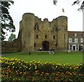
Tonbridge Castle, Castle Street, Tonbridge and Malling TN9 1BH, United Kingdom

River Walk Junction
is a minor waterways place
at the junction of
the River Medway (Non-tidal section)
with
the River Medway (Tonbridge Northern Route).
Tonbridge Junction (northern route) (Junction with the northern route from Tonbridge)
is on
the River Medway (Non-tidal section),
5 furlongs
to the west.
Yalding Wharf
is on
the River Medway (Non-tidal section),
8 miles and ½ furlongs
and 6 locks
to the east.
Tonbridge Junction (northern route) (Junction with the northern route from Tonbridge)
is on
the River Medway (Non-tidal section),
5¼ furlongs
to the west.
The nearest place in the direction of Tonbridge Junction (northern route) is New Wharf Road Bridge;
¼ furlongs
away.
The nearest place in the direction of Yalding Wharf is Tonbridge Bridge;
½ furlongs
away.
The nearest place in the direction of Tonbridge Junction (northern route) is New Wharf Road Footbridge;
¾ furlongs
away.
Mooring here is unrated.
| River Medway (Non-tidal section) | ||
|---|---|---|
| Tonbridge Junction (northern route) | 5 furlongs | |
| River Walk Footbridge No 2 | 1½ furlongs | |
| Tonbridge Town Lock Weir Entrance No 2 | 1 furlong | |
| River Walk Footbridge No 1 | ¾ furlongs | |
| New Wharf Road Bridge | ¼ furlongs | |
| River Walk Junction | ||
| Tonbridge Bridge | ½ furlongs | |
| Tonbridge Wharf | 1¼ furlongs | |
| Tonbridge Town Lock Weir Entrance No 1 | 2 furlongs | |
| Tonbridge Town Lock No 1 | 2¼ furlongs | |
| Tonbridge Town Lock Weir Exit No 1 | 2½ furlongs | |
| River Medway (Tonbridge Northern Route) | ||
| River Walk Junction | ||
| New Wharf Road Footbridge | ¾ furlongs | |
| The Slade Footbridge | 1 furlong | |
| Sportsfield Footbridge | 3¾ furlongs | |
| Tonbridge Junction (northern route) | 5¼ furlongs | |
There are no links to external websites from here.
Why not log in and add some (select "External websites" from the menu (sometimes this is under "Edit"))?
Why not log in and add some (select "External websites" from the menu (sometimes this is under "Edit"))?
Mouseover for more information or show routes to facility
Nearest place to turn
In the direction of Allington Lock No 10
Tonbridge Town Lock Weir Entrance No 1 — 2 furlongs away
On the River Medway (Non-tidal section) in the direction of Allington Lock No 10
Tonbridge Town Lock Weir Exit No 1 — 2½ furlongs and 1 lock away
On the River Medway (Non-tidal section) in the direction of Allington Lock No 10
Eldridge's Lock Winding Hole — 1 mile, 5¾ furlongs and 2 locks away
On the River Medway (Non-tidal section) in the direction of Allington Lock No 10
Porter's Lock Weir Entrance — 2 miles, 3¾ furlongs and 2 locks away
On the River Medway (Non-tidal section) in the direction of Allington Lock No 10
Porter's Lock Weir Exit — 2 miles, 5¾ furlongs and 3 locks away
On the River Medway (Non-tidal section) in the direction of Allington Lock No 10
East Lock Weir Entrance — 3 miles, 5¾ furlongs and 3 locks away
On the River Medway (Non-tidal section) in the direction of Allington Lock No 10
East Lock Weir Exit — 3 miles, 7¾ furlongs and 4 locks away
On the River Medway (Non-tidal section) in the direction of Allington Lock No 10
Oak Weir Lock Weir Exit — 4 miles, 5 furlongs and 5 locks away
On the River Medway (Non-tidal section) in the direction of Allington Lock No 10
Sluice Weir Lock Weir Exit — 6 miles and 6 locks away
On the River Medway (Non-tidal section) in the direction of Allington Lock No 10
Stoneham Lock Weir Exit — 7 miles, 1¼ furlongs and 6 locks away
On the River Medway (Non-tidal section) in the direction of Allington Lock No 10
Hampstead Lock Weir Exit — 8 miles, 5¼ furlongs and 7 locks away
On the River Medway (Non-tidal section) in the direction of Allington Lock No 10
Teston Lock Weir Entrance — 11 miles, 3½ furlongs and 7 locks away
On the River Medway (Non-tidal section) in the direction of Allington Lock No 10
Teston Lock Weir Exit — 11 miles, 4 furlongs and 8 locks away
On the River Medway (Non-tidal section) in the direction of Allington Lock No 10
Farleigh Lock Weir Exit — 13 miles, 5¼ furlongs and 9 locks away
On the River Medway (Non-tidal section) in the direction of Allington Lock No 10
Allington Lock Weir Entrance — 18 miles, ½ furlongs and 9 locks away
On the River Medway (Non-tidal section) in the direction of Allington Lock No 10
Allington Lock Weir Exit — 18 miles, 2 furlongs and 10 locks away
Travel to Allington Lock No 10, then on the River Medway (Tidal section) to Allington Lock Weir Exit
In the direction of Tonbridge Rail Bridge
Tonbridge Junction (northern route) — 5 furlongs away
On the River Medway (Non-tidal section) in the direction of Tonbridge Rail BridgeNo information
CanalPlan has no information on any of the following facilities within range:water point
rubbish disposal
chemical toilet disposal
self-operated pump-out
boatyard pump-out
Direction of TV transmitter (From Wolfbane Cybernetic)
There is no page on Wikipedia called “River Walk Junction”
Wikipedia pages that might relate to River Walk Junction
[River Sheaf]
Grade I-listed Abbeydale Industrial Hamlet. A River Sheaf Walk has been developed which follows the river from Granville Square out to Millhouses Park
[Cheyne Walk]
width of the river, it fronted the river along its whole length. At its western end, Cheyne Walk meets Cremorne Road end-on at the junction with Lots Road
[Liesbeek River]
Liesbeek It is perfectly possible to walk almost the entire length of the Liesbeek River on public footpaths. The whole walk is about 9.7km in length, and should
[Road junction]
junction is where two or more roads meet. Roads began as a means of linking locations of interest: towns, forts and geographic features such as river
[River Colne, Hertfordshire]
to its junction with the Grand Junction, to cross the Fray's River, the River Colne and the Colne Brook. Between Croxley Green, where the River Gade joins
[Cave Junction, Oregon]
Cave Junction is a city in Josephine County, Oregon, United States. As of the 2010 census, the city population was 1,883. Its motto is the "Gateway to
[Lea Valley Walk]
The Lea Valley Walk is a 50-mile (80 km) long-distance path located between Leagrave, the source of the River Lea near Luton, and the Thames, at Limehouse
[Poplar Walk]
Christ Church at the junction with Broad Walk to the north and the River Thames near Folly Bridge to the south. At this point, the river is known as "The
[Oxford Canal]
within Oxford known as the Four Rivers. The canal begins in Warwickshire near Hawkesbury Village at Hawkesbury Junction, also known as Sutton Stop, where
[River Shuttle]
School until it flows into the River Cray just south of Hall Place. A walk called the Shuttle Riverway follows the river for its entire length of five
Results of Google Search
River Walk Trail - Junction City, KSThe River Walk Trail is a 4.8 mile trail that winds along the Republican River from the outlet tubes of Milford Lake and links up to the new horse trails at Milford lake, Â ...
Results 1 - 30 of 89 ... The Riverwalk Trail is a cooperative agreement among the Junction City Parks & Recreation Dept., the Fort Riley Army Base, and the Corps ...
Grab a fishing pole, or put on your walking shoes as you head to E Ash to Riverwalk Landing. Enjoy a quiet time in the gazebo, fish from the dock or take a walk ...
Enjoy more than 60 trees and 300 native wetland plants. This park also features a gazebo, a dock and parking area. At Riverwalk Landing you can sit, relax and ...
Along the Colorado River there are 24 miles of paved paths, perfect for walking, biking (including e-bikes except at the Audobon section of the trail), even ...
One of the best ways to explore Junction City and Geary County is to get outdoors and walk, bike ride or ... Junction City Wetlands Trail ... Old River Bluff Trail ...
Notice. UPDATE (04/10/20): Via Executive Order No. 20-21, sales of general nonresident turkey permits have been suspended.
Delta River Walk Park. As of June 22, 2016. In a partnership with the City of Delta Junction, this trail plan will begin the early stages leading to phase I. AÂ ...
Apr 11, 2016 ... White River Junction — A group of residents wants to build a new kind of walking path along the bank of the Connecticut River, but town ...
Find over 1101 of the best walking routes in White River Junction. Maps, races, & running clubs in White River Junction, VT. Track & analyze your walks.


