CanalPlanAC

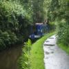
Narrows by bridge No 61

 
Reddisher Road, Kirklees HD7 6NF, United Kingdom
 
Information about the place
Narrows by bridge No 61 is a minor waterways place on the Huddersfield Narrow Canal between Tunnel End Footbridge No 62 (1¼ furlongs to the west) and Railway Lock No 42E (Marsden. Eastern summit lock) (3½ furlongs to the east).
 
 
The nearest place in the direction of Tunnel End Footbridge No 62 is Tunnel End Railway Bridge No 61; ½ furlongs away.
 
The nearest place in the direction of Railway Lock No 42E is High Lea Narrows; 2½ furlongs away.

Mooring here is good (a nice place to moor), mooring rings or bollards are available.

This is the site of a bridge, the canal may be narrow as a consequence.


Amenities
 
Maps
If you are a user and are logged on, or if you are actively planning a route, a map will be displayed here.
Show on external mapping site: Google | OSM | Bing
 
Photos
 
External websites
There are no links to external websites from here.
Why not log in and add some (select "External websites" from the menu (sometimes this is under "Edit"))?
 
Nearest facilities

Mouseover for more information or show routes to facility

Nearest water point

In the direction of Ashton-under-Lyne Junction

On this waterway in the direction of Ashton-under-Lyne Junction
Standedge Tunnel (western entrance)3 miles, 3¾ furlongs away
On this waterway in the direction of Ashton-under-Lyne Junction
Wool Road Bridge No 705 miles, 3½ furlongs and 9 locks away
On this waterway in the direction of Ashton-under-Lyne Junction
Grove Road Bridge No 9611 miles, 3½ furlongs and 24 locks away
On this waterway in the direction of Ashton-under-Lyne Junction
Fairfield Junction18 miles, 7¾ furlongs and 32 locks away
Travel to Ashton-under-Lyne Junction, then on the Ashton Canal (Main Line) to Fairfield Junction

In the direction of Aspley Basin (Huddersfield)

Slaithwaite Winding Hole3 miles, 1¼ furlongs and 21 locks away
On this waterway in the direction of Aspley Basin (Huddersfield)
Waterside Lock No 21E3 miles, 1¾ furlongs and 21 locks away
On this waterway in the direction of Aspley Basin (Huddersfield)
Aspley Basin (Huddersfield)7 miles, 7½ furlongs and 42 locks away
On this waterway in the direction of Aspley Basin (Huddersfield)
Shepley Bridge Sanitary Station14 miles, 4 furlongs and 53 locks away
Travel to Aspley Basin (Huddersfield), then on the Huddersfield Broad Canal to Cooper Bridge Junction, then on the Calder and Hebble Navigation (Main Line) to Shepley Bridge Sanitary Station
Brighouse Basin13 miles, 5¾ furlongs and 55 locks away
Travel to Aspley Basin (Huddersfield), then on the Huddersfield Broad Canal to Cooper Bridge Junction, then on the Calder and Hebble Navigation (Main Line) to Brighouse Basin
Salterhebble Sanitary Station17 miles, 7¾ furlongs and 64 locks away
Travel to Aspley Basin (Huddersfield), then on the Huddersfield Broad Canal to Cooper Bridge Junction, then on the Calder and Hebble Navigation (Main Line) to Salterhebble Sanitary Station
Salterhebble Junction18 miles, ¼ furlongs and 65 locks away
Travel to Aspley Basin (Huddersfield), then on the Huddersfield Broad Canal to Cooper Bridge Junction, then on the Calder and Hebble Navigation (Main Line) to Salterhebble Junction

Nearest rubbish disposal

In the direction of Ashton-under-Lyne Junction

Wool Road Visitor Mooring5 miles, 3¾ furlongs and 9 locks away
On this waterway in the direction of Ashton-under-Lyne Junction

In the direction of Aspley Basin (Huddersfield)

Pickle Lock No 22E3 miles, ¾ furlongs and 20 locks away
On this waterway in the direction of Aspley Basin (Huddersfield)
Aspley Basin (Huddersfield)7 miles, 7½ furlongs and 42 locks away
On this waterway in the direction of Aspley Basin (Huddersfield)
Shepley Bridge Sanitary Station14 miles, 4 furlongs and 53 locks away
Travel to Aspley Basin (Huddersfield), then on the Huddersfield Broad Canal to Cooper Bridge Junction, then on the Calder and Hebble Navigation (Main Line) to Shepley Bridge Sanitary Station
Brighouse Lower Basin Visitor Moorings13 miles, 5½ furlongs and 54 locks away
Travel to Aspley Basin (Huddersfield), then on the Huddersfield Broad Canal to Cooper Bridge Junction, then on the Calder and Hebble Navigation (Main Line) to Brighouse Lower Basin Visitor Moorings
Horbury Basin Residential Moorings & Sanitary Station19 miles, ½ furlongs and 60 locks away
Travel to Aspley Basin (Huddersfield), then on the Huddersfield Broad Canal to Cooper Bridge Junction, then on the Calder and Hebble Navigation (Main Line) to Horbury Basin Residential Moorings & Sanitary Station
Salterhebble Sanitary Station17 miles, 7¾ furlongs and 64 locks away
Travel to Aspley Basin (Huddersfield), then on the Huddersfield Broad Canal to Cooper Bridge Junction, then on the Calder and Hebble Navigation (Main Line) to Salterhebble Sanitary Station

Nearest chemical toilet disposal

In the direction of Ashton-under-Lyne Junction

Wool Road Bridge No 705 miles, 3½ furlongs and 9 locks away
On this waterway in the direction of Ashton-under-Lyne Junction
Grove Road Bridge No 9611 miles, 3½ furlongs and 24 locks away
On this waterway in the direction of Ashton-under-Lyne Junction
Fairfield Junction18 miles, 7¾ furlongs and 32 locks away
Travel to Ashton-under-Lyne Junction, then on the Ashton Canal (Main Line) to Fairfield Junction

In the direction of Aspley Basin (Huddersfield)

Pickle Lock No 22E3 miles, ¾ furlongs and 20 locks away
On this waterway in the direction of Aspley Basin (Huddersfield)
Waterside Lock No 21E3 miles, 1¾ furlongs and 21 locks away
On this waterway in the direction of Aspley Basin (Huddersfield)
Aspley Basin (Huddersfield)7 miles, 7½ furlongs and 42 locks away
On this waterway in the direction of Aspley Basin (Huddersfield)
Shepley Bridge Sanitary Station14 miles, 4 furlongs and 53 locks away
Travel to Aspley Basin (Huddersfield), then on the Huddersfield Broad Canal to Cooper Bridge Junction, then on the Calder and Hebble Navigation (Main Line) to Shepley Bridge Sanitary Station
Brighouse Basin13 miles, 5¾ furlongs and 55 locks away
Travel to Aspley Basin (Huddersfield), then on the Huddersfield Broad Canal to Cooper Bridge Junction, then on the Calder and Hebble Navigation (Main Line) to Brighouse Basin
Savile Town Wharf and Basin (Dewsbury)17 miles, 7½ furlongs and 57 locks away
Travel to Aspley Basin (Huddersfield), then on the Huddersfield Broad Canal to Cooper Bridge Junction, then on the Calder and Hebble Navigation (Main Line) to Dewsbury Arm Junction, then on the Calder and Hebble Navigation (Dewsbury Old Cut) to Savile Town Wharf and Basin (Dewsbury)
Horbury Basin Residential Moorings & Sanitary Station19 miles, ½ furlongs and 60 locks away
Travel to Aspley Basin (Huddersfield), then on the Huddersfield Broad Canal to Cooper Bridge Junction, then on the Calder and Hebble Navigation (Main Line) to Horbury Basin Residential Moorings & Sanitary Station
Salterhebble Sanitary Station17 miles, 7¾ furlongs and 64 locks away
Travel to Aspley Basin (Huddersfield), then on the Huddersfield Broad Canal to Cooper Bridge Junction, then on the Calder and Hebble Navigation (Main Line) to Salterhebble Sanitary Station

Nearest place to turn

In the direction of Ashton-under-Lyne Junction

On this waterway in the direction of Ashton-under-Lyne Junction
Diggle Winding Hole3 miles, 6¼ furlongs away
On this waterway in the direction of Ashton-under-Lyne Junction
Wool Road Winding Hole5 miles, 4¼ furlongs and 9 locks away
On this waterway in the direction of Ashton-under-Lyne Junction
Saddleworth Visitor Centre Winding Hole6 miles, 2¼ furlongs and 11 locks away
On this waterway in the direction of Ashton-under-Lyne Junction
Manns Wharf Bridge Winding Hole7 miles, 5 furlongs and 13 locks away
On this waterway in the direction of Ashton-under-Lyne Junction
Roughtown Court Winding Hole8 miles, 6½ furlongs and 18 locks away
On this waterway in the direction of Ashton-under-Lyne Junction
Mossley Bottoms Winding Hole9 miles, 6 furlongs and 20 locks away
On this waterway in the direction of Ashton-under-Lyne Junction
Knowle Street Winding Hole13 miles, 6¼ furlongs and 25 locks away
On this waterway in the direction of Ashton-under-Lyne Junction
Staley Wharf Winding Hole15 miles and 29 locks away
On this waterway in the direction of Ashton-under-Lyne Junction
Ashton-under-Lyne Junction15 miles, 7¾ furlongs and 32 locks away
On this waterway in the direction of Ashton-under-Lyne Junction
Dukinfield Junction16 miles, 3¾ furlongs and 32 locks away
Travel to Ashton-under-Lyne Junction, then on the Ashton Canal (Main Line) to Dukinfield Junction
Portland Basin Arm16 miles, 4¼ furlongs and 32 locks away
Travel to Ashton-under-Lyne Junction, then on the Ashton Canal (Main Line) to Dukinfield Junction, then on the Peak Forest Canal (Lower) to Portland Basin Arm
Dunkirk Farm Bridge Winding Hole18 miles, 1 furlong and 32 locks away
Travel to Ashton-under-Lyne Junction, then on the Ashton Canal (Main Line) to Dukinfield Junction, then on the Peak Forest Canal (Lower) to Dunkirk Farm Bridge Winding Hole

In the direction of Aspley Basin (Huddersfield)

Booth Lock Winding Hole1 mile, 4¼ furlongs and 11 locks away
On this waterway in the direction of Aspley Basin (Huddersfield)
Slaithwaite Winding Hole3 miles, 1¼ furlongs and 21 locks away
On this waterway in the direction of Aspley Basin (Huddersfield)
Linthwaite Winding Hole4 miles, 1¾ furlongs and 26 locks away
On this waterway in the direction of Aspley Basin (Huddersfield)
Isis Lock Winding Hole5 miles, 6 furlongs and 34 locks away
On this waterway in the direction of Aspley Basin (Huddersfield)
University Arm7 miles, 6¾ furlongs and 42 locks away
On this waterway in the direction of Aspley Basin (Huddersfield)
Aspley Basin (Huddersfield)7 miles, 7½ furlongs and 42 locks away
On this waterway in the direction of Aspley Basin (Huddersfield)
Anchor Street Winding Hole8 miles, 4½ furlongs and 42 locks away
Travel to Aspley Basin (Huddersfield), then on the Huddersfield Broad Canal to Anchor Street Winding Hole

Nearest self-operated pump-out

In the direction of Ashton-under-Lyne Junction

Wool Road Bridge No 705 miles, 3½ furlongs and 9 locks away
On this waterway in the direction of Ashton-under-Lyne Junction

In the direction of Aspley Basin (Huddersfield)

Slaithwaite Winding Hole3 miles, 1¼ furlongs and 21 locks away
On this waterway in the direction of Aspley Basin (Huddersfield)

Nearest boatyard pump-out

In the direction of Ashton-under-Lyne Junction

Portland Basin Arm16 miles, 4¼ furlongs and 32 locks away
Travel to Ashton-under-Lyne Junction, then on the Ashton Canal (Main Line) to Dukinfield Junction, then on the Peak Forest Canal (Lower) to Portland Basin Arm

In the direction of Aspley Basin (Huddersfield)

Aspley Basin (Huddersfield)7 miles, 7½ furlongs and 42 locks away
On this waterway in the direction of Aspley Basin (Huddersfield)
Shepley Bridge Marina14 miles, 4¼ furlongs and 53 locks away
Travel to Aspley Basin (Huddersfield), then on the Huddersfield Broad Canal to Cooper Bridge Junction, then on the Calder and Hebble Navigation (Main Line) to Shepley Bridge Marina
Direction of TV transmitter (From Wolfbane Cybernetic)
 
 
Geograph
 
Wikipedia

There is no page on Wikipedia called “Narrows by bridge”

Wikipedia pages that might relate to Narrows by bridge
[Verrazzano-Narrows Bridge] Verrazano-Narrows Bridge or Narrows Bridge) is a suspension bridge connecting the New York City boroughs of Staten Island and Brooklyn. It spans the Narrows, a [Tacoma Narrows Bridge] Tacoma Narrows Bridge is a pair of twin suspension bridges that span the Tacoma Narrows strait of Puget Sound in Pierce County, Washington. The bridges connect [Narrows Bridge (Perth)] The Narrows Bridge is a freeway and railway crossing of the Swan River in Perth, Western Australia. Made up of two road bridges and a railway bridge constructed [Tacoma Narrows Bridge (1950)] The 1950 Tacoma Narrows Bridge is a suspension bridge in the U.S. state of Washington that carries the westbound lanes of Washington State Route 16 (known [Lions Gate Bridge] Lions Gate Bridge, opened in 1938 and officially known as the First Narrows Bridge, is a suspension bridge that crosses the first narrows of Burrard Inlet [Narrows Covered Bridge] The Narrows Covered Bridge crosses Sugar Creek at the eastern edge of Turkey Run State Park and is a single span Burr Arch Truss covered bridge structure [Suspension bridge] late 1967, killing forty-six people. Tacoma Narrows Bridge, (USA), 853 m – 1940. The Tacoma Narrows bridge was vulnerable to structural vibration in sustained [Golden Gate Bridge] cables to the bridge towers. Although the Golden Gate Bridge design has proved sound, a later Moisseiff design, the original Tacoma Narrows Bridge, collapsed [Buffalo Narrows] Buffalo Narrows is a northern village in Saskatchewan, Canada. It is a community of 1,110 people. Located at the "Narrows" between Peter Pond Lake and [Deer Isle Bridge] problems that were similar to those of the Whitestone Bridge and the original Tacoma Narrows Bridge, which collapsed shortly after it opened. The problems
 
Google

Results of Google Search

Tacoma Narrows Bridge: Women of the Bridge
As caisson construction goes, the Tacoma Narrows Bridge Project outdoes ... No matter what a person's gender, McConville says, "We all have to earn the respect of those we work with. ... The "Women of the Bridge" range in age from 23 to 61.
List of covered bridges in Quebec - Wikipedia
In 2012, there were 82 covered bridges in Quebec. In the early 1900s, there were more than ...... Grassy Narrow Bridge, Moffet, 61-70-12, Modified Lattice, ~ 1950, 1983 .... trademark of the Wikimedia Foundation, Inc., a non-profit organization.
Bridgehunter.com | Narrows Covered Bridge 14-61-36
Narrows Covered Bridge 14-61-36. Posted October 18, 2016, by Tony Dillon ( spansaver [at] hotmail [dot] com). I'm not 100?ositive Gloria, but my guess is that ...
Bremerton ferry vs. Tacoma Narrows bridge?? - Bremerton Forum ...
May 16, 2018 ... 61 reviews. 7. Re: Bremerton ferry vs. Tacoma Narrows bridge?? May 16, 2018, 10:24 PM. OK… So I am getting that this may not be the best ...
Narrows Covered Bridge - Wikipedia
The Narrows Covered Bridge crosses Sugar Creek at the eastern edge of Turkey Run State ... Maintained by, State of Indiana Department of Natural Resources. WGCB Number. 14-61-36. Characteristics ... He later met his second wife, who was living at a farm not far from the narrows, while working on the bridge.
A Colossal Bridge Will Rise Across the Hudson - The New York Times
Jan 19, 2014 ... A replacement for the Tappan Zee, the longest bridge in New York, will carry ... in 1964 when the Verrazano-Narrows Bridge slowly soared over his ... the enormity of what we're doing, the number of people involved,” he said.
Dynamic Properties of Stay Cables on the Penobscot Narrows Bridge
The U.S. Government assumes no liability for the use of the information contained in this ... or Grant No. DTFH61-07-D-00034. 12. ...... The Penobscot Narrows Bridge is a cable-stay bridge connecting the town of Prospect and. Verona Island in ...
Construction worker dies after he's struck by truck on Verrazano ...
Oct 29, 2014 ... Alex Schell, 61, of Queens died of his injuries in the 2:34 a.m. workplace accident . ... The Verrazano-Narrows Bridge is shown in this 2013 photo. ... An STV spokeswoman did not immediately return a phone call seeking ...
Tacoma Narrows Bridge
May 20, 2015 ... SR 16 Tacoma Narrows Bridge by the numbers. • Average daily toll transactions: 41,000. • Total number of transactions: 14 million. • Gross toll ...
A Narrow Bridge: J.J. Gesher: 9781938849824: Amazon.com: Books
A Narrow Bridge [J.J. Gesher] on Amazon.com. *FREE* shipping on ... Note: Available at a lower price from other sellers that may not offer free Prime shipping .