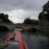
A6 Road Bridge (Bedford)
is a place on the waterways
on the River Great Ouse (Canalized Section) between
  Bedford (¾ furlongs
   to the east) and
  Kempston Mill (Head of Navigation for most boats) (2 miles and 4 furlongs
   to the southwest).
  The nearest place in the direction of Kempston Mill is Riverside Bedford Footbridge;
  ¾ furlongs
   away.
Mooring here is impossible (it may be physically impossible, forbidden, or allowed only for specific short-term purposes).
There is a bridge here.
| Duck Mill Lock Weir Exit No 1 | 2½ furlongs | |
| Duck Mill Lock | 2¼ furlongs | |
| Duck Mill Lock Weir Entrance No 2 | 2¼ furlongs | |
| Duck Mill Lock Weir Entrance No 1 | 1¼ furlongs | |
| Bedford | ¾ furlongs | |
| A6 Road Bridge (Bedford) | ||
| Riverside Bedford Footbridge | ¾ furlongs | |
| Bedford Town Mooring No 2  | 1¼ furlongs | |
| Sovereigns Quay EA Mooring  | 1¾ furlongs | |
| Prebend Street Bridge | 2¼ furlongs | |
| Prebend Street Railway Bridge | 2¾ furlongs | |
Amenities here
Amenities nearby at Bedford
Amenities nearby at Riverside Bedford Footbridge
Amenities in Bedford
Amenities at other places in Bedford
- Great Ouse Navigation | boating, moorings, navigation notices — associated with River Great Ouse
 - Information regarding the Great Ouse navigation and tributaries.
 - Information for boaters on the River Great Ouse - GOV.UK — associated with River Great Ouse
 - River Great Ouse: bridge heights, locks, overhead power lines and facilities.
 - Facebook Account — associated with River Great Ouse
 - Anglian Waterways Manager Facebook Account
 - Facebook Anglian Waterways Page — associated with River Great Ouse
 - Facebook Page for Environment Agency Anglian Waterways
 
Mouseover for more information or show routes to facility
Nearest water point
In the direction of Brownshill Staunch (Lock)
St Neots Priory Centre Mooring — 15 miles, ½ furlongs  and 7 locks away
On this waterway in the direction of Brownshill Staunch (Lock)Nearest rubbish disposal
In the direction of Brownshill Staunch (Lock)
St Neots Priory Centre Mooring — 15 miles, ½ furlongs  and 7 locks away
On this waterway in the direction of Brownshill Staunch (Lock)Nearest place to turn
In the direction of Brownshill Staunch (Lock)
Duck Mill Lock Weir Entrance No 2 — 2¼ furlongs  away
On this waterway in the direction of Brownshill Staunch (Lock)
Duck Mill Lock Weir Exit No 1 — 2½ furlongs  and 1 lock away
On this waterway in the direction of Brownshill Staunch (Lock)
Priory Marina — 1 mile, 1¼ furlongs  and 1 lock away
On this waterway in the direction of Brownshill Staunch (Lock)
Cardington Lock Weir Exit No 2 — 2 miles, 5 furlongs  and 2 locks away
On this waterway in the direction of Brownshill Staunch (Lock)
Site of Old Mills Lock — 6 miles, 5 furlongs  and 4 locks away
On this waterway in the direction of Brownshill Staunch (Lock)
Great Barford Lock Weir Exit — 7 miles, 3 furlongs  and 5 locks away
On this waterway in the direction of Brownshill Staunch (Lock)
Roxton Lock Weir Exit — 9 miles, 5¼ furlongs  and 6 locks away
On this waterway in the direction of Brownshill Staunch (Lock)
Eynesbury Manor Marina — 13 miles, 4¼ furlongs  and 6 locks away
On this waterway in the direction of Brownshill Staunch (Lock)
River Mill Marina — 13 miles, 7 furlongs  and 6 locks away
On this waterway in the direction of Brownshill Staunch (Lock)
St Neots Marina — 14 miles, 7½ furlongs  and 7 locks away
On this waterway in the direction of Brownshill Staunch (Lock)
St Neots Lock Weir Entrance — 15 miles, 7½ furlongs  and 7 locks away
On this waterway in the direction of Brownshill Staunch (Lock)
Mill Lane Bridge Winding Hole — 16 miles, 2¼ furlongs  and 8 locks away
On this waterway in the direction of Brownshill Staunch (Lock)
St Neots Lock Weir Exit — 16 miles, 6 furlongs  and 8 locks away
On this waterway in the direction of Brownshill Staunch (Lock)No information
CanalPlan has no information on any of the following facilities within range:chemical toilet disposal
self-operated pump-out
boatyard pump-out
Direction of TV transmitter (From Wolfbane Cybernetic)
 
There is no page on Wikipedia called “A6 Road Bridge”
Wikipedia pages that might relate to A6 Road Bridge
[A6 road (England)]
The A6 is one of the main historic north–south roads in England. It runs from Luton in Bedfordshire to Carlisle in Cumbria, although it formerly started
[List of bridges in Albania]
Shushica Bridge (520 m) - it crosses the Devoll river as a segment of the Banjë-Gramsh road. The tallest bridge in the country is the Fshat Bridge (157 m)
[Forth Road Bridge]
Forth Road Bridge is a suspension bridge in east central Scotland. The bridge opened in 1964 and at the time was the longest suspension bridge in the
[Danyang–Kunshan Grand Bridge]
dazzling new bridges, including the longest and highest, but many have fostered debt and corruption". The New York Times. Hunan. p. A6. Archived from
[A roads in Zone 6 of the Great Britain numbering scheme]
A roads in zone 6 in Great Britain starting east of the A6 and A7 roads, and west of the A1 (road beginning with 6). "A613 (Gateshead)". sabre-roads.org
[List of road–rail bridges]
Road–rail bridges are bridges shared by road and rail lines. Road and rail may be segregated so that trains may operate at the same time as cars (e.g
[Suez Canal Bridge]
Mubarak Peace Bridge, also known as the Egyptian-Japanese Friendship Bridge, Al Salam Bridge, or Al Salam Peace Bridge, is a road bridge crossing the Suez
[Digha–Sonpur Bridge]
The Digha–Sonpur bridge (Hindi: दीघा-सोनपुर पुल) or J.P. Setu (Hindi: जेपी सेतु) is a rail-cum-road bridge across river Ganga, connecting Digha Ghat in
[Pamban Bridge]
constructed parallel to the rail bridge. This road bridge is also known as Indira Gandhi Road Bridge. The Pamban Road Bridge connects the National Highway (NH 49)
[A6 road (Zimbabwe)]
7164; 29.8627 Info coordinates of A6 road (Zimbabwe), Zimbabwe. Latitude: -21.7164 Longitude: 29.8627 Latitude.to|A6 Road (Zimbabwe), Zimbabwe|Retrieved
Results of Google Search
Bedford road bridge to be rebuilt for railway electrification - BBC NewsMay 29, 2019 ... Bromham Road bridge in Bedford will be shut from 24 June until Spring 2020, ...  Diversions will be in place via the A6 and Clapham Road.
Jun 21, 2019 ... A diversion via the A6 and Clapham Road will be clearly signposted. ... Bromham  Road Bridge is a busy route in and out of Bedford and road ...
May 29, 2019 ... Diversions will be in place via the A6 and Clapham Road. A temporary bridge for  pedestrians and cyclists has already been erected next to the ...
Oct 7, 2019 ... Network's Rail closure of Bromham Road Bridge for their ... the A6 coming into  Bedford and in Queens Park during the morning rush hour, and ...
The A6 is one of the main historic north–south roads in England. It runs from  Luton in Bedfordshire to Carlisle in Cumbria, although it formerly ... From here the  road bridges the River Nene and the Nene Way before bypassing  Irthlingborough.
To Town Centre. MANTON LANE. CLAPHAM ROAD. CLAPHAM ROAD. A6  PAULA RADCLIFFE WAY. CLAPHAM ROAD. Bedford Modern. School.  Sainsbury's.
Jun 8, 2020 ... From Thursday 18 June, Oakley Road Bridge will be closed 24/7 and the ... Street  junction and Bedford will be closed overnight for up to seven weeks to ... The A6  southbound will also need to be closed overnight from 6pm to ...
May 29, 2019 ... Network Rail have just announced that Bromham Road bridge will ... Traffic will  be diverted via the A6 and Clapham Road, which Network Rail ... The work is part  of the electrification of the Midland Main Line between Bedford, ...
Jun 8, 2020 ... From 18 June 2020, Oakley Road Bridge closed 24/7 and A6 southbound  between Clapham High Street junction and Bedford will be closed ...

![Bedford Bridge from the Swan Hotel. A view over the bridge and River Great Ouse from a 2nd floor window on the front of the Swan Hotel. Retrospective view: [[[6299759]]]. by Richard Dorrell – 05 October 2019](https://s0.geograph.org.uk/geophotos/06/29/97/6299772_30b823ec_120x120.jpg)


![River Great Ouse and Swan Hotel, Bedford. The hotel was built as a home in 1794 for the 5th Duke of Bedford [ see http://en.wikipedia.org/wiki/Francis_Russell%2C_5th_Duke_of_Bedford ]. by John N Dix – October 2004](https://s0.geograph.org.uk/photos/30/43/304392_185442e9_120x120.jpg)


![Across the river. Looking south over the River Great Ouse at Bedford Bridge to the hotel currently trading under the Mercure brand.I took this image from an 8th floor bedroom in 2003, when the hotel was the Park Inn: [[[629934]]]. by Richard Dorrell – 05 October 2019](https://s1.geograph.org.uk/geophotos/06/29/97/6299769_31e115e2_120x120.jpg)