CanalPlanAC

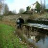
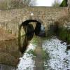
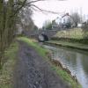
Ward Lane Bridge No 66

 
Ward Lane, Saddleworth OL3 5JU, United Kingdom
 
Information about the place
Ward Lane Bridge No 66 is a minor waterways place on the Huddersfield Narrow Canal between Royal George Aqueduct (4 miles and ½ furlongs and 13 locks to the southwest) and Diggle (4½ furlongs and 2 locks to the northeast).
 
 
The nearest place in the direction of Royal George Aqueduct is Diggle Subway Aqueduct; 2 furlongs away.
 
The nearest place in the direction of Diggle is Geoffrey Dickens Lock No 31W; ½ furlongs away.

There may be access to the towpath here.

Mooring here is unrated.

There is a bridge here which takes a minor road over the canal.


Amenities

Amenities here

 Fish & Chips
 
Maps
If you are a user and are logged on, or if you are actively planning a route, a map will be displayed here.
Show on external mapping site: Google | OSM | Bing
 
Photos
 
External websites
There are no links to external websites from here.
Why not log in and add some (select "External websites" from the menu (sometimes this is under "Edit"))?
 
Nearest facilities

Mouseover for more information or show routes to facility

Nearest water point

In the direction of Ashton-under-Lyne Junction

Wool Road Bridge No 701 mile, 2½ furlongs and 7 locks away
On this waterway in the direction of Ashton-under-Lyne Junction
Grove Road Bridge No 967 miles, 2½ furlongs and 22 locks away
On this waterway in the direction of Ashton-under-Lyne Junction
Fairfield Junction14 miles, 6¾ furlongs and 30 locks away
Travel to Ashton-under-Lyne Junction, then on the Ashton Canal (Main Line) to Fairfield Junction
New Islington Marina19 miles, 1¼ furlongs and 50 locks away
Travel to Ashton-under-Lyne Junction, then on the Ashton Canal (Main Line) to Ducie Street Junction, then on the Rochdale Canal to New Islington Marina Entrance, then on the Rochdale Canal (Main Line) to Cotton Field Wharf Marina, then on the Rochdale Canal (New Islington Marina Arm) to New Islington Marina
Staffordshire, Kenworthy and other Arms19 miles, 7 furlongs and 57 locks away
Travel to Ashton-under-Lyne Junction, then on the Ashton Canal (Main Line) to Ducie Street Junction, then on the Rochdale Canal to Castlefield Junction, then on the Bridgewater Canal (Main Line) to Staffordshire, Kenworthy and other Arms
Potato Wharf Arm & The New Basin19 miles, 7¾ furlongs and 57 locks away
Travel to Ashton-under-Lyne Junction, then on the Ashton Canal (Main Line) to Ducie Street Junction, then on the Rochdale Canal to Castlefield Junction, then on the Bridgewater Canal (Main Line) to Potato Wharf Arm & The New Basin

In the direction of Aspley Basin (Huddersfield)

Standedge Tunnel (western entrance)5¼ furlongs and 2 locks away
On this waterway in the direction of Aspley Basin (Huddersfield)
Standedge Tunnel (eastern entrance)3 miles, 7¼ furlongs and 2 locks away
On this waterway in the direction of Aspley Basin (Huddersfield)
Slaithwaite Winding Hole7 miles, 2¼ furlongs and 23 locks away
On this waterway in the direction of Aspley Basin (Huddersfield)
Waterside Lock No 21E7 miles, 2¾ furlongs and 23 locks away
On this waterway in the direction of Aspley Basin (Huddersfield)
Aspley Basin (Huddersfield)12 miles, ½ furlongs and 44 locks away
On this waterway in the direction of Aspley Basin (Huddersfield)
Shepley Bridge Sanitary Station18 miles, 5 furlongs and 55 locks away
Travel to Aspley Basin (Huddersfield), then on the Huddersfield Broad Canal to Cooper Bridge Junction, then on the Calder and Hebble Navigation (Main Line) to Shepley Bridge Sanitary Station
Brighouse Basin17 miles, 6¾ furlongs and 57 locks away
Travel to Aspley Basin (Huddersfield), then on the Huddersfield Broad Canal to Cooper Bridge Junction, then on the Calder and Hebble Navigation (Main Line) to Brighouse Basin

Nearest rubbish disposal

In the direction of Ashton-under-Lyne Junction

Wool Road Visitor Mooring1 mile, 2¾ furlongs and 7 locks away
On this waterway in the direction of Ashton-under-Lyne Junction
Marple Bottom Lock Bridge Winding Hole19 miles, 3 furlongs and 30 locks away
Travel to Ashton-under-Lyne Junction, then on the Ashton Canal (Main Line) to Dukinfield Junction, then on the Peak Forest Canal (Lower) to Marple Bottom Lock Bridge Winding Hole

In the direction of Aspley Basin (Huddersfield)

Pickle Lock No 22E7 miles, 1¾ furlongs and 22 locks away
On this waterway in the direction of Aspley Basin (Huddersfield)
Aspley Basin (Huddersfield)12 miles, ½ furlongs and 44 locks away
On this waterway in the direction of Aspley Basin (Huddersfield)
Shepley Bridge Sanitary Station18 miles, 5 furlongs and 55 locks away
Travel to Aspley Basin (Huddersfield), then on the Huddersfield Broad Canal to Cooper Bridge Junction, then on the Calder and Hebble Navigation (Main Line) to Shepley Bridge Sanitary Station
Brighouse Lower Basin Visitor Moorings17 miles, 6½ furlongs and 56 locks away
Travel to Aspley Basin (Huddersfield), then on the Huddersfield Broad Canal to Cooper Bridge Junction, then on the Calder and Hebble Navigation (Main Line) to Brighouse Lower Basin Visitor Moorings

Nearest chemical toilet disposal

In the direction of Ashton-under-Lyne Junction

Wool Road Bridge No 701 mile, 2½ furlongs and 7 locks away
On this waterway in the direction of Ashton-under-Lyne Junction
Grove Road Bridge No 967 miles, 2½ furlongs and 22 locks away
On this waterway in the direction of Ashton-under-Lyne Junction
Fairfield Junction14 miles, 6¾ furlongs and 30 locks away
Travel to Ashton-under-Lyne Junction, then on the Ashton Canal (Main Line) to Fairfield Junction

In the direction of Aspley Basin (Huddersfield)

Pickle Lock No 22E7 miles, 1¾ furlongs and 22 locks away
On this waterway in the direction of Aspley Basin (Huddersfield)
Waterside Lock No 21E7 miles, 2¾ furlongs and 23 locks away
On this waterway in the direction of Aspley Basin (Huddersfield)
Aspley Basin (Huddersfield)12 miles, ½ furlongs and 44 locks away
On this waterway in the direction of Aspley Basin (Huddersfield)
Shepley Bridge Sanitary Station18 miles, 5 furlongs and 55 locks away
Travel to Aspley Basin (Huddersfield), then on the Huddersfield Broad Canal to Cooper Bridge Junction, then on the Calder and Hebble Navigation (Main Line) to Shepley Bridge Sanitary Station
Brighouse Basin17 miles, 6¾ furlongs and 57 locks away
Travel to Aspley Basin (Huddersfield), then on the Huddersfield Broad Canal to Cooper Bridge Junction, then on the Calder and Hebble Navigation (Main Line) to Brighouse Basin

Nearest place to turn

In the direction of Ashton-under-Lyne Junction

Wool Road Winding Hole1 mile, 3¼ furlongs and 7 locks away
On this waterway in the direction of Ashton-under-Lyne Junction
Saddleworth Visitor Centre Winding Hole2 miles, 1¼ furlongs and 9 locks away
On this waterway in the direction of Ashton-under-Lyne Junction
Manns Wharf Bridge Winding Hole3 miles, 4 furlongs and 11 locks away
On this waterway in the direction of Ashton-under-Lyne Junction
Roughtown Court Winding Hole4 miles, 5½ furlongs and 16 locks away
On this waterway in the direction of Ashton-under-Lyne Junction
Mossley Bottoms Winding Hole5 miles, 5 furlongs and 18 locks away
On this waterway in the direction of Ashton-under-Lyne Junction
Knowle Street Winding Hole9 miles, 5¼ furlongs and 23 locks away
On this waterway in the direction of Ashton-under-Lyne Junction
Staley Wharf Winding Hole10 miles, 7 furlongs and 27 locks away
On this waterway in the direction of Ashton-under-Lyne Junction
Ashton-under-Lyne Junction11 miles, 6¾ furlongs and 30 locks away
On this waterway in the direction of Ashton-under-Lyne Junction
Dukinfield Junction12 miles, 2¾ furlongs and 30 locks away
Travel to Ashton-under-Lyne Junction, then on the Ashton Canal (Main Line) to Dukinfield Junction
Portland Basin Arm12 miles, 3¼ furlongs and 30 locks away
Travel to Ashton-under-Lyne Junction, then on the Ashton Canal (Main Line) to Dukinfield Junction, then on the Peak Forest Canal (Lower) to Portland Basin Arm
Dunkirk Farm Bridge Winding Hole14 miles and 30 locks away
Travel to Ashton-under-Lyne Junction, then on the Ashton Canal (Main Line) to Dukinfield Junction, then on the Peak Forest Canal (Lower) to Dunkirk Farm Bridge Winding Hole
Lumb Lane Bridge Winding Hole14 miles, ¼ furlongs and 30 locks away
Travel to Ashton-under-Lyne Junction, then on the Ashton Canal (Main Line) to Lumb Lane Bridge Winding Hole
Canal Street Winding Hole14 miles, 5 furlongs and 30 locks away
Travel to Ashton-under-Lyne Junction, then on the Ashton Canal (Main Line) to Dukinfield Junction, then on the Peak Forest Canal (Lower) to Canal Street Winding Hole
Fairfield Junction14 miles, 6¾ furlongs and 30 locks away
Travel to Ashton-under-Lyne Junction, then on the Ashton Canal (Main Line) to Fairfield Junction

In the direction of Aspley Basin (Huddersfield)

Diggle Winding Hole2¾ furlongs and 2 locks away
On this waterway in the direction of Aspley Basin (Huddersfield)
Standedge Tunnel End Winding Hole4 miles and 2 locks away
On this waterway in the direction of Aspley Basin (Huddersfield)
Booth Lock Winding Hole5 miles, 5¼ furlongs and 13 locks away
On this waterway in the direction of Aspley Basin (Huddersfield)
Slaithwaite Winding Hole7 miles, 2¼ furlongs and 23 locks away
On this waterway in the direction of Aspley Basin (Huddersfield)
Linthwaite Winding Hole8 miles, 2¾ furlongs and 28 locks away
On this waterway in the direction of Aspley Basin (Huddersfield)
Isis Lock Winding Hole9 miles, 7 furlongs and 36 locks away
On this waterway in the direction of Aspley Basin (Huddersfield)

Nearest self-operated pump-out

In the direction of Ashton-under-Lyne Junction

Wool Road Bridge No 701 mile, 2½ furlongs and 7 locks away
On this waterway in the direction of Ashton-under-Lyne Junction
New Islington Marina19 miles, 1¼ furlongs and 50 locks away
Travel to Ashton-under-Lyne Junction, then on the Ashton Canal (Main Line) to Ducie Street Junction, then on the Rochdale Canal to New Islington Marina Entrance, then on the Rochdale Canal (Main Line) to Cotton Field Wharf Marina, then on the Rochdale Canal (New Islington Marina Arm) to New Islington Marina

In the direction of Aspley Basin (Huddersfield)

Slaithwaite Winding Hole7 miles, 2¼ furlongs and 23 locks away
On this waterway in the direction of Aspley Basin (Huddersfield)

Nearest boatyard pump-out

In the direction of Ashton-under-Lyne Junction

Portland Basin Arm12 miles, 3¼ furlongs and 30 locks away
Travel to Ashton-under-Lyne Junction, then on the Ashton Canal (Main Line) to Dukinfield Junction, then on the Peak Forest Canal (Lower) to Portland Basin Arm

In the direction of Aspley Basin (Huddersfield)

Aspley Basin (Huddersfield)12 miles, ½ furlongs and 44 locks away
On this waterway in the direction of Aspley Basin (Huddersfield)
Shepley Bridge Marina18 miles, 5¼ furlongs and 55 locks away
Travel to Aspley Basin (Huddersfield), then on the Huddersfield Broad Canal to Cooper Bridge Junction, then on the Calder and Hebble Navigation (Main Line) to Shepley Bridge Marina
Direction of TV transmitter (From Wolfbane Cybernetic)
 
 
Geograph
 
Wikipedia

There is no page on Wikipedia called “Ward Lane Bridge”

Wikipedia pages that might relate to Ward Lane Bridge
[Bridge (ward)] Bridge is a small ward in the City of London and is named from its closeness to London Bridge. Since boundary changes in 2003, Bridge is bounded by the [Billingsgate] London Bridge and Tower Bridge in the south-east of the Square Mile. The modern Ward extends south to the Thames, west to Lovat Lane and Rood Lane, north [Lions Gate Bridge] the bridge, but the low flat delta land to the north required construction of the extensive North Viaduct. The bridge has three reversible lanes, the [Kigamboni Bridge] Kigamboni Bridge is a 680-meter-long bridge in Tanzania that connects the Dar es Salaam ward of Kurasini from the east to the west of Kigamboni district [Triborough Bridge] River span, a suspension bridge across the Hell Gate of the East River, connects Queens with Wards Island. It carries eight lanes of Interstate 278, four [Eleanor Ward Bridge] The Eleanor Ward Bridge is a four-lane road bridge in Coquitlam, British Columbia. It spans the Coquitlam River, connecting the Coquitlam Town Centre area [Candlewick] traffic from London Bridge to its western edge along Laurence Pountney Lane, Sherbourne Lane and Abchurch Lane in Walbrook ward. There are two churches [Sowerby Bridge] Sowerby Bridge (/ˌsɔːrbi/) is a market town in the Upper Calder Valley in Calderdale in West Yorkshire, England. The Calderdale Council ward population [Apperley Bridge] Apperley Bridge is a village in the metropolitan borough of the City of Bradford, in West Yorkshire, England in the Idle and Thackley Ward. Apperley Bridge is [Diane Lane] Diane Colleen Lane (born January 22, 1965) is an American actress and producer. Born and raised in New York City, Lane made her screen debut in George
 
Google

Results of Google Search

Dobcross Mill, Diggle, Bridge 66, Ward Lane Bridge to Bridge 69 ...
Mar 11, 2020 ... Dobcross Mill, Diggle, Bridge 66, Ward Lane Bridge to Bridge 69, Alice Footbridge ... Reason: 3rd Party Works. Is the towpath closed? No ...
SADDLEWORTH CIRCUIT
The main route continues along High Stile Lane heading ... down Ward Lane down to the canal, walk over bridge no. 66 and turn left to retrace your steps.
High Occupancy Vehicle (HOV) Lanes - Rules and FAQs - Travel ...
Feb 18, 2020 ... No. For a hybrid vehicle to use Virginia's HOV lanes, you must have Virginia ... Note that the I-66 express lanes inside the Beltway require all ...
Route 66: Radiance, Rust & Revival on the Mother Road — City of ...
Conceived in honor of the 90th anniversary of Route 66, this exhibition celebrates the ... Her very existence today demonstrates that her legacy is not just in the past, but that she ... Ward Alan and Shirley Jolly Minge Collection ... and bridges between Fort Smith and Albuquerque, and road construction west of Albuquerque.
Interstate 66 - Wikipedia
Interstate 66 (I-66) is an Interstate Highway in the eastern United States. As indicated by its even route number, it runs in an east–west direction. ... Virginia Route 267 (Dulles Toll Road) meets the parkway with a eastbound entrance and ... I-66 was originally to connect to the Three Sisters Bridge, but as that bridge was ...
Mount Ward - Alberta, Canada | AllTrails
Results 1 - 10 of 35 ... Mount Ward is a 6.7 mile moderately trafficked out and back trail located ... 66, Alberta, Canada that features a lake and is rated as difficult. ... The first part of the trail is on a rocky dirt road used by ATVs. ... The map is not accurate when you go past the lake and try to follow the trail ... Seven Bridges Trail. 1
RTD Stations and Park-n-Rides
Address: 26800 E 84th Ave; City: Denver; Parking: No RTD parking; Bike Racks: No ... This station has a pedestrian bridge that provides access across I-225 to the Aurora ... Address: 6900 S Race St; City: Centennial; Parking: No RTD parking; Bike Racks: No; Bike Lockers: No; Bus Routes: 66 ... Ward Road Park-n- Ride.
Route 66 Isleta Pueblo A History of Highways and Travel at Isleta
relocating the existing bridge—no feasible alternative was ... ethnographic study of the Native American Route 66 experience in ... the adventure of the open road and all there was to experience along it. ... Ward Hicks Advertising Collection.
Directions - Rock Creek Park (U.S. National Park Service)
Dec 13, 2020 ... Directions to the Nature Center and Planetarium: Via Route 66: Take Route 66 across the Theodore Roosevelt Bridge. |; Get in the right lane on ...