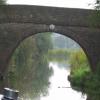
Green Lane Bridge No 57
Eight Acre Covert, Green Lane, North West Leicestershire DE12 7DE, United Kingdom
Address is taken from a point 250 yards away.

Green Lane Bridge No 57
is a minor waterways place
on the Ashby Canal (Main Line) between
Snarestone Tunnel (southern entrance) (Snarestone village is over the top of the tunnel.) (6½ furlongs
to the northwest) and
Turn Bridge No 52 (Shackerstone) (1 mile and 7 furlongs
to the east).
The nearest place in the direction of Snarestone Tunnel (southern entrance) is Gopsall Wharf;
1 furlong
away.
The nearest place in the direction of Turn Bridge No 52 (Shackerstone) is Timms Bridge No 56;
3¼ furlongs
away.
There is access (suitable for wheels) to the towpath here.
Mooring here is unrated.
There is a bridge here which takes a track over the canal.
Globe Inn | 6½ furlongs | |
Site of Midland Railway Bridge | 4¼ furlongs | |
Pare's Bridge No 59 | 3¾ furlongs | |
Gopsall Wharf Bridge No 58 | 1 furlong | |
Gopsall Wharf | 1 furlong | |
Green Lane Bridge No 57 | ||
Timms Bridge No 56 | 3¼ furlongs | |
Hills Bridge No 54 | 1 mile, ½ furlongs | |
Shackerstone Winding Hole | 1 mile, 5 furlongs | |
Town Bridge No 53 | 1 mile, 5 furlongs | |
Turn Bridge No 52 (Shackerstone) | 1 mile, 7 furlongs |
Mouseover for more information or show routes to facility
Nearest water point
In the direction of Marston Junction
Bosworth Marina & Wharf Winding Hole — 5 miles, 1¾ furlongs away
On this waterway in the direction of Marston Junction
Bosworth Wharf Bridge No 42 — 5 miles, 2¼ furlongs away
On this waterway in the direction of Marston Junction
Sutton Cheney Wharf — 8 miles, 7 furlongs away
On this waterway in the direction of Marston Junction
Trinity Marina — 14 miles, ¾ furlongs away
On this waterway in the direction of Marston Junction
Limekiln Bridge No 15 — 15 miles, 1 furlong away
On this waterway in the direction of Marston Junction
In the direction of Ashby Canal Current Head of Navigation
Snarestone Services — 1 mile, 1½ furlongs away
On this waterway in the direction of Ashby Canal Current Head of NavigationNearest rubbish disposal
In the direction of Marston Junction
Bosworth Marina & Wharf Winding Hole — 5 miles, 1¾ furlongs away
On this waterway in the direction of Marston Junction
Stoke Golding Wharf — 11 miles, 3 furlongs away
On this waterway in the direction of Marston Junction
Trinity Marina — 14 miles, ¾ furlongs away
On this waterway in the direction of Marston Junction
In the direction of Ashby Canal Current Head of Navigation
Snarestone Services — 1 mile, 1½ furlongs away
On this waterway in the direction of Ashby Canal Current Head of NavigationNearest chemical toilet disposal
In the direction of Marston Junction
Bosworth Marina & Wharf Winding Hole — 5 miles, 1¾ furlongs away
On this waterway in the direction of Marston Junction
Sutton Cheney Wharf — 8 miles, 7 furlongs away
On this waterway in the direction of Marston Junction
Trinity Marina — 14 miles, ¾ furlongs away
On this waterway in the direction of Marston Junction
In the direction of Ashby Canal Current Head of Navigation
Snarestone Services — 1 mile, 1½ furlongs away
On this waterway in the direction of Ashby Canal Current Head of NavigationNearest place to turn
In the direction of Marston Junction
Shackerstone Winding Hole — 1 mile, 5 furlongs away
On this waterway in the direction of Marston Junction
Carlton Bridge Winding Hole — 4 miles, 2¼ furlongs away
On this waterway in the direction of Marston Junction
Bosworth Marina & Wharf Winding Hole — 5 miles, 1¾ furlongs away
On this waterway in the direction of Marston Junction
Jackson's Bridge Winding Hole — 5 miles, 4½ furlongs away
On this waterway in the direction of Marston Junction
Shenton Bend — 7 miles, 3½ furlongs away
On this waterway in the direction of Marston Junction
Sutton Cheney Wharf — 8 miles, 7 furlongs away
On this waterway in the direction of Marston Junction
Basin Bridge Winding Hole — 12 miles, ½ furlongs away
On this waterway in the direction of Marston Junction
Trinity Marina — 14 miles, ¾ furlongs away
On this waterway in the direction of Marston Junction
Hinckley Wharf Arm Junction — 14 miles, 4¾ furlongs away
On this waterway in the direction of Marston Junction
In the direction of Ashby Canal Current Head of Navigation
Turnover Bridge Winding Hole — 1 mile, 1¼ furlongs away
On this waterway in the direction of Ashby Canal Current Head of Navigation
Faulkes Circular Winding Hole — 1 mile, 3 furlongs away
On this waterway in the direction of Ashby Canal Current Head of Navigation
Measham Wharf Branch Junction — 3 miles, 1 furlong away
Travel to Ashby Canal Current Head of Navigation, then on the Ashby Canal (unrestored) to Measham Wharf Branch Junction
Site of Proposed Measham Wharf — 3 miles, 4 furlongs away
Travel to Ashby Canal Current Head of Navigation, then on the Ashby Canal (unrestored) to Measham Wharf Branch Junction, then on the Ashby Canal (Measham Wharf Branch, unrestored) to Site of Proposed Measham Wharf
Bath Yard Basin — 6 miles, 7¼ furlongs and 1 lock away
Travel to Ashby Canal Current Head of Navigation, then on the Ashby Canal (unrestored) to Brooks Close Terminus, then on the Ashby Canal (restored but unconnected) to Bath Yard BasinNearest self-operated pump-out
In the direction of Marston Junction
Bosworth Marina & Wharf Winding Hole — 5 miles, 1¾ furlongs away
On this waterway in the direction of Marston Junction
Trinity Marina — 14 miles, ¾ furlongs away
On this waterway in the direction of Marston JunctionNearest boatyard pump-out
In the direction of Marston Junction
Trinity Marina — 14 miles, ¾ furlongs away
On this waterway in the direction of Marston JunctionDirection of TV transmitter (From Wolfbane Cybernetic)
Wikipedia has a page about Green Lane Bridge
The Green Lane Bridge is a concrete arch bridge over the Schuylkill River and carries Green Lane in Philadelphia. The bridge connects Belmont Hills with Manayunk.
Other Wikipedia pages that might relate to Green Lane Bridge
[Chesapeake Bay Bridge]
was added in 1973. The bridge is officially named the Gov. William Preston Lane Jr. Memorial Bridge after William Preston Lane Jr. who, as the 52nd Governor
[Green Lanes (London)]
the eastern edge of Finsbury Park. As it crosses the New River over Green Lanes Bridge, it enters the London Borough of Haringey, it then runs 1.4 miles
[Green lane (road)]
A green lane is a type of road, usually an unmetalled rural route. In particular, a green lane is unmetalled, and may be so infrequently used that there
[Brick Lane]
to mark the entrance to Brick Lane and to ‘Banglatown’. Like Brick Lane’s lamp posts, the arch displays the red and green colours of the Bangladesh flag
[Heywood Branch Canal]
disused in 1937 and demolished in 1956. Between Canal Street Bridge and Green Lane Bridge were Bridge Mill, a cotton mill from 1893 until 1929, and Park Street
[Jacques Cartier Bridge]
Jacques Cartier's first voyage up the St. Lawrence River. The five-lane highway bridge is 3,425.6 m (11,239 ft) in length, including the approach viaducts
[Sydney Harbour Bridge]
bridge is located at Dawes Point in The Rocks area, and the northern end at Milsons Point in the lower North Shore area. There are six original lanes
[Lovers' lane]
Thurso, Scotland. Lovers Lane station is a DART Light Rail station in Dallas, Texas. Lover's Lane Bridge is a historic bridge spanning the Dog River in
[Listed buildings in Edleston]
Heritage List for England, retrieved 9 January 2014 Historic England, "Green Lane Bridge No.90 (1138540)", National Heritage List for England, retrieved 9