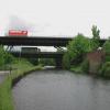
Tinsley Motorway Bridge
is a minor waterways place
on the Sheffield and South Yorkshire Navigation (Sheffield Canal) between
Rawmarsh Road Bridge No 39 (3 miles and 4 furlongs
and 7 locks
to the northeast) and
Sheffield Terminal Warehouse (3 miles and 4¼ furlongs
and 8 locks
to the southwest).
The nearest place in the direction of Rawmarsh Road Bridge No 39 is Tinsley Sheffield Road Pipe Bridge;
½ furlongs
away.
The nearest place in the direction of Sheffield Terminal Warehouse is Sheffield Road Bridge;
1 furlong
away.
Mooring here is unrated.
There is a bridge here which takes a motorway over the canal.
Tinsley Bottom Lock No 12 | 2½ furlongs | |
Tinsley Lock No 11 | 2 furlongs | |
Tinsley Forge Bridge No 1 | 1¼ furlongs | |
Tinsley Top Lock No 10 | 1 furlong | |
Tinsley Sheffield Road Pipe Bridge | ½ furlongs | |
Tinsley Motorway Bridge | ||
Sheffield Road Bridge | 1 furlong | |
Tinsley Lock No 9 | 1 furlong | |
Tinsley Pipe Bridges | 2¼ furlongs | |
Shepcote Lane Railway Bridge | 3¾ furlongs | |
Tinsley Bottom Lock No 7 | 3¾ furlongs |
- S&SY navigation info — associated with Sheffield and South Yorkshire Navigation
- Sheffield & South Yorkshire navigation info from IWA
Mouseover for more information or show routes to facility
Nearest water point
In the direction of Rawmarsh Road Bridge No 39
Eastwood Lock No 5 — 4 miles, ¾ furlongs and 7 locks away
Travel to Rawmarsh Road Bridge No 39, then on the Sheffield and South Yorkshire Navigation (Main Line) to Eastwood Lock No 5
Kilnhurst Flood Lock No 7 — 6 miles, 6½ furlongs and 9 locks away
Travel to Rawmarsh Road Bridge No 39, then on the Sheffield and South Yorkshire Navigation (Main Line) to Kilnhurst Flood Lock No 7
Swinton Lock Activity Centre and CRT Sanitary Station — 8 miles, 4 furlongs and 11 locks away
Travel to Rawmarsh Road Bridge No 39, then on the Sheffield and South Yorkshire Navigation (Main Line) to Swinton Lock Activity Centre and CRT Sanitary Station
Mexborough Low Lock No 10 — 11 miles, ¾ furlongs and 12 locks away
Travel to Rawmarsh Road Bridge No 39, then on the Sheffield and South Yorkshire Navigation (Main Line) to Mexborough Low Lock No 10
Sprotbrough Lock No 11 — 14 miles, 4¼ furlongs and 13 locks away
Travel to Rawmarsh Road Bridge No 39, then on the Sheffield and South Yorkshire Navigation (Main Line) to Sprotbrough Lock No 11
Doncaster Town Lock No 12 — 17 miles, 6¼ furlongs and 14 locks away
Travel to Rawmarsh Road Bridge No 39, then on the Sheffield and South Yorkshire Navigation (Main Line) to Doncaster Town Lock No 12
Doncaster Visitor Pontoon Moorings — 18 miles, ¾ furlongs and 15 locks away
Travel to Rawmarsh Road Bridge No 39, then on the Sheffield and South Yorkshire Navigation (Main Line) to Doncaster Visitor Pontoon Moorings
In the direction of Sheffield Terminal Warehouse
Victoria Quays — 3 miles, 4 furlongs and 8 locks away
On this waterway in the direction of Sheffield Terminal WarehouseNearest rubbish disposal
In the direction of Rawmarsh Road Bridge No 39
Eastwood Lock No 5 — 4 miles, ¾ furlongs and 7 locks away
Travel to Rawmarsh Road Bridge No 39, then on the Sheffield and South Yorkshire Navigation (Main Line) to Eastwood Lock No 5
Doncaster Visitor Pontoon Moorings — 18 miles, ¾ furlongs and 15 locks away
Travel to Rawmarsh Road Bridge No 39, then on the Sheffield and South Yorkshire Navigation (Main Line) to Doncaster Visitor Pontoon Moorings
In the direction of Sheffield Terminal Warehouse
Tinsley CRT facilities — 6½ furlongs and 7 locks away
On this waterway in the direction of Sheffield Terminal Warehouse
Victoria Quays — 3 miles, 4 furlongs and 8 locks away
On this waterway in the direction of Sheffield Terminal WarehouseNearest chemical toilet disposal
In the direction of Rawmarsh Road Bridge No 39
Eastwood Lock No 5 — 4 miles, ¾ furlongs and 7 locks away
Travel to Rawmarsh Road Bridge No 39, then on the Sheffield and South Yorkshire Navigation (Main Line) to Eastwood Lock No 5
Swinton Lock Activity Centre and CRT Sanitary Station — 8 miles, 4 furlongs and 11 locks away
Travel to Rawmarsh Road Bridge No 39, then on the Sheffield and South Yorkshire Navigation (Main Line) to Swinton Lock Activity Centre and CRT Sanitary Station
In the direction of Sheffield Terminal Warehouse
Tinsley CRT facilities — 6½ furlongs and 7 locks away
On this waterway in the direction of Sheffield Terminal Warehouse
Victoria Quays — 3 miles, 4 furlongs and 8 locks away
On this waterway in the direction of Sheffield Terminal WarehouseNearest place to turn
In the direction of Rawmarsh Road Bridge No 39
Tinsley Lower Flight Weir Exit — 2¾ furlongs and 3 locks away
On this waterway in the direction of Rawmarsh Road Bridge No 39
Rotherham Junction — 2 miles, 3 furlongs and 6 locks away
On this waterway in the direction of Rawmarsh Road Bridge No 39
Main Street Junction — 2 miles, 4½ furlongs and 6 locks away
On this waterway in the direction of Rawmarsh Road Bridge No 39
Central Road Winding Hole — 2 miles, 5½ furlongs and 7 locks away
On this waterway in the direction of Rawmarsh Road Bridge No 39
Rawmarsh Road Winding Hole — 3 miles, 3½ furlongs and 7 locks away
On this waterway in the direction of Rawmarsh Road Bridge No 39
Sir Frank Price Lock Arm — 4 miles, ¼ furlongs and 7 locks away
Travel to Rawmarsh Road Bridge No 39, then on the Sheffield and South Yorkshire Navigation (Main Line) to Sir Frank Price Lock Arm
Sir Frank Price Lock Weir Exit — 4 miles, 1½ furlongs and 8 locks away
Travel to Rawmarsh Road Bridge No 39, then on the Sheffield and South Yorkshire Navigation (Main Line) to Sir Frank Price Lock Weir Exit
Kilnhurst Flood Lock Winding Hole — 6 miles, 4¾ furlongs and 9 locks away
Travel to Rawmarsh Road Bridge No 39, then on the Sheffield and South Yorkshire Navigation (Main Line) to Kilnhurst Flood Lock Winding Hole
Swinton Junction — 8 miles, 3¼ furlongs and 10 locks away
Travel to Rawmarsh Road Bridge No 39, then on the Sheffield and South Yorkshire Navigation (Main Line) to Swinton Junction
Swinton Road Corner — 8 miles, 7 furlongs and 11 locks away
Travel to Rawmarsh Road Bridge No 39, then on the Sheffield and South Yorkshire Navigation (Main Line) to Swinton Road Corner
Sprotbrough Lock Weir Exit — 14 miles, 4¾ furlongs and 14 locks away
Travel to Rawmarsh Road Bridge No 39, then on the Sheffield and South Yorkshire Navigation (Main Line) to Sprotbrough Lock Weir Exit
Doncaster Visitor Pontoon Moorings — 18 miles, ¾ furlongs and 15 locks away
Travel to Rawmarsh Road Bridge No 39, then on the Sheffield and South Yorkshire Navigation (Main Line) to Doncaster Visitor Pontoon Moorings
Gas House Bight — 18 miles, 2¼ furlongs and 15 locks away
Travel to Rawmarsh Road Bridge No 39, then on the Sheffield and South Yorkshire Navigation (Main Line) to Gas House Bight
In the direction of Sheffield Terminal Warehouse
Don Valley Stadium Visitor Moorings — 1 mile, 5½ furlongs and 8 locks away
On this waterway in the direction of Sheffield Terminal Warehouse
Shirland Road Bridge Winding Hole — 2 miles and 8 locks away
On this waterway in the direction of Sheffield Terminal Warehouse
Victoria Quays — 3 miles, 4 furlongs and 8 locks away
On this waterway in the direction of Sheffield Terminal Warehouse
Sheffield Terminal Warehouse — 3 miles, 4¼ furlongs and 8 locks away
On this waterway in the direction of Sheffield Terminal WarehouseNo information
CanalPlan has no information on any of the following facilities within range:self-operated pump-out
boatyard pump-out
Direction of TV transmitter (From Wolfbane Cybernetic)
There is no page on Wikipedia called “Tinsley Motorway Bridge”
Wikipedia pages that might relate to Tinsley Motorway Bridge
[Tinsley Viaduct]
Tinsley Viaduct is a two-tier road bridge in Sheffield, England; it was the first of its kind in the United Kingdom. It carries the M1 and the A631 3
[M1 motorway]
United Kingdom floods. Part of the motorway close to Tinsley Viaduct was closed to allow safe demolition of the Tinsley cooling towers in the early hours
[Blackburn Meadows Power Station]
closure of the station. Positioned directly alongside the major motorway bridge, Tinsley viaduct, the towers were an iconic landmark for the area, particularly
[River Don, Yorkshire]
later became part of the Great Central Railway. Tinsley Viaduct carries the M1 London to Leeds motorway and the A631 road over the River Don. This two-tier
[Sheffield & Tinsley Canal]
The Sheffield & Tinsley Canal is a canal in the City of Sheffield, England. It runs 3.9 miles (6.3 km) from Tinsley, where it leaves the River Don, to
[List of multi-level bridges]
High Level Bridge, Newcastle upon Tyne, Gateshead (railway and roadway) Tinsley Viaduct, Sheffield) (M1 motorway and local road) Britannia Bridge Menai Strait
[River Don Navigation]
the site of the Meadowhall Shopping Centre and the Tinsley Viaduct, which carries the M1 motorway over the valley of the River Don. From here there is
[List of bridges in the United Kingdom]
Newport, City Bridge Newport City footbridge Newport, George Street Bridge Newport, Great Western Railway Usk bridge Newport, M4 motorway Usk bridge Newport
[Tinsley Green, West Sussex]
Stream, a tributary of the River Mole, passes under Radford Road at Tinsley Bridge. The road runs east–west from the B2036 road to Crawley's Manor Royal
[Gatwick Stream]
Forest, alongside Tilgate golf course, through Maidenbower, Three Bridges, and Tinsley Green to meet the River Mole on the border between West Sussex and