CanalPlanAC

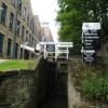
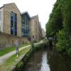
Stanley Dawson Lock No 1E

 
Huddersfield University, Queensgate, Huddersfield HD1 3DH, United Kingdom
 
Information about the place
Stanley Dawson Lock No 1E is a minor waterways place on the Huddersfield Narrow Canal between Golcar (2 miles and 4¼ furlongs and 11 locks to the west) and Aspley Basin (Huddersfield) (Moorings for Huddersfield and Junction of Huddersfield Broad and Narrow Canals) (1¾ furlongs to the northeast).
 
 
The nearest place in the direction of Golcar is University Footbridge No 20B; ½ furlongs away.
 
The nearest place in the direction of Aspley Basin (Huddersfield) is Huddersfield University Footbridge No 20 (Huddersfield University); ½ furlongs away.

There may be access to the towpath here.

Mooring here is unrated.

There is a bridge here which takes pedestrian traffic over the canal.

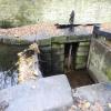
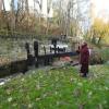
This is a lock, the rise of which is not known.


Amenities

Amenities nearby at Huddersfield University Footbridge No 20

 Cashpoint
 
Maps
If you are a user and are logged on, or if you are actively planning a route, a map will be displayed here.
Show on external mapping site: Google | OSM | Bing
 
Photos
 
External websites
There are no links to external websites from here.
Why not log in and add some (select "External websites" from the menu (sometimes this is under "Edit"))?
 
Nearest facilities

Mouseover for more information or show routes to facility

Nearest water point

In the direction of Ashton-under-Lyne Junction

Waterside Lock No 21E4 miles, 3¾ furlongs and 20 locks away
On this waterway in the direction of Ashton-under-Lyne Junction
Slaithwaite Winding Hole4 miles, 4½ furlongs and 21 locks away
On this waterway in the direction of Ashton-under-Lyne Junction
Standedge Tunnel (eastern entrance)7 miles, 7½ furlongs and 42 locks away
On this waterway in the direction of Ashton-under-Lyne Junction
Standedge Tunnel (western entrance)11 miles, 1¼ furlongs and 42 locks away
On this waterway in the direction of Ashton-under-Lyne Junction
Wool Road Bridge No 7013 miles, 1¼ furlongs and 51 locks away
On this waterway in the direction of Ashton-under-Lyne Junction
Grove Road Bridge No 9619 miles, 1¼ furlongs and 66 locks away
On this waterway in the direction of Ashton-under-Lyne Junction

In the direction of Aspley Basin (Huddersfield)

Aspley Basin (Huddersfield)1¾ furlongs and 1 lock away
On this waterway in the direction of Aspley Basin (Huddersfield)
Shepley Bridge Sanitary Station6 miles, 6¼ furlongs and 12 locks away
Travel to Aspley Basin (Huddersfield), then on the Huddersfield Broad Canal to Cooper Bridge Junction, then on the Calder and Hebble Navigation (Main Line) to Shepley Bridge Sanitary Station
Brighouse Basin6 miles, ¼ furlongs and 14 locks away
Travel to Aspley Basin (Huddersfield), then on the Huddersfield Broad Canal to Cooper Bridge Junction, then on the Calder and Hebble Navigation (Main Line) to Brighouse Basin
Salterhebble Sanitary Station10 miles, 2¼ furlongs and 23 locks away
Travel to Aspley Basin (Huddersfield), then on the Huddersfield Broad Canal to Cooper Bridge Junction, then on the Calder and Hebble Navigation (Main Line) to Salterhebble Sanitary Station
Broad Cut Low Lock No 313 miles, 3¼ furlongs and 20 locks away
Travel to Aspley Basin (Huddersfield), then on the Huddersfield Broad Canal to Cooper Bridge Junction, then on the Calder and Hebble Navigation (Main Line) to Broad Cut Low Lock No 3
Salterhebble Junction10 miles, 2½ furlongs and 24 locks away
Travel to Aspley Basin (Huddersfield), then on the Huddersfield Broad Canal to Cooper Bridge Junction, then on the Calder and Hebble Navigation (Main Line) to Salterhebble Junction
Sowerby Bridge Basin12 miles, 4¼ furlongs and 24 locks away
Travel to Aspley Basin (Huddersfield), then on the Huddersfield Broad Canal to Cooper Bridge Junction, then on the Calder and Hebble Navigation (Main Line) to Salterhebble Junction, then on the Calder and Hebble Navigation (Main Line) to Sowerby Bridge Basin
Ramsdens Bridge Sanitary Station18 miles, 7 furlongs and 24 locks away
Travel to Aspley Basin (Huddersfield), then on the Huddersfield Broad Canal to Cooper Bridge Junction, then on the Calder and Hebble Navigation (Main Line) to Fall Ing Junction, then on the Aire and Calder Navigation (Wakefield Section) to Ramsdens Bridge Sanitary Station
Stanley Ferry Water Point18 miles, 7¾ furlongs and 24 locks away
Travel to Aspley Basin (Huddersfield), then on the Huddersfield Broad Canal to Cooper Bridge Junction, then on the Calder and Hebble Navigation (Main Line) to Fall Ing Junction, then on the Aire and Calder Navigation (Wakefield Section) to Stanley Ferry Water Point
Hebden Bridge Services17 miles, 7¾ furlongs and 31 locks away
Travel to Aspley Basin (Huddersfield), then on the Huddersfield Broad Canal to Cooper Bridge Junction, then on the Calder and Hebble Navigation (Main Line) to Salterhebble Junction, then on the Calder and Hebble Navigation (Main Line) to Sowerby Bridge Junction, then on the Rochdale Canal to Hebden Bridge Services

Nearest rubbish disposal

In the direction of Ashton-under-Lyne Junction

Pickle Lock No 22E4 miles, 5 furlongs and 21 locks away
On this waterway in the direction of Ashton-under-Lyne Junction
Wool Road Visitor Mooring13 miles, 1½ furlongs and 51 locks away
On this waterway in the direction of Ashton-under-Lyne Junction

In the direction of Aspley Basin (Huddersfield)

Aspley Basin (Huddersfield)1¾ furlongs and 1 lock away
On this waterway in the direction of Aspley Basin (Huddersfield)
Shepley Bridge Sanitary Station6 miles, 6¼ furlongs and 12 locks away
Travel to Aspley Basin (Huddersfield), then on the Huddersfield Broad Canal to Cooper Bridge Junction, then on the Calder and Hebble Navigation (Main Line) to Shepley Bridge Sanitary Station
Brighouse Lower Basin Visitor Moorings5 miles, 7¾ furlongs and 13 locks away
Travel to Aspley Basin (Huddersfield), then on the Huddersfield Broad Canal to Cooper Bridge Junction, then on the Calder and Hebble Navigation (Main Line) to Brighouse Lower Basin Visitor Moorings
Horbury Basin Residential Moorings & Sanitary Station11 miles, 2¾ furlongs and 19 locks away
Travel to Aspley Basin (Huddersfield), then on the Huddersfield Broad Canal to Cooper Bridge Junction, then on the Calder and Hebble Navigation (Main Line) to Horbury Basin Residential Moorings & Sanitary Station
Salterhebble Sanitary Station10 miles, 2¼ furlongs and 23 locks away
Travel to Aspley Basin (Huddersfield), then on the Huddersfield Broad Canal to Cooper Bridge Junction, then on the Calder and Hebble Navigation (Main Line) to Salterhebble Sanitary Station
Sowerby Bridge Basin12 miles, 4¼ furlongs and 24 locks away
Travel to Aspley Basin (Huddersfield), then on the Huddersfield Broad Canal to Cooper Bridge Junction, then on the Calder and Hebble Navigation (Main Line) to Salterhebble Junction, then on the Calder and Hebble Navigation (Main Line) to Sowerby Bridge Basin
Ramsdens Bridge Visitor Moorings18 miles, 7½ furlongs and 24 locks away
Travel to Aspley Basin (Huddersfield), then on the Huddersfield Broad Canal to Cooper Bridge Junction, then on the Calder and Hebble Navigation (Main Line) to Fall Ing Junction, then on the Aire and Calder Navigation (Wakefield Section) to Ramsdens Bridge Visitor Moorings
Hebden Bridge Services17 miles, 7¾ furlongs and 31 locks away
Travel to Aspley Basin (Huddersfield), then on the Huddersfield Broad Canal to Cooper Bridge Junction, then on the Calder and Hebble Navigation (Main Line) to Salterhebble Junction, then on the Calder and Hebble Navigation (Main Line) to Sowerby Bridge Junction, then on the Rochdale Canal to Hebden Bridge Services

Nearest chemical toilet disposal

In the direction of Ashton-under-Lyne Junction

Waterside Lock No 21E4 miles, 3¾ furlongs and 20 locks away
On this waterway in the direction of Ashton-under-Lyne Junction
Pickle Lock No 22E4 miles, 5 furlongs and 21 locks away
On this waterway in the direction of Ashton-under-Lyne Junction
Wool Road Bridge No 7013 miles, 1¼ furlongs and 51 locks away
On this waterway in the direction of Ashton-under-Lyne Junction
Grove Road Bridge No 9619 miles, 1¼ furlongs and 66 locks away
On this waterway in the direction of Ashton-under-Lyne Junction

In the direction of Aspley Basin (Huddersfield)

Aspley Basin (Huddersfield)1¾ furlongs and 1 lock away
On this waterway in the direction of Aspley Basin (Huddersfield)
Shepley Bridge Sanitary Station6 miles, 6¼ furlongs and 12 locks away
Travel to Aspley Basin (Huddersfield), then on the Huddersfield Broad Canal to Cooper Bridge Junction, then on the Calder and Hebble Navigation (Main Line) to Shepley Bridge Sanitary Station
Brighouse Basin6 miles, ¼ furlongs and 14 locks away
Travel to Aspley Basin (Huddersfield), then on the Huddersfield Broad Canal to Cooper Bridge Junction, then on the Calder and Hebble Navigation (Main Line) to Brighouse Basin
Savile Town Wharf and Basin (Dewsbury)10 miles, 1¾ furlongs and 16 locks away
Travel to Aspley Basin (Huddersfield), then on the Huddersfield Broad Canal to Cooper Bridge Junction, then on the Calder and Hebble Navigation (Main Line) to Dewsbury Arm Junction, then on the Calder and Hebble Navigation (Dewsbury Old Cut) to Savile Town Wharf and Basin (Dewsbury)
Horbury Basin Residential Moorings & Sanitary Station11 miles, 2¾ furlongs and 19 locks away
Travel to Aspley Basin (Huddersfield), then on the Huddersfield Broad Canal to Cooper Bridge Junction, then on the Calder and Hebble Navigation (Main Line) to Horbury Basin Residential Moorings & Sanitary Station
Salterhebble Sanitary Station10 miles, 2¼ furlongs and 23 locks away
Travel to Aspley Basin (Huddersfield), then on the Huddersfield Broad Canal to Cooper Bridge Junction, then on the Calder and Hebble Navigation (Main Line) to Salterhebble Sanitary Station
Sowerby Bridge Basin12 miles, 4¼ furlongs and 24 locks away
Travel to Aspley Basin (Huddersfield), then on the Huddersfield Broad Canal to Cooper Bridge Junction, then on the Calder and Hebble Navigation (Main Line) to Salterhebble Junction, then on the Calder and Hebble Navigation (Main Line) to Sowerby Bridge Basin
Ramsdens Bridge Sanitary Station18 miles, 7 furlongs and 24 locks away
Travel to Aspley Basin (Huddersfield), then on the Huddersfield Broad Canal to Cooper Bridge Junction, then on the Calder and Hebble Navigation (Main Line) to Fall Ing Junction, then on the Aire and Calder Navigation (Wakefield Section) to Ramsdens Bridge Sanitary Station
Hebden Bridge Services17 miles, 7¾ furlongs and 31 locks away
Travel to Aspley Basin (Huddersfield), then on the Huddersfield Broad Canal to Cooper Bridge Junction, then on the Calder and Hebble Navigation (Main Line) to Salterhebble Junction, then on the Calder and Hebble Navigation (Main Line) to Sowerby Bridge Junction, then on the Rochdale Canal to Hebden Bridge Services

Nearest place to turn

In the direction of Ashton-under-Lyne Junction

Isis Lock Winding Hole1 mile, 7½ furlongs and 8 locks away
On this waterway in the direction of Ashton-under-Lyne Junction
Linthwaite Winding Hole3 miles, 4 furlongs and 16 locks away
On this waterway in the direction of Ashton-under-Lyne Junction
Slaithwaite Winding Hole4 miles, 4½ furlongs and 21 locks away
On this waterway in the direction of Ashton-under-Lyne Junction

In the direction of Aspley Basin (Huddersfield)

University Arm1 furlong and 1 lock away
On this waterway in the direction of Aspley Basin (Huddersfield)
Aspley Basin (Huddersfield)1¾ furlongs and 1 lock away
On this waterway in the direction of Aspley Basin (Huddersfield)
Anchor Street Winding Hole6¾ furlongs and 1 lock away
Travel to Aspley Basin (Huddersfield), then on the Huddersfield Broad Canal to Anchor Street Winding Hole
New Road Winding Hole1 mile, 2¼ furlongs and 1 lock away
Travel to Aspley Basin (Huddersfield), then on the Huddersfield Broad Canal to New Road Winding Hole
Deighton Road Bridge Winding Hole2 miles, 3¾ furlongs and 6 locks away
Travel to Aspley Basin (Huddersfield), then on the Huddersfield Broad Canal to Deighton Road Bridge Winding Hole
Cooper Bridge Junction3 miles, 5¾ furlongs and 10 locks away
Travel to Aspley Basin (Huddersfield), then on the Huddersfield Broad Canal to Cooper Bridge Junction
Battye Weir Entrance4 miles, 3 furlongs and 11 locks away
Travel to Aspley Basin (Huddersfield), then on the Huddersfield Broad Canal to Cooper Bridge Junction, then on the Calder and Hebble Navigation (Main Line) to Battye Weir Entrance
Shepley Bridge Marina6 miles, 6¾ furlongs and 12 locks away
Travel to Aspley Basin (Huddersfield), then on the Huddersfield Broad Canal to Cooper Bridge Junction, then on the Calder and Hebble Navigation (Main Line) to Shepley Bridge Marina
Brighouse Basin6 miles, ¼ furlongs and 14 locks away
Travel to Aspley Basin (Huddersfield), then on the Huddersfield Broad Canal to Cooper Bridge Junction, then on the Calder and Hebble Navigation (Main Line) to Brighouse Basin
Ganny Winding Hole6 miles, 5½ furlongs and 15 locks away
Travel to Aspley Basin (Huddersfield), then on the Huddersfield Broad Canal to Cooper Bridge Junction, then on the Calder and Hebble Navigation (Main Line) to Ganny Winding Hole
Dewsbury Arm Junction9 miles, 1¾ furlongs and 16 locks away
Travel to Aspley Basin (Huddersfield), then on the Huddersfield Broad Canal to Cooper Bridge Junction, then on the Calder and Hebble Navigation (Main Line) to Dewsbury Arm Junction
Savile Town Wharf and Basin (Dewsbury)10 miles, 1¾ furlongs and 16 locks away
Travel to Aspley Basin (Huddersfield), then on the Huddersfield Broad Canal to Cooper Bridge Junction, then on the Calder and Hebble Navigation (Main Line) to Dewsbury Arm Junction, then on the Calder and Hebble Navigation (Dewsbury Old Cut) to Savile Town Wharf and Basin (Dewsbury)
Horbury Basin Residential Moorings & Sanitary Station11 miles, 2¾ furlongs and 19 locks away
Travel to Aspley Basin (Huddersfield), then on the Huddersfield Broad Canal to Cooper Bridge Junction, then on the Calder and Hebble Navigation (Main Line) to Horbury Basin Residential Moorings & Sanitary Station
Salterhebble Wharf10 miles, 1½ furlongs and 22 locks away
Travel to Aspley Basin (Huddersfield), then on the Huddersfield Broad Canal to Cooper Bridge Junction, then on the Calder and Hebble Navigation (Main Line) to Salterhebble Wharf
Salterhebble Bottom Basin Visitor Moorings10 miles, 1¾ furlongs and 22 locks away
Travel to Aspley Basin (Huddersfield), then on the Huddersfield Broad Canal to Cooper Bridge Junction, then on the Calder and Hebble Navigation (Main Line) to Salterhebble Bottom Basin Visitor Moorings
Salterhebble Sanitary Station10 miles, 2¼ furlongs and 23 locks away
Travel to Aspley Basin (Huddersfield), then on the Huddersfield Broad Canal to Cooper Bridge Junction, then on the Calder and Hebble Navigation (Main Line) to Salterhebble Sanitary Station
Waller Bridge Winding Hole13 miles, 1½ furlongs and 20 locks away
Travel to Aspley Basin (Huddersfield), then on the Huddersfield Broad Canal to Cooper Bridge Junction, then on the Calder and Hebble Navigation (Main Line) to Waller Bridge Winding Hole

Nearest self-operated pump-out

In the direction of Ashton-under-Lyne Junction

Slaithwaite Winding Hole4 miles, 4½ furlongs and 21 locks away
On this waterway in the direction of Ashton-under-Lyne Junction
Wool Road Bridge No 7013 miles, 1¼ furlongs and 51 locks away
On this waterway in the direction of Ashton-under-Lyne Junction

In the direction of Aspley Basin (Huddersfield)

Ramsdens Bridge Sanitary Station18 miles, 7 furlongs and 24 locks away
Travel to Aspley Basin (Huddersfield), then on the Huddersfield Broad Canal to Cooper Bridge Junction, then on the Calder and Hebble Navigation (Main Line) to Fall Ing Junction, then on the Aire and Calder Navigation (Wakefield Section) to Ramsdens Bridge Sanitary Station
Hebden Bridge Services17 miles, 7¾ furlongs and 31 locks away
Travel to Aspley Basin (Huddersfield), then on the Huddersfield Broad Canal to Cooper Bridge Junction, then on the Calder and Hebble Navigation (Main Line) to Salterhebble Junction, then on the Calder and Hebble Navigation (Main Line) to Sowerby Bridge Junction, then on the Rochdale Canal to Hebden Bridge Services

Nearest boatyard pump-out

Direction of TV transmitter (From Wolfbane Cybernetic)
 
 
Geograph
 
Wikipedia

There is no page on Wikipedia called “Stanley Dawson Lock No 1E”

Wikipedia pages that might relate to Stanley Dawson Lock No 1E
[1904–05 FAHL season] Ottawa Hockey Club. The Dawson City team had won no championships and was not a member of any recognized senior league, yet Stanley Cup trustees P.D. Ross [Ottawa Senators (original)] players were selected from other Dawson City clubs. Dawson City's challenge was accepted in the summer of 1904 by the Stanley Cup trustees and scheduled to [List of United States counties and county equivalents] Virginia. Among the 50 states, 44 are partitioned entirely into counties, with no county equivalents. Louisiana is instead divided into 64 equivalent parishes [British & Irish Lions] white for the first time. On the 1930 tour a delegation led by the Irish lock George Beamish expressed their displeasure at the fact that while the blue [Pulp Fiction] Literature/Film Quarterly 26, no. 1. Dawson, Jeff (1995). Quentin Tarantino: The Cinema of Cool (New York and London: Applause). ISBN 1-55783-227-7 Desser, David [Northampton Saints] into the England setup while younger players such as Paul Grayson, Matt Dawson and Nick Beal came through the ranks and would follow the duo into the England [Fallen woman] has in the last seventeen years, opened the doors of its various Homes to no less than 6,722 fallen women and girls, of which number seventy out of every [Suez Crisis] Risse-Kappen 1997, p. 98. Dawson, R.; Rosecrance, R. (1966). "Theory and Reality in the Anglo-American Alliance". World Politics. 19 (1): 21–51. doi:10.2307/2009841 [List of people who disappeared mysteriously: post-1970] Lyn Dawson". The Australian. 15 May 2018. Archived from the original on 22 January 2019. "Chris Dawson arrest: How police swooped on Lyn Dawson murder [List of Australia national rugby union players] Number Name Position Date first cap obtained Opposition 1 CarewPatrick 'Paddy' Carew lock 24 June 1899 v Great Britain at Sydney 2 CarsonJames Carson
 
Google

Results of Google Search

Low water levels at Lock 1 | Canal & River Trust
Apr 28, 2020 ... Due to fluctuating water levels Lock 1 is now non operational and is closed to navigation. ... Starts at: Lock 1 East, Stanley Dawson Lock.
Huddersfield 3 - Virtual canal trip along the Huddersfield Narrow ...
Lock 1e. Historically "First Lock" but now named "Stanley Dawson Lock" in ... a re -built bridge means that wide beamed boats are not able to reach this part.
Lake Lock Rail Road - Wikipedia
The Lake Lock Rail Road was an early narrow gauge railway built near Wakefield, West Yorkshire, England. The railway is recognised as the world's first public railway, though other ... The railway commenced at Lake Lock, near Stanley, Wakefield on the Aire ... Living History Local Guide No 4. ... Dawson, Anthony (2018).
general services administration federal supply service authorized ...
Note: This SIN does not include services related to physical access control that meet the requirements of the GSA ... ORDERING ADDRESS: Stanley Convergent Security Solutions, Inc. Stanley ... requirements. Programmable 1 to 30 sec. timed lock release, Two follower relay ... Ms. Joyce Roberts-Dawson, Dealer. Reno.
Madoff's customer list
OF STANLEY AND PAMELA CHAIS ... REVOCABLE TRUST DATED 1/26/93. 800 NE 195TH ... NO BELLMORE, NY 11710 01501 ... MELVIN N LOCK TRUST.
Vote Summary Report
Jul 1, 2014 ... SEPTEMBER 2015. Report was run from July 1, 2014 - June 30, 2015 ... Securities without Preemptive Rights up to. Aggregate ... Mgmt. For. For. 1e. Elect Director Stanley F. Barshay. Mgmt. For. For. 1f ... Re-elect Jonathan Dawson as Director. Mgmt. For ... 2.7 Approve Lock-up Period in Respect to. Mgmt.