CanalPlanAC

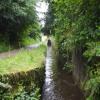
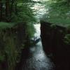
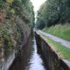
Original Site of Lock No 21E

 
Bridge Street, Upper Rotcher HD7 5JN, United Kingdom
 
Information about the place
Original Site of Lock No 21E is a minor waterways place on the Huddersfield Narrow Canal between Railway Lock No 42E (Marsden. Eastern summit lock) (2 miles and 7 furlongs and 21 locks to the west) and Titanic Mill (Linthwaite) (6½ furlongs and 4 locks to the east).
 
 
The nearest place in the direction of Railway Lock No 42E is Platt Lane Bridge No 42; ½ furlongs away.
 
The nearest place in the direction of Titanic Mill is Spot Lock No 20E; 1¼ furlongs away.

Mooring here is unrated.


Amenities

Amenities here

 Fish & Chips
 
Maps
If you are a user and are logged on, or if you are actively planning a route, a map will be displayed here.
Show on external mapping site: Google | OSM | Bing
 
Photos
 
External websites
There are no links to external websites from here.
Why not log in and add some (select "External websites" from the menu (sometimes this is under "Edit"))?
 
Nearest facilities

Mouseover for more information or show routes to facility

Nearest water point

In the direction of Ashton-under-Lyne Junction

Waterside Lock No 21E½ furlongs away
On this waterway in the direction of Ashton-under-Lyne Junction
Slaithwaite Winding Hole1¼ furlongs and 1 lock away
On this waterway in the direction of Ashton-under-Lyne Junction
Standedge Tunnel (eastern entrance)3 miles, 4 furlongs and 22 locks away
On this waterway in the direction of Ashton-under-Lyne Junction
Standedge Tunnel (western entrance)6 miles, 6 furlongs and 22 locks away
On this waterway in the direction of Ashton-under-Lyne Junction
Wool Road Bridge No 708 miles, 5¾ furlongs and 31 locks away
On this waterway in the direction of Ashton-under-Lyne Junction
Grove Road Bridge No 9614 miles, 6 furlongs and 46 locks away
On this waterway in the direction of Ashton-under-Lyne Junction

In the direction of Aspley Basin (Huddersfield)

Aspley Basin (Huddersfield)4 miles, 5 furlongs and 20 locks away
On this waterway in the direction of Aspley Basin (Huddersfield)
Shepley Bridge Sanitary Station11 miles, 1¾ furlongs and 31 locks away
Travel to Aspley Basin (Huddersfield), then on the Huddersfield Broad Canal to Cooper Bridge Junction, then on the Calder and Hebble Navigation (Main Line) to Shepley Bridge Sanitary Station
Brighouse Basin10 miles, 3½ furlongs and 33 locks away
Travel to Aspley Basin (Huddersfield), then on the Huddersfield Broad Canal to Cooper Bridge Junction, then on the Calder and Hebble Navigation (Main Line) to Brighouse Basin
Salterhebble Sanitary Station14 miles, 5½ furlongs and 42 locks away
Travel to Aspley Basin (Huddersfield), then on the Huddersfield Broad Canal to Cooper Bridge Junction, then on the Calder and Hebble Navigation (Main Line) to Salterhebble Sanitary Station
Broad Cut Low Lock No 317 miles, 6¾ furlongs and 39 locks away
Travel to Aspley Basin (Huddersfield), then on the Huddersfield Broad Canal to Cooper Bridge Junction, then on the Calder and Hebble Navigation (Main Line) to Broad Cut Low Lock No 3
Salterhebble Junction14 miles, 6 furlongs and 43 locks away
Travel to Aspley Basin (Huddersfield), then on the Huddersfield Broad Canal to Cooper Bridge Junction, then on the Calder and Hebble Navigation (Main Line) to Salterhebble Junction
Sowerby Bridge Basin16 miles, 7¾ furlongs and 43 locks away
Travel to Aspley Basin (Huddersfield), then on the Huddersfield Broad Canal to Cooper Bridge Junction, then on the Calder and Hebble Navigation (Main Line) to Salterhebble Junction, then on the Calder and Hebble Navigation (Main Line) to Sowerby Bridge Basin

Nearest rubbish disposal

In the direction of Ashton-under-Lyne Junction

Pickle Lock No 22E1¾ furlongs and 1 lock away
On this waterway in the direction of Ashton-under-Lyne Junction
Wool Road Visitor Mooring8 miles, 6¼ furlongs and 31 locks away
On this waterway in the direction of Ashton-under-Lyne Junction

In the direction of Aspley Basin (Huddersfield)

Aspley Basin (Huddersfield)4 miles, 5 furlongs and 20 locks away
On this waterway in the direction of Aspley Basin (Huddersfield)
Shepley Bridge Sanitary Station11 miles, 1¾ furlongs and 31 locks away
Travel to Aspley Basin (Huddersfield), then on the Huddersfield Broad Canal to Cooper Bridge Junction, then on the Calder and Hebble Navigation (Main Line) to Shepley Bridge Sanitary Station
Brighouse Lower Basin Visitor Moorings10 miles, 3 furlongs and 32 locks away
Travel to Aspley Basin (Huddersfield), then on the Huddersfield Broad Canal to Cooper Bridge Junction, then on the Calder and Hebble Navigation (Main Line) to Brighouse Lower Basin Visitor Moorings
Horbury Basin Residential Moorings & Sanitary Station15 miles, 6 furlongs and 38 locks away
Travel to Aspley Basin (Huddersfield), then on the Huddersfield Broad Canal to Cooper Bridge Junction, then on the Calder and Hebble Navigation (Main Line) to Horbury Basin Residential Moorings & Sanitary Station
Salterhebble Sanitary Station14 miles, 5½ furlongs and 42 locks away
Travel to Aspley Basin (Huddersfield), then on the Huddersfield Broad Canal to Cooper Bridge Junction, then on the Calder and Hebble Navigation (Main Line) to Salterhebble Sanitary Station
Sowerby Bridge Basin16 miles, 7¾ furlongs and 43 locks away
Travel to Aspley Basin (Huddersfield), then on the Huddersfield Broad Canal to Cooper Bridge Junction, then on the Calder and Hebble Navigation (Main Line) to Salterhebble Junction, then on the Calder and Hebble Navigation (Main Line) to Sowerby Bridge Basin

Nearest chemical toilet disposal

In the direction of Ashton-under-Lyne Junction

Waterside Lock No 21E½ furlongs away
On this waterway in the direction of Ashton-under-Lyne Junction
Pickle Lock No 22E1¾ furlongs and 1 lock away
On this waterway in the direction of Ashton-under-Lyne Junction
Wool Road Bridge No 708 miles, 5¾ furlongs and 31 locks away
On this waterway in the direction of Ashton-under-Lyne Junction
Grove Road Bridge No 9614 miles, 6 furlongs and 46 locks away
On this waterway in the direction of Ashton-under-Lyne Junction

In the direction of Aspley Basin (Huddersfield)

Aspley Basin (Huddersfield)4 miles, 5 furlongs and 20 locks away
On this waterway in the direction of Aspley Basin (Huddersfield)
Shepley Bridge Sanitary Station11 miles, 1¾ furlongs and 31 locks away
Travel to Aspley Basin (Huddersfield), then on the Huddersfield Broad Canal to Cooper Bridge Junction, then on the Calder and Hebble Navigation (Main Line) to Shepley Bridge Sanitary Station
Brighouse Basin10 miles, 3½ furlongs and 33 locks away
Travel to Aspley Basin (Huddersfield), then on the Huddersfield Broad Canal to Cooper Bridge Junction, then on the Calder and Hebble Navigation (Main Line) to Brighouse Basin
Savile Town Wharf and Basin (Dewsbury)14 miles, 5 furlongs and 35 locks away
Travel to Aspley Basin (Huddersfield), then on the Huddersfield Broad Canal to Cooper Bridge Junction, then on the Calder and Hebble Navigation (Main Line) to Dewsbury Arm Junction, then on the Calder and Hebble Navigation (Dewsbury Old Cut) to Savile Town Wharf and Basin (Dewsbury)
Horbury Basin Residential Moorings & Sanitary Station15 miles, 6 furlongs and 38 locks away
Travel to Aspley Basin (Huddersfield), then on the Huddersfield Broad Canal to Cooper Bridge Junction, then on the Calder and Hebble Navigation (Main Line) to Horbury Basin Residential Moorings & Sanitary Station
Salterhebble Sanitary Station14 miles, 5½ furlongs and 42 locks away
Travel to Aspley Basin (Huddersfield), then on the Huddersfield Broad Canal to Cooper Bridge Junction, then on the Calder and Hebble Navigation (Main Line) to Salterhebble Sanitary Station
Sowerby Bridge Basin16 miles, 7¾ furlongs and 43 locks away
Travel to Aspley Basin (Huddersfield), then on the Huddersfield Broad Canal to Cooper Bridge Junction, then on the Calder and Hebble Navigation (Main Line) to Salterhebble Junction, then on the Calder and Hebble Navigation (Main Line) to Sowerby Bridge Basin

Nearest place to turn

In the direction of Ashton-under-Lyne Junction

Slaithwaite Winding Hole1¼ furlongs and 1 lock away
On this waterway in the direction of Ashton-under-Lyne Junction
Booth Lock Winding Hole1 mile, 6 furlongs and 11 locks away
On this waterway in the direction of Ashton-under-Lyne Junction
Standedge Tunnel End Winding Hole3 miles, 3¼ furlongs and 22 locks away
On this waterway in the direction of Ashton-under-Lyne Junction
Diggle Winding Hole7 miles, ¾ furlongs and 22 locks away
On this waterway in the direction of Ashton-under-Lyne Junction
Wool Road Winding Hole8 miles, 6¾ furlongs and 31 locks away
On this waterway in the direction of Ashton-under-Lyne Junction
Saddleworth Visitor Centre Winding Hole9 miles, 4½ furlongs and 33 locks away
On this waterway in the direction of Ashton-under-Lyne Junction
Manns Wharf Bridge Winding Hole10 miles, 7½ furlongs and 35 locks away
On this waterway in the direction of Ashton-under-Lyne Junction

In the direction of Aspley Basin (Huddersfield)

Linthwaite Winding Hole7½ furlongs and 4 locks away
On this waterway in the direction of Aspley Basin (Huddersfield)
Isis Lock Winding Hole2 miles, 3¾ furlongs and 12 locks away
On this waterway in the direction of Aspley Basin (Huddersfield)
University Arm4 miles, 4½ furlongs and 20 locks away
On this waterway in the direction of Aspley Basin (Huddersfield)
Aspley Basin (Huddersfield)4 miles, 5 furlongs and 20 locks away
On this waterway in the direction of Aspley Basin (Huddersfield)
Anchor Street Winding Hole5 miles, 2 furlongs and 20 locks away
Travel to Aspley Basin (Huddersfield), then on the Huddersfield Broad Canal to Anchor Street Winding Hole
New Road Winding Hole5 miles, 5½ furlongs and 20 locks away
Travel to Aspley Basin (Huddersfield), then on the Huddersfield Broad Canal to New Road Winding Hole
Deighton Road Bridge Winding Hole6 miles, 7¼ furlongs and 25 locks away
Travel to Aspley Basin (Huddersfield), then on the Huddersfield Broad Canal to Deighton Road Bridge Winding Hole
Cooper Bridge Junction8 miles, 1 furlong and 29 locks away
Travel to Aspley Basin (Huddersfield), then on the Huddersfield Broad Canal to Cooper Bridge Junction
Battye Weir Entrance8 miles, 6¼ furlongs and 30 locks away
Travel to Aspley Basin (Huddersfield), then on the Huddersfield Broad Canal to Cooper Bridge Junction, then on the Calder and Hebble Navigation (Main Line) to Battye Weir Entrance
Shepley Bridge Marina11 miles, 2 furlongs and 31 locks away
Travel to Aspley Basin (Huddersfield), then on the Huddersfield Broad Canal to Cooper Bridge Junction, then on the Calder and Hebble Navigation (Main Line) to Shepley Bridge Marina
Brighouse Basin10 miles, 3½ furlongs and 33 locks away
Travel to Aspley Basin (Huddersfield), then on the Huddersfield Broad Canal to Cooper Bridge Junction, then on the Calder and Hebble Navigation (Main Line) to Brighouse Basin
Ganny Winding Hole11 miles, ¾ furlongs and 34 locks away
Travel to Aspley Basin (Huddersfield), then on the Huddersfield Broad Canal to Cooper Bridge Junction, then on the Calder and Hebble Navigation (Main Line) to Ganny Winding Hole
Dewsbury Arm Junction13 miles, 5 furlongs and 35 locks away
Travel to Aspley Basin (Huddersfield), then on the Huddersfield Broad Canal to Cooper Bridge Junction, then on the Calder and Hebble Navigation (Main Line) to Dewsbury Arm Junction

Nearest self-operated pump-out

In the direction of Ashton-under-Lyne Junction

Slaithwaite Winding Hole1¼ furlongs and 1 lock away
On this waterway in the direction of Ashton-under-Lyne Junction
Wool Road Bridge No 708 miles, 5¾ furlongs and 31 locks away
On this waterway in the direction of Ashton-under-Lyne Junction

Nearest boatyard pump-out

In the direction of Ashton-under-Lyne Junction

Portland Basin Arm19 miles, 6½ furlongs and 54 locks away
Travel to Ashton-under-Lyne Junction, then on the Ashton Canal (Main Line) to Dukinfield Junction, then on the Peak Forest Canal (Lower) to Portland Basin Arm

In the direction of Aspley Basin (Huddersfield)

Aspley Basin (Huddersfield)4 miles, 5 furlongs and 20 locks away
On this waterway in the direction of Aspley Basin (Huddersfield)
Shepley Bridge Marina11 miles, 2 furlongs and 31 locks away
Travel to Aspley Basin (Huddersfield), then on the Huddersfield Broad Canal to Cooper Bridge Junction, then on the Calder and Hebble Navigation (Main Line) to Shepley Bridge Marina
Sowerby Bridge Basin16 miles, 7¾ furlongs and 43 locks away
Travel to Aspley Basin (Huddersfield), then on the Huddersfield Broad Canal to Cooper Bridge Junction, then on the Calder and Hebble Navigation (Main Line) to Salterhebble Junction, then on the Calder and Hebble Navigation (Main Line) to Sowerby Bridge Basin
Direction of TV transmitter (From Wolfbane Cybernetic)
 
 
Geograph
 
Wikipedia

There is no page on Wikipedia called “Original Site of Lock No 21E”

Wikipedia pages that might relate to Original Site of Lock No 21E
[Lock (water navigation)] A lock is a device used for raising and lowering boats, ships and other watercraft between stretches of water of different levels on river and canal waterways [Erie Canal] and dry Erie Canal lock 18, high above. Enlarged Double Lock No. 23, Old Erie Canal, Rotterdam Schoharie Crossing State Historic Site at Fort Hunter Old [Huddersfield Narrow Canal] more years in any case.[citation needed] Lock 21E was relocated a short distance upstream, to the other side of Platt Lane, in order to ensure that the [Peterborough Lift Lock] The Peterborough Lift Lock is a boat lift located on the Trent Canal in the city of Peterborough, Ontario, Canada, and is Lock 21 on the Trent-Severn Waterway [Anti-lock braking system] An anti-lock braking system (ABS) is a safety anti-skid braking system used on aircraft and on land vehicles, such as cars, motorcycles, trucks, and buses [List of Hallmark Channel Original Movies] in January 2004. In addition to stand-alone original films, both channels broadcast a number of original franchise series, including Garage Sale Mystery [Caps Lock] CAPS LOCK ⇪ Caps Lock is a button on a computer keyboard that causes all letters of bicameral scripts to be generated in capital letters. It is a toggle [Lock and Dam No. 2] Lock and Dam No. 2 is located along the Upper Mississippi River near Hastings, Minnesota and construction commenced in 1927. The eastern dam portion is [Lock Haven, Pennsylvania] Lock Haven is the county seat of Clinton County, in the U.S. state of Pennsylvania. Located near the confluence of the West Branch Susquehanna River and [SIM lock] A SIM lock, simlock, network lock, carrier lock or (master) subsidy lock is a technical restriction built into GSM and CDMA mobile phones by mobile phone
 
Google

Results of Google Search

Huddersfield Narrow Canal - Wikipedia
The Huddersfield Narrow Canal is an inland waterway in northern England. It runs just under .... Eleven years later, Sellers Engineering relocated to a new site. ... The section of canal through Slaithwaite town centre, between locks 21E and 23E, ... No other such cases are known on navigable waterways worldwide although ...
PG21 & PG21E
Page 1 ... installed standard mortise cylinder (not supplied) will alter- nately arm and disarm .... amount in excess of ALARM LOCK's original selling price of the ...
Leviton 47605-21E 21-Inch Structured Media Enclosure, White ...
Leviton 47605-21E 21-Inch Structured Media Enclosure, White - Electrical Boxes - Amazon.com. ... Leviton Structured Media Center Hinged Cover Add-on Lock and Key .... Highly recommended and Amazon's price was cheaper than other sites due to ... I did not use any official Leviton "components" (or stand-offs) with this ...
Check if a site's connection is secure - Google Chrome Help
Lock Secure; View site information Info or Not secure; Dangerous Not secure or ... If you see a full-page error message saying "Your connection is not private," ...
How Can I Tell If a Website Is Safe? Look For These 5 Signs – The ...
Aug 24, 2018 ... An unsafe website can spread malware, steal your information, send spam, ... Without an SSL certificate, that information is exposed and easily ...
How do I tell if my connection to a website is secure? | Firefox Help
Firefox uses a padlock icon next to a website's URL to let you know your connection is encrypted. ... orange triangle grey lock 42 unblocked mixed content 42 ... to a website without the padlock icon in the address bar - in this case it is neither ...
United Nations
Jul 2, 2015 ... Page 1 ... Proposal for an amendment to Regulation No. ... Original: English ... The effectiveness of the braking system, including the anti-lock ...
HTTPS does not mean a site is safe | Kaspersky Lab official blog
Jan 17, 2018 ... Let's be honest, when most people see a little green lock with the word “Secure” to the left of a URL, they think the site is safe. Ditto for spotting ...
Master MCP Q & A: 1993 – 2018
Jan 18, 2018 ... following default IWPA radii: 500 feet for transient non-community wells and 750 feet for .... Therefore, MGP remediation wastes generated at 21E sites that exhibit ...... Once a PIP is developed, is the content locked in stone?
UNION High Security Door Systems, Door Handles, Door Locks ...
By continuing to browse this website without changing your browser cookie ... Today, UNION C-Series locks are identical to the original, manufactured from start ... of specialists in leading and managing the specification of locks and hardware.